Tokyo Metropolitan Road Route 129: Visiting Hours, Tickets, and Comprehensive Travel Guide
Date: 04/07/2025
Introduction
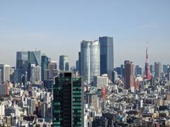
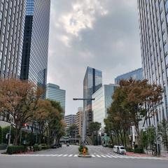
Tokyo Metropolitan Road Route 129, also known as Ring Road No. 2 (Kanjo Daini), is a pivotal component in Tokyo’s vast urban infrastructure. Serving as a major arterial road, it links vital commercial, residential, and cultural districts while supporting economic activity, urban redevelopment, and disaster resilience. Route 129 is not just a functional road but also exemplifies Tokyo’s innovative approach to urban planning, seamlessly integrating advanced technology, sustainability, and multi-modal development. For visitors, Route 129 provides access to vibrant neighborhoods such as Ginza, Shimbashi, and Toranomon, making it a notable feature for those eager to explore Tokyo’s dynamic cityscape.
This guide delivers a structured, detailed overview of Route 129’s historical development, technical specifications, travel tips, accessibility, nearby attractions, and its broader significance within the context of Tokyo’s Three Loop Roads strategy. Whether you’re planning to drive, cycle, use public transit, or simply want to understand Tokyo’s urban infrastructure, this resource will help you make the most of your experience.
For more information on Tokyo’s transport network and city planning initiatives, consult resources from the Tokyo Metropolitan Government, Yomiuri Shimbun, and guides like Tsunagu Japan.
Table of Contents
- Introduction
- Historical Background and Urban Development
- Construction, Engineering, and Integration
- Technical Specifications
- Access and Travel Tips
- Route 129 in Tokyo’s Road Network
- Technological Features and Management
- Environmental and Sustainability Initiatives
- Future Developments
- Emergency and Disaster Resilience
- Multi-Modal Urban Development
- Nearby Attractions and Events
- Practical Visitor Information
- FAQ
- Summary & Conclusion
- References & Further Reading
Historical Background and Urban Development
Route 129 emerged as an outcome of Tokyo’s post-war modernization and urban expansion. Conceived as part of a larger initiative to alleviate congestion and support economic growth, its development was orchestrated by the Tokyo Metropolitan Government through strategic planning acts and infrastructure projects (Tokyo Metropolitan Government). The route’s planning and construction were influenced by the City Planning Act and Building Standards Act to ensure resilience and accessibility (Tokyo Urban Development History).
The road plays an integral role in linking neighborhoods, facilitating smooth traffic flow, and supporting both local and intercity logistics. It has been recognized as an “Important Logistics Road,” reflecting its significance in Tokyo’s transportation ecosystem.
Construction, Engineering, and Integration
Land Acquisition and Preparation
Developing Route 129 in Tokyo’s dense urban environment required extensive coordination between government, private developers, and residents. The process involved years of negotiation, relocation, and site preparation.
Infrastructure Design and Engineering
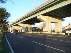
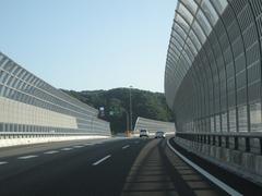
Route 129 was engineered to modern standards, emphasizing safety, efficiency, and disaster resilience. Typical features include multi-lane carriageways, wide sidewalks, and utility corridors (Infrastructure Plans PDF).
Construction and Completion
With the involvement of leading construction firms, the road’s construction included earthworks, paving, drainage, and the erection of bridges and overpasses. Projects of this scope commonly span 5–10 years, as seen in redevelopments like West Harumi 5-Chome (West Harumi Redevelopment). Upon completion, Route 129 was integrated into Tokyo’s broader transport network, enhancing connectivity and mobility.
Technical Specifications
- Width: 20–25 meters, enabling multiple traffic lanes, sidewalks, and bicycle paths.
- Surface: Durable asphalt or concrete, designed for heavy urban traffic.
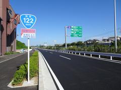
- Safety: Features include clear signage, controlled crossings, pedestrian barriers, and modern traffic signals.
- Disaster Resilience: Includes elevated sections, reinforced embankments, and advanced drainage (Tokyo Resilience Project).
Access and Travel Tips
General Accessibility
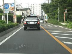
Route 129 is a public metropolitan road, accessible 24/7 with no entry fee or tickets required. It is primarily for motor vehicles, but many sections offer sidewalks and bicycle lanes.
Best Times to Travel
Avoid peak congestion by traveling outside rush hours: 7–9 AM and 5–7 PM. Weekend traffic is generally lighter, but special events may affect flow.
Navigation
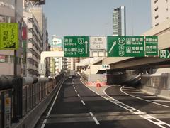
For drivers and cyclists, the route is well-signposted. Utilize real-time traffic information via navigation apps or government sites (Go Tokyo: Getting Around). Public transit options are abundant, with multiple train and subway stations adjacent to the route.
Bicycle and Pedestrian Experience
While the main carriageway is for vehicles, adjacent paths and crossings are available for cyclists and pedestrians. During select events, segments of Route 129 are opened to foot traffic.
Route 129 in Tokyo’s Road Network
Route 129 is integrated within Tokyo’s Three Loop Roads strategy, alongside the Central Circular Route and Tokyo Outer Loop Road. These ring roads distribute traffic, reduce congestion in central areas, and provide redundancy for emergency situations (Tokyo Metropolitan Government PDF).
Recent infrastructure projects, such as closing the 1.3-kilometer gap between Toranomon and Shimbashi in 2022, have greatly improved connectivity and traffic flow (Yomiuri Shimbun).
Technological Features and Management
Advanced technologies such as ETC2.0 electronic toll collection, real-time traffic monitoring, and big data analytics optimize traffic management on Route 129. These systems improve efficiency, reduce delays, and enhance safety for all users.
Environmental and Sustainability Initiatives
Route 129 is designed with Tokyo’s sustainability goals in mind. Features include street trees, eco-friendly materials, solar-powered lighting, smart traffic controls, and systems to mitigate noise and air pollution (Tokyo Green Biz).
Future Developments
Ongoing and future enhancements focus on expanding pedestrian and cycling infrastructure, improving public spaces, and integrating smart city technologies. These upgrades align with Tokyo’s 2050 strategy for sustainable, adaptable urban mobility (Tokyo 2050 Strategy).
Emergency and Disaster Resilience
Route 129 is a vital part of Tokyo’s disaster preparedness plan, serving as a designated evacuation route and firebreak. Its wide medians and multiple lanes enable access for emergency vehicles and support the city’s resilience strategies (Tokyo Metropolitan Government PDF).
Multi-Modal Urban Development
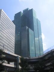
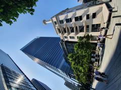
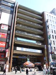
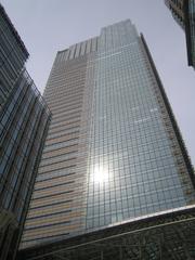
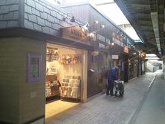
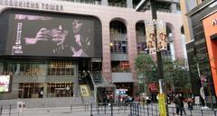
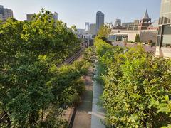
Route 129 exemplifies Tokyo’s approach to vertical urbanism, integrating multi-level roadways with commercial and residential developments such as Toranomon Hills. Underpasses are utilized for retail spaces like Ginza Nine and Ginza Inz. Future plans may see further transformation of sections into public pedestrian zones, taking inspiration from projects like New York’s High Line (Yomiuri Shimbun).
Nearby Attractions and Events
Attractions
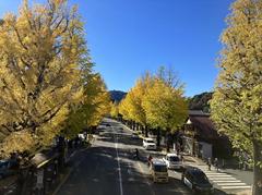
Route 129 offers access to areas rich in culture and history, including Ginza’s shopping and dining, Shimbashi’s business district, and Toranomon’s commercial hubs. Local markets, parks, and traditional neighborhoods are easily reached from the route.
Special Events
Events like the Ginza Sky Walk temporarily open Route 129 to pedestrians, providing unique urban exploration opportunities (Yomiuri Shimbun).
Practical Visitor Information
- Accessibility: Route 129 is open 24/7 with no fees.
- Transport: Accessible by car, taxi, sightseeing bus, and public transport. IC cards like Suica or Pasmo make transit seamless (Japan Guide: IC Cards).
- Cycling: Many sections have bike lanes; rentals are available nearby (22places: Cycling in Tokyo).
- Pedestrian Access: Use designated sidewalks and crossings. During special events, certain sections become pedestrian zones.
- Real-Time Information: Check official sites and navigation apps for traffic and event updates.
Frequently Asked Questions (FAQ)
Q: Is Route 129 accessible for cyclists?
A: Yes, many sections have dedicated bike lanes and sidewalks.
Q: Are there tolls on Route 129?
A: Some sections, especially those integrated with the expressway system, may be tolled. ETC is accepted.
Q: Can I walk or cycle on Route 129?
A: The main road is for vehicles, but adjacent paths are available. Foot and bicycle access is permitted during special events.
Q: What are the hours and fees for Route 129?
A: Open 24/7; there are no entry fees.
Q: How does Route 129 connect with public transport?
A: It is adjacent to several train and subway stations for easy transfers.
Q: What attractions are near Route 129?
A: Ginza, Shimbashi, Toranomon, local markets, parks, and cultural sites.
Summary & Conclusion
Tokyo Metropolitan Road Route 129 is a cornerstone of Tokyo’s transportation network, balancing historical significance with advanced technology and modern urban design. It supports efficient traffic flow, connects key districts, and offers resilience in emergencies. For residents and visitors, Route 129 provides efficient access to major destinations and unique experiences during special events like the Ginza Sky Walk.
As Tokyo continues to innovate, Route 129 will see enhancements in pedestrian and cycling infrastructure, green urban development, and smart mobility solutions. Understanding its role within the city’s broader transportation strategy enriches the experience of navigating Tokyo.
For real-time updates, travel tips, and further guides, download the Audiala app and explore resources from official Tokyo government websites and trusted travel platforms.
References & Further Reading
- Tokyo Metropolitan Government
- Tokyo Urban Development History
- Yomiuri Shimbun
- Tsunagu Japan
- West Harumi Redevelopment
- Japan Guide: IC Cards
- Go Tokyo: Getting Around
- 22places: Cycling in Tokyo
