Japan National Route 16: Visiting Hours, Tickets, and Travel Guide
Date: 14/06/2025
Introduction
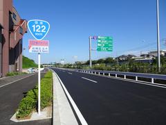
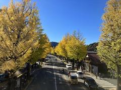
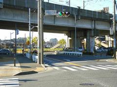
Japan National Route 16 is a major ring road that encircles the Tokyo metropolitan area, connecting key cities like Yokohama, Saitama, Hachioji, and Chiba. Established in 1952, it has grown into a vital transportation artery, fostering economic growth, urban development, and cultural exchange throughout the Kanto region. Stretching approximately 241 kilometers, Route 16 offers both locals and travelers access to an impressive array of historical sites, natural retreats, lively urban centers, and cultural landmarks. This comprehensive guide explores Route 16’s historical context, current infrastructure, travel tips, and the best attractions along the route, helping you plan a rewarding journey around Tokyo’s dynamic periphery (Open Book Publishers, Japan Guide, Yokohama Japan).
Contents
- Early Origins and Historical Context
- Postwar Reconstruction and Route 16’s Development
- Urban and Economic Impact
- Key Infrastructure and Engineering Features
- Travel Tips and Accessibility
- Major Attractions and Cultural Highlights
- Disaster Preparedness Role
- Route 16 in Modern Transportation Networks
- Frequently Asked Questions (FAQ)
- Conclusion
- Internal and External Resources
Early Origins and Historical Context
Japan’s road network has ancient roots. Early trails, dating back to the Jōmon and Yayoi periods, supported trade and communication. By the Edo period (1603–1868), these paths evolved into a more formal road system, including the famous gokaidō (five main roads) radiating from Edo (modern Tokyo). Although Route 16 is not one of these original five, its route mirrors historic pathways, serving as a modern ring road connecting the capital’s expanding suburbs (Open Book Publishers).
Postwar Reconstruction and the Birth of Route 16
After World War II, Japan prioritized rebuilding its infrastructure. Officially designated in 1952, Route 16 was constructed to connect major satellite cities around Tokyo, fostering suburban growth and supporting the region’s economic resurgence. The Ministry of Land, Infrastructure, Transport and Tourism (MLIT) oversaw the highway’s development, ensuring it formed a strategic loop integrating residential, commercial, and industrial zones (Wikimedia Commons, MLIT Road Bureau).
Urban and Economic Impact
Route 16’s design as a metropolitan beltway played a significant role in Tokyo’s suburbanization and economic expansion. By linking major cities such as Yokohama, Saitama, Chiba, and Hachioji, it facilitated the movement of goods, commuters, and services, supporting the rise of new residential neighborhoods and industrial districts. Its intersections with other expressways and rail lines further integrated the Kanto region’s transportation network, enabling efficient travel and commercial logistics (MLIT Road Bureau).
Key Infrastructure and Engineering Features
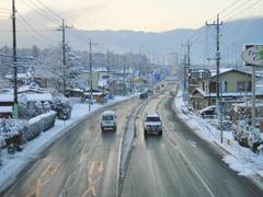
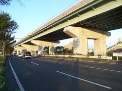
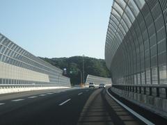
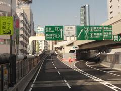
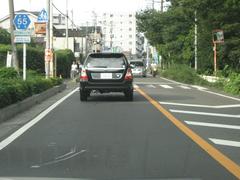
Route 16 is a diverse corridor, with sections ranging from multi-lane expressways in urban centers to two-lane roads in suburban areas. The route includes numerous bridges, tunnels, and interchanges, designed to withstand earthquakes and typhoons—essential in Japan’s disaster-prone environment. Ongoing upgrades and maintenance by MLIT and local governments ensure the highway remains safe and efficient (Open Book Publishers).
Travel Tips and Accessibility
- Traffic Patterns: Peak congestion occurs weekdays from 7:00–9:00 AM and 5:00–7:00 PM. Use navigation apps and check MLIT advisories for real-time updates.
- Cycling: Some parallel roads are suitable for cyclists, but dedicated lanes are limited. Exercise caution, especially near busy interchanges.
- Rest Stops: Service areas along Route 16 provide dining, restrooms, and local souvenirs.
- Public Transit Links: The highway is accessible from numerous train stations, including Tachikawa (JR Chuo Line), Hachioji (JR Chuo/Keio), and Yokohama (Yokohama Line).
- Accessibility: Most major attractions and service areas along Route 16 offer wheelchair access and facilities for disabled travelers.
Major Attractions and Cultural Highlights
Kawagoe (“Little Edo”)
-
Kurazukuri Street: Edo-period warehouses, sweet shops, and the Toki no Kane bell tower.
- Hours: Shops open 10:00 AM–5:00 PM
- Tickets: Festival Museum ~300 yen
- Accessibility: Pedestrian-friendly; some historic sites have limited wheelchair access (Kurazukuri Street)
-
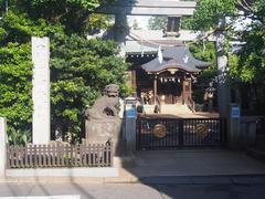
Kawagoe Hikawa Shrine: Noted for summer wind chime festival.
- Hours: 6:00 AM–8:00 PM (Kawagoe Hikawa Shrine)
Yokohama
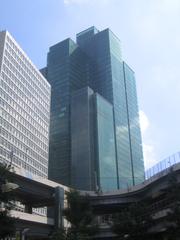
- Minato Mirai 21: Modern waterfront with shopping, dining, and entertainment.
- Landmark Tower: Observation deck, 10:00 AM–9:00 PM, ~1,000 yen
- CupNoodles Museum: 10:00 AM–6:00 PM, adults 500 yen, children 300 yen, closed Tuesdays (Minato Mirai 21)
- Chinatown: Largest in Japan; open 24/7, with vibrant food streets and festivals (Yokohama Chinatown)
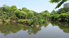
- Sankeien Garden: Traditional garden, 9:00 AM–5:00 PM, 700 yen
Hachioji
- Mount Takao: Popular hiking spot with panoramic views and Yakuoin Temple.
- Cable Car: 9:00 AM–5:00 PM, round-trip 940 yen
- Trails: Open 24/7 (Mount Takao)
- Hachioji Castle Ruins: Historical site, open year-round, free
Tachikawa
- Showa Kinen Park: Expansive park with seasonal festivals, cycling, and boating.
- Hours: 9:30 AM–5:00 PM, closed Mondays
- Tickets: Adults 450 yen, students 210 yen (Showa Kinen Park)
Saitama and Chiba
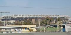
- Saitama Stadium 2002: Major sports venue, especially for football (Saitama Stadium 2002)
- Lalaport Tokyo-Bay: Large shopping and entertainment complex (Lalaport Tokyo-Bay)
Disaster Preparedness Role
Route 16 is an essential evacuation and emergency supply route, with reinforced structures and regular disaster drills to ensure functionality during earthquakes or typhoons (Open Book Publishers).
Route 16 in Modern Transportation Networks
The highway integrates with major expressways (Chuo, Tomei, Kan-Etsu) and extensive rail lines, allowing seamless travel by car or public transit. Widespread use of navigation apps and electronic toll collection (ETC) systems streamlines journeys (NAVITIME Japan).
Frequently Asked Questions (FAQ)
Q: Is Route 16 accessible for cyclists?
A: Some sections and parallel roads are navigable by bike, but dedicated lanes are limited. Use caution.
Q: What are typical visiting hours for attractions?
A: Most museums and historical sites open 9:00/10:00 AM to 5:00/6:00 PM; parks may open earlier.
Q: Are there tolls on Route 16?
A: Route 16 itself is usually toll-free, but connecting expressways require tolls.
Q: Are guided tours available at major sites?
A: Yes, especially at places like Showa Kinen Park and breweries in Fussa. Check official sites for details.
Q: When is the best time to visit?
A: Spring (cherry blossoms) and autumn (foliage) are ideal.
Conclusion
Japan National Route 16 is far more than a transportation corridor. It is a vibrant loop uniting historical towns, modern urban centers, scenic parks, and cultural icons. With easy access by both car and public transit, Route 16 offers visitors the flexibility to experience the full spectrum of the Kanto region’s attractions. Plan according to seasonal highlights, use real-time navigation tools, and immerse yourself in a journey that blends Japan’s past and present.
For further planning, download the Audiala app for real-time guidance and curated audio tours, and follow us on social media for the latest updates.
Internal Links
External Resources
- Showa Kinen Park Official Site
- Mount Takao Information
- Yokota Air Base Friendship Festival
- Kawagoe Tourism
- Yokohama Attractions
- Lalaport Tokyo-Bay Shopping Mall
- NAVITIME Japan Travel Guide
Sources and Further Reading
- Open Book Publishers: Japan’s Transport History
- MLIT Road Bureau Traffic Info
- Japan Guide: Exploring Japan National Route 16
- Yokohama Japan: Key Attractions
- Yokohama Chinatown Official Site
- NAVITIME Japan Travel Guide
