Plan and listen to Passerelle De L'Estacade with Audiala.
Audio guide in your pocket, itinerary in your browser. Built for the way you actually visit.
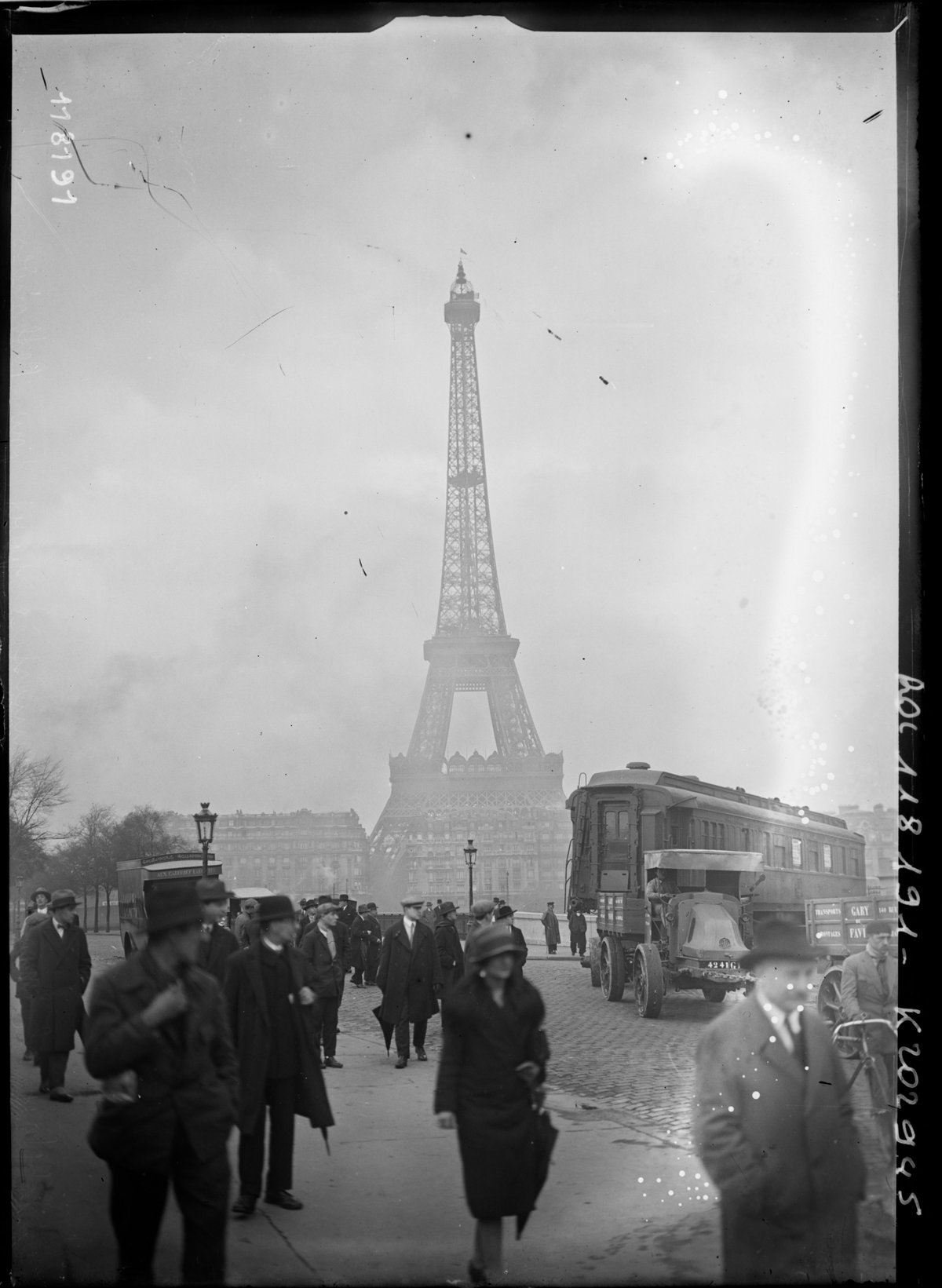
Introduction
The Passerelle de l’Estacade, once a unique pedestrian bridge across the Seine in Paris, occupies a special place in the city’s historical and cultural landscape. Originally constructed in the 18th century as a wooden groyne to protect the bustling quays of the former Île Louviers, it evolved into a vital pedestrian crossing by the 19th century. Although demolished in the 1930s, its legacy lives on through art, urban history, and the enduring vibrancy of the surrounding riverbanks. This guide delves into the estacade’s rich history, architectural features, and enduring significance, while providing practical tips for visitors wishing to explore the site’s heritage and nearby attractions.
For a deeper historical and artistic exploration, see Artifex in Opere, Wikipedia on Île Louviers, and FranceGenWeb.
Origins and Early Development
The Passerelle de l’Estacade traces its roots to the 1770s, when a wooden groyne was constructed at the upstream end of the Seine between Île Louviers and Île Saint-Louis. This groyne was designed to break up river ice and protect moored boats, supporting the island’s role as a busy commercial dock (Wikipedia: Île Louviers).
By 1843, a pedestrian footbridge was added atop this structure, transforming the estacade into a crucial crossing point for Parisians. The bridge connected the Île Saint-Louis to the Right Bank, enhancing accessibility and reinforcing the significance of the river’s islands in the urban economy and daily life.
Architectural Features and Evolution
Wooden Construction and Engineering
The initial design of the Passerelle de l’Estacade prioritized function, employing timber piles and beams for flexibility and ease of repair. Its exposed wooden framework and diagonal bracing gave it a distinctive skeletal silhouette that became a recurring subject in Parisian art (Artifex in Opere).
Adaptations and Modernization
The estacade endured repeated challenges from floods and fires. After the devastating flood of 1910, the structure was rebuilt in 1913 with masonry piers and steel reinforcements, reflecting contemporary advances in engineering and materials. This version of the bridge maintained its role as a pedestrian crossing until its demolition in the 1930s.
Artistic Impact
Artists such as Stanislas Lépine and Henri Rivière were drawn to the bridge’s stark lines and atmospheric setting, capturing its presence in paintings and prints. These artworks preserve the memory and aura of the estacade, highlighting its place in the visual and cultural history of Paris (Artifex in Opere).
Role in Parisian Urban Life
Connection and Accessibility
The estacade was more than a bridge—it was a strategic link between the Île Saint-Louis and the Right Bank, facilitating the movement of people, goods, and ideas during a period when river islands were economic and social hubs (Wikipedia: Île Louviers).
Social and Cultural Functions
Beyond its utilitarian role, the bridge’s steps provided access to a bateau-lavoir (floating laundry boat), making it a lively gathering place for washerwomen, fishermen, and passersby. The estacade became an integral part of Parisian daily life and a symbol of the city’s adaptability (Artifex in Opere).
The “Provisional That Lasts”
Although originally conceived as a temporary wooden structure, the estacade endured for decades—earning the nickname “le provisoire qui dure,” or “the provisional that lasts.” Its longevity and repeated repairs exemplified Paris’s resilience and ingenuity.
Decline and Demolition
Urban Transformation
The estacade’s importance waned as Île Louviers was physically joined to the Right Bank in the 1840s, diminishing the need for a distinct crossing. Nonetheless, the bridge continued to serve pedestrians until the early 20th century.
Final Years
After being severely damaged in the 1910 flood and briefly replaced with a more robust structure, the Passerelle de l’Estacade was ultimately demolished between 1932 and 1938 as part of broader urban renewal efforts (Artifex in Opere).
Visiting Information
Current Site and Accessibility
Although the Passerelle de l’Estacade no longer exists, its former location is marked by the esplanade des Villes-Compagnons-de-la-Libération, along quai Henri-IV near Île Saint-Louis. The area is open year-round and freely accessible.
Getting There
- Metro: Pont Marie (Line 7) and Sully-Morland (Line 7) are the nearest stations.
- Bus: Several lines serve quai Henri-IV.
- On Foot or Bike: Riverside promenades and bike lanes make the area easy to reach.
Visitor Tips
- No ticket or reservation is required.
- The site is wheelchair accessible, though some cobblestone paths nearby may be uneven.
- Early morning and evening visits offer the best lighting and fewer crowds.
- Bring a camera to capture scenic river views and historic ambiance.
Nearby Attractions
- Île Saint-Louis: Explore its historic architecture, art galleries, and cafés.
- Pont Marie: A short walk offers stunning views and photo opportunities.
- Quai de Béthune: Lively riverside promenade with shops and restaurants.
- Jardin des Plantes: Paris’s renowned botanical garden is nearby.
Guided Tours and Special Events
Many walking tours of the Seine include the estacade’s history. Seasonal events, such as Paris Plages in summer, enliven the riverbanks with activities and festivities (Paris Tourism & Travel Guides).
Legacy and Historical Significance
The Passerelle de l’Estacade symbolizes Paris’s ongoing relationship with the Seine and its ability to blend engineering innovation with daily life. Its transformation from a utilitarian groyne to a celebrated pedestrian crossing illustrates the city’s adaptability. Though absent from the skyline, the bridge’s memory is preserved in art, literature, and the urban landscape, continuing to inspire visitors and locals alike (Artifex in Opere).
Key Dates and Facts
- 1770s: Construction of the original wooden estacade (Wikipedia: Île Louviers)
- 1843: Addition of the pedestrian footbridge
- 1910: Flood destroys the wooden bridge
- 1913: Stone and steel bridge erected
- 1932–1938: Final demolition during urban renewal
Frequently Asked Questions (FAQs)
Q: Can I visit the Passerelle de l’Estacade today?
A: The bridge was demolished in the 1930s. However, the site and surrounding quays are accessible and feature historical markers.
Q: Are there memorials or plaques marking the site?
A: Some informational plaques and tour commentary reference the estacade’s history.
Q: Is the area accessible for those with limited mobility?
A: Yes, though some cobblestone areas may require extra care.
Q: Are guided tours available?
A: Several local companies offer walking tours of the riverbanks, often including stories about the estacade.
Q: What are the best times to visit?
A: Early mornings and evenings provide beautiful light and a quieter atmosphere.
Explore More
For further exploration of Paris’s river heritage:
Discover More
Though the Passerelle de l’Estacade no longer spans the Seine, its legacy remains embedded in the city’s history, art, and urban spirit. By visiting the site, exploring nearby attractions, and engaging with its story, travelers gain a unique insight into the evolution of Parisian infrastructure and river life. For more travel tips, historical guides, and curated walking tours, download the Audiala app and follow us on social media.
Audiala2024
Listen to the full story in the app
The whole Passerelle De L'Estacade,
told well.
Audio guides for 1,100+ cities across 96 countries. History, stories, and local insight — offline ready.

Verified, and shown.
Researched and written by the Audiala editorial team from historical records, architectural archives, and local expertise.
Last reviewed