Reichsbrücke Vienna: Visiting Hours, Tickets, and Historical Sites Guide
Date: 14/06/2025
Introduction
The Reichsbrücke, one of Vienna’s most recognizable landmarks, is more than a bridge—it is a symbol of the city’s resilience, technological progress, and urban vibrancy. Spanning the Danube River, it connects Vienna’s historic core with its dynamic northeastern districts, providing vital transport links and breathtaking views. This comprehensive guide explores the Reichsbrücke’s compelling history, architectural evolution, practical visitor information, and its cultural significance, making it invaluable for travelers, history enthusiasts, and locals alike. Whether you’re interested in engineering marvels, urban exploration, or simply enjoying scenic walks and cycling in Vienna, this guide ensures you experience the Reichsbrücke to its fullest. For in-depth historical and technical details, consult external resources like Austria-Forum and Open Library.
Contents
- Introduction
- Historical Overview
- Visiting the Reichsbrücke: Practical Information
- Architectural Features and Urban Context
- Cycling and Walking: Routes and Tips
- Nearby Attractions
- Visitor Amenities and Seasonal Tips
- Events and Photographic Opportunities
- Frequently Asked Questions (FAQ)
- Conclusion and Call to Action
- References and External Links
Historical Overview
From Kronprinz-Rudolf-Brücke to the Modern Reichsbrücke
First Bridge (1876–1937):
Built as part of Vienna’s major Danube regulation project, the original Kronprinz-Rudolf-Brücke was inaugurated in 1876. At over 1,000 meters, it was a pioneering structure, using caisson foundations sunk deep below water level—a first for Vienna (Austria-Forum). The bridge addressed the city’s growing need to connect the center with expanding districts across the Danube.
Interwar Period and Renaming:
After World War I, it was renamed Reichsbrücke (“Imperial Bridge”) in 1919, reflecting Austria’s new identity. The bridge remained a critical urban link during challenging times.
Second Bridge (1937–1976):
In response to increased traffic, a new chain suspension bridge opened in 1937, featuring four traffic lanes, tram tracks, and walkways. It survived World War II with substantial fortification, including reinforced piers to withstand bombing (Austria-Forum). By the 1970s, it was a crucial thoroughfare for over 45,000 vehicles daily.
Collapse and Reconstruction:
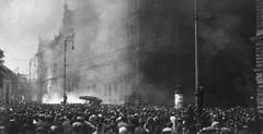
On August 1, 1976, the bridge tragically collapsed due to structural failure from water infiltration, resulting in a single fatality. The disaster prompted a national reevaluation of bridge safety. A temporary military-engineered crossing served until the new bridge was completed.
Third and Current Bridge (1980–Present):
Inaugurated on November 8, 1980, the present Reichsbrücke is a modern, prestressed concrete double-decker bridge, known as the “Johann Nestroy.” Measuring 864.5 meters, it accommodates six vehicle lanes, U-Bahn tracks, and dedicated paths for pedestrians and cyclists (Austria-Forum). Its robust design incorporates advanced structural monitoring, deep foundations, and waterproofing, ensuring long-term safety and durability.
For an authoritative historical account, see Schicksal einer Brücke: die Reichsbrücke von der Planung bis zum Einsturz by Walter Jaksch (Open Library).
Visiting the Reichsbrücke: Practical Information
Visiting Hours and Accessibility
- Open 24/7: The Reichsbrücke is accessible to pedestrians, cyclists, and vehicles at all times, with no entry fee or ticket required.
- Universal Access: Wide paths, ramps, and elevators make the bridge fully accessible for wheelchairs and strollers.
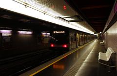
- Public Transport: Vienna’s U1 subway line crosses the bridge, connecting the city center to Donaustadt. Several tram and bus lines also serve the area.
Tickets and Guided Tours
- No Tickets Required: There is no charge to cross or visit the Reichsbrücke.
- Guided Tours: While there are no official bridge-only tours, many Vienna walking and cycling tours include the Reichsbrücke as part of their route. Booking in advance is advisable during peak tourist seasons.
Parking and Approaches
- Parking: No parking on the bridge, but several garages and street parking options are available on both sides, particularly near Donau City and Donaustadt.
- Cycling: Dedicated cycling paths run along both sides of the bridge, forming part of Vienna’s extensive cycling network (Komoot).
Architectural Features and Urban Context
The Reichsbrücke’s modernist, functional design reflects Vienna’s approach to combining aesthetics with urban utility. The double-decker structure separates vehicle, subway, pedestrian, and cycling traffic, supporting multimodal transit and enhancing safety.
- Structure: Prestressed concrete with hollow box girders, supporting U-Bahn tracks below the road deck.
- Length and Width: 864.5 meters long, six vehicle lanes, and dedicated paths for non-motorized traffic.
- Lighting: The bridge is illuminated at night, improving safety and creating a striking visual element in Vienna’s skyline.
- Integration: It links major landmarks such as the Vienna International Center and Donauinsel, and offers panoramic city and river views (Mapcarta).
Cycling and Walking: Routes and Tips
- Cycling: Reichsbrücke is a key segment in cycling circuits ranging from 16–25 km, suitable for all fitness levels. Bike rentals are available nearby (Komoot).
- Walking: Pedestrian paths are well maintained. For the best experience, visit during early morning or evening for fewer crowds and optimal photography conditions.
- Safety: Cyclists should be cautious on curves, and all users should be aware of increased activity during festivals or peak hours.
Nearby Attractions
- Donauinsel (Danube Island): A 21-km recreational island accessible from the bridge, popular for jogging, cycling, swimming, and picnics.
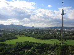
- Donaupark: Features green spaces, playgrounds, and the Donauturm (Danube Tower) with panoramic city views.
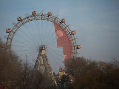
- Prater and Prater Hauptallee: Vienna’s historic amusement park and green boulevard, home to the Wiener Riesenrad (Giant Ferris Wheel).
- UNO City (Vienna International Centre): The UN’s European headquarters.
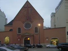
- St. Francis of Assisi Church: A neo-Romanesque architectural gem near Mexikoplatz.
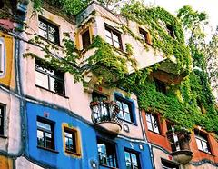
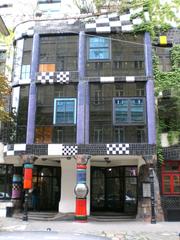
- KunstHausWien Museum: Home to contemporary art and the Hundertwasser Museum.
All attractions are easily accessible via U-Bahn, tram, or by foot and bike along the well-marked routes.
Visitor Amenities and Seasonal Tips
- Facilities: Benches, rest spots, and lighting along the bridge enhance comfort and safety. Ramps and elevators provide full accessibility.
- Best Time to Visit: Spring and early autumn offer mild weather and fewer crowds. Summer is lively with festivals and outdoor activities; winter visitors should dress warmly and watch for icy paths.
Events and Photographic Opportunities
- Major Events: The Vienna City Marathon and Donauinselfest (Europe’s largest open-air music festival) draw crowds and highlight the bridge’s role in city life.
- Photography: The bridge offers unique perspectives of Vienna’s skyline, Danube River, and Donauinsel. Sunrise, sunset, and nighttime illumination are especially photogenic. Use alt tags such as “Reichsbrücke Vienna at sunset” and “Vienna skyline view from Reichsbrücke footpath” for optimal SEO.
Frequently Asked Questions (FAQ)
Q: What are the Reichsbrücke visiting hours?
A: The bridge is open 24/7, with free access for everyone.
Q: Is there an entrance fee or ticket required?
A: No, the bridge is a public thoroughfare with no fees or tickets required.
Q: Are there guided tours of the bridge?
A: While there are no bridge-only tours, many city walking and cycling tours include the Reichsbrücke.
Q: Is the bridge accessible for people with disabilities?
A: Yes, wide paths, ramps, and elevators ensure full accessibility.
Q: What attractions are near the Reichsbrücke?
A: Donauinsel, Prater, Donaupark, UNO City, and St. Francis of Assisi Church are all nearby.
Q: Can I rent a bike near the Reichsbrücke?
A: Yes, several bike rental stations are located at both ends of the bridge.
Q: Are there parking facilities nearby?
A: Yes, parking garages and street parking are available near both ends of the bridge.
Conclusion and Call to Action
The Reichsbrücke is a powerful symbol of Vienna’s transformation, embodying the city’s historical resilience, engineering excellence, and commitment to sustainable urban life. Its seamless integration of transport, accessibility, and proximity to top city attractions make it an essential experience for any visitor. Whether you’re crossing for daily commutes, exploring on foot or bike, or seeking panoramic views and cultural events, the Reichsbrücke invites you to discover Vienna from a unique vantage point.
Plan your visit today—use real-time navigation apps, explore cycling and walking routes, and dive deeper into Vienna’s history. For more travel tips and up-to-date information, download the Audiala app, check our related guides, and follow us on social media.
References and External Links
- Austria-Forum: Reichsbrücke
- Open Library: Schicksal einer Brücke
- DDSG-BlueDanube Visitor FAQ
- Vienna Sightseeing Tours
- Mapcarta: Reichsbrücke
- Komoot: Reichsbrücke Cycling Route
- Wien Vienna: Reichsbrücke
- Wikipedia: Reichsbrücke
- Trek Zone: Reichsbrücke Vienna
- Secret Vienna: Reichsbrücke Collapse History
Image Suggestions:
Include photographs of the Reichsbrücke showing its double-decker design, panoramic Danube views, nighttime illumination, and nearby attractions. Suggested alt tags: “Reichsbrücke Vienna pedestrian path,” “Vienna skyline from Reichsbrücke,” “U-Bahn tracks below Reichsbrücke road deck,” “Reichsbrücke at night.”
Internal Linking Suggestions:
