Aderklaaer Straße Vienna: Visiting Hours, Tickets, Historical Sites, and Urban Travel Guide
Date: 04/07/2025
Introduction
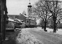
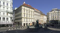
Aderklaaer Straße, situated in Vienna’s 21st (Floridsdorf) and 22nd (Donaustadt) districts, stands as a testament to the city’s seamless integration of historic roots and contemporary urban living. Named after the nearby village of Aderklaa in 1910, this thoroughfare reflects Vienna’s tradition of commemorating regional history in its street names and highlights the city’s expansion during the late 19th and early 20th centuries (Wien Geschichte Wiki). Today, Aderklaaer Straße is more than a street—it’s an urban corridor that connects residents, commuters, and visitors to Vienna’s vibrant northern districts, green spaces, and modern amenities.
This comprehensive guide covers the historical origins of Aderklaaer Straße, its significance in Vienna’s urban development, visitor access, transportation options, and nearby attractions. Whether you are a history enthusiast, a commuter, or a traveler seeking authentic Viennese experiences beyond the city center, this article equips you with everything you need for an enriching visit.
Table of Contents
- Historical Origins and Naming
- Urban Development and Strategic Significance
- Integration with Vienna’s Transportation Network
- Visiting Hours, Ticketing, and Accessibility
- Nearby Attractions and Urban Experience
- Architectural and Social Landmarks
- Demographic and Urban Context
- Citygate Development and Amenities
- Practical Visitor Tips
- Frequently Asked Questions (FAQ)
- Summary and Key Visitor Takeaways
- References and Further Reading
Historical Origins and Naming
Aderklaaer Straße owes its name to the nearby Lower Austrian village of Aderklaa, a site with notable historical significance due to its role in the Napoleonic Wars. The street was officially named in 1910 as part of Vienna’s practice of honoring regional history through urban toponymy. Its extension in 1947 by the Vienna City Council’s Committee for Culture further solidified its role in city planning, though part of it was later renamed Oskar-Grissemann-Straße (Wien Geschichte Wiki).
This naming tradition highlights the city’s expansion after the 1848 revolutions, integrating suburban areas to accommodate a burgeoning population and enhance connectivity (World City History).
Urban Development and Strategic Significance
Aderklaaer Straße is a central artery in Vienna’s urban landscape, especially within the context of the STEP 2025 Urban Development Plan (Smart City Vienna). As Vienna grows towards two million residents, sustainable mobility, compact city planning, and neighborhood revitalization guide its evolution. The street links residential zones, schools, and commercial hubs, functioning as a vital north-south axis.
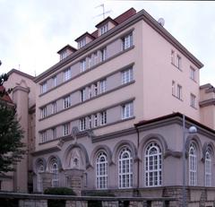
A notable landmark is the municipal school at Aderklaaer Straße 2, constructed in 1937, symbolizing the area’s educational and community focus (Wien Geschichte Wiki). The district’s design supports higher housing density and green space integration, echoing Vienna’s commitment to livability.
Integration with Vienna’s Transportation Network
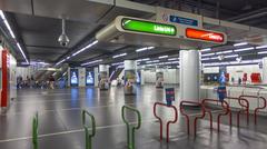
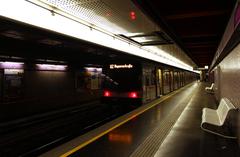
Aderklaaer Straße benefits from exceptional public transport connections. The U1 metro line’s Aderklaaer Straße station provides direct, rapid access to Vienna’s city center and other major districts (UrbanRail.Net). The U1, Vienna’s longest and busiest metro line, exemplifies the city’s focus on efficient, sustainable public mobility (Smart City Vienna).
Additional transport links include:
- Bus Lines: Multiple routes connect to adjacent neighborhoods (BusMaps).
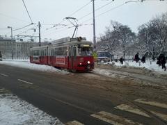
- Tram Stops: Located on nearby Leopoldauer Straße.
- Cycling Infrastructure: Dedicated bike lanes and bike-sharing stations.
- Park-and-Ride Facility: Adjacent to the station, with approximately 1,500 parking spaces.
Visiting Hours, Ticketing, and Accessibility
Visiting Hours
- Aderklaaer Straße (Street): Publicly accessible 24/7.
- Aderklaaer Straße U-Bahn Station: Operates from approximately 5:00 AM to midnight; extended hours on weekends and event nights.
Ticketing
- Public Transport: Vienna’s unified ticketing system covers U-Bahn, trams, and buses. Tickets (single, daily, weekly, Vienna City Card) are available at station machines, online, or via the Wien Mobil app (Wiener Linien).
- Validation: Tickets must be validated before boarding.
Accessibility
Aderklaaer Straße and its station are fully accessible, featuring:
- Elevators and ramps for step-free access.
- Tactile guidance for visually impaired travelers.
- Wide, well-maintained pavements.
- Accessible transport vehicles.
For detailed accessibility guides, consult Visiting Vienna.
Nearby Attractions and Urban Experience
While Aderklaaer Straße itself is primarily residential and transit-oriented, it serves as a gateway to vibrant local destinations:
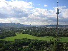
- Donaupark and Danube Tower (Donauturm): Expansive park with gardens and Austria’s tallest observation tower (Vienna Tourist Information).
- Alte Donau (Old Danube): Recreational lake for swimming, boating, and seasonal events (Visiting Vienna).
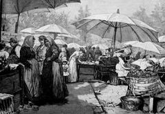
- Floridsdorf Market: Traditional market with fresh produce, open daily (6:00 AM–6:00 PM).
- Donauzentrum Mall: Vienna’s largest shopping center.
- Citygate Shopping Center: Modern retail, dining, and service hub (Citygate Shopping Center).
Nearby districts offer green spaces, local eateries, and authentic Viennese experiences.
Architectural and Social Landmarks
- Municipal School at Aderklaaer Straße 2: Built in 1937, emblematic of interwar educational investment (Wien Geschichte Wiki).
- Contemporary Housing Developments: Reflect Vienna’s post-war and modern architectural styles.
- Religious Institutions: Historically significant as record-keepers and community centers until 1938.
Demographic and Urban Context
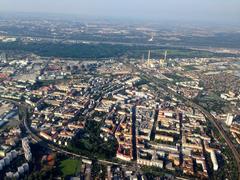
Floridsdorf and Donaustadt are among Vienna’s most dynamic, fast-growing, and diverse districts. Continuous investment in housing, infrastructure, and public services fuels a vibrant neighborhood atmosphere (Smart City Vienna).
Citygate Development and Amenities
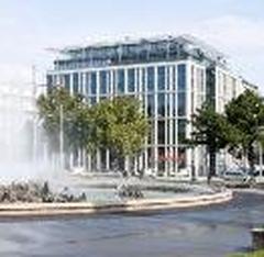
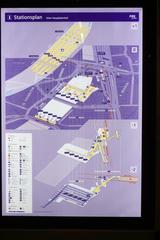
The Citygate project (2013–2015) has transformed the area around Aderklaaer Straße station with:
- Residential Towers: Approximately 1,000 housing units.
- Green Spaces: A landscaped park and playgrounds.
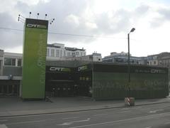
- Citygate Shopping Center: Directly accessible from the station, offering retail, supermarkets, cafés, and regular community events.
- Essential Services: Pharmacies, banks, and medical practices, all within pedestrian-friendly surroundings.
Practical Visitor Tips
- Transport: Use the U1 for direct access to the city center (Stephansplatz in 15–20 minutes); trams, buses, and cycling paths extend connectivity.
- Tickets: Purchase and validate tickets before boarding. Vienna Card offers unlimited travel and discounts (Vienna Tourist Board).
- Accessibility: Elevators, tactile guidance, and barrier-free infrastructure throughout.
- Safety: The area is well-lit, secure, and regularly patrolled; exercise standard precautions at night (Emily Embarks).
- Local Etiquette: Stand on the right on escalators, yield seats, avoid blocking doors, and respect quiet hours after 10:00 PM.
- Language: German is primary, but English is widely spoken. Basic German phrases are appreciated (All About Vienna).
- Dining: Reservations recommended for popular spots; tipping 5–10% customary; tap water is safe.
Frequently Asked Questions (FAQ)
Q: What are the operating hours of Aderklaaer Straße U-Bahn station?
A: Approximately 5:00 AM to midnight, with extended service on weekends.
Q: Is the area accessible for wheelchair users?
A: Yes, the station and public spaces are fully accessible with lifts and ramps.
Q: Where can I buy public transport tickets?
A: At station machines, online, or through the Wien Mobil App. Tickets must be validated before use.
Q: Are there guided tours in the area?
A: No dedicated tours for Aderklaaer Straße, but local agencies offer tours including Floridsdorf and nearby sites.
Q: Can I park my car near the station?
A: Yes, a large Park-and-Ride facility is available.
Q: What attractions are nearby?
A: Donaupark, Danube Tower, Floridsdorf Market, Donauzentrum, and Citygate Shopping Center.
Summary and Key Visitor Takeaways
Aderklaaer Straße exemplifies Vienna’s successful blend of historical heritage and modern urban planning. Its accessible U-Bahn station and strategic location make it an ideal base for exploring Vienna’s northern districts, green spaces, and local attractions. The area’s commitment to inclusivity, sustainability, and community ensures a comfortable and enriching experience for all types of visitors.
Top Tips:
- Use the U1 for fast access to and from the city center.
- Explore nearby green spaces and markets for authentic local culture.
- Take advantage of Citygate’s shopping and dining options.
- Travel outside rush hours for a more relaxed journey.
- Stay updated via the Wien Mobil App and Visiting Vienna for schedules, events, and accessibility.
References and Further Reading
- Aderklaaer Straße: A Historical and Visitor’s Guide to Vienna’s Dynamic Urban Corridor, 2025, Wien Geschichte Wiki (Wien Geschichte Wiki)
- Visiting Aderklaaer Straße Vienna: Accessibility, Transport, Tickets, and Nearby Historical Attractions, 2025, Visiting Vienna (Visiting Vienna)
- A Comprehensive Visitor’s Guide to Aderklaaer Straße Station: Layout, Tickets, Accessibility, and Nearby Attractions, 2025, Wiener Linien (Wiener Linien)
- UrbanRail.Net: Vienna U-Bahn Information, 2025 (UrbanRail.Net)
- Smart City Vienna: Urban Development Plan 2025, 2025 (Smart City Vienna)
- MetroLineMap: Aderklaaer Straße Station Overview, 2025 (MetroLineMap)
- Vienna Unwrapped: Things to Do in Vienna July (Vienna Unwrapped)
- Citygate Shopping Center (Citygate Shopping Center)
- The Vienna Blog: Practical Tips for Visiting Vienna (The Vienna Blog)
- Emily Embarks: Is Vienna Safe? (Emily Embarks)
- All About Vienna: Cultural Etiquette and Tips for Vienna Visitors (All About Vienna)
For more Vienna travel insights, itineraries, and event updates, download the Audiala mobile app and follow us on social media. Enjoy your journey through Aderklaaer Straße and the thriving districts of Vienna!


