Donaustadtbrücke Visiting Hours, Tickets, and Travel Guide for Vienna Historical Sites
Date: 04/07/2025
Introduction
Donaustadtbrücke is a cornerstone of Vienna’s modern infrastructure, spanning the Danube River and linking the dynamic district of Donaustadt with the city’s core. Beyond its role as a critical transit route, the bridge is a symbol of Vienna’s commitment to innovative engineering, sustainable urban development, and harmonious integration of transportation with recreation. This comprehensive guide provides in-depth insights into Donaustadtbrücke’s history, design, visitor amenities, accessibility, transportation links, and the many attractions just steps away, ensuring a rewarding experience for all who visit this remarkable landmark.
Table of Contents
- Introduction
- History and Engineering
- Visitor Information
- Nearby Attractions
- Accessibility and Safety
- Summary and Recommendations
- Sources and Further Reading
History and Engineering
Origins and Construction
Donaustadtbrücke was conceived during a period of major urban transformation, directly associated with the construction of Vienna’s Freudenau Hydropower Plant and the nearby Praterbrücke (Građevinar, Foller, 2006). It answered the city’s growing need for robust, flexible crossings to facilitate eastern expansion, particularly as Donaustadt evolved into a vital part of Vienna’s urban landscape.
Initially opened as a two-lane road bridge, Donaustadtbrücke was designed with the foresight to accommodate future transit needs. Its adaptability became central to its story, allowing a seamless transition from road traffic to the integration of the U2 metro line—a reflection of Vienna’s broader approach to anticipatory, multi-modal infrastructure (Građevinar, Foller, 2006).
Architectural and Technical Features
The bridge’s cable-stayed structure is characterized by a striking A-shaped pylon and a system of radiating cables, enabling long, unobstructed spans and a visually compelling profile (austriasites.com). Engineering flexibility was paramount: provisions for doubling the cables were built in from the start, allowing for future increases in load capacity and the safe accommodation of metro traffic (Građevinar, Foller, 2006).
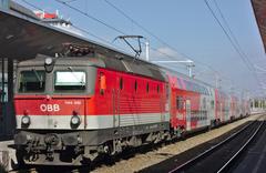
The bridge now supports the U2 line, with its metro deck above the original road structure. Corrosion-resistant steel, energy-efficient lighting, and vibration-dampening technologies ensure durability and minimize impact on the surrounding environment and neighborhoods (wienerlinien.at, wien.info).
Urban Integration and Development
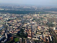
Donaustadtbrücke exemplifies Vienna’s “smart city” principles—integrating high-capacity public transport and pedestrian connectivity into urban planning. Its linkage of central Vienna with “Transdanubia” (Donaustadt and beyond) has been pivotal in fostering balanced, polycentric city growth (STEP2025 - Urban Development Plan Vienna).
The bridge’s location connects directly to Donauinsel, Vienna’s 21-kilometer-long recreational island, and serves as a launch point for further exploration of the city’s green spaces and modern districts (Spotted by Locals). The surrounding area, once underutilized, has been revitalized as a result, contributing to the city’s commitment to sustainable, human-centered urban environments (EIB City Transformed Vienna).
Socio-Cultural Significance
Donaustadtbrücke is not only a feat of engineering but also a vibrant part of daily life in Vienna. Its position offers direct access to Donauinsel’s parks, cycling routes, and festival grounds. The bridge also supports Vienna’s ambition to reduce car dependency by promoting cycling, walking, and public transit (STEP2025 - Urban Development Plan Vienna).
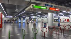
The area is enlivened by contemporary art installations, notably Portuguese artist Pedro Cabrita Reis’s vibrant works at the bridge’s U-Bahn station, which symbolically represent a new “crossing” of the Danube (en.wikipedia.org).
Visitor Information
Visiting Hours and Accessibility
- Bridge Access: The bridge is open 24/7 for U-Bahn trains; pedestrian and cycling access is provided by adjacent crossings (see below).
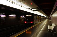
- U-Bahn Station: Donaustadtbrücke U-Bahn station operates from approximately 5:00 AM to midnight, with extended hours on weekends (wienerlinien.at).
- Accessibility: The station and platforms are fully accessible, with elevators, ramps, tactile guidance for the visually impaired, and clear signage (Vienna Tourist Board).
Note: The Donaustadtbrücke itself does not have pedestrian or bike lanes; use the nearby Praterbrücke for walking or cycling across the Danube (de.wikipedia.org).
Tickets and Transport
- Public Transit: Standard Wiener Linien tickets and passes are valid for U-Bahn, tram, and bus travel, including rides across Donaustadtbrücke (wienerlinien.at).
- Purchase Points: Tickets available at stations, online, and via the Wiener Linien app.
- Cycling: Dedicated lanes are available on adjacent bridges (Praterbrücke), with bike-sharing stations nearby (Grete Walz).
Guided Tours, Events, and Photography
- Guided Tours: While there are no tours dedicated solely to Donaustadtbrücke, many city and riverfront tours include it as a highlight, focusing on Vienna’s contemporary urban development and infrastructure.
- Events: The nearby Donauinsel hosts major festivals, notably the Donauinselfest each summer (visitingvienna.com), easily accessed from the bridge area.
- Photography: The U2 line offers panoramic views of the Danube and skyline, especially at sunrise or sunset. The best external vantage points are from Donauinsel or the riverbanks near Handelskai.
Practical Tips
- Best Time to Visit: Summer is ideal for festivals and outdoor activities; early mornings and evenings offer the best light for photography.
- Accessibility: The station and trains are wheelchair accessible; check individual attractions for additional accessibility features (Motion4Rent).
- No Entry Fee: There is no fee to cross or visit the bridge; transit tickets are only required for U-Bahn travel.
Nearby Attractions
Donauinsel (Danube Island)
A beloved recreational hub, Donauinsel stretches 21 kilometers and offers swimming, cycling, jogging, picnicking, and open-air bars. It’s the site of Vienna’s largest festivals and can be accessed from both ends of Donaustadtbrücke (Spotted by Locals, visitingvienna.com).
Danube Park & Danube Tower
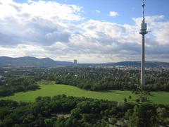
A short U-Bahn ride or walk from the bridge lies Donaupark, a vast green space with gardens, playgrounds, and the iconic Danube Tower (Donauturm)—Austria’s tallest building, offering panoramic city views and dining (viennatouristinformation.com).
Prater and Donaukanal
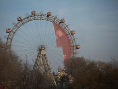
Prater park, home to the historic Giant Ferris Wheel, provides classic amusement park fun, hiking, and traditional dining. The Donaukanal is an urban hotspot, especially in summer, with street art, open-air bars, and the Summerstage festival (vienna-unwrapped.com).
Dining and Events
The riverbank and Donauinsel host a range of dining options, from relaxed cafes to Danube dinner cruises (travel-buddies.com). Traditional wine taverns (Heurigen) in nearby districts offer authentic Viennese cuisine and atmosphere (visitingvienna.com).
Accessibility and Safety
- Physical Accessibility: Step-free access, elevators, and tactile guidance at the U-Bahn station; wide, flat walkways at adjacent bridges (Vienna Tourist Board).
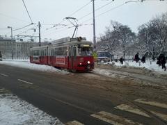
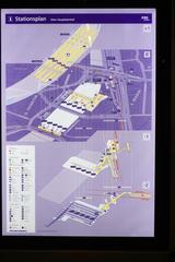
- Transport Integration: U2 metro, buses, and trams all connect at the Donaustadtbrücke station.
- Cycling/Walking: Use Praterbrücke for bike and pedestrian crossings; Wien Mobil bike-sharing is available nearby (Grete Walz).
- Safety: The bridge and U-Bahn station are well-lit, monitored, and secure. Emergency call points and staff assistance are available (Vienna Unwrapped).
Tip: Check weather conditions before visiting, as the bridge area can be windy or slippery in winter. During summer, bring water and sun protection.
Summary and Recommendations
Donaustadtbrücke epitomizes Vienna’s approach to urban vitality: blending innovation, sustainability, and accessibility. It is a transit artery for the U2 line, a vantage point over the Danube, and a gateway to Vienna’s most vibrant green and cultural spaces. For visitors, it offers panoramic views, seamless transport links, and proximity to top attractions like Donauinsel, Danube Park, and Prater (wienerlinien.at, viennatouristinformation.com).
Visitor Tips:
- Use the U2 metro line for fast, scenic access.
- If walking or cycling, use Praterbrücke.
- Take advantage of Vienna’s unified ticketing for convenience and savings.
- Plan visits to coincide with summer festivals or enjoy tranquil winter views.
- Download the Audiala app for personalized guides, accessibility info, and real-time updates (Audiala).
Sources and Further Reading
- Građevinar, Foller, 2006
- austriasites.com
- geschichtewiki.wien.gv.at
- Vienna Tourist Board
- Wiener Linien
- STEP2025 - Urban Development Plan Vienna
- EIB City Transformed Vienna
- Visiting Vienna - Alte Donau
- Vienna Tourist Information: Danube Park and Danube Tower
- Vienna Unwrapped: Summerstage and Donaukanal
- Wikipedia: Donaustadtbrücke Station
- Motion4Rent
- Grete Walz
- Austria by Öffis
- Spotted by Locals


