Friedensbrücke Vienna: Visiting Hours, Tickets, and Travel Guide
Date: 04/07/2025
Introduction
Friedensbrücke—literally “Peace Bridge”—is an iconic landmark spanning the Danube Canal in Vienna, Austria. Connecting the historic districts of Alsergrund (9th) and Brigittenau (20th), the bridge is both a vital transportation artery and a symbol of Vienna’s commitment to peace, unity, and urban progress. Built between 1924 and 1926 to commemorate the Treaty of Saint-Germain-en-Laye and the birth of Austria’s republic, Friedensbrücke stands as a living testament to the city’s resilience and evolving identity (de.wikipedia.org, discoverpeace.eu).
This in-depth guide details Friedensbrücke’s history and cultural significance, provides up-to-date visitor information, highlights nearby attractions, and offers travel tips for a seamless and enriching experience.
Table of Contents
- History of Friedensbrücke
- Cultural Significance
- Visitor Information
- Travel Tips and Getting There
- Nearby Attractions
- Frequently Asked Questions (FAQ)
- Facilities and Accessibility
- Final Tips and Summary
- References and External Links
History of Friedensbrücke
19th-Century Origins
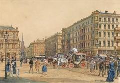
The location of today’s Friedensbrücke has been a major crossing over the Danube Canal since the late 1800s. By 1873, a horse-drawn tram began service here, and in 1897, the bridge became the route for Vienna’s first electric tram—an early indicator of the area’s importance as a transport hub (de.wikipedia.org).
Construction and Symbolism
The current bridge was constructed from 1924 to 1926, designed by Otto Schönthal and Emil Hoppe, with engineering by Waagner Biro. Its name, “Friedensbrücke,” honors the 1919 Treaty of Saint-Germain-en-Laye, marking a hopeful new era of peace after World War I and the founding of the Austrian republic (discoverpeace.eu).
WWII and Restoration
During the Nazi occupation in 1941, the bridge was renamed “Brigittenauer Brücke” in an attempt to suppress its peace symbolism. In 1946, the original name was restored, reaffirming Vienna’s dedication to peace and reconciliation (homepage.univie.ac.at).
Architectural Features
Friedensbrücke’s design features steel girders and a reinforced concrete deck, supporting wide lanes for vehicles, trams, cyclists, and pedestrians. The bridge is integral to Vienna’s U4 metro line and tram network, exemplifying modern engineering and urban planning (evendo.com).
Cultural Significance
Friedensbrücke is deeply woven into Vienna’s history and collective memory. It reflects the aspirations of “Red Vienna” in the interwar period, with its focus on social justice and international solidarity. The bridge has also served as a symbol of Vienna’s role as an East-West meeting point during the Cold War and remains a motif in local art and literature (discoverpeace.eu, wien.info).
Public spaces near the bridge host events and gatherings, and the structure itself is a favorite for leisurely strolls, photography, and community activities. Its integration with Vienna’s extensive cycling and pedestrian paths also highlights the city’s commitment to sustainability and green living.
Visitor Information
Opening Hours and Tickets
- Open 24/7: Friedensbrücke is a public bridge accessible year-round, day and night.
- No Admission Fees: There are no tickets or entrance fees; visitors can walk, cycle, or drive across at any time (evendo.com).
Guided Tours
Although there are no dedicated tours for Friedensbrücke, various Vienna walking tours include it among their stops, providing historical context and insights. Check local tourism offices or online platforms for schedules.
Travel Tips and Getting There
By Public Transport
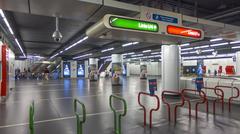
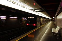
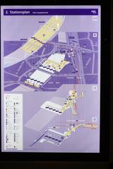
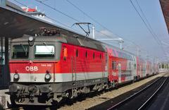
- U-Bahn (Metro): Take the U4 line to Friedensbrücke station, right next to the bridge (homepage.univie.ac.at).
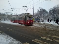
- Tram: Lines 5 and 33 stop nearby; line 2 also provides access within walking distance.
- Bus: Several city bus routes serve the Alsergrund and Brigittenau districts.
Important: From June 28 to September 1, 2025, the U4 line will be partially closed for modernization between Schottenring and Friedensbrücke. Replacement buses and alternative routes will be available—see real-time updates on the Wiener Linien website (wien.gv.at).
By Bicycle and On Foot
Vienna’s extensive cycling infrastructure makes it easy to reach Friedensbrücke by bike. Dedicated bike paths along the Danube Canal lead directly to the bridge, and several bike-sharing stations are nearby. Walking is equally pleasant, especially from neighboring districts along the scenic canal paths (wien.gv.at).
By Car
Vehicle lanes are available, but parking in the vicinity is limited. Public transportation or cycling is recommended for convenience and sustainability.
Nearby Attractions
- Sigmund Freud Museum: In Alsergrund, a short walk from the bridge.
- Prater Park: A recreational hub in Leopoldstadt, accessible via public transport.
- Danube Canal Promenade: Lined with street art, open-air bars, and walking trails.
- Augarten Park: A tranquil green space nearby.
- Schwedenplatz: Bustling square with historic and cultural attractions.
Pair your visit to Friedensbrücke with these nearby sites for a richer Vienna experience.
Frequently Asked Questions (FAQ)
Q: What are the visiting hours for Friedensbrücke?
A: The bridge is open 24/7 without restrictions.
Q: Is there an entry fee or ticket required?
A: No, Friedensbrücke is free and accessible to all.
Q: How can I reach Friedensbrücke by public transport?
A: Use the U4 metro (with summer 2025 adjustments), tram lines 5, 33, or 2, or local buses.
Q: Is the bridge wheelchair accessible?
A: Yes, ramps and smooth pathways ensure full accessibility.
Q: Are guided tours available?
A: While not dedicated to the bridge, several Vienna city tours include Friedensbrücke as a stop.
Q: When is the best time for photography?
A: Early morning, late afternoon, and sunset provide the best lighting and views.
Facilities and Accessibility
- Nearby cafés and shops: Numerous options for coffee, pastries, and snacks in both Brigittenau and Alsergrund.
- Rest areas: Benches and green spaces along the canal.
- Public toilets: Available at the U-Bahn station and in nearby parks.
- Accessibility: The bridge and public transport vehicles are fully accessible to wheelchair users and those with strollers (wien.gv.at).
- Safety: The area is well-lit and monitored, but visitors should remain aware of their surroundings, especially after dark.
Final Tips and Summary
Friedensbrücke is an inviting, historically rich destination that encapsulates Vienna’s values of peace, resilience, and inclusivity. Its strategic location, panoramic views, and easy access by public transport make it a must-see for both first-time visitors and locals. Whether you’re photographing the skyline at sunset, cycling along the canal, or exploring nearby cultural sites, Friedensbrücke offers a unique window into Vienna’s vibrant urban life.
For the best experience:
- Stay informed about public transport changes, especially during summer 2025.
- Consider combining your visit with a walk along the Danube Canal, a coffee in a riverside café, or a trip to Augarten.
- Download the Audiala app for interactive guides and up-to-date event info.
References and External Links
- Friedensbrücke (Wien) – Wikipedia
- Discover Peace: Friedensbrücke Vienna
- Friedensbrücke Vienna – Evendo
- Vienna U-Bahn U4 Line – University of Vienna
- Evendo: Friedensbrücke Vienna
- Vienna Public Transport Summer 2025 Updates – Wien.gv.at
- Friedensbrücke Cultural Guide – Wien.info
- Audiala App for Vienna Cultural Tours


