Puente de San Antonio Panzacola: Visiting Hours, Tickets, and Travel Guide – Mexico City
Date: 03/07/2025
Introduction
Nestled in the historic heart of Coyoacán, Mexico City, the Puente de San Antonio Panzacola stands as a living monument to the city’s colonial past, artistic heritage, and enduring community spirit. This guide offers an in-depth look at the bridge’s history, architectural features, cultural significance, visiting hours, ticket information, and practical travel tips—everything you need to plan a memorable experience at one of Mexico City’s most charming and historically rich sites (Coyoacán Alcaldía; CDMX Travel).
Table of Contents
- Introduction
- Historical Background and Construction
- Architectural Features and Artistic Significance
- Cultural and Social Importance
- Visiting Hours, Tickets, and Accessibility
- Travel Tips and Nearby Attractions
- Conservation Efforts and Responsible Tourism
- Frequently Asked Questions (FAQs)
- Visuals and Interactive Media
- Plan Your Visit
- References
Historical Background and Construction
Origin and Purpose:
Constructed between the 16th and 18th centuries, the Puente de San Antonio Panzacola was built to span the Magdalena River—Mexico City’s last living river—and link the agricultural lands of Coyoacán with neighboring San Ángel and the expanding capital. The bridge’s name, “Panzacola,” is believed to derive from the Nahuatl words for “flag” and “enclosure,” reflecting deep indigenous roots in the area’s history (CDMX Travel; INAH).
Materials and Craftsmanship:
Built from resilient local volcanic stone, the bridge’s arched masonry demonstrates a blend of Spanish colonial engineering and indigenous craftsmanship. Its original design allowed for efficient water flow and safe passage for pedestrians, carts, and animals—a testament to the foresight and skill of its builders (Programa Destinos México; Coyoacán Alcaldía).
Architectural Features and Artistic Significance
Design Highlights:
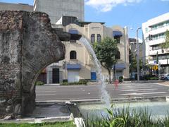
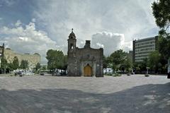
The bridge features classic single and multi-arched designs, robust stone balustrades, and parapets. Notable are the carved stone lizards along the structure, a nod to the area’s natural history and the etymology of “Panzacola.” The adjacent Capilla de San Antonio Panzacola, dating from the same era, adds a spiritual and visual complement to the site (wikicity.com; MexicoCity.cdmx.gob.mx).
Artistic Inspiration:
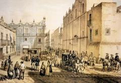
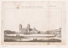
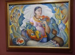
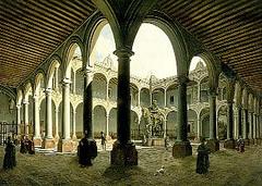
Artists such as José María Velasco, Eugenio Landesio, and Casimiro Castro have immortalized the bridge and its surroundings in paintings and drawings, highlighting its enduring aesthetic appeal (artsandculture.google.com).
Cultural and Social Importance
Symbol of Community:
Beyond its function, the bridge is a symbolic heart of Coyoacán, serving as a backdrop for festivals, local gatherings, and religious processions, especially during the feast of San Antonio. Its proximity to vibrant plazas, markets, and the Frida Kahlo Museum makes it an integral part of the neighborhood’s cultural life (Time Out Mexico).
Educational Value:
The bridge is frequently included in educational tours and history walks, providing a tangible connection to the city’s colonial, revolutionary, and modern narratives (INAH).
Visiting Hours, Tickets, and Accessibility
Location:
Francisco Sosa s/n, Barrio Santa Catarina, Coyoacán, 04010, Mexico City (mexicoalternativounam.com).
Hours:
The bridge is accessible to the public 24 hours a day, year-round. For safety and the best ambiance, visit between 9:00 AM and 6:00 PM.
Tickets:
There is no entrance fee—visiting the bridge and its surroundings is completely free. The neighboring Capilla de San Antonio Panzacola may have limited hours and may require prior arrangement for entry (letstraveltomexico.com).
Accessibility:
The bridge and surrounding area are pedestrian-friendly but feature cobblestone and uneven surfaces, which may present challenges for wheelchairs, strollers, and those with mobility issues.
Transport:
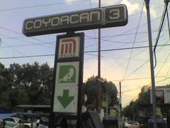
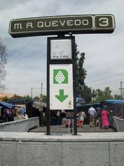
Easily reached by foot, bicycle, or public transit. The nearest Metro stations are “Coyoacán” and “Viveros/Derechos Humanos” (Line 3), each about a 20–30 minute walk away. Local buses and taxis are also available.
Travel Tips and Nearby Attractions
Best Times to Visit:
Weekdays are quieter; weekends are lively with more local activity. Early mornings offer peaceful, photogenic scenes.
Dress and Safety:
Wear comfortable walking shoes for cobblestones. The area is safe during daylight but standard urban precautions are advised after dark.
Nearby Sights:
- Plaza Santa Catarina: Leafy square with a historic yellow church.
- Frida Kahlo Museum (Casa Azul): Former home and museum of the iconic artist.
- Mercado de Coyoacán: Bustling market for street food and souvenirs.
- Jardín Centenario & Jardín Hidalgo: Central plazas perfect for relaxing and people-watching (voyagemexique.info).
Food & Refreshments:
Enjoy local treats like churros and elotes from street vendors, or dine at cafes along Francisco Sosa.
Events:
Coyoacán is vibrant during festivals, especially Day of the Dead (late October–early November) and San Antonio’s feast in June, when the bridge and chapel are decorated with flowers and candles (letstraveltomexico.com).
Conservation Efforts and Responsible Tourism
Preservation:
The bridge, declared a historical monument in 1932, is protected by municipal and national heritage authorities. Restoration projects and restricted vehicular access help safeguard the site (INAH).
Visitor Etiquette:
Respect the structure—avoid climbing, graffiti, or littering. Responsible tourism is essential for maintaining the bridge’s legacy.
Frequently Asked Questions (FAQs)
Q: Are there entry fees or tickets?
A: No, visiting the bridge is free.
Q: What are the best visiting hours?
A: Daylight hours (9:00 AM–6:00 PM) are best for safety and atmosphere.
Q: Is the bridge accessible for wheelchairs/strollers?
A: Cobblestone surfaces and lack of ramps make accessibility limited.
Q: Are guided tours available?
A: Yes, some walking tours include the bridge. The “Paseos Históricos” program offers occasional free guided tours (medium.com).
Q: Can I take photos?
A: Photography is encouraged. Please be respectful during religious services or community events.
Visuals and Interactive Media
For planning and inspiration, browse high-quality images of the bridge on official tourism websites and Google Arts & Culture. Look for alt tags such as “Puente de San Antonio Panzacola stone arches in Coyoacán” and “Magdalena River under Puente de San Antonio Panzacola.” Interactive maps can help you locate the bridge and nearby attractions.
Plan Your Visit
- Morning: Stroll along Francisco Sosa to the bridge.
- Midday: Visit Plaza Santa Catarina and have lunch at Mercado de Coyoacán.
- Afternoon: Explore the Frida Kahlo Museum or Jardín Centenario.
- Evening: Enjoy Coyoacán’s plazas and return to the bridge for sunset views.
For guided tours, digital maps, and real-time updates, download the Audiala app. Stay connected on social media for the latest news, travel tips, and cultural events.
References
- Coyoacán Alcaldía
- Programa Destinos México
- CDMX Travel
- mexicoalternativounam.com
- Time Out Mexico
- INAH
- letstraveltomexico.com
- wikicity.com
- artsandculture.google.com
- voyagemexique.info
- MexicoCity.cdmx.gob.mx
- medium.com


