Cumbres del Ajusco National Park: Comprehensive Visiting Guide, Hours, Tickets, and Travel Tips
Date: 04/07/2025
Introduction
Cumbres del Ajusco National Park is a striking natural retreat located on the southern edge of Mexico City. Renowned for its volcanic landscapes, exceptional biodiversity, and deep-rooted cultural history, the park is a sanctuary for outdoor enthusiasts, history buffs, and families looking for a refreshing escape from the city’s bustle. Just about 40 kilometers from Mexico City’s center, Cumbres del Ajusco is easily accessible and offers visitors a harmonious blend of ecological richness, historical significance, and recreational opportunities (INAH; Secretaría de Cultura CDMX).
This guide covers everything you need to know: from the park’s history and cultural legacy to current visiting hours, ticket details, transportation options, must-see attractions, and responsible travel tips.
Table of Contents
- Introduction
- Historical and Cultural Heritage
- Geography, Climate, and Ecology
- Visitor Information: Hours, Tickets, Accessibility
- Trails, Activities, and Wildlife
- Conservation Efforts and Visitor Responsibility
- Nearby Attractions and Cultural Sites
- Frequently Asked Questions (FAQ)
- Summary and Recommendations
- References
Historical and Cultural Heritage
Pre-Hispanic and Indigenous Significance
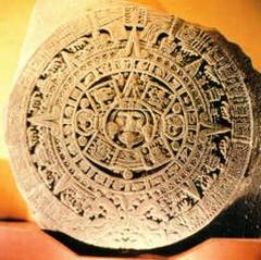
The name “Ajusco” comes from the Nahuatl “axochco,” meaning “place of water sources.” The mountain range was revered by the Mexica and earlier cultures for its abundant springs and sacred peaks. Archaeological evidence ties the area to Teotihuacan and Toltec civilizations, and indigenous groups like the Tlalpan and Xochimilca held rituals here to honor rain deities and ensure agricultural fertility (INAH; Secretaría de Cultura CDMX).
Colonial Era and Modern Transformation
Following the Spanish conquest, the region saw the introduction of European agricultural practices, ranches, and settlements. The Ajusco springs remained vital as water sources for colonial Mexico City. The rugged terrain also served as a sanctuary for indigenous communities who resisted colonial domination, helping preserve native traditions and languages (CONANP).
National Park Designation
Recognizing the area’s ecological and cultural value, Cumbres del Ajusco was declared a national park in 1936. Today, it protects more than 9,200 hectares of volcanic peaks, forests, and high-altitude grasslands, serving as an ecological buffer for the Valley of Mexico and a living record of the region’s history (CONANP; SEMARNAT).
Geography, Climate, and Ecology
Location and Topography
Situated in the Tlalpan and Magdalena Contreras boroughs, Cumbres del Ajusco is part of the Sierra de Ajusco-Chichinauhtzin in the Cordillera Neovolcánica. Its dramatic terrain includes Cerro Ajusco (La Cruz del Marqués), the city’s highest point at 3,930 meters, and other peaks like Pico del Águila and Pico Santo Tomás (Wikipedia).
Climate and Seasonal Variations
- Dry Season (Nov–Apr): Cool, clear, and ideal for hiking.
- Rainy Season (May–Oct): Afternoon showers, lush landscapes, and frequent fog.
- Winter: Occasional snowfall at higher elevations, making for unique scenic experiences.
Average daytime temperatures range from 10°C to 18°C, with colder nights—especially at altitude (Trek Zone).
Ecology and Hydrology
The park’s forests—dominated by pine, sacred fir, and oak—play a crucial role in regional water capture, feeding springs that supply Mexico City and forming the headwaters of the Balsas and Lerma rivers. Over 520 species of flora and fauna inhabit the park, including the endangered volcano rabbit (CONANP).
Visitor Information
Visiting Hours
- Open daily: 7:00 AM – 6:00 PM
- Best times: Early morning to avoid crowds and enjoy cooler temperatures
- Note: Hours may vary seasonally; check official sources before visiting.
Tickets and Fees
- Pedestrian entry: Free
- Vehicles: Approx. 30–50 MXN per car
- Guided tours/special activities: Additional fees may apply
Tickets are available at park entrances or through authorized tour operators (descubreanp.conanp.gob.mx; trip.com).
Accessibility and Transportation
- By car: Take the Picacho-Ajusco Highway or Cuernavaca exit from Tlalpan, following signs to San Miguel Ajusco.
- Public transport: Limited; some buses from Mexico City’s center reach nearby villages, from where taxis can be hired.
- Parking: Available but fills up on weekends and holidays.
- Facilities: Basic—restrooms, picnic areas, and some parking. Bring your own water, food, and supplies.
Accessibility for people with disabilities is limited; lower-elevation areas are more manageable, but steep and rocky trails may be challenging.
Trails, Activities, and Wildlife
Hiking and Outdoor Activities
- Cerro Ajusco (La Cruz del Marqués): The park’s highest peak (3,930 m), offering panoramic views on clear days (Wikipedia).
- Pico del Águila: Known for its eagle-like silhouette and scenic overlooks.
- Other activities: Mountain biking, trail running, horseback riding, and, in winter, snow hikes.
Wildlife and Birdwatching
- Mammals: Volcano rabbit, white-tailed deer, coyote, bobcat, ringtail.
- Birds: Red-tailed hawks, Mexican jays, woodpeckers, owls, and more.
- Herpetofauna: Mexican alligator lizard, Ajusco salamander, and various frogs.
Best wildlife viewing times are early morning and late afternoon (descubreanp.conanp.gob.mx; Trek Zone).
Cultural and Historical Sites
Explore archaeological remnants from pre-Hispanic cultures and colonial-era churches in nearby villages like Santo Tomás de Ajusco and San Miguel Ajusco. These towns also host traditional festivals and serve as gateways to the park (Alcaldía Tlalpan).
Conservation Efforts and Visitor Responsibility
Cumbres del Ajusco is vital for city air quality, water regulation, and biodiversity. However, it faces threats from urban encroachment, illegal logging, and lack of a formal management plan (news.mongabay.com).
Visitor Guidelines:
- Stay on marked trails
- Pack out all trash
- Avoid disturbing wildlife and plants
- Participate in guided tours and educational programs to support conservation (nationalparksassociation.org)
Nearby Attractions and Cultural Sites
- Pedregal de San Ángel Ecological Reserve: Volcanic landscapes and unique flora
- Coyoacán: Colonial charm, museums, and traditional markets
- Tlalpan Historic Center: Plazas, churches, and local eateries
- Museo Nacional de Antropología, Chapultepec Castle, Museo Soumaya: All within easy driving distance from the park (Trek Zone)
Frequently Asked Questions (FAQ)
Q: What are the park’s opening hours?
A: 7:00 AM to 6:00 PM daily; confirm before visiting as times may change seasonally.
Q: Is there an entrance fee?
A: Pedestrian entry is free; vehicle entry is 30–50 MXN.
Q: How do I get there by public transport?
A: Limited; take buses toward Tlalpan or San Miguel Ajusco, then use taxis for the final stretch.
Q: Are pets allowed?
A: Pets are generally not permitted to protect local wildlife.
Q: Are guided tours available?
A: Yes, local organizations offer ecological and cultural tours.
Q: Is the park accessible for people with disabilities?
A: Accessibility is limited to certain areas; contact park staff for up-to-date info.
Summary and Recommendations
Cumbres del Ajusco National Park is a premier destination for those seeking natural beauty, outdoor adventure, and a window into Mexico’s layered history. Its sacred peaks, lush forests, and vibrant wildlife make it a top spot for hiking, photography, and cultural exploration. Modest entrance fees, basic amenities, and proximity to Mexico City make it accessible for day trips or longer stays.
Visitor Tips:
- Arrive early for the best experience
- Dress in layers and wear sturdy shoes
- Bring your own water and snacks
- Respect trail etiquette and conservation rules
- Download the Audiala app for interactive maps, tours, and real-time updates
Responsible tourism and participation in conservation initiatives support the park’s ongoing preservation. Whether you’re drawn by panoramic vistas, rare species, or the deep cultural heritage, Cumbres del Ajusco offers an enriching and unforgettable adventure.
References
- This article draws on official and expert sources, including INAH, Secretaría de Cultura CDMX, CONANP, SEMARNAT, Alcaldía Tlalpan, Programa Destinos México, National Parks Association, and Mongabay News.
For up-to-date details, visit CONANP or Programa Destinos México.

