Pre-Hispanic Origins and Etymology
Atlalilco’s roots date back to the pre-Hispanic era, when the Valley of Mexico was a patchwork of lakes and indigenous settlements. "Atlalilco" is Nahuatl for "where water is contained," highlighting the area’s close relationship with the region’s waterways (MexicoCity.cdmx.gob.mx). Historically, Atlalilco formed one half of Iztapalapa, paired with Axomulco. Its location enabled crucial agricultural activity, especially the innovative chinampa system (Wikipedia).
Atlalilco in the Aztec Era
During the Aztec Empire’s height, Atlalilco and Iztapalapa were integral to the vast hydraulic and agricultural systems that sustained Tenochtitlan. The region’s chinampas and waterways enabled intensive food production and facilitated trade and transportation (blog.vibeadventures.com). Atlalilco’s communities played active roles in religious ceremonies and the maintenance of these systems, furthering their integration into the empire’s cultural and economic life.
Colonial Transformation and Urban Development
The Spanish conquest in 1521 brought sweeping changes. The draining of lakes and construction of churches over indigenous ceremonial sites marked the colonial transformation (mexicohistorico.com). Atlalilco retained elements of its indigenous identity within the framework of new colonial institutions. Despite these changes, local traditions, festivals, and communal organization survived and continue to shape the neighborhood’s character.
Modernization and the Arrival of the Metro
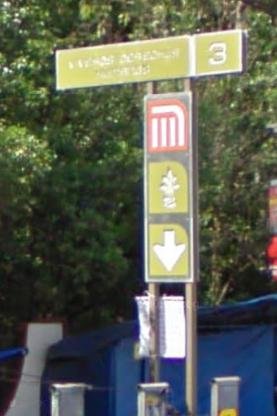
The 20th and 21st centuries saw rapid urbanization, culminating in the construction of the Mexico City Metro. The Atlalilco metro station, inaugurated in 1994, serves as a crucial interchange between Lines 8 and 12 (Wikipedia). The station’s logo—a stylized well—pays tribute to Atlalilco’s origins. Its extended transfer tunnel, built after an intermediate station was cancelled, reflects the scale of modernization in the area (MexicoCity.cdmx.gob.mx).
Visiting Atlalilco: Practical Information
Visiting Hours and Tickets
- Neighborhood & Streets Open access, no fee required.
- Metro Station Operational daily from 5:00 AM to midnight.
- Cultural Sites & Parks Check specific sites for hours; most open 9:00 AM–5:00 PM, Tuesday–Sunday.
- Metro Fare 5 pesos per ride, payable via Integrated Mobility Card (MexicoCity.cdmx.gob.mx).
Accessibility and Travel Tips
- Accessibility Elevators and ramps at the metro station.
- Transport Use Metro Lines 8 and 12; avoid rush hours (7–9 AM, 5–8 PM).
- Safety Exercise standard urban caution, especially at night.
- Attire Comfortable shoes recommended for exploring historic streets.
Guided Tours and Special Events
- Guided Tours Offered by local operators, covering history, architecture, and festivals (GetYourGuide).
- Festivals Major events include the Feast of Santa Bárbara and the Passion Play of Iztapalapa.
- Booking Reserve in advance during festival periods for best access.
Atlalilco’s Barrios Originarios and Nearby Attractions
Explore the historic barrios originarios (original neighborhoods) of Iztapalapa, such as Santa Bárbara and San Lucas, each with its own unique traditions (MexicoCity.cdmx.gob.mx). Notable nearby attractions include:
- Cerro de la Estrella National Park Site of the New Fire Ceremony.
- Pueblo Culhuacán Known for colonial chapels and cultural centers.
- Casa de Cultura Guillermo Bonfil Batalla Local arts and heritage.
- Xochimilco UNESCO-listed canals and chinampas, accessible via Metro Line 12 (Mapcarta).
- Coyoacán Frida Kahlo Museum, markets, and colonial plazas.
Frequently Asked Questions (FAQ)
Q: What are Atlalilco’s visiting hours?
A: The neighborhood and metro station are accessible daily, with the metro operating from 5:00 AM to midnight. Check individual sites for specific hours.
Q: Is there an entrance fee to visit Atlalilco?
A: No fee for the neighborhood; metro fare is 5 pesos per ride. Some cultural sites or tours may require tickets.
Q: Are guided tours available?
A: Yes, guided tours focusing on history and culture are available through local operators.
Q: Is Atlalilco accessible for people with disabilities?
A: The metro station features elevators and ramps. Some historic streets may be uneven.
Q: What are the best times to visit?
A: Spring (March–May) for festivals; weekdays and mornings for fewer crowds.