Anny Jagiellonki Bridge Visiting Hours, Tickets, and Warsaw Historical Sites Guide
Date: 03/07/2025
Introduction
The Anny Jagiellonki Bridge in Warsaw, Poland, stands as a testament to the city’s continuous evolution—melding modern engineering with cultural heritage. Inaugurated in December 2020, the bridge spans the Vistula River and connects key southern districts, serving as a crucial transport artery and urban landmark. With its advanced construction techniques and dedication to multimodal accessibility, the Anny Jagiellonki Bridge embodies both Warsaw’s infrastructural ambitions and its historical narrative, named after the renowned Queen Anna Jagiellon. This guide delivers comprehensive insights for visitors: practical travel tips, accessibility details, historical background, and the bridge’s urban and cultural significance (Wikipedia, WhiteMAD, Bailey Bridge Solution, 2024).
Contents
- Historical Context and Construction
- Visiting Information: Hours, Accessibility, and Getting There
- Bridge Features: Architecture, Engineering, and Urban Integration
- Cultural and Economic Impact
- Nearby Attractions and Travel Tips
- Frequently Asked Questions (FAQ)
- Visuals and Further Resources
- Conclusion and Visitor Recommendations
- Sources
Historical Context and Construction
Warsaw’s Urban Need and Planning
Warsaw’s rapid expansion and the natural barrier of the Vistula River have made robust cross-river connections vital. Historically, existing bridges like Łazienkowski and Siekierkowski struggled with increasing traffic, prompting city planners to initiate a new southern crossing to relieve congestion and support the S2 expressway—the city’s southern ring road (Wikipedia).
Initially referred to as the “Southern Bridge” (Most Południowy), the structure was officially named in 2021 after Anna Jagiellon, a monarch of the Jagiellonian dynasty, symbolizing a bridge between Warsaw’s regal heritage and its modern aspirations.
Construction Milestones and Techniques
- Timeline: Construction commenced in June 2017 and concluded in December 2020, spanning approximately three and a half years.
- Engineering: The bridge consists of twin parallel structures, each with four traffic lanes, accompanied by separated pedestrian and cycling paths.
- Techniques Used:
- Incremental Launching Method: Assembled sections are gradually pushed across supports, minimizing environmental impact.
- Balanced Cantilever Method: Allows construction of long spans over the river without falsework, protecting the river ecosystem.
- Movable Scaffolding System: Used for precise casting of concrete segments on the approaches (Wikipedia).
- Materials: The superstructure employs steel and reinforced concrete, with foundations anchored in large-diameter drilled piles for stability on the floodplain (WhiteMAD).
- Sustainability: The project achieved high DGNB environmental and technical quality indices, reflecting its commitment to sustainable construction (DGNB).
Visiting Information: Hours, Accessibility, and Getting There
Visiting Hours and Tickets
- Open 24/7: The bridge is accessible at all times for pedestrians, cyclists, and vehicles.
- Free Entry: No tickets or entrance fees are required to cross or visit the bridge.
Accessibility
- Universal Access: Barrier-free ramps, tactile paving, and clear signage ensure the bridge is accessible to all, including wheelchair users and families with strollers.
- Lighting: Energy-efficient LED lighting provides safety and ambiance for evening visits.
How to Get There
- Public Transport: Multiple bus lines serve the Wilanów and Wawer districts. The bridge is linked to the city’s cycling and pedestrian networks (ZTM Warsaw).
- By Car: Integrated into the S2 expressway, with parking at nearby junctions.
- Cycling/Walking: Connects seamlessly to city cycling paths and riverfront boulevards.
Bridge Features: Architecture, Engineering, and Urban Integration
Dimensions and Capacity
- Length: 1.5 kilometers (0.93 miles)—the longest in Warsaw
- Width: Each structure supports four traffic lanes, plus dedicated pedestrian and cycling lanes
- Span Distribution: 342 meters (west bank), 628 meters (east bank), plus spans over the river and floodplain (Wikipedia)
Architectural and Environmental Integration
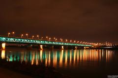
- Design: Minimalist, sleek lines using steel and glass, harmonizing with both historic and contemporary elements of the city.
- Environmental Sensitivity: Flat deck and careful landscaping minimize visual and ecological impact.
- Nighttime Illumination: The bridge transforms into a luminous landmark after dark.
Urban Connectivity
- Strategic Role: A critical link in the S2 expressway and Warsaw’s development strategy, fostering inter-district cohesion and supporting local centers (EIB, 2019).
- Multimodal Function: Accommodates vehicles, public transport, pedestrians, and cyclists, promoting sustainable mobility (Bailey Bridge Solution, 2024).
Cultural and Economic Impact
- Symbolism: Named for Queen Anna Jagiellon, the bridge honors Poland’s royal past while reflecting Warsaw’s modern identity (Warsaw History).
- Community Space: Expansive pedestrian zones serve as gathering points, offering panoramic city and river views.
- Development Catalyst: Enhanced accessibility has stimulated economic growth, increased property values, and attracted new investment, especially on the east bank (EIB, 2019).
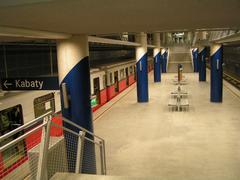
- Public Transport Integration: Direct tram and bus links, plus proximity to metro stations, ensure the bridge is a vital node in Warsaw’s transit grid.
Nearby Attractions and Travel Tips
- Czerniakowski Port: Scenic riverfront, cafes, and leisure spaces near the western approach.
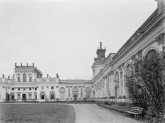
- Wilanów Palace: A short drive away, this historic royal residence offers tours and gardens.
- Vistula Boulevards: Lively promenades with art installations, pop-up bars, and event spaces.
- Żoliborz & Białołęka Districts: Leafy parks, modernist architecture, and authentic Warsaw experiences.
Tips:
- Visit at sunrise or sunset for the most impressive views and photographs.
- Be cautious of cyclists on shared pathways; stay to the right and keep valuables secure.
- No public toilets on the bridge—use nearby park or shopping center facilities.
- Download city transport apps for real-time schedules and ticketing (Veturilo).
Frequently Asked Questions (FAQ)
Q: What are the visiting hours?
A: The bridge is open 24/7, year-round.
Q: Is there an entry fee?
A: No, access is free for all users.
Q: Is the bridge accessible for people with disabilities?
A: Yes, with barrier-free design and tactile paving.
Q: Can I cycle or walk across the bridge?
A: Yes, both pedestrians and cyclists have dedicated lanes.
Q: Are there guided tours?
A: While there are no official tours of the bridge itself, local tours may include it as a point of interest.
Q: Are there amenities on the bridge?
A: Benches and rest areas are available; public toilets and food vendors are nearby but not on the bridge.
Visuals and Further Resources
- Images: Panoramic photos at sunrise/sunset, architectural details, and aerial views
- Maps: Highlighting access points and connections to public transport
- Virtual Tours: Explore interactive panoramas if available
Conclusion and Visitor Recommendations
The Anny Jagiellonki Bridge represents Warsaw’s forward-thinking vision—balancing historical homage, innovative engineering, and inclusive urban design. Open day and night with no entry fee, it’s an accessible vantage point for exploring the city’s skyline and a gateway to vibrant neighborhoods and historical sites. Whether crossing by foot, bike, or car, visitors can enjoy breathtaking views and direct links to Warsaw’s top attractions. For an optimal experience, leverage public transportation, visit during golden hour, and combine your bridge walk with local sightseeing.
Plan your visit today, and for the latest updates and travel tips, download the Audiala app. Share your experience with #AnnyJagiellonkiBridge and become part of Warsaw’s evolving story.
Sources and Further Reading
- Anny Jagiellonki Bridge, Warsaw: History, Visitor Info, and Travel Tips
- Architectural and Engineering Features of Anny Jagiellonki Bridge
- Anny Jagiellonki Bridge in Warsaw: Visiting Hours, Tickets, and Historical Significance
- Visiting Anny Jagiellonki Bridge in Warsaw: Hours, Access, and Tips
- WhiteMAD, New Footbridge in Warsaw: The Construction Connected the Czerniakowski Port Wharves
- Bailey Bridge Solution, The Significance and Impact of Pedestrian Bridges in Urban Landscapes, 2024
- Warsaw History, Warsaw - The Heart of Poland and Its Historical Significance


