Tomášikova, Bratislava, Slovakia: Visiting Hours, Tickets, and Historical Sites Guide
Date: 15/06/2025
Introduction
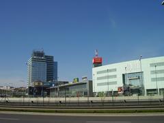
Tomášikova Street is a dynamic urban corridor in Bratislava, weaving together the city’s historical layers and contemporary vibrancy. Named after Samo Tomášik, a celebrated Slovak writer and Lutheran pastor, this street exemplifies the city’s commitment to national heritage while embracing modern development. Situated between the Ružinov and Nové Mesto districts, Tomášikova offers a blend of administrative landmarks, recreational spaces, and excellent transport links.
This in-depth guide covers Tomášikova’s historical evolution, cultural significance, key attractions, practical visitor information, and highlights major nearby sites like Bratislava Castle. Whether you are a history enthusiast, urban explorer, or first-time visitor, this guide will help you make the most of your time on Tomášikova and beyond (sk.wikipedia; bratislava.info; Minv.sk; VisitBratislava.com).
Table of Contents
- Introduction
- Historical Evolution of Tomášikova
- Attractions and Key Features
- Visitor Information
- Frequently Asked Questions (FAQ)
- Bratislava Castle: History & Visitor Guide
- Summary & Recommendations
- References
1. Historical Evolution of Tomášikova
Early Geography and Historical Context
Tomášikova’s roots trace back to the left bank of the Novozámocké arm of the Danube River, an area that was gradually urbanized from the late 19th century. While Bratislava’s city core was a historic crossroads since Celtic and Roman times, the Tomášikova area remained peripheral until the city’s expansion brought new infrastructure and residential quarters (sk.wikipedia; bratislava.info).
Naming and Cultural Significance
The street honors Samo Tomášik (1813–1887), embodying the city’s tradition of commemorating key figures in national culture. This practice, especially prevalent in the 20th century, aimed to reinforce Slovak identity within urban spaces (sk.wikipedia).
20th Century Urban Development
Pre-World War II & Early Modernization
Although railways and industry began shaping Bratislava in the early 20th century, Tomášikova’s transformation accelerated only mid-century (bratislavaguide.com).
Socialist Urban Planning
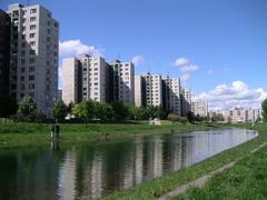
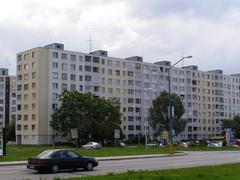
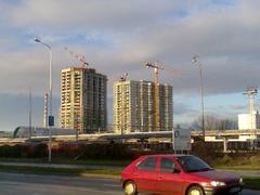
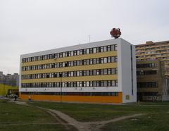
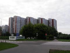
From the 1950s to the 1980s, socialist planners developed Tomášikova into a wide, multi-lane avenue, establishing it as a core axis for new housing estates, administrative centers, and transportation links within Ružinov and Nové Mesto (architektura-urbanizmus.sk).
Post-1989 and Contemporary Urbanism
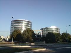
Following political and economic changes after 1989, Tomášikova witnessed significant office, commercial, and mixed-use development, mirroring Bratislava’s broader urban evolution (humannageografia.sk).
2. Attractions and Key Features Along Tomášikova
Spatial Layout and Connectivity
Tomášikova stretches southeast to northwest, intersecting Gagarinova, Ružinovská, Trnavská cesta, and Vajnorská streets. It separates Štrkovec and Ostredky neighborhoods and features a central tram median between Vajnorská and Bratislava-Nové Mesto railway station (sk.wikipedia).
Transport Infrastructure
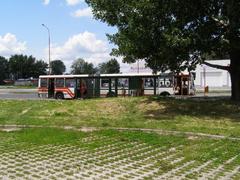
The street is a key part of Bratislava’s public transport network, serviced by several tram and bus lines. The tram corridor connects Ružinov and Nové Mesto with the city center, ensuring efficient movement for commuters and visitors (skyscrapercity.com).
Notable Landmarks
- Kuchajda Lake: A recreational area for jogging, swimming, and relaxation.
- Bratislava-Nové Mesto Railway Station: Major transport hub at the street’s northern end.
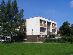
- Office for Spatial Planning and Construction (Tomášikova 64A): Administrative landmark (uupv.sk).
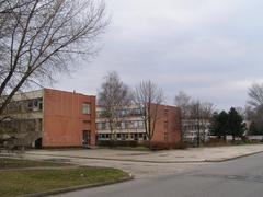
- Educational Institutions: Including Gymnázium Ladislava Novomeského, hosting occasional public events (GLNT Edupage).
- Štrkovec Lake: Popular for outdoor sports and leisure.
3. Visitor Information: Planning Your Visit
Accessibility and Transport
- Public Transport: Easily reached via tram lines 1 and 3 and various bus routes. The nearby Bratislava-Nové Mesto railway station connects with regional and national lines (VisitBratislava.com).
- Cycling/Walking: Wide sidewalks and bike-sharing stations make the area pedestrian- and cyclist-friendly.
- Parking: Limited on-street and paid parking options are available, especially near administrative buildings.
Visiting Hours and Tickets
- Street Access: Open 24/7; no entrance fees.
- Administrative Buildings: Typically open Monday–Friday, 8:00–15:00 or 17:00, with reduced hours on Fridays (Minv.sk).
- Recreational Areas: Parks and lakes are generally open from dawn to dusk.
Guided Tours and Photographic Spots
- While Tomášikova is not the focus of dedicated tours, some Bratislava city tours may highlight its modernist architecture and urban significance.
- Photo Tip: The broad avenue, tram lines, and surrounding parks are best captured during golden hour.
Nearby Attractions and Amenities
- Dining: Cafés, bistros, and restaurants offer Slovak and international cuisine.
- Parks: Ružinov Park and Štrkovec Lake provide green spaces for relaxation.
- Shops & Services: Pharmacies, banks, and convenience stores are close by.
Safety Tips
Tomášikova is considered safe. As in any city, remain aware of your belongings, especially in crowded public transport or events.
4. Frequently Asked Questions (FAQ)
Q: How do I get to Tomášikova from the city center?
A: Take tram lines 1 or 3 towards Ružinov or Nové Mesto; stops are well marked.
Q: Are there entrance fees for attractions on Tomášikova?
A: The street is free to visit. Some facilities at Kuchajda or Štrkovec lakes may charge fees.
Q: Is Tomášikova accessible for people with disabilities?
A: Yes, with wide sidewalks and accessible tram stops; check specific venues for details.
Q: Are there guided tours on Tomášikova?
A: No dedicated tours, but some city tours include the area.
Q: What nearby attractions can I visit?
A: Old Town, Blue Church, and Eurovea Shopping Center are within 10–15 minutes by tram or bus.
5. Bratislava Castle: History, Visiting Hours, and Visitor Guide
Overview
Bratislava Castle, an iconic hilltop fortress above the Danube, is a must-see for history and culture lovers. With origins in the 9th century, it has served as a royal residence and strategic fortification, and now hosts the Slovak National Museum.
Visiting Information
- Opening Hours:
- April–October: Daily 9:00–18:00
- November–March: Daily 10:00–16:00
- Closed January 1st and December 24–26
- Tickets:
- Adults €10, seniors/students €7, children under 6 free. Family and group discounts available.
- Tickets can be purchased onsite or online.
- Guided Tours: Available in several languages; advance booking recommended.
- Accessibility: Ramps and assistance available for visitors with limited mobility.
- Photo Spots: Outer terraces, castle tower, and gardens offer panoramic city and river views.
- Nearby Attractions: Old Town, Slovak National Gallery, UFO Observation Deck.
Travel Tips
- Arrive early to avoid crowds.
- Wear comfortable shoes for cobblestone paths.
- Combine your visit with a Danube promenade walk.
- Check Bratislava Castle for event updates.
6. Summary & Recommendations
Tomášikova Street epitomizes Bratislava’s transformation from rural riverbank to a modern city artery. It blends administrative and educational landmarks, recreational spaces like Kuchajda and Štrkovec lakes, public transport convenience, and diverse architecture. The street and its surroundings are accessible, safe, and vibrant, offering a glimpse into everyday Bratislava life beyond the Old Town.
For up-to-date visitor info, event schedules, and interactive maps, refer to official tourism sites and the Audiala app. Tomášikova’s evolving cityscape makes it a rewarding destination for those seeking Bratislava’s contemporary spirit alongside its rich history (sk.wikipedia; uupv.sk; VisitBratislava.com).
7. References
- Tomášikova Street, Bratislava: History, Attractions, and Travel Tips
- Bratislava History
- Office for Spatial Planning and Construction
- Bratislava Public Transport and Tourism
- Urban Development of Bratislava
- Post-1989 Urban Transformation in Bratislava
- Administrative Buildings Information
For more Bratislava guides, transport updates, and city insights, download the Audiala app or visit the official tourism portals.
