Golden Horn Metro Bridge Istanbul: Complete Visiting Hours, Tickets, and Attractions Guide
Date: 04/07/2025
Introduction
The Golden Horn Metro Bridge (Haliç Metro Köprüsü) is a defining symbol of Istanbul’s modern transformation, seamlessly connecting the historic districts of Beyoğlu and Fatih. As both an engineering marvel and an urban landmark, the bridge enhances mobility across the Golden Horn estuary while maintaining a deep respect for Istanbul’s UNESCO-protected skyline. This guide presents everything visitors need to know: from its architectural highlights, historical context, and cultural significance to practical tips on access, tickets, and nearby attractions (Springer; Nomadic Niko).
Table of Contents
- Origins and Planning
- Construction Timeline and Technical Features
- Heritage and Cultural Significance
- Visiting Information: Hours, Tickets, Access
- Nearby Attractions
- Integration with Istanbul’s Urban Fabric
- Sustainability and Environmental Features
- Frequently Asked Questions (FAQ)
- Summary and Recommendations
Origins and Planning
Conceived in the early 2000s, the Golden Horn Metro Bridge was envisioned to modernize Istanbul’s transit network by linking the city center with the Atatürk Airport and beyond via the M2 metro line. Designed by architect Hakan Kıran and engineer Michel Virlogeux, the bridge’s cable-stayed structure was carefully planned to minimize its impact on the city’s historic skyline, resulting in reduced pylon heights and a color scheme that complements surrounding landmarks (Springer; Nomadic Niko). Strategic placement between Beyoğlu and Fatih ensures efficient transit and urban integration.
Construction Timeline and Technical Features
- Construction Period: 2009–2014
- Total Length: 936 meters (3,071 feet)
- Central Span: 180 meters (590 feet)
- Pylon Height: 65 meters (after heritage impact modifications)
- Width: 12.6 meters
- Key Features:
- Cable-stayed design: Offers structural efficiency and an elegant profile.
- Swing section: On the Küçükpazar side, a 120-meter swing bridge enables ships to pass, opening within 4–6 minutes (Nomadic Niko).
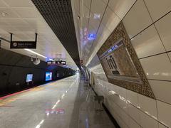
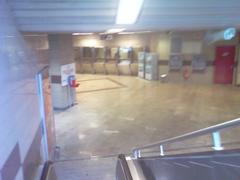
- Haliç Metro Station: Located mid-span, with a 180-meter platform and 90-meter canopy (Wikipedia).
- Pedestrian Walkways: Wide, secure paths on both sides for pedestrians and cyclists.
Heritage and Cultural Significance
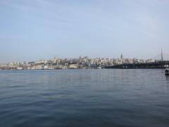
The bridge’s location and design were subject to thorough heritage impact assessments due to proximity to landmarks like the Süleymaniye Mosque and Hagia Sophia. Adjustments, including lower pylons and subdued lighting, were made to balance modern needs with preservation of the UNESCO World Heritage skyline (Michael Kloos). Despite its contemporary appearance, studies show the bridge harmonizes with, though subtly alters, the city’s historical visual identity (Yildiz University).
Visiting Information: Hours, Tickets, Access
Visiting Hours
- Pedestrian Walkways: Open 24/7 for walking and cycling.
- Metro Services: M2 line operates approximately 6:00 AM–midnight daily (absoluteistanbul.com; istanbul.tips).
Tickets & Entry
- Pedestrian and Cyclist Access: Free, no ticket required.
- Metro: Requires Istanbulkart (public transit card), available at metro stations and kiosks.
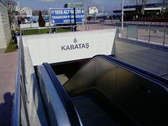
- Accessibility: Elevators and ramps at both ends; bridge and stations are wheelchair and stroller accessible.
Best Times to Visit
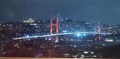
- Photography: Early morning and late afternoon offer the best natural light; sunset and evening showcase beautiful LED illumination.
- Safety: Well-lit and monitored, but stay alert during late-night hours.
How to Get There
- By Metro: M2 line—get off at Haliç Station, which is on the bridge.
- By Bus: Several lines connect to points near the bridge on both Beyoğlu and Fatih sides.
- On Foot: Easily reachable from Galata Tower, Eminönü, and other central locations.
Nearby Attractions
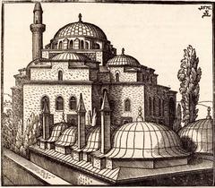
- Süleymaniye Mosque: A short walk on the Fatih side, offering citywide views.
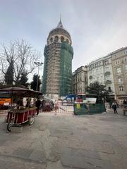
- Galata Tower: Iconic medieval tower near the Beyoğlu end.
- Balat & Fener: Colorful, historic neighborhoods with vibrant cafes and architecture.
- Eminönü & Spice Bazaar: Bustling market district, perfect for foodies and shoppers (istanbul.tips).
Integration with Istanbul’s Urban Fabric
The bridge is a key link in the M2 metro line, connecting Yenikapı and Hacıosman and serving as a major transit corridor for locals and visitors. Its swing section preserves maritime activity, while pedestrian paths foster a walkable urban environment (Istanbul Tourist Information). The bridge’s slender, unobtrusive silhouette reflects a commitment to both modernization and respect for Istanbul’s historic urban core.
Sustainability and Environmental Features
- Materials: Durable, eco-friendly construction reduces long-term maintenance.
- Energy: LED lighting minimizes power use and light pollution (TurkiyeWorld).
- Urban Mobility: Encourages metro and pedestrian travel, reducing traffic and emissions.
- Environmental Impact: Designed to fit into ongoing restoration efforts along the Golden Horn (TurkiyeWorld).
Frequently Asked Questions (FAQ)
Q: What are the pedestrian visiting hours?
A: Walkways are open 24/7; metro operates 6:00 AM–midnight.
Q: Is there a fee to walk or cycle across the bridge?
A: No; access is free for pedestrians and cyclists.
Q: Is the bridge accessible for wheelchairs and strollers?
A: Yes, thanks to elevators and ramps at both ends.
Q: What’s the best way to reach the bridge?
A: Take the M2 metro to Haliç Station, or use nearby bus lines.
Q: Are there restrooms or food facilities?
A: Not on the bridge, but nearby stations and neighborhoods offer amenities.
Q: Are guided tours available?
A: While there are no official bridge tours, many city walking tours include stops for panoramic views and photos.
Summary and Recommendations
The Golden Horn Metro Bridge embodies Istanbul’s ongoing dialogue between tradition and innovation. Opened in 2014, it not only improves citywide transit but also offers exceptional vistas and a free, accessible route across the Golden Horn. Whether you’re commuting, sightseeing, or capturing the city at sunset, the bridge provides a unique and memorable experience. Enhance your visit with the Audiala app for up-to-date transit info and curated walking tours—and take time to explore the historical neighborhoods at either end of this remarkable crossing (istanbul.tips; Istanbul Tourist Information).
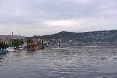
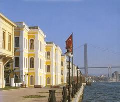
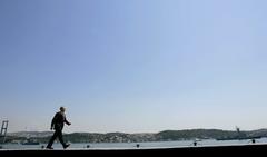
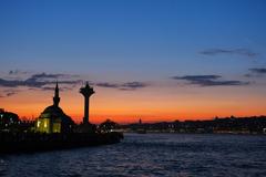
Alt text: Golden Horn Metro Bridge spanning the waterway at sunset with Istanbul skyline in the background.
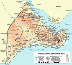
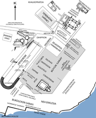
Alt text: Map highlighting Golden Horn Metro Bridge and surrounding Istanbul landmarks.
Official Sources and Further Reading
This guide draws upon the following authoritative sources for accuracy and completeness:
- Golden Horn Metro Bridge Istanbul: History, Visiting Information, and Nearby Attractions, Springer
- Golden Horn Metro Bridge: Visiting Hours, Tickets, and Architectural Significance, Nomadic Niko & TurkiyeWorld, TurkiyeWorld
- Golden Horn Metro Bridge Istanbul: Visiting, Hours, and Transportation Guide, absoluteistanbul.com
- Golden Horn Metro Bridge Visiting Hours, Tickets, and Guide, istanbul.tips
- Heritage Impact Assessment, Michael Kloos
- Examining the Impacts of Golden Horn Metro Bridge on Historical Skyline, Yildiz University
- Golden Horn Metro Bridge, Wikipedia
- Istanbul Tourist Information
- Istanbul Sightseeing: The Golden Horn
For the latest transportation updates and detailed city guides, download the Audiala app or visit our recommended resources.

