Villiers Island (Ookwemin Minising) Visiting Hours, Tickets, and Attractions Guide: Toronto’s New Waterfront Landmark
Date: 04/07/2025
Introduction: History, Cultural Significance, and Visitor Overview
Villiers Island—officially known as Ookwemin Minising, meaning “Place of the black cherry trees” in Anishinaabemowin—stands as Toronto’s most ambitious waterfront revitalization project. Located at the mouth of the Don River, this transformative neighbourhood is a convergence of Toronto’s industrial heritage, Indigenous reconciliation, ecological renewal, and sustainable urban design. Once dominated by heavy industry and shaped by 19th- and 20th-century land reclamation, the area has been restored through the $1.3 billion Port Lands Flood Protection Project, which recreated the natural river mouth, added wetlands, and implemented advanced flood protection infrastructure. This transformation has reclaimed 240 hectares of prime waterfront for vibrant new uses (Waterfront Toronto; Urban Strategies).
Ookwemin Minising is designed as a climate-positive, inclusive community integrating over 50 acres of parkland, extensive pedestrian and cycling networks, and future light rail transit. Indigenous placekeeping is central to its identity, with the 2024 naming reflecting deep collaboration with local Indigenous Nations and embedding language, culture, and stewardship in public art and programming (City of Toronto).
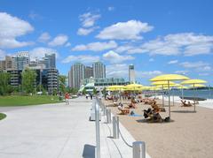
Visitors can explore green spaces like Biidaasige Park, stroll scenic waterfront promenades, and participate in seasonal guided tours and Indigenous-led cultural events. The island is fully accessible and family-friendly, with barrier-free pathways and amenities. Its proximity to the Distillery District, Canary District, and East Bayfront makes it an attractive destination for history buffs, nature lovers, and urban explorers alike (BlogTO; Jane’s Walk Festival).
Table of Contents
- Introduction
- Early Industrial Roots and Geographic Transformation
- The Port Lands Flood Protection Project
- Vision for a Climate-Positive Community
- Heritage and Cultural Significance
- Urban Significance and City-Building
- Visiting Villiers Island: Hours, Tickets, and Accessibility
- Nearby Attractions and Amenities
- Special Events and Guided Tours
- Visuals and Media
- Frequently Asked Questions (FAQs)
- Conclusion
Early Industrial Roots and Transformation
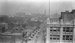
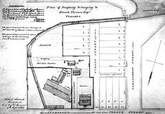
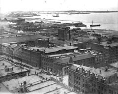
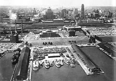
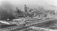
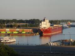
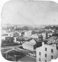
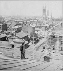
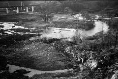
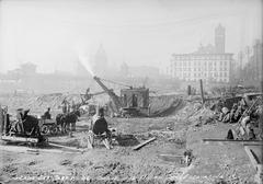
Originally part of Toronto’s Port Lands—a vast area created through land reclamation—the Villiers Island area was a hub for heavy industry and shipping throughout the 19th and 20th centuries. The Don River was straightened and channelized to support industrial expansion, but these interventions led to ecological degradation and persistent flooding. By the late 20th century, the area was underutilized and environmentally compromised (Urban Strategies).
The Port Lands Flood Protection Project
The Port Lands Flood Protection Project was a turning point, restoring the Don River’s natural mouth, creating wetlands, and constructing robust flood defences. This $1.25 billion initiative was led by Waterfront Toronto, the City, and TRCA, unlocking 240 hectares of land for new sustainable communities (Waterfront Toronto).
Vision for a Climate-Positive Community
The Villiers Island Precinct Plan set ambitious goals for sustainability, energy efficiency, and climate resilience. Key features include:
- Naturalized riverbanks and wetlands for biodiversity and stormwater management
- Pedestrian and cycling networks for active transportation
- Mixed-use development with affordable housing and community amenities
- Green building standards and renewable energy initiatives
The planning process included extensive public engagement and technical studies to ensure a resilient, low-carbon neighbourhood (Urban Strategies).
Heritage and Cultural Significance
Ookwemin Minising sits on traditional territories of several Indigenous Nations. The planning process has prioritized Indigenous engagement, as seen in the naming and public art programs. Several industrial heritage structures are being preserved and adaptively reused, blending Toronto’s working waterfront legacy with new cultural narratives (Urban Strategies).
Urban Significance and City-Building
The island will deliver thousands of new homes—including a significant proportion of affordable units—plus retail, commercial, and community spaces. Parks, waterfront access, and mobility networks connect Villiers Island to downtown Toronto and the broader waterfront (Waterfront Toronto).
Visiting Villiers Island: Hours, Tickets, and Accessibility
Visiting Hours and Access
- General Access: Open daily from dawn to dusk; free of charge
- Special Events/Tours: Check Waterfront Toronto or event listings for schedules and ticketing
Transportation
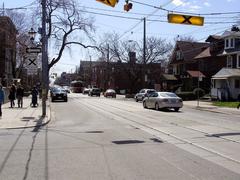
- Public Transit: TTC streetcars and buses serve the area; the Cherry Street bridge is the main entry for pedestrians and cyclists
- Cycling/Walking: Extensive paths and boardwalks connect the island to the mainland
- Driving: Limited parking is available; public transit and cycling are recommended
Accessibility
- Barrier-Free Design: Smooth paths, ramps, accessible washrooms
- Family-Friendly: Playgrounds, splash pads, and picnic areas
Attractions and Highlights
Parks and Natural Features
- Biidaasige Park: Wetlands, trails, play structures, and scenic viewpoints
- Riverfront Promenades: Dedicated cycling and walking paths with interpretive signage
Cultural Landmarks
- Indigenous Art and Storytelling: Interpretive panels and public art installations narrate Indigenous heritage
- Heritage Properties: Restored historic sites like 309 Cherry Street
Urban Design
- Equinox Bridge: Landmark pedestrian bridge, winner of an international design competition
- Mixed-Use Development: Retail, dining, and cultural venues planned as development progresses
Special Events and Guided Tours
Seasonal guided tours focus on Indigenous culture, ecological restoration, and urban design. Jane’s Walk Festival and other annual events offer opportunities for deeper exploration. Check Jane’s Walk Festival and Waterfront Toronto for event schedules.
Nearby Attractions
- Distillery District: Heritage village with shops, galleries, and dining
- Canary District & East Bayfront: Vibrant neighbourhoods with waterfront amenities
- Toronto Islands: Beaches and recreation, accessible by ferry
Dining, Amenities, and Services
- Food Options: Food trucks and pop-up vendors during events; permanent establishments coming soon
- Restrooms: Temporary facilities available; permanent amenities in development
- Visitor Centres: Maps, event info, and guided tour bookings
Visuals and Media
Find interactive maps, virtual tours, and high-resolution images on Waterfront Toronto’s website. Virtual content and alt-tagged visuals enhance trip planning and accessibility.
Travel Tips
- Best Time to Visit: Spring to fall; early mornings and evenings for photography
- What to Bring: Comfortable shoes, weather-appropriate layers, reusable water bottle, camera
- Accessibility: Some areas may be under construction—check updates before arrival
Frequently Asked Questions (FAQs)
Q: Is there an entry fee?
A: Access to parks and public spaces is free. Special events and tours may require tickets.
Q: How do I get to the island?
A: Use TTC streetcars or buses; the Cherry Street bridge is the main pedestrian/cyclist entry.
Q: Is the island accessible?
A: Yes, with barrier-free paths and amenities.
Q: Are pets allowed?
A: Yes, on-leash in outdoor areas.
Q: Are there food and drink options?
A: Food trucks and pop-ups are available during events; permanent options are planned.
Summary and Call to Action
Ookwemin Minising (Villiers Island) exemplifies Toronto’s future-focused approach to urban regeneration—harmonizing its industrial legacy with ecological restoration, Indigenous placekeeping, and innovative design. Enjoy open-access parks, accessible amenities, and a vibrant mix of culture and recreation year-round. As the neighbourhood continues to grow, it will offer more housing, retail, community spaces, and cultural events, all within a climate-positive, inclusive framework.
Plan your visit using public transit or active transportation, explore nearby heritage districts, and stay updated on events through Waterfront Toronto’s resources and the Audiala app. Experience how thoughtful city-building can create resilient, inclusive communities that celebrate both Toronto’s natural ecosystems and Indigenous heritage.
Official Sources and Further Reading
- Villiers Island Precinct Plan, Urban Strategies Inc.
- 6 FAQs About Villiers Island, Waterfront Toronto
- Our New Waterfront Coming to View, Waterfront Toronto
- Port Lands Indigenous Place Naming Initiative, City of Toronto
- Waterfront Toronto Awards Consultant Contract for New Island Community, Renew Canada
- GHD and SLA Deliver Infrastructure Design for Toronto’s Newest Island
- Villiers Island Toronto Planning Documents, City of Toronto
- A New Name for Toronto’s Waterfront Neighbourhood, The Star
- Villiers Island Toronto, BlogTO
- Jane’s Walk Festival Event: Ookwemin Minising


