Leaside Bridge: Comprehensive Guide to Visiting a Toronto Historical Landmark
Date: 04/07/2025
Introduction
Spanning the Don River Valley and connecting the neighborhoods of Leaside and East York, the Leaside Bridge stands as one of Toronto’s most significant feats of early 20th-century engineering. Opened in 1927, this reinforced concrete arch and deck truss bridge not only revolutionized transportation in the city’s east end but also served as a catalyst for urban growth and integration. Today, it remains a vital corridor for vehicles, pedestrians, and cyclists, while offering panoramic views and direct access to some of Toronto’s best natural and cultural attractions. This guide provides a thorough overview of the Leaside Bridge’s history, architectural features, visitor information, safety considerations, and nearby points of interest—ensuring you can make the most of your visit to this iconic Toronto landmark (Toronto.ca; BlogTO).
Table of Contents
- Origins and Early Advocacy
- Planning, Funding, and Engineering Innovation
- Official Opening and Early Impact
- Structural Evolution and Modernization
- Heritage Recognition and Cultural Significance
- Visitor Information
- Nearby Attractions
- Photography and Urban Exploration
- FAQs
- Conclusion
- References
Origins and Early Advocacy
The origins of the Leaside Bridge, initially called the Confederation Viaduct, lie in the rapid development of Toronto’s eastern suburbs in the early 1900s. By the 1920s, as Leaside and East York grew, the Don Valley posed a major barrier to transportation and economic integration. Community leaders and residents advocated for a new crossing, recognizing the need to link these burgeoning neighborhoods to the rest of Toronto (Toronto.ca).
In 1924, the Township of East York and the Town of Leaside began formal discussions to address the issue. The area, influenced by the “Garden City” planning of Frederick Gage Todd and named after early settler John Lea, was poised for a boom, but remained isolated until the bridge was built (BlogTO).
Planning, Funding, and Engineering Innovation
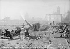
The bridge’s construction was a collaborative effort between several levels of government, funded by the Province of Ontario, York County, the City of Toronto, the Town of Leaside, and the Township of East York. The original budget was $870,000, a considerable sum for the time (Toronto.ca). Ground was broken in late 1926, and under the guidance of chief engineer Frank Barber, construction was completed in just 10 months despite the challenges posed by the Don Valley’s terrain and winter conditions (BlogTO).
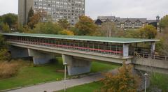
The bridge’s design—a long deck truss with reinforced concrete arches—was notable for its innovative approach, allowing for fewer piers and minimal environmental impact in the valley. At 427 meters (1,401 feet) long and over 45 meters (143 feet) high, the Leaside Bridge even surpasses the famed Prince Edward Viaduct in height (Historic Bridges; Abandoned UE).
Official Opening and Early Impact
The Leaside Bridge officially opened on October 29, 1927, in a ceremony attended by Ontario’s Lieutenant Governor and local dignitaries. The new structure was immediately hailed as a transformative link, dramatically improving east-west connectivity and spurring further residential and industrial development in Leaside and East York (Toronto.ca).
The first vehicles across were a TTC bus and a bread wagon, symbolizing the integration of the two communities and the bridge’s role in daily life.
Structural Evolution and Modernization
With Toronto’s continued expansion, the Leaside Bridge has seen several upgrades. In the late 1960s, its deck was widened by adding outriggers to support six lanes of traffic, a challenging engineering project that preserved much of the original structure’s character (Historic Bridges; Abandoned UE). The original decorative handrails, removed during this process, were restored during a 2005 renovation.
Despite its robust construction, the bridge is known for noticeable vibrations when heavy traffic passes—a quirk familiar to regular users (Abandoned UE).
Heritage Recognition and Cultural Significance
In 2004, the Leaside Bridge was designated on Toronto’s Inventory of Heritage Properties, underscoring its historical and architectural value (Toronto.ca). While less famous than the Prince Edward Viaduct, it remains a vital piece of Toronto’s infrastructure and history.
The bridge’s height has also made it a site of concern regarding suicides. Unlike the Prince Edward Viaduct, the Leaside Bridge does not currently have a suicide prevention barrier, though city officials are studying potential safety upgrades (Global News; Toronto City Council).
Visitor Information
Access, Hours, and Getting There
- Open 24/7: As a public roadway, the Leaside Bridge is accessible at any time, with no tickets or entrance fees required.
- By Transit: Served by TTC bus routes along Millwood Road and Leslie Street; nearby stops connect to Leaside and Thorncliffe Park (TTC Routes).
- By Bike/Foot: The bridge links directly to the Don Valley Trail network, ideal for walking, running, or cycling.
- By Car: Accessible from both Leaside and East York; street parking is available in surrounding neighborhoods, though spots may be limited during peak times.
Safety and Accessibility
- Sidewalks and Barriers: Wide, well-maintained sidewalks with protective barriers make the bridge safe for pedestrians and cyclists.
- Wheelchair Access: Sidewalks have curb cuts at both ends, though some approach gradients may challenge users with limited mobility.
- Lighting: The bridge is lit at night, enhancing safety for evening visitors.
- Vibrations: The bridge may vibrate with heavy traffic, which is normal and not a cause for concern.
Parking
- Street Parking: Available in Leaside and East York; obey local regulations.
- No Dedicated Lots: No bridge-specific parking, so plan accordingly.
Nearby Attractions
- Don Valley Parklands and Trails: Access to the Lower Don Trail and East Don Trail for scenic walks, jogging, and cycling (City of Toronto Trails).
- Evergreen Brick Works: About 2 km south, this acclaimed community hub offers gardens, markets, art, and educational programs.
- Leaside Village: Known for heritage homes, tree-lined streets, and local shops and restaurants (Leaside Village History).
- Thorncliffe Park: A multicultural neighborhood with diverse dining and cultural events.
Photography and Urban Exploration
The Leaside Bridge’s dramatic arches, expansive views of the Don Valley, and city skyline make it a favorite for photographers. The bridge is especially photogenic at sunrise, sunset, and during autumn. Urban explorers may note the intricate truss work visible from beneath the deck, and graffiti art adds a colorful backdrop for photos.
Frequently Asked Questions (FAQs)
Q: Is there an entry fee to visit Leaside Bridge?
A: No, the bridge is free and accessible 24/7.
Q: Is the bridge wheelchair accessible?
A: Yes, though some gradients at approaches may pose challenges.
Q: Are pets allowed?
A: Yes, but keep pets leashed and clean up after them.
Q: Can I park near Leaside Bridge?
A: Street parking is available in adjacent neighborhoods.
Q: Are guided tours available?
A: There are no official tours, but self-guided walking routes through Leaside and the Don Valley are popular.
Q: Is photography allowed?
A: Yes, and the site is popular with both amateur and professional photographers.
Conclusion
The Leaside Bridge is a testament to Toronto’s spirit of growth, innovation, and community. Its history, architectural distinction, and scenic location make it a must-visit for both locals and tourists. With convenient access, safety features, and proximity to vibrant neighborhoods and natural spaces, it’s an ideal destination for walking, cycling, photography, and urban exploration. Whether you’re interested in history, architecture, or simply want to enjoy beautiful views, plan your visit to Leaside Bridge and discover one of Toronto’s enduring landmarks.
For updated visitor tips, maps, and guided audio tours, download the Audiala app and explore our related guides to Toronto’s historical sites.
Visuals and Media
- Include high-quality images of the Leaside Bridge’s arches and walkways.
- Add a map showing the bridge’s location, connecting trails, and transit stops.
- Consider embedding a virtual tour video for an immersive preview.
References
- Leaside Bridge Toronto: History, Visiting Information, and Travel Tips (Toronto.ca)
- That Time Toronto Built a Giant Bridge in Record Time (BlogTO)
- Leaside Bridge Toronto: Visiting Information, History, and Architectural Significance (BlogTO)
- Leaside Bridge Toronto Safety and Modernization (Toronto City Council)
- Leaside Bridge Details and Heritage Status (Historic Bridges)
- Toronto New Suicide Barrier Deaths at DVP Passenger (Global News)
- Toronto Transit Commission buses (TTC Routes)
- Don Valley Trail network (City of Toronto Trails)
- Leaside Village history (Leaside Village History)
- City of Toronto road maintenance and closures (City of Toronto road maintenance page)
- Toronto Bike Share (Bike Share Toronto)
- City of Toronto events calendar (City of Toronto events calendar)
- Audiala app (Audiala)


