Martin Goodman Trail Toronto: Visiting Hours, Tickets, and Travel Guide
Date: 04/07/2025
Introduction to the Martin Goodman Trail
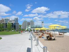
The Martin Goodman Trail is one of Toronto’s premier waterfront pathways, stretching approximately 56 kilometers along the scenic shores of Lake Ontario. This multi-use trail welcomes cyclists, runners, walkers, and rollerbladers of all ages and abilities, serving as both a recreational hotspot and a vital ecological corridor. Established in 1984 and named after Martin Goodman, the former president and editor-in-chief of the Toronto Star, the trail symbolizes Toronto’s dedication to urban revitalization, environmental stewardship, and public accessibility (Wikipedia; roadtripontario.ca).
The trail connects diverse neighborhoods—from the historic Beaches to the bustling Harbourfront—highlighting Toronto’s rich cultural heritage and landmarks such as the Humber Bay Arch Bridge and Tommy Thompson Park (Trek Zone; tctrail.ca). It is open year-round, 24/7, and is free for all visitors, making it one of the city’s most inclusive public spaces.
Table of Contents
- Introduction
- History and Development
- Visiting Hours & Ticket Information
- Cultural Significance & Community Impact
- Key Trail Features & Historical Landmarks
- Environmental Stewardship
- Trail Route Overview & Accessibility
- Safety Tips & Seasonal Highlights
- Nearby Attractions
- Frequently Asked Questions (FAQ)
- Travel Tips & Visitor Guide
- Conclusion
- References
History and Development
Established in 1984, the Martin Goodman Trail was a landmark urban planning achievement, created to improve public access to Toronto’s waterfront, foster recreation, and protect the natural environment (Wikipedia). The trail honors Martin Goodman, whose advocacy for public spaces and healthy urban life was instrumental in shaping Toronto’s waterfront vision (roadtripontario.ca). Originally 18 kilometers long, the trail has been expanded and upgraded over the decades through city planning initiatives like the Western Waterfront Master Plan (Toronto.ca), now acting as a key segment of the greater Waterfront Trail network (Waterfront Trail).
Visiting Hours & Ticket Information
- Hours: The Martin Goodman Trail is accessible 24 hours a day, 365 days a year.
- Fees: There are no entrance fees or tickets required to use the trail.
- Events: Occasionally, special events or guided tours may require registration or a fee—check local event listings or the official Waterfront Toronto website for updates.
Cultural Significance & Community Impact
Honoring Toronto’s Heritage
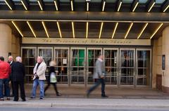
Traversing neighborhoods like The Beaches, Sunnyside, and Harbourfront, the trail exposes visitors to Toronto’s multicultural legacies and historic sites, including Sunnyside Pavilion, Palais Royale, and the Freedom for Hungary Monument (tctrail.ca).
Indigenous Placekeeping and Urban Wellbeing
Recent revitalization projects incorporate Indigenous histories and perspectives, led by Toronto’s Indigenous Advisory Circle (Toronto.ca). The trail is designed to be accessible, inclusive, and supportive of community wellbeing, with features for wheelchair users and family-friendly amenities (letsgoplayoutside.com).
Key Trail Features & Historical Landmarks
- Humber Bay Arch Bridge: A signature architectural feature on the western edge, offering sweeping views of Toronto’s skyline (greatruns.com).
- Sunnyside and Western Beaches: Home to historic leisure sites like Sunnyside Pavilion and Palais Royale.
- The Beaches & Eastern Waterfront: Victorian homes, sandy beaches (Kew-Balmy, Woodbine, Ashbridges Bay), and vibrant local festivals (roadtripontario.ca).
- Harbourfront Centre: A cultural hub with art galleries, theatres, and waterfront events (roadtripontario.ca).
- Fort York National Historic Site: Accessible near Garrison Crossing, offering a glimpse into Toronto’s military past.
Environmental Stewardship
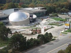
The trail is a prime example of sustainable design, connecting green spaces like Tommy Thompson Park and Ontario Place. It supports biodiversity, with native plantings, wildlife corridors, shoreline restoration, and urban forestry initiatives. The MGT is integrated with broader conservation efforts, such as the Port Lands and Don Mouth Naturalization Project (PortLandsTO.ca; Waterfront Toronto). Double rows of trees along Queens Quay provide shade, mitigate heat, and enhance air quality (City of Toronto, 2009).
Trail Route Overview & Accessibility
- Route: Extends from the Humber Bay Arch Bridge (west) to the Rouge River (east), mostly flat and paved (Trek Zone; Walkablog).
- Key Sections:
- Western: Humber Bay, Sunnyside Beach, Marilyn Bell Park
- Central: Ontario Place, Coronation Park, Queen’s Quay, Cherry Beach
- Eastern: Ashbridge’s Bay Park, Woodbine Park, Beaches Boardwalk (Ontario Trails)
- Accessibility: Paved, wide, and generally level; accessible for wheelchairs, strollers, and mobility devices (Toronto Accessibility Guide).
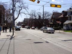
- Transit & Parking: TTC streetcars and buses serve major entry points; parking available at key parks (TTC).
- Amenities: Benches, rest areas, washrooms, water fountains, and bike repair stations at major parks.
Safety Tips & Seasonal Highlights
- Trail Etiquette: Cyclists yield to pedestrians, keep right except to pass, and use bells or verbal signals. Speed limits (typically 20 km/h) apply in busy areas (Toronto Cycling Rules).
- Lighting: Well-lit in central areas (Queen’s Quay, Sunnyside, Beaches); less lighting east of Cherry Beach and west of Humber Bay—prefer daylight for these sections.
- Emergency Services: Emergency call boxes in busy zones; dial 911 for help (Toronto Police Services).
- Seasonal Highlights:
- Spring: Cherry blossoms at Exhibition Place, migratory birds at Tommy Thompson Park (TRCA)
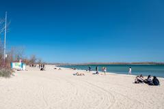
- Summer: Festivals at Harbourfront Centre, swimming and sunbathing at Sunnyside and Woodbine Beaches (Harbourfront Centre Events)
- Autumn: Fall foliage, peak bird migration
- Winter: Cross-country skiing, snowshoeing, and Winter Stations art at The Beaches (Winter Stations)
Nearby Attractions
- Ontario Place: Entertainment, concerts, and waterfront festivals.
- Harbourfront Centre: Arts, culture, and dining.
- Tommy Thompson Park: Urban wilderness and birdwatching.
- The Beaches: Boardwalk, volleyball, and local shops.
- Exhibition Place & Budweiser Stage: Large event venues and concerts.
- Fort York: Historic military site.
Frequently Asked Questions (FAQ)
Q: Are there entrance fees or tickets required?
A: No, the trail is free and open year-round.
Q: What are the best times to visit?
A: Spring through autumn offer ideal weather, but the trail is open and accessible 24/7.
Q: Is the trail wheelchair accessible?
A: Yes, most sections are accessible with paved surfaces and ramps.
Q: Are pets allowed?
A: Yes, dogs must be leashed and owners should clean up after them.
Q: Are there guided tours?
A: Occasionally, especially during festivals or special events—check local listings or the Waterfront Trail app.
Q: How do I report emergencies?
A: Use the emergency call boxes or dial 911.
Travel Tips & Visitor Guide
- Plan Ahead: Use the Waterfront Trail app for maps and updates.
- Stay Hydrated: Water fountains at major parks—carry a refillable bottle.
- Dress for Weather: Toronto’s weather can change quickly; layers and rain gear are recommended.
- Respect Etiquette: Keep right, pass on the left, and use bells/voice when overtaking.
- Check Event Schedules: Festivals and races may affect access (City of Toronto events calendar).
- Protect from Sun: Use sunscreen and hats in summer.
- Be Wildlife Aware: Do not feed wildlife and use insect repellent in marshy areas.
Conclusion
The Martin Goodman Trail is a celebrated urban oasis, capturing the essence of Toronto’s waterfront with its blend of natural beauty, cultural landmarks, and accessible recreation. With 24/7 free access, ample amenities, and connections to historical sites, it’s a must-visit for locals and tourists alike. Whether you’re seeking an active outing, a peaceful walk, or a cultural adventure, the trail promises a memorable experience in every season.
Stay informed about special events, trail conditions, and guided tours by downloading the Waterfront Trail app and following official Toronto tourism channels.
References
- Martin Goodman Trail - Wikipedia
- Martin Goodman Trail: Visiting Hours, Attractions, and Historical Sites in Toronto - Roadtrip Ontario
- Martin Goodman Trail Toronto: Visiting Hours, Key Attractions & Travel Tips - Trek Zone
- Martin Goodman Trail: Visiting Hours, Tickets, and Ecological Highlights in Toronto - City of Toronto and Waterfront Toronto, Waterfront Toronto
- Visiting the Martin Goodman Trail: Accessibility, Safety, Seasonal Highlights, and Visitor Guide - City of Toronto
- Martin Goodman Trail Stories - Trans Canada Trail
- Waterfront Trail - Toronto Community
- Port Lands and Don Mouth Naturalization Project - PortLandsTO.ca
- Toronto Cycling Rules and Safety - City of Toronto


