Papineau-Leblanc Bridge Montreal: Visiting Hours, Tickets, and Travel Guide
Date: 14/06/2025
Introduction
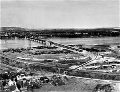
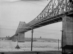
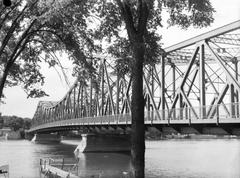
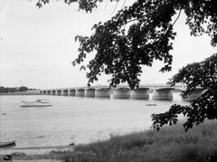
The Papineau-Leblanc Bridge is a vital transportation artery spanning the Rivière des Prairies, connecting the Island of Montréal to Laval. Known for its pioneering cable-stayed design and significant role in the region’s urban development, the bridge stands as both an engineering feat and a symbol of Québec’s evolving urban landscape. Whether you’re a commuter, history enthusiast, or visitor looking to explore Montréal’s infrastructure, this comprehensive guide covers everything you need to know— from historical background and technical innovations to practical visitor information and nearby attractions.
Table of Contents
- Introduction
- Historical Background and Significance
- Engineering and Structural Features
- Visitor Information
- Renovation and Traffic Management (2022–2026)
- FAQs
- Key Facts and Figures
- Conclusion
- References and Further Reading
Historical Background and Significance
Origins and Naming
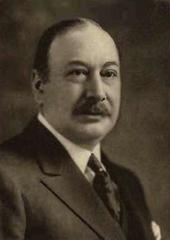
Constructed between 1968 and 1969, the Papineau-Leblanc Bridge was named in honor of Joseph Papineau, a notable politician, and Alpha Leblanc, a key figure in Laval’s agricultural heritage. This dual dedication reflects both the political and rural roots of the region (Commission de toponymie du Québec).
Construction and Socioeconomic Impact
Built during a period of significant urban expansion, the bridge was designed to accommodate the increasing movement of people and goods between Montréal and Laval. Upon its opening, it was the longest cable-stayed bridge in North America—an engineering milestone that facilitated suburban growth and economic integration in the metropolitan area (Commission de toponymie du Québec).
The bridge also briefly bore the name Pont Pietro-Rizzuto (1999–2000), recognizing contributions by local entrepreneur Pietro Rizzuto (Commission de toponymie du Québec).
Engineering and Structural Features
Design and Innovations
The Papineau-Leblanc Bridge’s cable-stayed design was groundbreaking in the late 1960s. Stretching 459 meters with six vehicle lanes, its construction featured high-strength steel cables and reinforced concrete to create a slender yet robust structure. This design minimized the need for in-water piers, preserving river navigation and reducing environmental impact (Commission de toponymie du Québec).
Notable technical features include:
- Orthotropic steel deck for enhanced load distribution
- Expansion joints and advanced drainage for Québec’s harsh winters
- Strategic integration with Boulevard Henri-Bourassa and Autoroute 19, supporting Bus Rapid Transit and Express Bus Networks (Montreal.ca)
Maintenance and Renovation Timeline
Major Renovations (2022–2026)
To address aging infrastructure, the bridge underwent comprehensive structural upgrades:
- Deck Reinforcement: Installation of bolted steel plates (Journal de Montréal)
- Cable-Stay Replacement: Upgrading and replacing internal cables for increased safety (Québec.ca)
- Surface Renewal: Asphalt and membrane replacement to prevent water infiltration (La Presse)
- Guardrail Upgrades: Modern safety barriers and wheel guards installed
Most critical works occurred from April 2023 to August 2024, with finishing touches and inspections into 2026. Nighttime work minimized daytime disruption (Journal de Montréal).
Visitor Information
Access, Hours, and Safety
- Open 24/7: The bridge is accessible at all times for vehicles, with no ticket or permit required.
- Pedestrian and Cyclist Access: Direct access is not available; use adjacent bridges with designated paths (Wikipedia: List of bridges to the Island of Montreal).
- Public Transit: Multiple STM and STL bus routes cross or approach the bridge, connecting neighborhoods on both sides.
- Parking: Available near adjacent parks and major boulevards; check local signage for regulations.
- Accessibility: Public transit vehicles serving the bridge are wheelchair-accessible.
Viewpoints and Attractions
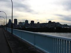
Best views of the bridge and surrounding river can be enjoyed from:
- Parc de la Rivière-des-Prairies (Montréal)
- Parc Alpha Leblanc (Laval)
- Parc de l’Île-de-la-Visitation: Offers riverside trails and historic sites (Montreal Attractions)
Nearby Points of Interest
- Ahuntsic Park: Green space for relaxation and riverside views.
- Marché Central: Large shopping and dining complex.
- Centropolis Laval: Entertainment and events hub.
- Cosmodôme: Interactive space science museum in Laval (Treksplorer: Things to Do in Montreal)
Travel Tips
- Avoid Rush Hours: Peak traffic is 7–9 a.m. and 4–6 p.m.
- Photography: Visit at sunrise or sunset for optimal lighting.
- Transit: Use Henri-Bourassa Boulevard or Boulevard Levesque East for bus access.
- Check Traffic Updates: Always consult Québec 511 before traveling.
Renovation and Traffic Management (2022–2026)
Temporary Restrictions and Detours
- Lane Reductions: Two lanes per direction during major works; all lanes reopened by August 2024 (Courrier Laval).
- Heavy Vehicle Ban: Except for buses/emergency vehicles, trucks were rerouted to other crossings until August 2024 (Laval News).
- Speed Limits: Reduced to 70 km/h during construction.
- Night/Weekend Closures: For major interventions and inspections; detours were clearly marked (CityNews Montreal).
Communication and Updates
- Real-time info via Québec 511
- Frequent alerts from CityNews Montreal and La Presse
- On-site signage for detours and speed limits
Frequently Asked Questions (FAQ)
Q: What are the Papineau-Leblanc Bridge visiting hours?
A: The bridge is open 24 hours a day, 7 days a week.
Q: Is there a fee or ticket required to cross?
A: No, the bridge is a public roadway with no toll.
Q: Can I walk or bike across?
A: No, direct pedestrian/cycling access is not available. Use alternative crossings (Wikipedia: List of bridges to the Island of Montreal).
Q: Are there parking facilities nearby?
A: Yes, parking is available at adjacent parks and boulevards.
Q: How can I get real-time traffic updates?
A: Use Québec 511 or local news outlets.
Q: Are heavy vehicles now permitted?
A: Yes, all vehicle restrictions were lifted after August 2024 with the completion of major works.
Key Facts and Figures
- Type: Cable-stayed bridge
- Length: 459 meters
- Lanes: 6
- Year Opened: 1969
- Main Connections: Montréal (Avenue Papineau) and Laval (Boulevard Leblanc)
- Historical Names: Papineau-Leblanc Bridge, Pont Pietro-Rizzuto (1999–2000)
- Renovations: Major works 2022–2024; final touch-ups through 2026 (La Presse)
- Significance: Longest cable-stayed bridge in North America at the time of completion (Commission de toponymie du Québec)
Conclusion
The Papineau-Leblanc Bridge remains a cornerstone of Montréal’s infrastructure, exemplifying engineering excellence and regional connectivity. Its recent renovations ensure lasting safety and enhanced commuter experience. While direct pedestrian and cycling access on the bridge is not available, excellent viewpoints, adjacent parks, and efficient public transit make the area accessible and inviting for visitors. Plan your trip using real-time resources and enjoy exploring both the bridge and the vibrant communities it links.
Explore more:
- Learn about other Montreal bridges and their histories.
- Discover the sustainable mobility corridor on Boulevard Henri-Bourassa.
Stay Updated: Download the Audiala app for real-time updates and follow us on social media for news on Montréal’s infrastructure and attractions.
References and Further Reading
- Commission de toponymie du Québec
- Montreal.ca
- CityNews Montreal
- Journal de Montréal
- La Presse
- Courrier Laval
- Québec.ca
- Treksplorer: Things to Do in Montreal
- Montreal Attractions
- Québec 511
