Boulevard Métropolitain Montreal: Visiting Hours, Tickets, and Travel Guide
Date: 04/07/2025
Introduction
Boulevard Métropolitain, officially part of Autoroute 40 (A-40), is a cornerstone of Montreal’s urban infrastructure. Stretching approximately 15 kilometers across the northern sector of the city, the “Met” is not a traditional tourist attraction, but its significance in shaping Montreal’s economic, social, and urban landscape is undeniable. This guide offers a detailed overview of its history, urban impact, travel tips, and practical advice for visitors and residents navigating this vital corridor.
Table of Contents
- Introduction
- Early Planning and Conception (1920s–1950s)
- Construction and Inauguration (1950s–1960s)
- Urban Impact and Socioeconomic Transformation
- Environmental and Social Consequences
- Modernization and Ongoing Evolution (2000s–2020s)
- Using Boulevard Métropolitain: Travel Tips and Visitor Information
- Route and Structure
- Key Interchanges and Nearby Attractions
- Accessibility and Transit Options
- Safety and Traffic Notes for Visitors
- Scenic Viewing Opportunities
- Boulevard Métropolitain’s Urban and Economic Role
- Navigating Boulevard Métropolitain: Essential Tips for Visitors
- Frequently Asked Questions (FAQ)
- Conclusion
- Related Articles
- Visual Media
- References
Early Planning and Conception (1920s–1950s)
The concept of a metropolitan boulevard in Montreal originated in 1929, when the Quebec government approved plans to facilitate traffic flow around downtown. However, the Great Depression and World War II delayed the project for decades. Expropriations began in the early 1950s, setting the stage for its eventual realization (Radio-Canada).
Construction and Inauguration (1950s–1960s)
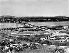
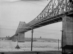
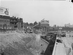
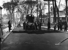
Boulevard Métropolitain was constructed between 1959 and 1969, officially opening in 1960. Its elevated design was a significant engineering feat for the era, spanning neighborhoods from Saint-Laurent in the west to Anjou and Rivière-des-Prairies in the east. The project, while modernizing the city, also divided established communities, altered landscapes, and became a symbol of Montreal’s postwar ambitions (Wikipedia).
Urban Impact and Socioeconomic Transformation
The Met quickly became the backbone of Montreal’s road network, linking major north-south arteries and driving industrial relocation from the port to areas adjacent to the expressway. This shift contributed to suburbanization and economic redistribution. Boroughs such as Saint-Laurent and Anjou benefited from increased accessibility and commercial growth (Montreal.ca).
Environmental and Social Consequences
While the expressway improved mobility, it also created physical barriers that divided neighborhoods and reduced green space. Chronic congestion, air and noise pollution, and community division remain ongoing concerns. Proposals to bury sections of the highway have been considered but remain unimplemented due to high costs (Montreal.ca).
Modernization and Ongoing Evolution (2000s–2020s)
Decades after its construction, the Métropolitain is undergoing phased renovations, particularly along the eastern segment. Efforts focus on structural reinforcement, traffic management, and integration with sustainable transportation initiatives, such as cycling infrastructure and improved public transit connections (Mobilité Montréal).
Using Boulevard Métropolitain: Travel Tips and Visitor Information
Visiting Hours:
The Métropolitain operates around the clock as a public roadway. There are no tickets or official visiting hours.
Traffic Advice:
Expect heavy congestion during weekday rush hours (7–9 AM and 4–6 PM). Real-time updates are available via Mobilité Montréal and popular navigation apps.
Accessibility:
The highway connects seamlessly with major north-south arteries, including Boulevard Saint-Laurent, L’Acadie, and Pie-IX. Several bus routes and metro stations are within proximity, offering alternative transit options.
Cycling and Walking:
The expressway itself is not accessible to cyclists or pedestrians, but parallel streets and the Réseau express vélo (REV) provide safe routes for non-motorized travel.
Nearby Attractions:
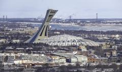
Key destinations accessible via exits include Marché Central, Saint-Laurent’s industrial and business districts, Olympic Stadium, and the Montreal Botanical Garden.
Route and Structure
Boulevard Métropolitain is an elevated expressway that traverses Montreal from the Décarie Interchange (A-15) in the west to Anjou in the east, where it transitions into Autoroute Félix-Leclerc. Its strategic location provides efficient east-west connectivity across the island.
Key Interchanges and Nearby Attractions
- Décarie Interchange (A-15): Connects to residential and commercial centers.
- Côte-de-Liesse Interchange (A-520): Access to Montréal-Trudeau International Airport.
- Pie-IX (Boulevard Pie-IX): Near Olympic Stadium and Botanical Garden.
- L’Acadie: Adjacent to Marché Central shopping district.
- Anjou Interchange (A-25): Connection to eastern boroughs and retail zones.
Accessibility and Transit Options
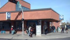
While the Métropolitain itself is exclusively for motor vehicles, surface streets beneath the elevated highway are accessible to pedestrians and cyclists. STM bus lines run parallel or intersect the corridor, and several metro stations serve neighborhoods nearby.
Safety and Traffic Notes for Visitors
- Driving Tips: Avoid peak hours for smoother travel. Navigation apps are essential for real-time updates and alternate routes.
- Construction: Ongoing renovations may cause lane closures or detours. Consult Quebec 511 before your trip.
- Weather: Elevated sections are exposed to wind and ice in winter. Exercise caution and ensure your vehicle is winter-ready.
Scenic Viewing Opportunities
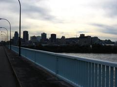
Although stopping on the expressway is prohibited, nearby overpasses and intersecting streets offer panoramic views of Montreal’s skyline and the elevated viaduct—ideal for urban photography and cityscapes.
Boulevard Métropolitain’s Urban and Economic Role
Strategic Transportation Corridor
As part of the Trans-Canada Highway, the Métropolitain is integral to Montreal’s local and regional connectivity, supporting significant daily vehicle traffic and facilitating commercial logistics (Wikipedia: Transportation in Montreal).
Economic Development
The corridor fosters economic vitality, with investments exceeding $365 million in modernization and business support. Projects like the Bluebird Self Storage flagship at 5785 Boulevard Métropolitain demonstrate ongoing urban renewal (AgoraMTL: Blue Bird Metropolitain).
Urban Connectivity
While the elevated highway can create physical barriers, city initiatives aim to improve walkability, cycling infrastructure, and transit integration, transforming the corridor into a more accessible, community-friendly space.
Social and Cultural Dimensions
The Met is embedded in local culture, referenced in media, and serves as a canvas for public art and community projects. Efforts to humanize its presence include landscaping, green spaces, and public art installations (Montreal.ca: Metropolitan Economic Development).
Navigating Boulevard Métropolitain: Essential Tips for Visitors
- Plan off-peak travel: Early mornings or late evenings are less congested.
- Use public transit: STM buses and metro lines provide easy access to adjacent neighborhoods.
- Explore nearby attractions: Use the Métropolitain as a conduit to reach shopping centers, cultural sites, and parks.
- Pay attention to signage: Road signs are in French (“Sortie” means “Exit”).
- Leverage resources: Download the Audiala app for real-time traffic alerts and city guides.
Frequently Asked Questions (FAQ)
Q: Is the Métropolitain toll-free?
A: Yes, there are no tolls.
Q: Can cyclists or pedestrians use the expressway?
A: No, but parallel streets and cycling paths are available nearby.
Q: Are there guided tours?
A: No official tours exist for the expressway, but walking and cycling tours in adjacent neighborhoods offer urban planning insights.
Q: Where is parking available?
A: Use local lots or street parking in neighborhoods accessible via the Met’s exits.
Q: What language is used for signs?
A: French, but English is widely understood in commercial areas.
Q: What are the best resources for traffic updates?
A: Quebec 511 Road Conditions and Mobilité Montréal.
Conclusion
Boulevard Métropolitain is much more than a highway—it is a living symbol of Montreal’s modern evolution. Its construction catalyzed urban growth, shaped commuting patterns, and continues to inspire debates on sustainable city planning. Whether you’re a commuter, visitor, or urban enthusiast, understanding the Met’s history, challenges, and ongoing transformation offers a unique lens on Montreal’s past, present, and future.
For updated travel information, download the Audiala app, and consult official resources for the latest on traffic, transit, and city initiatives.
Related Articles
Visual Media
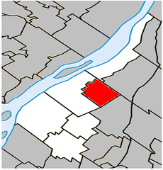
Alt text: Map illustrating the route of Boulevard Métropolitain across Montreal’s northern urban core.
References and Useful Links
- Radio-Canada
- Wikipedia
- Montreal.ca
- Mobilité Montréal
- MTL.org
- QuebecWonders.com
- AgoraMTL: Blue Bird Metropolitain
- GIS Geography
- Authentik Canada
- Quartz Mountain
- STM Public Transit
- Quebec 511 Road Conditions
