Champlain Bridge Montreal: Visiting Hours, Tickets, and Travel Guide
Date: 04/07/2025
Introduction
The Champlain Bridge is a cornerstone of Montreal’s urban landscape. Serving as a vital link between the island of Montreal and the South Shore, this landmark not only exemplifies engineering prowess but also embodies the city’s spirit of innovation, resilience, and connectivity. This comprehensive guide provides an in-depth look at the bridge’s history, architectural evolution, visitor amenities, and practical travel tips—ensuring you have all the information you need for a memorable visit to this iconic structure (jacquescartierchamplain.ca; Wikipedia: Champlain Bridge (1962–2019).
Table of Contents
- Introduction
- History & Significance
- Visiting the Champlain Bridge Area
- Architectural & Environmental Features
- Visitor Experience & Accessibility
- Travel Tips
- Events & Community Engagement
- Frequently Asked Questions (FAQ)
- References
History & Significance
Origins and Construction
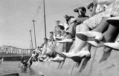
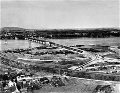
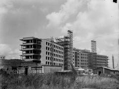
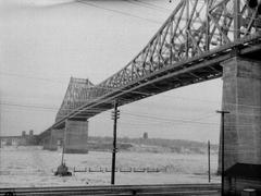
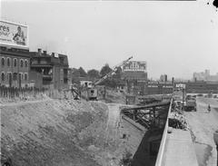
The original Champlain Bridge was conceived in the 1950s as a response to post-war population growth and the increasing demand for transportation infrastructure between Montreal and its rapidly expanding southern suburbs. Construction began in 1957, and the bridge officially opened in 1962, named in honor of Samuel de Champlain, the founder of Quebec City. The bridge quickly became a critical artery for commuters and commerce, integrating the city’s transportation network with major regional highways (montrealroads.com).
Socioeconomic Impact & Evolution
Initially a toll bridge, the Champlain Bridge became toll-free in 1990. Its strategic role in fostering suburban growth, facilitating trade, and supporting public transit made it one of Canada’s busiest crossings—at its peak, handling tens of millions of crossings annually (apnews.ca). Over time, adaptations included the addition of reserved bus lanes, innovative maintenance techniques, and structural reinforcements to extend its lifespan (jacquescartierchamplain.ca).
Replacement & Modernization
By the early 21st century, the original bridge’s aging structure prompted the Canadian government to launch the Samuel De Champlain Bridge project. Opened in 2019, the new bridge features a contemporary cable-stayed design, six vehicular lanes, a dedicated public transit corridor for the REM light rail, and a 3.4 km multi-use path for cyclists and pedestrians. This transformation marked a new era in sustainable infrastructure and urban mobility for Montreal (canada.ca; Provencher_Roy).
Visiting the Champlain Bridge Area
Hours & Accessibility
The Samuel De Champlain Bridge’s multi-use path is open daily from dawn until dusk, typically from 5:00 or 6:00 AM to 11:00 PM, weather permitting. Lighting along the path allows for safe early morning and evening visits. Accessibility features include barrier-free entrances, ramps, and wide lanes suitable for wheelchairs, strollers, and bicycles (samueldechamplainbridge.ca).
Tickets & Guided Tours
No ticket or fee is required to visit or cross the bridge by foot, bike, or vehicle—access is free for all users. While there are no regular guided tours, occasional special events and heritage walks are organized by local groups; these may require advance registration.
Transportation & Parking
- Public Transit: The REM light rail provides direct access to Nun’s Island and the South Shore, with stations near the bridge’s pedestrian and cyclist entrances. Tickets for the REM can be purchased at stations or online (REM Info).
- Car: There is no official bridge visitor parking. Visitors often use nearby shopping center lots or street parking on Nun’s Island, and parking near the La Riveraine bike path in Brossard. Always observe local parking regulations (Reddit Discussion).
- Cyclists/Pedestrians: The 3.4 km multi-use path connects Nun’s Island to Brossard, integrating with the city’s cycling network (Great Runs).
Nearby Attractions & Photo Spots
- Parc des Rapides: A riverside park ideal for birdwatching and photography.
- Lachine Canal: Scenic walking and cycling routes begin near the Old Port (A Taste for Travel).
- Ice Control Structure (Estacade): An adjacent cycling and walking path with unique river views.
- Nun’s Island: Parks, promenades, and modernist architecture.
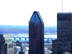
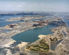
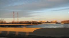
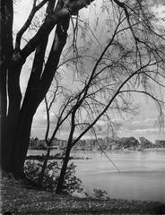
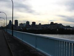
Lookout points on the bridge’s path provide panoramic views of downtown Montreal, the St. Lawrence River, and the South Shore—especially beautiful at sunrise and sunset.
Architectural & Environmental Features
The Samuel De Champlain Bridge is a 3.4 km cable-stayed structure, with a 170-meter central tower and a design built for a 125-year lifespan. The bridge was engineered for seismic resilience, extreme weather, and sustainability, using corrosion-resistant materials and advanced lighting that minimizes impacts on migratory birds (Provencher_Roy; Government of Canada).
Environmental stewardship guided the project, achieving Platinum-level ENVISION certification for sustainable infrastructure. The multi-use path and viewing platforms were designed to maximize accessibility and connectivity while respecting the river ecosystem.
Visitor Experience & Accessibility
- Multi-Use Path: Wide, separated from vehicle traffic, and equipped with scenic lookouts and benches.
- Accessibility: Barrier-free entrances, tactile paving, and clear signage for all users.
- Safety: Surveillance cameras, emergency call buttons, and well-lit pathways enhance security.
- Amenities: While there are benches at lookouts, visitors should note the absence of washrooms or water fountains on the bridge.
Travel Tips
- Use public transit or cycling to avoid parking challenges, especially during peak times.
- Bring water, sun protection, and dress for the weather.
- Dogs are welcome on leash; cyclists must yield to pedestrians.
- For real-time updates, check official bridge alerts and live cameras.
- For cyclists: BIXI bike-sharing stations are available seasonally near Nun’s Island access points.
Events & Community Engagement
The bridge corridor is featured in citywide events like charity runs, cycling festivals, and environmental illuminations (such as Earth Hour). While the bridge remains open during most events, nearby paths may host additional activities. Check local listings and the official bridge website for updates.
Frequently Asked Questions (FAQ)
Q: What are the visiting hours for the Champlain Bridge multi-use path?
A: Generally open from dawn (5:00 or 6:00 AM) to 11:00 PM, weather permitting.
Q: Is there an entrance fee or ticket required?
A: No, access is free for all users.
Q: Are dogs allowed?
A: Yes, dogs are permitted on leash.
Q: Is the bridge accessible to people with disabilities?
A: Yes, the multi-use path is fully accessible with barrier-free access at both ends.
Q: Are there washrooms or water fountains?
A: No; plan accordingly.
Q: Are guided tours available?
A: No regular tours, but occasional special events and walks are offered.
Q: Where can I park?
A: Use nearby street or shopping center parking on Nun’s Island, or parking near La Riveraine in Brossard. Observe posted signage.
Summary & Visitor Recommendations
The Champlain Bridge is more than a transportation link—it is a symbol of Montreal’s growth, resilience, and innovative spirit. The modern Samuel De Champlain Bridge provides safe, scenic, and accessible routes for pedestrians and cyclists, as well as seamless connections for motorists and public transit users. Whether you’re drawn by its architecture, panoramic views, or rich history, the bridge is a must-visit site. For the most current information on hours, events, and travel tips, consult official resources and consider using the Audiala app for guided tours and real-time updates (samueldechamplainbridge.ca; Great Runs).
References
- Champlain Bridge: A Historical Landmark and Visitor’s Guide to Montreal’s Iconic Crossing, 2025, Jacques Cartier and Champlain Bridges (jacquescartierchamplain.ca)
- Champlain Bridge Montreal: Visiting Hours, Tickets, and Essential Guide to This Iconic Montreal Landmark, 2025, Wikipedia and Related Sources (Wikipedia: Champlain Bridge (1962–2019))
- Samuel-De Champlain Bridge Project Overview, 2025, Provencher_Roy (Provencher_Roy)
- Historic Inauguration of the Samuel De Champlain Bridge, 2019, Government of Canada (canada.ca)
- Champlain Bridge Montreal: Visiting Hours, Tickets & Complete Tourist Guide, 2025, Great Runs (Great Runs)
- Samuel De Champlain Bridge Visitor Guide: Access, Hours & Tips for Montreal Historical Site, 2025, Official Bridge Website (samueldechamplainbridge.ca)
- Enhancing Montreal’s Transportation Network: The Nuns’ Island Bridge and its Role in the Champlain Bridge Corridor, 2025, AP News (apnews.ca)
Start planning your visit today and experience one of Montreal’s most remarkable landmarks. For up-to-date information and immersive audio tours, download the Audiala app and follow us on social media!

