Olivier-Charbonneau Bridge Montreal: Visiting Hours, Tickets, and Travel Guide
Date: 14/06/2025
Introduction
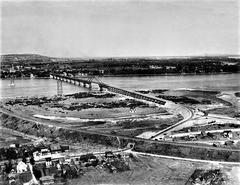
The Olivier-Charbonneau Bridge is an essential piece of infrastructure in Montreal, seamlessly connecting the Rivière-des-Prairies–Pointe-aux-Trembles borough with Laval’s St. François district over the Rivière des Prairies. Officially opened in May 2011, this cable-stayed bridge is more than a vital transportation link; it represents a harmonious blend of engineering innovation, environmental stewardship, and Quebec’s cultural heritage. Named after Olivier Charbonneau, the first European settler of Île Jésus (now Laval), the bridge not only alleviates congestion on alternative routes but also serves as a modern symbol of Montreal’s commitment to sustainable and inclusive urban mobility (Wikipedia; Courrier Laval).
This comprehensive guide provides all essential details for visitors and commuters, including visiting hours, toll payment options, accessibility features, travel tips, architectural highlights, and recommendations for nearby attractions.
Contents
- Early Conception and Planning
- Construction and Engineering Milestones
- Naming and Commemoration
- Socioeconomic and Urban Impact
- Visitor Information: Tolling, Access, and Travel Tips
- Toll Rates and Payment Options
- Visiting Hours and Accessibility
- Travel Tips
- Engineering and Architectural Highlights
- Environmental and Sustainable Mobility Initiatives
- Nearby Attractions and Photographic Spots
- Frequently Asked Questions (FAQ)
- Conclusion and Final Tips
Early Conception and Planning
The Olivier-Charbonneau Bridge, initially known as the A25 Bridge, was conceived to address increasing traffic congestion on existing crossings like the Pie IX Bridge and the Metropolitan Expressway. It is a pivotal element of a 7.2 km project to complete Highway 25, directly linking Montreal and Laval (Wikipedia; Everything Explained). Feasibility studies and public consultations were integral to its development, particularly with regard to environmental concerns raised by groups like Greenpeace.
Construction and Engineering Milestones
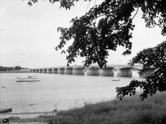
Construction began in 2008 as a major public-private partnership (PPP) in Quebec. Spanning 1.2 km across the Rivière des Prairies, the bridge accommodates six traffic lanes and a multifunctional path for pedestrians and cyclists on the east side (Systra). Completed within budget at $500 million, it opened to traffic on May 21, 2011 (Everything Explained).
Naming and Commemoration
In May 2012, the bridge was officially renamed to honor Olivier Charbonneau (1613–1687), a pioneering French settler and the first European inhabitant of Île Jésus (now Laval). This naming commemorates the region’s colonial past and cements the bridge’s place in Montreal’s cultural and historical landscape (Courrier Laval).
Socioeconomic and Urban Impact
Serving as a crucial alternative to overcrowded routes, the Olivier-Charbonneau Bridge connects Boulevard Henri Bourassa in Montreal to Highway 440 in Laval. By 2012, daily vehicle traffic exceeded 35,000, highlighting its importance for regional mobility and economic development (L’actualité).
Visitor Information: Tolling, Access, and Travel Tips
Toll Rates and Payment Options
As one of only two toll bridges in Quebec, the Olivier-Charbonneau Bridge employs a fully electronic tolling system—no cash payments are accepted. Rates as of 2025 vary by vehicle type, time of day, and subscription status, ranging from $2.96 to $39.46 (L’actualité). Payment options include:
- Transponder Account: Register for an online account and use an A25 transponder for automatic, discounted tolls.
- Video Tolling: Occasional users without a transponder will have their license plates recorded and receive invoices by mail, with an added administrative fee.
- Electric Vehicles: Registered EVs with a transponder are exempt from tolls under Quebec’s electrification program.
For current toll rates and account setup, visit the A25 Bridge Official Site.
Visiting Hours and Accessibility
- Vehicular Traffic: Open 24/7 for all vehicle types.
- Pedestrian/Cyclist Path: The dedicated multifunctional path is open seasonally from April 15 to November 15, providing a safe and scenic route between Montreal and Laval.
- Accessibility: The path is wheelchair accessible, with ramps and smooth surfaces for strollers and persons with reduced mobility. Clear signage connects the bridge to local cycling networks and riverfront parks.
Travel Tips
- Plan Ahead: Use electronic toll accounts or the A25 mobile app for streamlined crossing.
- Best Times to Visit: Spring through fall is ideal for walking or cycling the bridge.
- Transit Options: The bridge area is served by STM bus routes, with connections to Montreal’s metro and Exo commuter trains (TripSavvy).
- Cyclists: Use the BIXI bike-sharing system for affordable rentals (MyBeacon). Helmets and reflective gear are recommended.
- Parking: Limited parking near the bridge; consider public transit, cycling, or walking.
Engineering and Architectural Highlights
The Olivier-Charbonneau Bridge features a cable-stayed structure with two 60-meter pylons and a 1.2 km deck supported by steel cables. Its design minimizes the number of piers in the river, reducing environmental impact and providing expansive views. Built with high-strength steel and pre-stressed concrete, it incorporates advanced drainage and anti-icing systems, as well as real-time structural health monitoring sensors for safety and durability (Systra). At night, energy-efficient architectural lighting accentuates the bridge’s elegant lines, making it a distinctive feature on Montreal’s skyline.
Environmental and Sustainable Mobility Initiatives
Sustainable design was a priority throughout the bridge’s planning and construction. The multifunctional path encourages active transportation, and public transit is well integrated into the bridge’s approaches. The adoption of electronic tolling reduces congestion and idling emissions, while EV toll exemptions support Quebec’s green transportation goals (L’actualité). The bridge also supports faster regional bus services, enhancing mobility between Montreal and the North Shore.
Montreal’s broader sustainability strategy includes promoting public transit, cycling, and eco-friendly tourism (MTL Toolkit).
Nearby Attractions and Photographic Spots
- Parc de la Rivière-des-Prairies: Offers beautiful river and bridge views, ideal for walking and photography.
- Ruisseau-De Montigny Nature Park: Trails and wildlife viewing within walking distance (Trek Zone).
- Parc-nature de l’Île-de-la-Visitation: Easily accessible via bike or transit, known for greenery and historic sites.
- Saint-Leonard Cavern: Historic site beneath Pie-XII Park, offering guided tours.
- Galeries d’Anjou: Major shopping center, accessible by public transit.
All these locations are reachable by cycling, transit, or walking, supporting sustainable visits.
Frequently Asked Questions (FAQ)
Q: Do pedestrians or cyclists pay a toll?
A: No, tolls apply only to motor vehicles. Pedestrians and cyclists cross free of charge.
Q: What are the current toll rates?
A: Rates range from $2.96 to $39.46 depending on vehicle type and time. Electric vehicles with a transponder are exempt (A25 Bridge Official Site).
Q: When is the pedestrian/cyclist path open?
A: From April 15 to November 15, during daylight hours.
Q: Is the bridge open 24/7 for vehicles?
A: Yes, vehicular access is available at all times.
Q: Are guided tours available?
A: There are no official tours of the bridge, but nearby sites like Saint-Leonard Cavern offer guided visits.
Q: Is the bridge accessible for people with disabilities?
A: Yes, the multi-use path and transit system feature ramps, tactile guidance, and audio-visual aids.
Q: What are the best spots for bridge photography?
A: Parc de la Rivière-des-Prairies and other nearby parks provide excellent vantage points.
Conclusion and Final Tips
The Olivier-Charbonneau Bridge is more than a critical transport artery—it is a model of modern infrastructure, environmental responsibility, and cultural commemoration. Its innovative design, seamless integration with public transit, and commitment to active transportation make it a highlight for both commuters and visitors. Whether crossing by car, bike, or on foot, you can enjoy stunning river views and easy access to some of Montreal’s best parks and neighborhoods.
Tips for a great visit:
- Use public transit or active transportation for a greener trip.
- Visit during spring or summer to enjoy the full pedestrian/cyclist path.
- Check real-time toll and traffic information via the A25 app or website.
- Explore nearby nature parks and historical sites for a well-rounded experience.
For up-to-date information on tolls, access hours, and travel tips, consult the A25 Bridge Official Site. To enhance your experience, download the Audiala app and follow Montreal tourism channels for news and updates. Enjoy Montreal’s blend of heritage and innovation while exploring the Olivier-Charbonneau Bridge and its surroundings.
Sources
- Olivier-Charbonneau Bridge Wikipedia, 2025
- Exploring the Olivier-Charbonneau Bridge: History, Visitor Info, and Nearby Attractions, 2025
- Courrier Laval: Le pont A25 devient pont Olivier-Charbonneau, 2012
- L’actualité: Pont Olivier-Charbonneau la CDPQ acquiert 50% de la concession A25, 2025
- Systra: Olivier-Charbonneau Bridge Project, 2025
- A25 Bridge Official Site, 2025
- Traffic Technology Today: Emovis delivers upgraded electronic tolling system for Canada’s A25 highway, 2025
- MyBeacon: How to use public transportation in Montreal, 2024
- Trek Zone: Olivier-Charbonneau Bridge Montreal, 2024
- MTL Toolkit: Sustainable Tourism in Montreal, 2024

