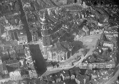
Skagerrakkanal Visiting Hours, Tickets, and Hamburg Historical Sites Guide
Date: 04/07/2025
Introduction
Nestled in Hamburg’s Alsterdorf district, the Skagerrakkanal stands as a testament to the city’s maritime heritage and innovative urban planning. This guide provides a comprehensive overview of the Skagerrakkanal, exploring its historical background, engineering achievements, visitor information, and its connection to nearby historical and cultural attractions. Whether you’re a history enthusiast, outdoor adventurer, or simply seeking a scenic escape, this article will help you make the most of your visit.
Table of Contents
- Introduction
- Early Canalization and Urban Development in Hamburg
- Construction and Features of the Skagerrakkanal
- Historical Significance and Naming
- Visiting Skagerrakkanal: Hours, Accessibility, and Tickets
- Activities and Experiences
- Nearby Attractions and Amenities
- Engineering and Urban Innovations
- Frequently Asked Questions (FAQ)
- Conclusion
- Sources
Early Canalization and Urban Development in Hamburg
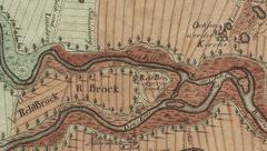
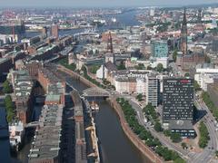
Hamburg’s identity is deeply linked to its waterways. In the late 19th and early 20th centuries, the city embarked on ambitious canalization projects to improve navigation, control flooding, and enable urban growth. The straightening of the Alster River from Ohlsdorf to Winterhude (1913–1918) was central to these efforts, allowing for new residential and commercial areas to flourish. Parallel canals—including the Brabandkanal, Inselkanal, and Skagerrakkanal—were constructed to maximize waterfront property and enhance the cityscape (de.wikipedia.org).
Construction and Features of the Skagerrakkanal
The Skagerrakkanal is a 1,125-meter-long side canal branching off the Alster River in Alsterdorf. Its width ranges from 20 meters to 40 meters at the central section. Notable features include:
- Artificial Island: Created between the Alster and Skagerrakkanal, spanning about 1,000 meters in length and up to 200 meters wide, accessible via Rathenaustraße and intersected by Alsterdorfer Damm.
- Bridges: Key crossings such as Skagerrakbrücke, Alsterdorfer Brücke, Wolffsonbrücke (for pedestrians and cyclists), and Rathenaubrücke enhance connectivity and offer scenic viewpoints.
- Access Points: The canal is easily reached by public transport, with nearby U-Bahn stations and bus services.
The canal’s design supports small boat navigation, integrates green spaces, and exemplifies Hamburg’s approach to combining utility with aesthetic appeal (Komoot; hamburg.de).
Historical Significance and Naming
Named after the 1916 Battle of Jutland (Skagerrakschlacht), the Skagerrakkanal honors Hamburg’s seafaring and naval legacy. The canal functions as a “Gewässer erster Ordnung” (first-order water body) and plays a key role in the city’s water management system. It stands as a living memorial to Hamburg’s transformation through early 20th-century engineering and urban planning (de.wikipedia.org).
Visiting Skagerrakkanal: Hours, Accessibility, and Tickets
- Opening Hours: The Skagerrakkanal is a public, freely accessible waterway open year-round, 24/7. Daylight hours are recommended for safety and the best experience.
- Tickets: No entrance fees are required. Guided tours and boat rentals are available from local operators, typically between 9:00 AM and 7:00 PM in spring and summer.
- Accessibility: Paved paths and dedicated bridges ensure easy access for pedestrians, cyclists, wheelchair users, and strollers.
- Transport: The canal is easily accessible via the Alsterdorf and Sengelmannstraße U-Bahn stations (U1 line) and several bus routes (Hamburg.com).
Activities and Experiences
Walking and Cycling
Flat, well-maintained paths along the canal invite visitors for walks, jogging, and cycling. The bridges—especially Skagerrakbrücke—offer excellent spots for panoramic photography and rest.
Boating and Water Activities
Several rental stations along the Alster provide kayaks, canoes, and stand-up paddleboards. The Skagerrakkanal’s calm waters and connections to the larger Alster lakes create ideal conditions for paddling. Advance bookings are recommended on weekends and holidays (hamburg.de).
Picnicking and Relaxation
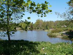
The canal’s green banks are perfect for picnics and relaxation. While there are no formal picnic facilities, visitors often bring their own supplies and enjoy the tranquil setting.
Nearby Attractions and Amenities
- Speicherstadt Warehouse District: A UNESCO World Heritage Site, famous for its neo-Gothic red-brick warehouses, museums, and cafes (UNESCO World Heritage Centre).
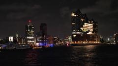
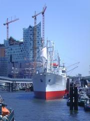
- HafenCity & Elbphilharmonie: Modern waterfront development with the iconic Elbphilharmonie concert hall (hamburg-travel.com).
- Stadtpark & Winterhude: Expansive parks and lively neighborhoods nearby, offering additional recreation and dining options.
- Miniatur Wunderland & International Maritime Museum: Popular family-friendly attractions in the Speicherstadt area.
Engineering and Urban Innovations
The Skagerrakkanal exemplifies Hamburg’s integration of water management, urban expansion, and recreational planning. The artificial island and series of distinctive bridges demonstrate early 20th-century engineering prowess and the city’s ongoing commitment to sustainable, accessible green spaces (de.wikipedia.org).
Frequently Asked Questions (FAQ)
Q: What are the Skagerrakkanal visiting hours?
A: The canal is open 24/7 year-round; daylight visits are advised for safety.
Q: Are tickets required to visit?
A: No, the Skagerrakkanal is free to access. Fees apply for boat rentals and guided tours.
Q: Is the area accessible for people with disabilities?
A: Most main paths are paved and wheelchair-friendly, though some waterside areas may be uneven.
Q: Can I rent boats or bikes nearby?
A: Yes, several stations offer kayak, canoe, and Stadtrad bike rentals.
Q: What historical sites are close to the canal?
A: Speicherstadt, HafenCity, and the Outer Alster Lake are all within easy reach.
Q: Is swimming allowed in the canal?
A: Swimming is prohibited due to safety and water quality.
Conclusion
The Skagerrakkanal is a hidden gem within Hamburg’s waterway network, blending history, engineering, and natural beauty. Open year-round and free to visit, it offers a range of activities—walking, cycling, boating—amid tree-lined banks and striking bridges. Its proximity to the Speicherstadt, HafenCity, and other major sites makes it an essential stop for travelers seeking both relaxation and cultural enrichment. Enhance your visit by exploring guided tours, leveraging public transport, and using digital resources such as the Audiala app for maps and audio guides.
Visuals and Media
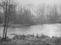
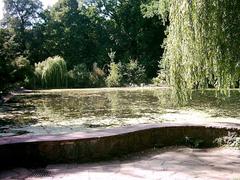
- Images: High-resolution photos of Skagerrakkanal’s bridges, tree-lined banks, and panoramic canal views. Recommended alt tags: “Skagerrakkanal Hamburg canal,” “Skagerrakbrücke bridge,” “Kayaking on Skagerrakkanal.”
- Maps: Interactive maps showing access points and nearby attractions.
- Virtual Tours: Available through local tourism websites and apps (Komoot).
Internal and External Links
- Hamburg.de – Alster and Canal Activities
- Komoot – Skagerrakbrücke Highlights
- Germany Travel Blog – Hamburg City Guide
- UNESCO World Heritage Centre – Speicherstadt
- Hamburg Travel – Culture & Music
- Hamburg.com – Visitor Information
Sources
- de.wikipedia.org
- hamburg.de
- UNESCO World Heritage Centre
- Komoot
- hamburg-travel.com
- germanytravel.blog
Enjoy your visit to the Skagerrakkanal! Download the Audiala app for audio guides and interactive content, and follow us on social media for the latest updates and tips on Hamburg’s waterways and historical sites.
