Moorfleeter Kanal: Visiting Hours, Tickets, and Comprehensive Guide to Hamburg’s Historic and Industrial Waterway
Date: 04/07/2025
Introduction
Moorfleeter Kanal, located in southeastern Hamburg, is a remarkable waterway that embodies the city’s deep-rooted connection with its rivers and canals. Once vital for agricultural drainage and the transport of goods, it now stands at the crossroads of Hamburg’s rural traditions, industrial evolution, and modern urban renewal. This guide provides a detailed exploration of the canal’s history, cultural significance, geography, visitor information—including Moorfleeter Kanal visiting hours and ticket details—plus tips to get the most from your visit, insights into nearby attractions, accessibility, and answers to frequently asked questions.
Table of Contents
- Introduction
- Historical Development of Moorfleeter Kanal
- Geographical Setting and Features
- Cultural and Industrial Significance
- Visitor Information
- Seasonal Considerations and Best Times to Visit
- Special Events, Guided Tours, and Photo Opportunities
- Frequently Asked Questions (FAQ)
- Related Articles and Resources
- Conclusion
Historical Development of Moorfleeter Kanal
Origins and Construction
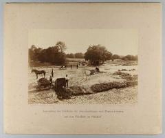
Built in the late 19th and early 20th centuries, Moorfleeter Kanal was engineered to support both the drainage of Hamburg’s fertile marshlands (the Marschlande) and the movement of agricultural goods into the city’s port. Its creation was part of a broader campaign to reclaim and manage the low-lying Vierlande and Marschlande areas, transforming flood-prone wetlands into thriving farmland (Hamburg’s Hanseatic legacy).
Economic Expansion and the Hanseatic Legacy
As Hamburg grew into a Hanseatic trading powerhouse, canals like Moorfleeter Kanal became critical infrastructure. They connected rural producers with urban markets and the port, transporting peat, produce, and building materials. The canal also played a defensive role, with regulated water levels protecting against Elbe flooding (Hanseatic trade and culture).
20th Century Transformations
With the rise of road and rail, the canal’s commercial shipping function declined, but it remained vital for irrigation and drainage. The landscape around the canal, dotted with greenhouses and vegetable fields, continues to supply Hamburg’s renowned markets (Hamburg’s traditional markets). After WWII disruptions, the area saw renewed investment, and in recent decades it has emerged as a recreational and ecological asset.
Geographical Setting and Features
Location, Course, and Connectivity
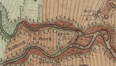
Moorfleeter Kanal runs for approximately 1,750 meters through the Billbrook industrial district, with a smaller section touching Moorfleet. Its width varies from 70 meters to 45 meters near its end (Fisch-Hitparade). The canal is part of a network that includes the Dove Elbe and other waterways, easily accessible via public transport or cycling paths. The S-Bahn stations Billwerder-Moorfleet and Rothenburgsort are nearby, and Hamburg’s “Stadtrad” bike system makes cycling convenient (Time Out Hamburg).
Hydrological and Ecological Importance
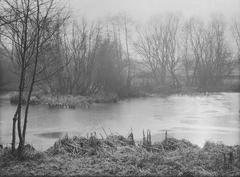
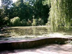
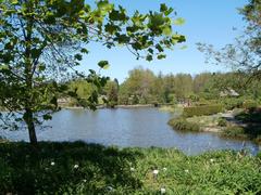
Moorfleeter Kanal is central to Hamburg’s water management, providing both drainage and irrigation. It is tidal—at low tide, mudflats and industrial features are exposed, creating a distinctive landscape (TideKing). Its banks support reeds, willows, and a range of birdlife, contributing to urban biodiversity (Hamburg’s bridges and canals).
Cultural and Industrial Significance
Agricultural Heritage
The canal underpinned the transformation of marshy areas into productive farmland. To this day, the Marschlande region is known for its high-quality vegetables and flowers, much of which passes through the city’s historic markets (Hamburg’s markets).
Hanseatic Identity
Hamburg’s “Free and Hanseatic City” identity is evident in the cooperative efforts that built and maintain the canal. This spirit of collaboration and resilience is woven into the area’s history (Hamburg’s Hanseatic legacy).
Modern Industrial Role and Revitalization
Moorfleeter Kanal traverses Billbrook/Rothenburgsort, Hamburg’s largest contiguous industrial district outside the port. With over 675 businesses and nearly 10,000 employees, the area remains a logistics and manufacturing powerhouse (Billbrook industrial district). The canal has seen recent infrastructure improvements—including dredging and modernization projects—to boost navigability and support logistics (Hafen Hamburg modernization).
Environmental Renewal
Notably, the area has undergone major remediation after historic industrial contamination, with long-term groundwater treatment and land reuse projects (industriestandort-billbrook.de). New initiatives emphasize solar energy, e-mobility infrastructure, and green space expansion.
Visitor Information
Visiting Hours and Tickets
- Access: Moorfleeter Kanal and its paths are open to the public year-round.
- Hours: Daylight visits are recommended for safety and optimal views.
- Tickets: No entry fees apply for walking or cycling along the canal. Tickets are only needed for specialized boat tours, which start at €11–€17 for adults (Hamburg Travel: Canal Trips).
Accessibility and Getting There
- Public Transport: S-Bahn stations Billwerder-Moorfleet and Rothenburgsort; multiple bus lines.
- Cycling: Flat terrain and paved paths; “Stadtrad” bike rental available.
- By Car: Limited parking; public transit or cycling is recommended.
Activities
- Walking & Cycling: Enjoy the network of paths and towpaths along the water.
- Boat Tours: While not on standard tourist routes, some private or industrial heritage tours include the canal (Hamburg Travel: Canal Trips).
- Photography: Capture contrasts between water, industry, and nature—especially at sunrise or high tide.
Safety and Facilities
- Stay on marked paths: Industrial activity is ongoing; some areas are off-limits.
- Limited amenities: Bring water and snacks. Dining and restrooms are more readily available in nearby neighborhoods or city center.
Seasonal Considerations and Best Times to Visit
- Best months: May to September—pleasant weather and green landscapes.
- Climate: Maritime, with mild summers and cool, damp winters. July averages 23°C (73°F) (Hamburg weather in July).
- Tide awareness: Tidal changes affect the canal’s appearance and accessibility (TideKing).
Special Events, Guided Tours, and Photo Opportunities
- Guided tours: Occasional industrial heritage or ecological walks are organized by local groups—check event calendars (industriestandort-billbrook.de).
- Photo spots: Bridges, the confluence with larger waterways, and revitalized green spaces.
- Nearby Attractions: Speicherstadt, HafenCity, Elbe promenades, and the historic Vierlande villages.
Frequently Asked Questions (FAQ)
Q: Is Moorfleeter Kanal free to visit?
A: Yes, public access is free. Only organized boat tours require tickets.
Q: What are the best visiting hours?
A: Daylight hours, particularly during high tide for optimal scenery.
Q: Are there standard tourist cruises on Moorfleeter Kanal?
A: Most standard tours focus elsewhere; private operators may include it by request.
Q: Is the canal suitable for cycling?
A: Yes, it’s ideal for cycling, with flat terrain and well-marked paths.
Q: Are amenities available at the canal?
A: Amenities are limited at the canal itself; more options are available in adjacent neighborhoods.
Related Articles and Resources
- Hamburg’s Hanseatic legacy
- Hanseatic trade and culture
- Exploring Hamburg’s waterways
- Billbrook industrial district
- Moorfleeter Kanal tides and visits
- Hafen Hamburg modernization
- Hamburg Travel: Canal Trips
- Time Out Hamburg
- industriestandort-billbrook.de
- Official Hamburg Tourism Site
- Public Transport Info – HVV Hamburg
- Audiala app and visitor resources
Conclusion
Moorfleeter Kanal is more than a waterway—it’s a living chronicle of Hamburg’s agricultural ingenuity, industrial ambition, and commitment to sustainable urban renewal. Whether you’re cycling its banks, joining a specialized boat tour, or exploring the evolving industrial landscape, you’ll gain unique insights into a city shaped by its relationship with water and trade. For the best experience, plan your visit with local tide tables, bring appropriate gear, and explore nearby attractions to fully appreciate this dynamic part of Hamburg.
Download the Audiala app for guided tours, interactive maps, and real-time updates. Stay connected via social media for the latest news and inspiration about Hamburg’s evolving waterways.
