Norges Geografiske Oppmåling Visiting Hours, Tickets, and Oslo Historical Sites Guide
Date: 04/07/2025
Introduction: The Significance of Norges Geografiske Oppmåling
Norges Geografiske Oppmåling (NGO)—the Norwegian Geographical Survey—stands as a foundational institution in Norway’s scientific and cultural history. Established in 1773, the NGO was one of Europe’s earliest national mapping authorities, catalyzing the development of modern cartography and geographical understanding in Norway. Its systematic surveying efforts supported military planning, infrastructure development, and environmental research, establishing standards that continue to shape Norwegian society today. While the original NGO headquarters in Oslo no longer operate as a public museum, the legacy of this venerable institution lives on through protected sites, archives, and museum exhibitions available to visitors in the city. This guide provides detailed information on visiting hours, ticketing, accessibility, and practical tips for exploring the heritage of Norges Geografiske Oppmåling and related Oslo historical sites (Norwegian Mapping Authority, Aftenposten, 2015).
Table of Contents
- Introduction: The Significance of Norges Geografiske Oppmåling
- Historical Background
- NGO’s Role in Norwegian Society and Science
- Visiting NGO-Related Sites in Oslo
- Practical Visitor Tips
- FAQ
- Conclusion and Call to Action
- Detailed Visitor Guide: Hours, Tickets, and Historical Insights
- Preservation, Future Prospects, and Events
- Media and Visual Suggestions
- Further Resources
Historical Background
Founded in the Enlightenment era, Norges Geografiske Oppmåling led the first systematic mapping and triangulation of Norway, producing vital topographic maps for military, administrative, and economic purposes (Norwegian Mapping Authority). The agency’s work began in earnest in 1779 under Heinrich Wilhelm von Huth and expanded throughout the 19th and 20th centuries, culminating in the comprehensive 1:50,000 scale Series M711 maps launched in 1955. In 1986, NGO transitioned into Statens kartverk (Norwegian Mapping Authority), relocating its headquarters to Hønefoss, but its legacy remains deeply embedded in Oslo’s scientific and administrative landscape.
NGO’s Role in Norwegian Society and Science
Modern Mapping Foundations
NGO’s pioneering surveys standardized Norwegian mapping, providing reliable data for defense, land management, and navigation. The adoption of advanced techniques, including aerial photogrammetry, enabled unprecedented precision in Norwegian maps (Norwegian Mapping Authority).
Influence on Place Names and Cultural Identity
NGO’s maps played a key role in standardizing Norwegian place names, particularly after the Place Name Law of 1991. This effort preserved linguistic heritage and reinforced national identity, especially in regions with significant Sami populations.
Infrastructure and Development
The agency’s mapping data underpinned Norway’s infrastructure expansion—supporting roads, railways, and resource management. Today, digital mapping continues to support urban planning, environmental monitoring, and public services (FieldGeo).
Scientific and Environmental Contributions
NGO’s extensive cartographic work has been fundamental for geological, hydrological, and environmental studies. Innovations in digital and 3D mapping are built on these deep-rooted traditions.
Visiting NGO-Related Sites in Oslo
Archival and Exhibition Access
While the original NGO building is not a public museum, several Oslo institutions provide access to its historical materials and exhibitions:
-
National Library of Norway
- Hours: Mon–Fri, 9:00 AM–5:00 PM; closed weekends and holidays.
- Tickets: Free entry; some special exhibitions may require tickets—see the official website.
- What to See: Historical maps, documents, and cartography exhibits.
-
Norwegian Museum of Science and Technology
- Hours: Tue–Sun, 10:00 AM–5:00 PM; closed Mondays.
- Tickets: Paid admission; discounts for students/seniors (museum website).
- Exhibits: Surveying instruments, historical maps, interactive cartography.
-
Norwegian Mapping Authority (Statens kartverk) Archives
- Location: Main office in Hønefoss; digital archives online.
- Access: By appointment; occasional guided tours in Oslo (Statens kartverk).
Accessibility and Guided Tours
Most institutions are wheelchair accessible and provide assistance for visitors with disabilities. Guided tours focusing on Norwegian mapping history are occasionally offered—check each institution’s website for schedules.
Detailed Visitor Guide: NGO Headquarters and Historic Nullpunkt
Location and Access
- Address: St. Olavs gate 32, central Oslo (Riksantikvaren)
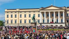
- Nearby: Royal Palace, Slottsparken, Nationaltheatret Station (metro, tram, bus)
- Parking: Limited; public transport recommended
Visiting Hours and Ticketing
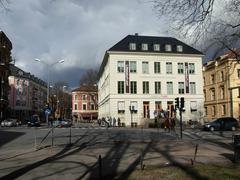
- NGO Building: Not open to the public; exterior and courtyard viewable from public areas year-round during daylight.
- Tickets: No fee for viewing exterior; interior access by appointment or during special events only (VisitOSLO).
The Nullpunkt: Norway’s Historic Height Reference
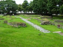
Located in the NGO courtyard, the nullpunkt stone served as Norway’s elevation reference point for 125 years, based on Oslofjord’s mean sea level (Aftenposten, 2015). It remains a significant historical landmark, viewable from the exterior.
Alt text: Historic nullpunkt stone at Norges Geografiske Oppmåling site in Oslo, Norway.
Architectural and Site Features
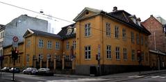
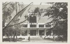
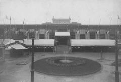
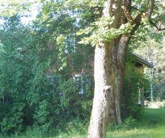
The building’s late 19th-century neoclassical design features round corner towers and a symmetrical façade, with a courtyard and a historically important garden (Riksantikvaren). Informational plaques (mainly in Norwegian) offer historical context.
Alt text: Historic 19th-century architecture of Norges Geografiske Oppmåling building in Oslo.
Navigating the Site
- Exterior/Garden: Viewable from public streets; interior access restricted due to preservation and redevelopment.
- Accessibility: Some limitations exist due to historic features; contact Riksantikvaren or the Oslo Visitor Centre for details.
Nearby Historical Sites
- Royal Palace and Slottsparken: 5-minute walk; scenic gardens and guided tours.
- National Museum: Norwegian art and cultural history.
- Akershus Fortress: Medieval fortification and city history.
- Oslo City Hall: Guided tours and exhibitions.
For more details, see the Oslo Historical Sites Guide.
Practical Visitor Tips
- Plan Ahead: Confirm opening hours and access restrictions before visiting.
- Language: Norwegian is primary, but English is widely spoken; most signage is bilingual.
- Combine Visits: Pair with nearby museums and landmarks for a full day of cultural exploration.
- Souvenirs: Find historic map reproductions at Oslokart.no and museum shops.
Events, Preservation, and Educational Opportunities
- Preservation: The NGO building and nullpunkt stone are protected heritage sites (Riksantikvaren).
- Redevelopment: Plans to convert the building into a hotel are under review; heritage features will be preserved (Aftenposten).
- Events: Occasional guided tours and open days during Oslo Open House or “Kartdagen” (Map Day) (Kartverket, Kartografi).
- Educational Resources: Explore map archives at the National Library and Oslo City Archives by appointment.
FAQ
Q1: What are the visiting hours of Norges Geografiske Oppmåling?
A1: There are no regular public hours; exterior and courtyard viewable during daylight.
Q2: Is there an entrance fee?
A2: No fee for viewing the exterior; special tours may require advance booking and a ticket.
Q3: Is the site accessible for visitors with disabilities?
A3: Some limitations exist; contact the Oslo Visitor Centre or Riksantikvaren for up-to-date details.
Q4: What nearby attractions can I visit?
A4: Royal Palace, National Museum, Akershus Fortress, National Library.
Q5: Where can I find historic map reproductions?
A5: Oslokart.no and select Oslo bookstores.
Safety, Travel, and Weather Tips
- Safety: Oslo is very safe (Nomadic Matt); emergency numbers: 112 (police), 110 (fire), 113 (ambulance).
- Weather: Summers are mild; winters are cold. Dress accordingly (Nordic Visitor).
- Transport: Nationaltheatret Station is the closest hub.
- Photography: Permitted outdoors; respect signage.
Media and Visual Recommendations
Use high-quality images of the façade, garden, nullpunkt stone, and location maps. Include alt tags with relevant keywords such as “Norges Geografiske Oppmåling visiting hours” and “Oslo historical sites.”
Alt text: Map showing location of Norges Geografiske Oppmåling in Oslo with nearby historical sites marked.
Conclusion and Call to Action
Norges Geografiske Oppmåling’s legacy is woven into Norway’s scientific, cultural, and administrative fabric. Whether you are a history enthusiast, a geography lover, or a casual visitor, exploring Oslo’s archives and historical sites linked to the NGO offers a unique window into the nation’s cartographic journey. For up-to-date information and deeper exploration, use the Audiala app and consult local heritage organizations online. Your respectful engagement supports the preservation of Norway’s geographic legacy.
Download the Audiala app for more travel tips and follow us on social media for event updates and Oslo heritage guides.
Further Resources
- Norwegian Mapping Authority, Kartverkets historie gjennom 250 år
- Aftenposten, Nå blir Norge høyere
- Norwegian Mapping Authority, About Kartverket
- FieldGeo, Landmåling i Norge
- Riksantikvaren, Innsigelse St. Olavs gate 32 i Oslo
- Store norske leksikon, Norges geografiske oppmåling
- VisitOSLO, Oslo Visitor Centre
All practical details are subject to change due to ongoing redevelopment and preservation efforts. Always verify current conditions before your visit.

