Frankfurter Kreuz Visiting Hours, Tickets, and Historical Sites in Frankfurt
Date: 03/07/2025
Introduction: The Significance of Frankfurter Kreuz
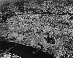
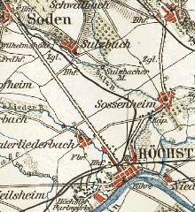
The Frankfurter Kreuz is a pivotal symbol of German and European transportation, ranking as the busiest motorway interchange in the European Union. Strategically positioned in Frankfurt am Main, this key junction links the A3 and A5 autobahns, supporting the daily passage of approximately 370,000 vehicles. Its influence extends beyond traffic management; it integrates critical economic corridors, connecting road, rail, and air transport due to its proximity to Frankfurt Airport and the central railway station. The interchange’s origins date to the early 20th century, with major planning in the 1920s and construction phases spanning pre-World War II designs, postwar rebuilding, and extensive modernization in the late 20th century.
Frankfurter Kreuz is renowned for its advanced engineering—most notably the construction of a high-speed rail tunnel beneath the interchange, executed without halting traffic above. While not a conventional tourist attraction with set visiting hours or ticket requirements, its scale and complexity attract infrastructure enthusiasts and urban planners. Visitors can observe the Kreuz from nearby vantage points and explore attractions like the Frankfurt Airport Visitor Terrace, the historic city center, and Messe Frankfurt. This guide offers a comprehensive look at the Frankfurter Kreuz’s history, engineering accomplishments, traffic management, visitor information, and wider cultural and economic impact.
For further details, see:
Wikipedia | Hessen Mobil | Frankfurt city infrastructure

Contents Overview
- Discovering the Frankfurter Kreuz: History, Visitor Information, and Significance
- Early Planning and Conception
- Design Decisions and Early Construction
- Postwar Resumption and Completion
- Growth in Traffic and Expansions
- 1990s Modernization and Rail Integration
- Recent Developments and Challenges
- Engineering and Maintenance
- Visiting Information
- Traffic Guide: Engineering, Access, and Visitor Tips
- Engineering and Structural Design
- Infrastructure and Traffic Management
- Visitor Information and Practical Tips
- Frankfurter Kreuz: Its Impact on Frankfurt
- Symbol of Mobility and Connectivity
- Historical Evolution and Urban Development
- Economic, Environmental, and Cultural Impact
- Events and Visitor Recommendations
Discovering the Frankfurter Kreuz: History, Visitor Information, and Significance
Early Planning and Conception
The roots of the Frankfurter Kreuz reach back to the 1920s as part of Germany’s growing embrace of motorized transport. The HaFraBa association, led by then-mayor Ludwig Landmann, envisioned a dedicated motor vehicle road network. By 1926, blueprints were created for a major junction near Frankfurt as part of the planned autobahn between Frankfurt and Basel, including a branch to Wiesbaden (Wikipedia).
When the National Socialist regime came to power in 1933, autobahn expansion was prioritized. The Frankfurter Kreuz became a central project, with provisional routes laid out between 1939 and 1941. However, World War II delayed construction (Wikipedia).
Design Decisions and Early Construction
In 1936, the “Kleeblatt” (cloverleaf) design was selected, inspired by Germany’s first cloverleaf interchange at Schkeuditzer Kreuz. This configuration enabled efficient, grade-separated flows between highways. Final plans resolved the airport connection at the B43 intersection (Wikipedia). Construction on the Frankfurt–Mannheim autobahn segment began in 1933, with detailed plans ready by 1934, though only preliminary work was completed due to the war.
Postwar Resumption and Completion
After WWII, Germany’s infrastructure was in ruins. Work resumed on February 16, 1953, leading to the opening of the Frankfurter Kreuz on July 10, 1956. The project cost 33.6 million Deutsche Mark, with 10.2 million DM allocated to the interchange alone (Wikipedia; Hessen Mobil).
Growth in Traffic and Expansions
Traffic at Frankfurter Kreuz increased dramatically, from 47,000 vehicles daily in the 1950s to 156,000 in the 1970s, and over 310,000 by 2006 (Wikipedia). Major expansions followed, including the 1970s addition of parallel lanes and improved connections, and further upgrades in the 1990s to handle ever-growing demand.
1990s Modernization and Rail Integration
In response to surging traffic, the 1990s modernization introduced phased upgrades, including new connections and improved airport access. The most notable feat was the construction of the Frankfurter-Kreuz-Tunnel beneath the interchange for the Cologne–Rhine/Main ICE line. Completed in 1998, the tunnel comprises four tubes totaling 2,600 meters and cost around 250 million Deutsche Mark, enabling direct high-speed rail links (Alamy). The 1990s expansion concluded in December 2000, with a total investment of 173 million euros (Wikipedia).
Recent Developments and Challenges
Despite ten-lane expansions and advanced management, persistent congestion remains. The state of Hesse has proposed expanding the A5 to ten lanes from Friedberg to the Kreuz, prompting debates among city officials, the ADAC, and environmental groups about the future of mobility and sustainability (BYC-News). Bicycle demonstrations and public protests reflect growing demand for environmentally friendly transport policies.
Engineering and Maintenance
Maintaining the Frankfurter Kreuz is a logistical challenge akin to “open-heart surgery” on the motorway. For example, in 2013, a major rehabilitation was completed in just 57 hours, minimizing disruption (Wirtgen Group).
Visiting Information
Frankfurter Kreuz is a functional motorway interchange, not a tourist attraction with formal hours or ticketing. However, infrastructure enthusiasts can observe the site from nearby vantage points or as part of driving and cycling routes.
- Accessibility: Reachable by car (A3/A5) and via public transport (regional trains, buses serving the airport).
- Travel Tips: Visit during early morning or evening for optimal traffic views and photography. The Kelsterbacher Hang offers safe observation points.
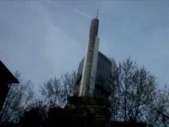
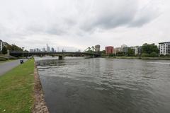
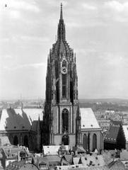
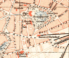
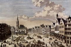
- Nearby Attractions: Frankfurt’s Römer, St. Bartholomew’s Cathedral, Museumsufer, and the Frankfurt Airport Visitor Terrace.
Traffic Guide: Engineering, Access, and Visitor Tips
Engineering and Structural Design
Strategic Location
Frankfurter Kreuz connects the east-west A3 and north-south A5 autobahns, forming the backbone of Germany’s road network and supporting both passenger and heavy freight traffic (Frankfurt city infrastructure).
Tunnel Construction
Beneath the Kreuz, engineers faced complex geology and high groundwater, requiring innovative tunneling methods for the Cologne–Rhine/Main high-speed rail line. A large-diameter tunnel was excavated using an HDBV (hydro-shield) screen to protect the road above, strictly controlling surface settlement to maintain traffic flow (DAUB-ITA Tunnel Projects).
Traffic Flow During Construction
Real-time monitoring ensured safety throughout the tunnel build, with no need to close the interchange to traffic.
Infrastructure and Traffic Management
Road Network and Connectivity
Frankfurter Kreuz serves as a central node in the Autobahn system, linking major German and European routes (Frankfurt city infrastructure).
Integration with Rail and Air
Proximity to Frankfurt Airport and the high-speed rail tunnel underscores the Kreuz’s multimodal significance.
Traffic Management Systems
Dynamic signage, variable speed limits, and real-time monitoring optimize flow, especially during events at Messe Frankfurt (Messe Frankfurt Traffic Management). During exhibitions, Messe Frankfurt coordinates traffic, assigns loading zones, and manages parking, including EV charging (Messe Frankfurt Traffic Services).
Visitor Information and Practical Tips
- By Car: Well-signposted and accessible. Plan extra time during peak hours or events.
- For Messe Frankfurt: Follow F-Rebstock signs, pre-register vehicles for event access.
- Parking: Book in advance, especially for EV charging.
- Motorhomes: Overnight parking is available; note utility limitations.
- Accessibility: Nearby facilities and public transport hubs offer accessibility features. Consult the UN Tourism accessibility portal for specifics.
- Safety: Observe variable speed limits and emergency procedures.
- Sustainable Transport: Use public transport (trains, S-Bahn, buses) to reduce congestion and emissions. Cycling and walking options connect to the city center but not the interchange itself.
Frankfurter Kreuz: Impact on Frankfurt and Europe
Symbol of Mobility and Connectivity
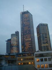
As the busiest interchange in the EU, Frankfurter Kreuz is central to travel and commerce. Its location beside Frankfurt Airport and the city’s main train station makes it a linchpin in European transport (Wikipedia; FR.de; Goethe-Institut; Frankfurt.de).
Historical Evolution and Urban Development
From early 20th-century plans to modern ten-lane highways and underground rail, Frankfurter Kreuz shaped regional development and attracted business, logistics, and investment (Wikipedia; TRID; Graphsearch EPFL).
Economic, Environmental, and Cultural Impact
The Kreuz underpins European trade, linking the Netherlands, Austria, Hamburg, and Switzerland (GermanSights). Its efficiency supports Frankfurt’s status as a financial and logistics hub, drawing international events at Messe Frankfurt (Goethe-Institut). The interchange also embodies urban debates about sustainability, with expansion plans sparking environmental protests and policy discussions (FR.de; BYC-News).
Social and Cultural Events
While the Kreuz itself does not host events, its accessibility supports major gatherings at Messe Frankfurt, sports competitions, and festivals (VisitFrankfurt). The interchange is integral to the city’s cosmopolitan identity, with nearly half of Frankfurt’s population originating from outside Germany (Wikipedia).
Visitor FAQs
Q: Are there visiting hours or tickets for Frankfurter Kreuz?
A: No, it is accessible 24/7 as a public motorway interchange.
Q: Can I tour the Frankfurter Kreuz?
A: There are no public tours; observation is from nearby safe vantage points only.
Q: How do I avoid traffic congestion?
A: Avoid rush hours (7–9 AM, 4–6 PM) and monitor real-time traffic updates.
Q: Is it accessible by public transport?
A: Yes, via Frankfurt Airport and city rail/bus connections.
Q: Are there EV charging stations?
A: Yes, at nearby facilities and Messe Frankfurt; advance booking is recommended.
Q: Are there events at the Kreuz?
A: No events occur directly at the interchange, but Messe Frankfurt and other venues nearby host major gatherings.
Summary and Visitor Recommendations
Frankfurter Kreuz remains a landmark of transportation innovation, shaping Frankfurt’s economic and urban landscape. Its evolution—from early plans to a modern, multimodal interchange—demonstrates Germany’s commitment to efficient, integrated mobility. While it is not a tourist destination in the traditional sense, the interchange’s scale, engineering, and significance make it a point of interest for travelers and residents alike. Comprehensive traffic management, proximity to cultural sites, and ongoing debates about sustainable mobility reflect the Kreuz’s vital role in contemporary European infrastructure.
For more information and travel planning, use resources such as the Audiala app, Messe Frankfurt traffic services, and official city portals. Embrace Frankfurter Kreuz as both a functional infrastructure marvel and a window into the dynamics of modern urban life.
Sources and Further Reading
- Frankfurter Kreuz - Wikipedia, 2025
- Hessen Mobil - Das Frankfurter Kreuz, 2025
- Frankfurt city infrastructure, 2025
- DAUB-ITA Tunnel Projects - Tunnelling underneath Frankfurt Kreuz Hub, 2025
- Messe Frankfurt Traffic Services, 2025
- FR.de - Friedberg umstrittener A5 Ausbau, 2025
- Goethe-Institut - Frankfurt Transportation, 2025
- VisitFrankfurt - Calendar of Events, 2025
- BYC-News - Hessen plans 10-lane expansion of A5, 2025
- Wirtgen Group - Frankfurter Kreuz Rehabilitation, 2013