Prins Clausplein Visiting Hours, Tickets, and Historical Sites in The Hague
Date: 03/07/2025
Introduction to Prins Clausplein in The Hague
Located on the eastern outskirts of The Hague, Netherlands, Prins Clausplein is a pivotal motorway interchange that connects the A4 and A12 motorways. Since its inauguration in 1985, Prins Clausplein has transformed from a solution to the former Leidschendam roundabout’s congestion into a symbol of Dutch engineering and urban planning. Its distinctive “Malthezer kruis” (Maltese Cross) design enables seamless connectivity between Amsterdam, Utrecht, Rotterdam, and The Hague, bolstering both regional mobility and economic vitality (cultureelerfgoed.nl).
Though not intended as a tourist destination, Prins Clausplein offers insights into the Netherlands’ pioneering infrastructure. Its four-level flyovers and integration with the Den Haag–Utrecht railway highlight the country’s commitment to multimodal transport solutions. While pedestrian access to the interchange is restricted, its strategic position serves as a gateway to The Hague’s notable cultural landmarks—such as the Binnenhof, Mauritshuis Museum, and Peace Palace—easily accessed via the city’s comprehensive public transport network (denhaag.com; thecrazytourist.com).
This guide provides a detailed exploration of Prins Clausplein’s history, design, visitor information, and its role within The Hague’s urban landscape. Whether you are a daily commuter, an infrastructure enthusiast, or a traveler, understanding Prins Clausplein helps you navigate and appreciate this dynamic region.
Table of Contents
- Historical Background and Development of Prins Clausplein
- Integration with Rail and Urban Networks
- Travel Tips and Visitor Information
- Innovations and Ongoing Improvements
- Architectural and Engineering Significance
- Socio-Economic Impact and Heritage Value
- Notable Events and Public Perception
- FAQ: Common Questions About Prins Clausplein
- Visitor’s Guide to Prins Clausplein and The Hague’s Historical Sites
- Summary and Visitor Recommendations
- Sources and Further Reading
Historical Background and Development of Prins Clausplein
Early Motorway Development and the Origins of Prins Clausplein
Prins Clausplein’s story begins with the dawn of Dutch motorway infrastructure. In 1937, the Netherlands opened its first motorway, the A12, spanning nine kilometers between Voorburg and Zoetermeer. This milestone marked the start of the Dutch motorway network (cultureelerfgoed.nl). Subsequent decades saw the A12 extended to Gouda and the late-1950s opening of the A4, with their intersection becoming a major regional traffic node as The Hague’s importance grew.
The Leidschendam Roundabout and the Need for Modernization
Before Prins Clausplein, the Leidschendam roundabout handled traffic at this location. By the 1970s and 1980s, increasing vehicle volumes led to severe congestion and delays, revealing the need for a more advanced solution. The inefficiency of the roundabout propelled plans for a modern, high-capacity interchange (cultureelerfgoed.nl).
Design and Construction of Prins Clausplein
To address these challenges, the Dutch government commissioned the construction of Prins Clausplein, which opened in 1985. The interchange replaced the Leidschendam roundabout and became a critical node for the A4 and A12. Featuring a rare “Malthezer kruis” (Maltese Cross) design, it is the only four-level, grade-separated motorway junction of its kind in the Netherlands. The A12 runs at the lowest level, the A4 above it, and two sets of flyovers on the upper levels enable direct connections between major cities (cultureelerfgoed.nl; Reddit).
The structure stands as a visual and engineering landmark, frequently referenced in discussions on infrastructure as urban art (TU Delft Repository).

Integration with Rail and Urban Networks
The Den Haag–Utrecht railway line crosses Prins Clausplein’s southwest side, highlighting its role as a multimodal hub. The integration of road and rail required complex planning to ensure safety and efficiency (cultureelerfgoed.nl). Additionally, in 1998, “vlechtwerken” (braided connections) were constructed between Prins Clausplein and the adjacent Ypenburg interchange to reduce weaving and improve traffic flow. At the same time, the A4 was widened to ten lanes, reflecting growing mobility demands.
Travel Tips and Visitor Information
- Traffic: Expect congestion during peak hours; check real-time updates via Dutch traffic apps or the Audiala app.
- Accessibility: No pedestrian or sightseeing access; intended solely for vehicular traffic.
- Nearby Attractions: Use public transport from the city center to reach sites like the Peace Palace, Mauritshuis Museum, and Binnenhof.
- Public Transport: The Den Haag–Utrecht railway and local buses provide alternatives to driving around Prins Clausplein.
Innovations and Ongoing Improvements
Continuous innovation characterizes Prins Clausplein’s history. In 2015, the A4 weaving section between Ypenburg and Prins Clausplein was reconfigured to separate major traffic flows, improving safety and efficiency. This solution, proposed by local resident Henk Sijsling, is commemorated with a road sign (cultureelerfgoed.nl).
Architectural and Engineering Significance
Prins Clausplein exemplifies Dutch expertise in maximizing urban space. Its four-level design and use of advanced construction materials allow for high capacity and structural durability. The interchange is frequently cited in professional and academic circles as a model for integrating large-scale infrastructure into dense urban environments (TU Delft Repository).
Socio-Economic Impact and Heritage Value
The interchange supports economic growth by facilitating smooth movement between major Dutch cities. Prins Clausplein is also recognized as “Post-65 Heritage,” reflecting its role in post-war urban expansion and modernization (cultureelerfgoed.nl).
Notable Events and Public Perception
Prins Clausplein and the adjacent A12 have been sites of public events and protests, such as climate blockades, highlighting the intersection of infrastructure, policy, and civic engagement (Wikipedia).
FAQ: Common Questions About Prins Clausplein
Is Prins Clausplein open to pedestrians or tourists?
No. It is a motorway interchange designed for vehicles only.
Which cities does Prins Clausplein connect?
Amsterdam, Utrecht, Rotterdam, and The Hague via the A4 and A12.
Are there travel apps for traffic at Prins Clausplein?
Yes, including the Audiala app.
Can I visit historical sites near Prins Clausplein?
Yes, but use public transport or drive from the interchange to city attractions.
Visitor’s Guide to Prins Clausplein and The Hague’s Historical Sites
Prins Clausplein Overview and Visitor Information
Prins Clausplein connects the A4, A12, and A13 motorways, serving as one of the country’s most complex interchanges. While not walkable or open for tours, motorists experience its engineering firsthand when transiting the region.
- Accessibility: No pedestrian access; visible from surrounding roads and by car.
- Hours: Operates 24/7; monitor for periodic maintenance closures.
- Tickets: No tickets required; it is a public road.
Engineering Highlights
The interchange features eight major viaducts and innovative “tand-nok-constructie” (tooth-and-notch construction), exemplifying Dutch bridge engineering.
Nearby Attractions and Practical Tips
- The Hague Central Station: Accessible via A12 for onward travel.
- Royal Library: Near Prins Clausplein, offers exhibitions and amenities.
- Parking: Q-Park CS New Babylon and P+R Station Ypenburg are recommended.
- Traffic Updates: Use Rijkswaterstaat Traffic Information or real-time apps.
Frequently Asked Questions
Can I tour Prins Clausplein?
No, but views are available from nearby public areas.
Are there visitor facilities?
No, but amenities exist at The Hague Central Station and Royal Library.
When is traffic lightest?
Avoid weekday rush hours; use real-time traffic apps.
Is public transport available nearby?
Yes, including trains and park-and-ride options.
Exploring The Hague’s Historical Sites Near Prins Clausplein
Mauritshuis Museum
The Mauritshuis Museum houses Dutch Golden Age art, featuring Vermeer and Rembrandt masterpieces.
Binnenhof and Hofvijver
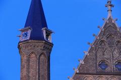
The historic Binnenhof is the center of Dutch politics and one of the world’s oldest parliaments.
Peace Palace
The Peace Palace is home to the International Court of Justice and offers guided tours.
Delft
Nearby Delft is known for its canals, blue pottery, and historic charm.
Other Attractions
- Kunstmuseum Den Haag: Modern art collections.
- Madurodam: Miniature park.
- Scheveningen Beach: Seaside resort.
- Shopping and Dining: The Passage, Chinatown.
- Parks: Paleistuin, Zuiderpark, Westduinpark.
Travel Tips
- Use Prins Clausplein for access by car, then switch to public transport.
- Park at P+R facilities for easy access to city attractions.
- Cycling is a popular way to explore The Hague.
Summary and Visitor Recommendations
Prins Clausplein is not a tourist attraction but a vital gateway to The Hague’s historical and cultural sites. Its innovative multi-level design exemplifies Dutch infrastructure and urban planning prowess (cultureelerfgoed.nl). Travelers can efficiently reach renowned sites like the Binnenhof, Mauritshuis, and Peace Palace using robust public transport and park-and-ride facilities. For optimal travel, consult real-time traffic apps and official tourism resources (denhaag.com; thecrazytourist.com).
By appreciating Prins Clausplein’s infrastructural significance, visitors gain a deeper understanding of The Hague’s role as a vibrant, interconnected urban hub.
Sources and Further Reading
- Cultureel Erfgoed: Prins Clausplein
- Den Haag Tourist Information
- The Crazy Tourist: Best Things to Do in The Hague
- A12 Motorway (Netherlands) Wikipedia
