Tramo Street Metro Manila: Visiting Hours, Tickets, and Tourist Guide
Date: 03/07/2025
Introduction: Tramo Street and Its Historical Significance
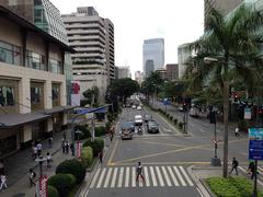
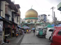
Tramo Street is a vital artery connecting the cities of Pasay and Parañaque in Metro Manila, Philippines. More than just a road, it is a living narrative of the region’s layered history—from its origins in the pre-colonial Namayan Kingdom, through Spanish and American colonial eras, to its present-day vibrancy as a bustling commercial and cultural corridor. For visitors, Tramo Street offers a unique lens into the evolving urban landscape of southern Metro Manila, where heritage, community, and modernity intersect (Nipino.com; VigattinTourism; goldenislandsenorita.net).
Originally settled by Tagalog communities thriving on fishing and agriculture near Manila Bay, the area—once called “Palanyag”—grew during the Spanish colonial period, with Tramo developing as a connector between emerging towns and parishes. The American era accelerated urban expansion and cemented Tramo Street’s status as a strategic commercial and transport route, especially with the establishment of military bases nearby (VigattinTourism). Today, it is a dynamic blend of residential neighborhoods, commercial establishments, and landmarks such as Baclaran Church and Baclaran Market. Its proximity to Ninoy Aquino International Airport and Parañaque Integrated Terminal Exchange (PITX) makes it a practical transit hub for both locals and travelers (Moovit).
This guide details Tramo Street’s historical context, cultural significance, transportation options, visitor tips, and nearby attractions—curated for history enthusiasts, cultural explorers, and transit travelers alike.
Table of Contents
- Historical and Colonial Origins
- American Period and Urban Expansion
- Post-War Development and Renaming
- Socio-Economic and Cultural Significance
- Community Landmarks and Festivals
- Transportation and Accessibility
- Nearby Attractions
- Travel Tips and Sample Itinerary
- Urban Challenges and Modernization
- FAQs
- Conclusion
Historical and Colonial Origins
Tramo Street’s roots stretch back to the pre-colonial era as part of the Namayan Kingdom, where Tagalog communities engaged in fishing and agriculture. The arrival of the Spanish in the 16th century transformed the area, introducing parishes and roads that would lay the groundwork for what is now Tramo Street (Nipino.com). The area’s development as a connector made it central to the formation of new settlements and commercial activity.
American Period and Urban Expansion
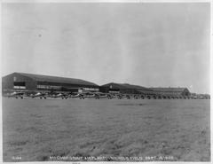
The American colonial period (1898–1946) brought rapid urbanization to Metro Manila. Pasay, close to the capital and emerging business centers, saw accelerated growth. Infrastructure projects made Tramo Street a key transit route linking southern suburbs with the city’s heart. The name “Tramo” is thought to derive from the Spanish word for “section” or “stretch,” reflecting its role in the urban road network. The establishment of Nichols Air Base (now Villamor Air Base) further increased Tramo’s importance as an access point for commerce and military logistics (VigattinTourism).
Post-War Development and Renaming
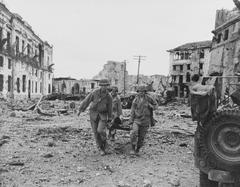
After World War II and Philippine independence, Metro Manila underwent major reconstruction. Street names shifted from colonial to nationalistic, with many roads renamed to honor Filipino leaders (Wikipedia). Despite these changes, Tramo Street has retained its popular identity—even as sections have been officially renamed (e.g., Andrews Avenue and Aurora Boulevard)—demonstrating the community’s connection to its history.
Socio-Economic and Cultural Significance
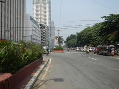
Tramo Street remains a commercial lifeline, connecting residential barangays, markets, and business hubs. Before the Skyway and SLEX, it was a preferred route between Pasay, Parañaque, and Makati (Nipino.com). Its accessibility spurred the growth of commercial centers and critical transport nodes like PITX.
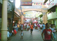
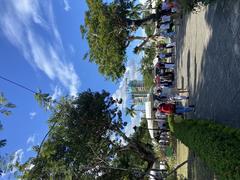
Cultural diversity flourishes along Tramo, home to long-time residents, migrant workers, and entrepreneurs. The street hosts local festivals, religious processions, and community gatherings, reflecting Metro Manila’s vibrant and resilient spirit (goldenislandsenorita.net).
Community Landmarks and Festivals
- Baclaran Church (National Shrine of Our Mother of Perpetual Help): Major pilgrimage site, especially busy on Wednesdays.
- Baclaran Market: Known for affordable goods, street food, and a lively atmosphere.
- Villamor Air Base: A historic military installation nearby.
- Local Festivals: Barangay fiestas and religious events enliven the area with music, food, and processions (overyourplace.com).
Transportation and Accessibility
Public Transport
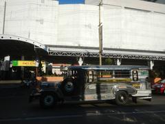
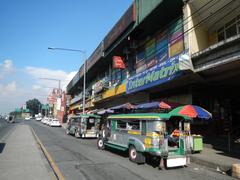
- Jeepneys and Buses: Serve routes along and near Tramo, connecting to Baclaran, Andrews Avenue, and PITX.
- LRT-1: Vito Cruz station is a short walk from Tramo, providing north-south access (Moovit).
- UV Express Vans: Offer quick point-to-point rides, useful during peak hours.
- Tricycles: Ideal for short trips within neighborhoods.
From Ninoy Aquino International Airport
- Taxi/Ride-Hailing: A 10-15 minute drive via Andrews Avenue.
- Public Transport: Jeepneys and buses from airport terminals.
Walking and Mobility
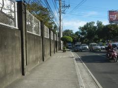
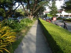
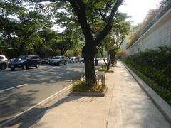
Sidewalks exist but may be crowded or uneven. Parking is limited; public transport or ride-hailing is recommended.
Nearby Attractions
- Cultural Center of the Philippines (CCP): Premier venue for performing arts.
- Star City Amusement Park: Family-friendly rides and entertainment.
- SM Mall of Asia: One of the world’s largest malls, offering shopping, dining, and entertainment.
- Manila Baywalk: Popular for leisure and sunset views.
Always check official venue websites for the latest visiting hours and ticketing policies.
Travel Tips and Sample Itinerary
- Morning: Attend Mass at Baclaran Church, then walk through Baclaran Market for breakfast.
- Afternoon: Explore CCP or SM Mall of Asia.
- Evening: Enjoy the sunset at Manila Baywalk or dine at a local eatery.
- Navigation: Use apps like Google Maps, Moovit, or Waze for real-time directions.
- Safety: Exercise standard precautions, avoid poorly lit areas at night, and keep valuables secure (The Broke Backpacker; Travel Safe Abroad).
Urban Challenges and Modernization
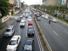
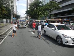
Tramo Street faces typical urban issues: congestion, informal settlements, and infrastructure strain (Nipino.com; adb.org). Ongoing efforts include road widening, drainage improvements, and better transport integration. Despite modernization, the area retains traditional eateries and community spaces alongside new developments.
Frequently Asked Questions (FAQ)
Q: Is Tramo Street safe for tourists?
A: Yes, with usual urban precautions—especially during the day in busy areas.
Q: How do I get to Tramo Street from the airport?
A: Via taxi, ride-hailing app, or jeepney/bus through Andrews Avenue.
Q: Are there entrance fees or set visiting hours?
A: Tramo Street is a public road open 24/7; nearby attractions set their own hours and fees.
Q: What foods should I try?
A: Filipino staples like adobo, sinigang, and street foods such as fish balls and kwek-kwek.
Q: Are there guided tours?
A: Some city tours include Tramo and nearby sites; check with local operators.
Conclusion
Tramo Street is more than a functional thoroughfare—it is a microcosm of Metro Manila’s heritage, diversity, and resilience. From pre-colonial settlements to modern urban life, it offers a rich tapestry of culture and community. Whether you seek history, local flavor, or practical transit, Tramo Street is an essential part of any Metro Manila itinerary.
Practical Visitor Recommendations
- Plan ahead: Use real-time navigation tools and check for festival dates.
- Travel light: Carry small bills and avoid bringing valuables.
- Engage locally: Greet locals, try street food, and explore community markets.
- Stay connected: Purchase a local SIM for data access.
- Support sustainability: Use public transport and dispose of waste properly.
References and Further Reading
- Nipino.com
- VigattinTourism
- goldenislandsenorita.net
- Moovit
- Wikipedia
- overyourplace.com
- adb.org
- The Broke Backpacker
- Travel Safe Abroad


