Circumferential Road 5–Kalayaan Avenue Interchange
Circumferential Road 5–Kalayaan Avenue Interchange, Metro Manila: Visiting Hours, Tickets, and Travel Guide
Date: 04/07/2025
Introduction
The Circumferential Road 5 (C-5)–Kalayaan Avenue Interchange is a cornerstone of Metro Manila’s urban infrastructure, serving as a vital link between Makati and Taguig. Designed to address chronic traffic congestion in one of the metropolis’s busiest corridors, the interchange exemplifies innovative urban planning and transport engineering in the Philippines. Since its inauguration in 2009, it has facilitated efficient daily commutes for hundreds of thousands, connecting major economic hubs such as Bonifacio Global City (BGC) and the Makati Central Business District. Beyond its utilitarian role, the interchange stands as a gateway to a vibrant array of cultural, recreational, and commercial attractions, reflecting Metro Manila’s dynamic growth and commitment to sustainable mobility.
This comprehensive travel guide offers detailed visitor information—including accessibility, nearby attractions, commuting tips, and future developments—making it an essential resource for residents, commuters, tourists, and urban enthusiasts alike. For real-time navigation and updates, apps such as Audiala are recommended. Authoritative sources have been referenced throughout to ensure the most accurate and up-to-date information (MMDA, Federal Land, Housing Interactive, Metro Manila Subway Project Updates).
Table of Contents
- Overview and Significance
- Historical Background and Construction
- Visiting Information
- Urban and Cultural Significance
- Nearby Attractions and Travel Tips
- Frequently Asked Questions (FAQ)
- Recent and Upcoming Developments
- Visual Resources
- External Links and Further Reading
- Summary and Final Tips
1. Overview and Significance
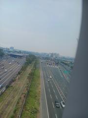
The C-5/Kalayaan Avenue Interchange is a key traffic node that links the major cities of Makati and Taguig. It enables smooth vehicular flow between the outer beltway (C-5) and Kalayaan Avenue, forming a strategic corridor for commuters and logistics. The interchange’s 24/7 operation supports the economic vitality of Metro Manila, easing congestion and connecting central business districts, residential zones, and popular lifestyle destinations.
2. Historical Background and Construction
The interchange was conceptualized to address severe congestion at the intersection of C-5 and Kalayaan Avenue. Initial feasibility studies by the Japan International Cooperation Agency (JICA) in 1978 proposed a signalized junction. However, growing traffic volumes necessitated a more robust solution.
By the early 2000s, daily vehicle counts exceeded 130,000, prompting the Metropolitan Manila Development Authority (MMDA) and Department of Public Works and Highways (DPWH) to consider grade-separated options. Competing proposals included a costly underpass and a more economical elevated U-turn interchange. The MMDA’s elevated U-turn slot design was adopted for its cost-efficiency and speed of construction, funded through a Japanese loan package.
-
Construction Timeline:
- Southern Elevated U-turn: Construction began April 2008, completed in six months.
- Northern Elevated U-turn: Started December 2008, completed April 2009.
- Officially inaugurated May 6, 2009.
-
Key Specifications:
- Elevated structure length: ~650 meters
- Six traffic lanes, designed for 150,000+ vehicles daily
3. Visiting Information
Accessibility & Visiting Hours
- Open 24/7: The interchange is a public road with no restricted hours.
- No Entrance Fees: Access is free for motorists, cyclists, and pedestrians where permitted.
- Pedestrian Access: Walkways and overpasses are available nearby, but care is advised due to heavy traffic.
Getting There
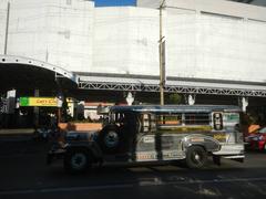
- By Public Transport: Jeepneys, buses, and ride-hailing services extensively serve the area.
- By Rail: MRT-3 stations Guadalupe and Buendia are nearby, connecting to Makati and other city centers.
- By Car: Easily accessible via C-5 or Kalayaan Avenue; parking is available at adjacent malls and commercial complexes.
Tip: For a less crowded visit, plan during mid-morning or early afternoon to avoid peak rush hours (7–10 AM, 5–8 PM).
4. Urban and Cultural Significance
The C-5/Kalayaan Interchange symbolizes Metro Manila’s innovative approach to urban mobility. Its elevated U-turn design was pioneering in the Philippines and has influenced subsequent traffic engineering projects. The interchange not only supports daily commutes but also enhances access to key economic, cultural, and recreational districts, contributing to the region’s development and vibrancy.
5. Nearby Attractions and Travel Tips
Top Nearby Attractions
- Bonifacio Global City (BGC): A thriving center for shopping, dining, and the arts.
- Makati Central Business District: Iconic malls, corporate towers, parks, and cultural sites.
- Ayala Triangle Gardens & BGC Greenway Park: Urban green spaces ideal for relaxation and urban photography.
- Museo ng Makati: Explore local heritage and history.
- The Mind Museum: Interactive science exhibits for families.
Dining & Shopping
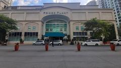
- Century City Mall, Rockwell Power Plant Mall, SM Aura Premier, Market! Market!, Ayala Center Makati: All offer a diverse array of dining, shopping, and entertainment options.
Leisure & Nightlife
- Poblacion District: Renowned for vibrant nightlife, rooftop bars, and street food.
Travel Tips:
- Wear comfortable shoes for exploring on foot.
- Use navigation apps like Google Maps or Waze for real-time guidance.
- Prepare for sudden weather changes, especially during the rainy season (June–November).
- For guided cultural experiences, check local listings for walking tours or museum events.
6. Frequently Asked Questions (FAQ)
Q: What are the operating hours of the interchange?
A: The C-5/Kalayaan Interchange operates 24 hours a day.
Q: Is there an entrance fee?
A: No, the interchange is a public road and free to access.
Q: Can I visit as a pedestrian?
A: Yes, but stay on designated walkways and overpasses for safety.
Q: How do I avoid traffic congestion?
A: Visit during off-peak hours and use real-time traffic apps.
Q: Are there guided tours?
A: None specifically for the interchange, but nearby cultural attractions may offer tours.
7. Recent and Upcoming Developments
- Planned Underpass and Signalized Intersection (from 2025): The MMDA, with approval from the national government, will replace the elevated U-turns with a six-lane underpass, enhancing capacity and safety.
- Integration with the Metro Manila Subway: The future Kalayaan Avenue Subway Station will connect the interchange to the wider rail network, providing seamless multimodal access (Metro Manila Subway Project Updates).
- Broader Mobility Initiatives: Intelligent transport systems, improved pedestrian and cycling facilities, and continued grade separation of major intersections are planned.
Temporary disruptions may occur during construction—stay informed via official MMDA and DPWH advisories.
8. Visual Resources
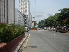
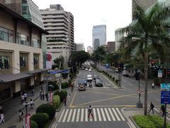
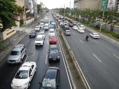
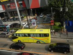
- *Alt: Elevated U-turn interchange at C-5 and Kalayaan Avenue, Metro Manila*
- Additional images: Aerial views, maps, and cityscapes available on official websites and local travel guides.
9. External Links and Further Reading
- MMDA Official Website
- DPWH Official Website
- Federal Land - Circumferential Roads in Metro Manila
- Housing Interactive - Kalayaan Avenue Neighborhood Guide
- Guide to the Philippines - Road Trip Destinations Near Manila
- Metro Manila Subway Project Updates
- BGC Official Site
- [Metro Manila Transportation Guide]
- [Top Attractions in Makati]
- [Travel Tips for Metro Manila]
10. Summary and Final Tips
The C-5/Kalayaan Avenue Interchange is more than an engineering feat—it is a symbol of Metro Manila’s resilience and progress. Its strategic location and pioneering design have substantially eased congestion and improved access to vital urban centers. As the city continues to evolve, the interchange is poised for further enhancement with a planned underpass and integration into the Metro Manila Subway, fostering a more sustainable and interconnected transport network.
For the best experience:
- Visit during off-peak hours.
- Utilize real-time navigation apps like Audiala.
- Explore nearby attractions such as BGC, Ayala Triangle Gardens, and cultural sites in Makati.
- Monitor traffic and construction updates through official MMDA and DPWH channels.
Whether you are a commuter, traveler, or city explorer, the C-5/Kalayaan Avenue Interchange offers not just convenience, but a window into the heart of Metro Manila’s vibrant urban life.
References
- This guide is based on information and updates from official and authoritative sources, including:


