Tranebergsbron Stockholm: Visiting Hours, Tickets, and Travel Guide
Date: 14/06/2025
Introduction
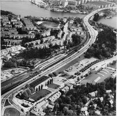
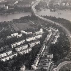
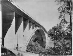
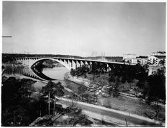
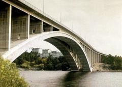
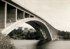
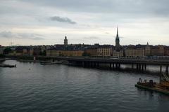
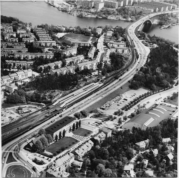
Tranebergsbron is one of Stockholm’s most iconic and historically significant bridges, seamlessly connecting Kungsholmen with the western suburbs of Bromma, including Traneberg and Alvik. Inaugurated in 1934, this elegant concrete arch was once the world’s longest of its kind and symbolizes Swedish engineering and modernist architecture. Today, Tranebergsbron continues to play a vital role in Stockholm’s urban development, supporting multimodal transportation and offering breathtaking views of Lake Mälaren and the city skyline.
This comprehensive guide covers everything you need to know for visiting Tranebergsbron: its fascinating history, architectural highlights, accessibility, nearby attractions, travel tips, and practical details to ensure a rewarding experience.
For further details and historical context, explore resources like Wikiwand, Stockholmskällan, and the official Stockholm Tourism Site.
Contents
- Introduction
- History of Tranebergsbron: From Royal Ambition to Modern Marvel
- Architectural and Engineering Significance
- Visiting Information: Hours, Access, and Tips
- Ways to Experience Tranebergsbron
- Practical Visitor Tips
- Nearby Attractions and Activities
- Photography and Scenic Opportunities
- Local Life and Events
- Amenities and Services
- Environmental and Social Impact
- Frequently Asked Questions (FAQ)
- Conclusion and Final Tips
- Sources
History of Tranebergsbron: From Royal Ambition to Modern Marvel
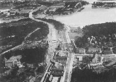
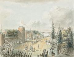
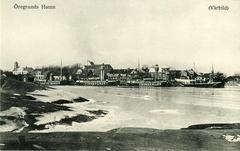
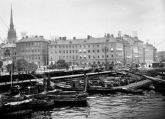
Tranebergsbron’s origins date back to 1787, when King Gustav III ordered the construction of a floating bridge to improve access between Stockholm and Drottningholm Palace. This first bridge laid the foundation for centuries of westward expansion (Wikiwand). As the city grew, new bridges were built and rebuilt at the site to accommodate increased traffic, transitioning from floating bridges to a pontoon bridge in the early 20th century. By the 1920s, these structures could no longer meet the demands of a rapidly modernizing city, prompting the decision to construct a permanent concrete arch bridge.
The current Tranebergsbron opened in 1934, designed by architect Paul Hedqvist and engineers Ernst Nilsson and Salomon Kasarnowsky. Its double-arched form and functionalist style reflected both the spirit of the age and Sweden’s commitment to urban innovation (Omkrets). The bridge quickly became an integral part of Stockholm’s transport network, supporting not only road traffic but also tramways, which were later converted into metro lines in the 1950s.
A major renovation between 1999 and 2005 preserved the historic concrete arches, replaced the roadways, and added a third span to accommodate modern traffic. Today, Tranebergsbron stands as a testament to Stockholm’s adaptive growth and sustainable urban planning (Stockholmskällan).
Architectural and Engineering Significance
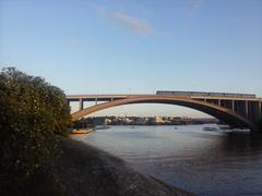
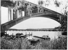
Tranebergsbron holds a prominent place in bridge engineering history. Upon completion, its 181-meter main arch was the world’s longest reinforced concrete span (Wonders of World Engineering). The bridge stretches approximately 580 meters long and 27.4 meters wide, with a vertical clearance of 26 meters—sufficient for maritime traffic and a nod to Stockholm’s future-oriented planning (Wikiwand).
The bridge’s design prioritized both function and aesthetics. Its clean lines and monumental double arches exemplify Swedish functionalism, while dedicated lanes for vehicles, cyclists, and pedestrians ensure accessibility for all. The 2000s renovation added a third span, further enhancing capacity while respecting the bridge’s original style (Omkrets).
Tranebergsbron is not only an engineering feat but also a cultural icon, influencing subsequent bridge designs and shaping Stockholm’s urban landscape (Alamy).
Visiting Information: Hours, Access, and Tips
- Visiting Hours: Tranebergsbron is a public bridge, open 24/7, year-round.
- Entrance/Tickets: No ticket or fee is required to visit or cross the bridge.
- Accessibility: Dedicated lanes for pedestrians and cyclists. Wheelchair- and stroller-friendly pathways with gentle slopes.
- Public Transport: The Alvik metro and tram station (Green Line, Tunnelbana, and Tvärbanan) is located at the western end. Multiple bus routes also serve the area (SL Journey Planner).
Ways to Experience Tranebergsbron
Walking and Cycling
Wide, well-maintained sidewalks and cycle lanes make Tranebergsbron ideal for scenic walks or bike rides. Stockholm’s city bike rentals and e-scooters are available at both ends of the bridge, allowing you to integrate the bridge into longer routes exploring Kungsholmen or heading west to Drottningholm Palace (Travel Notes & Beyond).
Public Transit
The bridge is an important artery for Stockholm’s metro (Tunnelbana), with the Green Line crossing the bridge’s northern span. Trams and buses also provide convenient access to nearby neighborhoods.
Guided Tours
While there are no dedicated guided tours focused solely on Tranebergsbron, many Stockholm city tours include the bridge as a highlight. Occasionally, special events or art installations take place beneath the arches (Designboom; ArchDaily).
Practical Visitor Tips
- Best Time to Visit: Late spring to early autumn (May–September) offers the best weather, with long daylight hours—up to 18 hours in June (Freetoursbyfoot).
- Weather: Dress in layers and bring a windproof jacket, as the bridge can be breezy.
- Safety: The bridge is well-lit and safe at all hours. Exercise standard caution when cycling or walking after dark.
- Cost: Crossing the bridge is free. Public transport tickets cost about 39 SEK for a single trip (SL Tickets), and bike rentals start at around 150 SEK per day.
Nearby Attractions and Activities
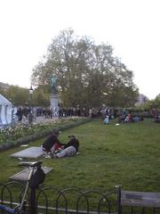
- Rålambshovsparken: A large urban park just east of the bridge, perfect for picnics, sports, and summer events (Freetoursbyfoot).
- Alvik and Traneberg: Charming neighborhoods with cafés, waterfront promenades, and local culture.
- Drottningholm Palace: A UNESCO World Heritage Site, easily accessible via public transport or a scenic bike ride.
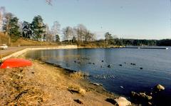
- Boat Tours: Several Lake Mälaren boat tours depart from nearby docks, offering unique views of the bridge.
Photography and Scenic Opportunities
Tranebergsbron is a favorite for photographers due to its elegant arches and panoramic views:
- Mid-Bridge: Offers unobstructed vistas toward the city center and Lake Mälaren.
- Rålambshovsparken: Shoreline vantage points capture the full span during golden hour.
- Alvik Waterfront: Western views with the Stockholm skyline as a backdrop.
Early mornings and late evenings provide the best light and fewer crowds.
Local Life and Events
Although the bridge itself is not a typical event venue, nearby parks like Rålambshovsparken host concerts, food markets, and cultural celebrations during the summer, including Swedish National Day and Midsummer (Freetoursbyfoot).
Amenities and Services
- Restrooms: Available at Rålambshovsparken and Alvik metro station.
- Food and Drink: Numerous cafés and restaurants can be found near Alvik and along the Kungsholmen waterfront (The Blonde Abroad).
- Bike Rentals: City bikes and e-scooters are available at both ends of the bridge.
Environmental and Social Impact
Tranebergsbron embodies Stockholm’s sustainability ethos by supporting public transit, walking, and cycling. Its infrastructure helps reduce congestion and emissions, while its accessibility fosters social cohesion across neighborhoods. Recent proposals aim to further activate spaces beneath the bridge for community use and arts (ArchDaily).
Frequently Asked Questions (FAQ)
Q: Is Tranebergsbron open year-round?
A: Yes, the bridge is accessible 24/7 throughout the year.
Q: Are there any fees or tickets required?
A: No, crossing Tranebergsbron is free of charge.
Q: Is the bridge wheelchair accessible?
A: Yes, sidewalks are wheelchair- and stroller-friendly.
Q: How do I get there by public transport?
A: Take the Stockholm Metro’s Green Line to Alvik station, or use local bus routes.
Q: Are guided tours available?
A: While there are no dedicated tours, many city tours include the bridge.
Q: Where are the best photo spots?
A: From mid-bridge, Rålambshovsparken, and the Alvik waterfront.
Conclusion and Final Tips
Tranebergsbron is more than a bridge—it’s a testament to Stockholm’s history, innovation, and commitment to sustainable urban living. Whether you walk, cycle, or ride the metro, you’ll enjoy spectacular views and a unique connection between city life and nature. With year-round, free access and proximity to vibrant neighborhoods and attractions, Tranebergsbron is a must-see for any visitor to Stockholm.
For the latest information, download the Audiala app for audio guides, interactive maps, and real-time updates. Explore more about Stockholm’s bridges, parks, and travel tips on our website, and follow us on social media for inspiration.
Sources and Further Reading
- Tranebergsbron Bridge: History, Visiting Hours, Tickets & Must-See Stockholm Landmark, 2025 (Wikiwand)
- Visiting Tranebergsbron: History, Tickets, and Travel Tips for Stockholm’s Iconic Bridge, 2025 (Stockholmskällan)
- Tranebergsbron: Stockholm’s Iconic Bridge – History, Visiting Hours, Tickets & Travel Tips, 2025 (sv.wikipedia.org)
- Visitor Experience, 2025 (Travel Notes & Beyond)
- Tranebergsbron Pontoon Bridge Over Tranebergssundet, DigitaltMuseum, 2025 (DigitaltMuseum)
- Visiondivision Activates Tranebergsbron Bridge in Stockholm, 2014 (Designboom)
- Stockholm Official Tourism, 2025 (Visit Stockholm)
- Start.Stockholm: Urban Development, 2025 (Start.Stockholm)
- Omkrets: Tranebergsbron, 2025 (Omkrets)
- Stockholm City Archives, 2025 (Stockholm City Archives)
