Forte Dos Reis Magos
NatalBrazil 5° S · 35° W Updated Apr 2026
Brazil's first trace italienne fort, built at the Potengi mouth in 1598, is also where Natal was founded on Christmas Day 1599 — and still debated by locals.
 Photo: Patriciof5 · CC BY-SA 4.0
- Time needed
- 1–2 hours
- Entry
- R$10 adults / R$5 half-price / Free for Natal residents
- Best season
- Morning or late afternoon year-round; avoid midday heat
The fortress that founded a city wasn't finished yet. Forte dos Reis Magos sits on a reef at the mouth of Natal's Potengi River in northeastern Brazil — a star-shaped military work begun on Epiphany 1598 that was still under construction when the city it was built to protect was formally founded on Christmas Day, 1599. Four centuries of siege, occupation, imprisonment, and reinvention have layered themselves into these walls, and every repair tells a story the original builders never intended.
The fort's shape tells one story. Five pointed bastions arranged in a star, following the trace italienne that was reshaping warfare across Europe. But its materials tell another: local sandstone and reef rock, patched and rebuilt across decades by a colony that could rarely afford to finish what it started. The design came from a Spanish Jesuit who had fought in Flanders. The labor came from a frontier outpost that could barely feed its garrison.
Today the fort sits where the Potengi meets the Atlantic, connected to the mainland by a causeway that floods at high tide. The views from the ramparts take in Natal's skyline, the dunes of Genipabu to the north, and open ocean to the east. Inside, thick walls and vaulted chambers hold a small museum and the quiet of everyone who passed through — Portuguese soldiers, Dutch conquerors, political prisoners, a lighthouse keeper's family.
What makes this place worth crossing Natal for isn't age or architecture alone. It's the gap between what the fort was supposed to be and what it actually was: under-garrisoned, short on water, repeatedly captured, constantly repaired. That tension between ambition and reality runs through every stone.
What to see
-
The Ramparts and Gun Terrace
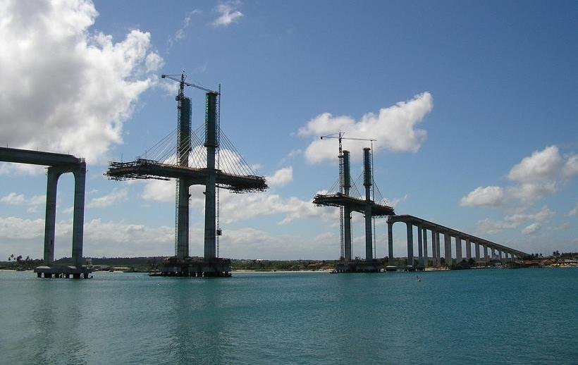
The upper terrace is where the fort stops being a history lesson and becomes a place. Cannons still line the bastions, aimed at a Potengi River mouth that once funneled Dutch warships and French trading vessels toward this exact spot. The wind up here is constant and aggressive — it tugs at hats and flattens conversation — because nothing stands between you and open Atlantic except salt air. From the river-facing wall, you look across to Redinha's dunes and the curved cables of the Newton Navarro bridge; from the seaward side, the reef platform below the fort reveals itself at low tide like a geological blueprint, the same sandstone that was quarried to build the walls you're standing on.
What catches most visitors off guard is the star-shaped plan itself, visible only from above or from the approach causeway. Designed by Gaspar de Samperes, a Jesuit who learned military engineering in Flanders, this was the first fort in Portuguese America to use the trace italienne — the angular bastion system that made medieval round towers obsolete across Europe. The half-bastions with their orillons, those curved protective ears shielding the gunners, date to 1598. They predate the Mayflower by twenty-two years.
-
The Chapel and Powder House
The strangest architectural decision inside the fort is also the most honest one. In the central two-story block, the ground floor holds a small chapel — plain, dim, thick-walled — where soldiers prayed before battle. Directly above it, reached by a narrow stair, sits the powder magazine where they stored the ammunition that made battle possible. Devotion below, destruction above, separated by a single stone ceiling roughly the width of a dining table. No other room in the fort tells you more about colonial military life than this vertical pairing.
The chapel itself is stripped bare now, but the cool air inside hits you physically after the terrace glare. Masonry walls over a meter thick swallow the wind noise, and the light drops to almost nothing. Beside or beneath this core block, depending on the source you trust, lies the freshwater cistern — the fort's most vulnerable secret. During the 1633 Dutch siege, the well sat outside the defended perimeter. Commander Pedro Gouveia, already wounded, watched his garrison surrender after days without drinkable water. The Dutch renamed the place Kasteel Keulen and held it for twenty-one years.
-
The Causeway Walk: Reef, Tide, and the Hidden Entrance
Skip the temptation to rush the 500-meter causeway. The walk out to the fort — across exposed reef, shallow tidal pools, and sand — is the best free exhibit in Natal. At low tide, the reef platform stretches wide and you can see the geological foundation the Portuguese chose to build on; at high tide, the water rises enough to nearly isolate the fort, turning it back into the coastal island it functioned as for centuries. Time your visit wrong and you'll wade. Time it right and you'll understand why this position controlled the river mouth for four hundred years.
The entrance itself is a final trick. You won't find a grand gate facing the causeway. Instead, the right-side bastion conceals a single narrow opening — you slip in sideways through a corridor designed to slow attackers, not welcome tourists. The folklorist Câmara Cascudo described this approach as intentionally disorienting, and it still works. One moment you're squinting in equatorial sun with the bridge and city skyline behind you; the next you're inside cool stone walls built the same Christmas week that Natal got its name, December 1599. Late afternoon light on the return walk is worth planning around.
Plan your visit
- Getting There
- The fort sits at the mouth of the Potengi River, off Av. Pres. Café Filho. Bus lines 125, N-35, N-43, N-84, and O-59 serve the area; the nearest train stop is Estação da Ribeira, but that's a 41-minute walk — grab a rideshare instead. Once you arrive, you still have to cross a long, fully exposed causeway over the reef to reach the entrance, so the last stretch is always on foot and always in the sun.
- Opening Hours
- As of 2026, the fort opens Tuesday through Sunday, 8:00–16:00. Closed Mondays year-round (a summer high-season Monday opening was trialed in January 2026 but hasn't stuck). Also closed January 1, December 25, and official election days — the Carnival schedule shifts annually, so check SETUR-RN notices if your trip overlaps.
- Time Needed
- A focused walk through the courtyard, cannons, and rampart views takes 45–60 minutes. If you read the displays and linger on the river-mouth panorama, budget 60–90 minutes. Add the causeway approach and you're looking at closer to two hours door-to-door from the parking area.
- Accessibility
- The fort has some ramps, an elevator, handrails at key points, and one wheelchair available on-site — but this is still a 16th-century stone fortification with uneven floors, dark rooms, and stairs in places. The long causeway approach is fully uncovered, with no shade at all. No braille signage exists, and the elevator may be intermittently out of service. Treat this as a moderate-effort historic site, not a barrier-free museum.
- Tickets
- As of February 2025, entry is R$10 full price, R$5 half-price for students, teachers, seniors 60+, and people with disabilities. Natal residents get in free with proof of address — just show an ID or utility bill. No online booking exists; tickets are walk-up only at the gate.
Tickets & tours.
These are guided options from our partners — same price as booking direct.
Show 3 more
Prices are indicative — final pricing and availability are confirmed at checkout. Audiala may earn a commission from bookings made through these links.
Also on GetYourGuide
More tours for Forte Dos Reis Magos
Curated from GetYourGuide. Same price as official, free cancellation on most.
 GetYourGuide
From Natal: Genipabu Dunes Buggy Adventure
from
€35
 GetYourGuide
From Natal: Pipa Beach Full-Day Excursion
from
€16
 GetYourGuide
From Natal: Pipa, Cacimbinhas, And Love Beach Full-Day Tour
from
€135
 GetYourGuide
Rio do Fogo/RN: Speedboat tour to the Parrachos de Rio do Fogo.
from
€46
Prices shown are indicative — final pricing and availability are confirmed at checkout. Audiala may receive a commission from bookings made via these links.
Photo Gallery


History
A Construction Site That Founded a City
Most origin stories are clean. Natal's is not. The Portuguese arrived at the Potengi bar in 1597 under Admiral Antônio da Costa Valente, intent on driving out French traders who had been operating along the Rio Grande do Norte coast with Indigenous allies. A provisional fortification went up on 6 January 1598 — Epiphany, the feast of the Three Kings, which gave the fort its name. But the masonry star-fort visitors see today most likely did not begin until 1603, and evidence suggests it was not effectively complete until around 1628.
In between, Natal was founded on 25 December 1599 — a city that existed before its own fortress was ready to defend it. That sequence tells you everything about colonial priorities on this coast: claim first, build later, and hope the French don't come back before the walls are up.
The turning point
The Week the Water Ran Out
On 8 December 1633, Dutch forces landed near Natal and positioned artillery on the dunes overlooking Forte dos Reis Magos. The fort had been designed to repel attacks from the sea, but the higher ground on its landward side was a blind spot its builders either missed or couldn't solve. Captain Pero Mendes de Gouveia commanded a small garrison and prepared to hold.
The siege lasted four days. Gouveia was wounded. And then the fort's oldest weakness decided the outcome: the well lay outside the defended walls. With Dutch guns controlling the ground between the garrison and its water supply, the defenders could not drink. According to one account, some occupants began negotiating surrender against Gouveia's wishes. On 12 December 1633, the fort fell.
The Dutch renamed it Kasteel Keulen and held it for two decades. But the real lesson was architectural. A fortress built to face the ocean had been beaten by gravity — by attackers who simply climbed higher. And a garrison that could withstand bombardment could not survive without water. If you notice a cistern inside the fort today, you are looking at the answer to the question that brought the place down.
Portuguese Frontier (1598–1633)
Dutch Occupation (1633–1654)
Prison, Lighthouse, Monument (1817–Present)
Tips for visitors
Morning or Late Afternoon
The causeway to the fort is a shadeless stone path over water — at midday, it radiates heat like a griddle. Arrive at 8:00 when gates open or after 15:00 for softer light and the best photographs of the Potengi River mouth.Daylight Visits Only
The Santos Reis neighborhood around the fort is fine during operating hours, with police presence and cameras near the parking area. After dark, the stretch empties out fast — local sources are blunt about not lingering. Use app-based transport for the return trip.Eat Ginga in Redinha
Skip the industrial snacks at the fort's sole convenience shop. The local move is to cross toward Redinha after your visit for ginga com tapioca — tiny fried fish tucked into tapioca crepes, Natal's signature street food and a recognized cultural heritage of Rio Grande do Norte. Budget prices, maximum authenticity.Respect the Chapel
A small chapel sits at the fort's center, and the Three Kings aren't just a name — they're still part of Natal's living religious identity. No posted dress code exists, but locals would side-eye anyone walking in shirtless or in dripping beach gear. Cover up enough that you wouldn't feel awkward in a small-town church.Pair It with the Potengi
The fort makes more sense as part of the Potengi rivermouth circuit than as a solo stop. Combine it with the Newton Navarro bridge views, the Complexo Cultural da Rampa nearby, and a Redinha food run — that's Natal's origin story in a single afternoon loop.Photography Is Welcome
No restrictions on handheld photography — the fort even hosted the Maré Foto Festival in November 2025. Drones are another story: Brazil requires ANAC registration for anything over 250g, and foreign-registered drones need explicit authorization. Don't fly without permits near a heritage site on an urban shoreline.
Frequently asked
Is Forte dos Reis Magos worth visiting?
Yes — this is the place where Natal began, and the setting alone justifies the trip: a star-shaped fortress on a reef between the Potengi River and the Atlantic, reached by a 500-meter causeway over sand and water. Inside, the contrast between sun-blasted ramparts and cool stone chambers tells you everything about what colonial life at this frontier felt like. Go for the history, stay for the panorama of bridge, dunes, and estuary that you can't get anywhere else in the city.
How long do you need at Forte dos Reis Magos?
Plan for 60 to 90 minutes, including the walk out along the exposed causeway. A quick loop through the courtyard, cannons, and rampart views takes about 45 minutes, but the chapel-beneath-the-powder-house stack, the cistern, and the concealed entrance all reward slower attention. If you combine the fort with time on Praia do Forte beach, budget a full morning.
How do I get to Forte dos Reis Magos from Natal?
The fort sits at Av. Pres. Café Filho on Praia do Forte, about 2.6 km from the Centro de Turismo. Bus lines 125, N-35, N-43, N-84, and O-59 serve the area. App-based rides or taxis are the simplest option; parking exists near the access point but is street-level, not a formal garage. From the drop-off, you still walk roughly 500 meters on an uncovered causeway — bring a hat and water.
Can you visit Forte dos Reis Magos for free?
Residents of Natal with proof of address enter free. Everyone else pays R$10 full price or R$5 half-price for students, teachers, seniors over 60, people with disabilities, and children over 12. Tickets are sold on-site only — no online booking system exists. Public school groups and senior organizations can arrange exemptions by contacting the Fundação José Augusto in advance.
What are the opening hours of Forte dos Reis Magos?
Tuesday through Sunday, 8:00 to 16:00, closed Mondays. The fort also closes on January 1, December 25, and official election days. During Natal's summer high season, Monday openings have been reported but aren't guaranteed year-round — if a Monday visit matters to your itinerary, confirm with the site before going.
What is the best time to visit Forte dos Reis Magos?
Late afternoon gives the best light on the causeway and ramparts, and the heat is less punishing. Natal's dry season, roughly October through January, means clearer skies and sharper views across the Potengi to Redinha and the dunes. The rainy months from March to July bring softer light and dramatic clouds — beautiful, but the exposed walkway becomes less comfortable. Check tides too: at high water the reef base floods, changing the whole feel of the approach.
What should I not miss at Forte dos Reis Magos?
The chapel-and-powder-house stack in the central block — devotion below, munitions above, separated by a single floor. That vertical pairing says more about colonial frontier life than any plaque. Look for the cistern nearby: it exists because the fort's original lack of freshwater helped the Dutch capture the place in 1633. And notice the entrance itself, hidden behind the right bastion so attackers couldn't charge straight in. Most visitors walk past it without realizing the architecture is still doing its job.
Is Forte dos Reis Magos accessible for wheelchairs?
Partially. The fort has ramps, an elevator, handrails, and one wheelchair available, but this is a 16th-century stone fortress on a reef — expect uneven surfaces, narrow passages, and limited accessibility for blind or low-vision visitors. The 500-meter causeway to the entrance is flat but fully exposed to sun and wind, with no shade. People with mobility or heat sensitivity should treat it as a moderate-effort visit, not a barrier-free museum.
Sources & attribution 38
- UNESCO World Heritage Centre — Brazilian Fortresses Ensemble — UNESCO Tentative List entry describing the fort as the first trace italienne fortification in Lusitanian America, with architectural and historical details
- IPHAN — Forte dos Reis Magos (Superintendência RN) — Official IPHAN heritage page with construction chronology, listing date (1949), deactivation history, and conservation status
- IPHAN — História de Natal — IPHAN page on Natal's history including the Portuguese arrival at Potengi in 1597 and the city's 1599 foundation
- IPHAN — Patrimônio Cultural (Página Detalhes 821) — IPHAN cultural heritage overview referencing the fort's role in Brazil's fortification system
- IPHAN — Notícias (Forte dos Reis Magos e Ministro do Turismo) — IPHAN news on archaeological research completed January 2015 and the fort's completion date references
- IPHAN — Nota sobre pichação do Forte dos Reis Magos — IPHAN statement on the September 2023 graffiti incident and restoration response
- IPHAN — Marco de Touros transferido ao Museu Câmara Cascudo — Official notice on the January 2021 transfer of the Marco de Touros from the fort to the Museu Câmara Cascudo
- IPHAN — Oficina virtual participativa sobre o Forte — IPHAN virtual workshop on the fort's history including 1904 deactivation and 1953-1958 restoration
- Memorial da Câmara Municipal de Natal — Forte dos Reis Magos — Municipal memorial page with founding narrative, January 6 holiday, and civic role of the fort
- Câmara Municipal de Natal — Cidade do Natal — City council page linking the fort to Natal's foundation on December 25, 1599 and the January 6 municipal holiday
- Repositório UFPE — Ismael de Freitas Paiva dissertation — Academic dissertation with detailed construction chronology, 1633 siege reconstruction, water vulnerability, and design attribution debates
- Fortalezas.net — Forte dos Reis Magos — Detailed fort profile including architectural layout, concealed entrance, tidal behavior, chapel/powder-house description, and 1633 siege details
- MuseusBr — Cadastro Nacional de Museus (Forte dos Reis Magos) — Official museum registry with opening hours, accessibility limitations, and facility details updated March 2024
- SETUR-RN — Carnival 2026 notice — State tourism secretariat confirming 8:00-16:00 hours around Carnival 2026
- 96FM — Valores e horários do Forte dos Reis Magos — Local radio coverage of the February 2025 ticket policy with pricing and half-price categories
- Saiba Mais — Nova política de ingressos — Local journalism detailing the new R$10 ticket policy effective February 1, 2025
- Tribuna do Norte — Forte atrai 500 visitantes por dia no verão — January 2026 report on summer visitation numbers, vendor activity, and possible Monday openings
- Tribuna do Norte — Forte é reaberto ao público — Coverage of new visiting hours and ticket pricing changes
- Tribuna do Norte — Maré Foto Festival 3ª edição — Coverage of the November 2025 photo festival held at the fort
- AGORA RN — Forte sofre com deterioração — January 2025 investigative report on deterioration, accessibility failures, on-site facilities, and merchant complaints
- AGORA RN — Restauração após pichações — Reporting on restoration following the September 2023 graffiti damage
- AGORA RN — Forte é reaberto em Natal (2021) — Coverage of the December 25, 2021 reopening ceremony with cultural programming
- Moovit — Transporte público Forte dos Reis Magos — Public transit lines, station proximity, and walking times to the fort
- FUMDHAM — Geoarchaeological study (Fumdhamentos XVIII) — Academic paper on the fort's reef base, construction materials from local sandstone, and tidal behavior around the site
- HPIP — Heritage of Portuguese Influence (Forte dos Reis Magos) — Architectural description including tenaille line and half-bastions with orillons
- Wanderlog — Fortaleza dos Reis Magos — Visitor experience data including typical 45-minute visit duration and practical tips
- AllTrails — Forte dos Reis Magos trail — Walking route data for the fort area approach
- iPatrimônio — Natal Forte dos Reis Magos — Heritage listing with 1949 tombamento confirmation
- Lonely Planet — Forte dos Reis Magos — Travel guide entry with visitor experience overview and rampart viewpoint notes
- SONDA/INPE — Natal climatology — Official climate data for Natal including rainy season timing (March-July) and dry season
- Saiba Mais — Natal celebra os Três Reis Magos — Coverage of January 6 Three Kings celebrations and their connection to the fort
- O Potengi — Maré Foto Festival programming — Details of cultural programming at the fort during the November 2025 photo festival
- Governo Federal — Turismo (Natal celebra aniversário) — Federal tourism ministry page on Natal's anniversary and the fort's role in city identity
- Natal das Antigas — História de Santos Reis — Local history blog on the Santos Reis neighborhood adjacent to the fort
- Tribuna do Norte — Ginga com tapioca patrimônio do RN — Reporting on ginga com tapioca's 2019 cultural heritage recognition in Rio Grande do Norte
- BrasilHis (Universidad de Salamanca) — Academic database confirming the December 12, 1633 surrender date
- Pesquisa Escolar Fundaj — Forte dos Três Reis Magos — Joaquim Nabuco Foundation educational article on the fort's construction timeline
- ANAC — Drone registration and foreign drone operations — Brazilian civil aviation authority rules for drone registration and operation near heritage sites
Built from cited sources · see the method · How we make our guides →
More in Natal.
18 places to discover — a few worth pairing.
Pick up where you left off
Saved and recently read places — kept on this device only.
Photo credits (13)
- Emerson França Filmmaker — Pexels License (https://www.pexels.com/license/) — Source: https://www.pexels.com/photo/31021957/
- Pedro Menezes — Unsplash License (https://unsplash.com/license) — Source: https://images.unsplash.com/photo-1515898958569-d1a4efff1384
- Forte-reis-magos — Onesimo.santos — CC BY-SA 3.0 (https://creativecommons.org/licenses/by-sa/3.0/) — Source: https://commons.wikimedia.org/wiki/File:Forte-reis-magos.jpg
- Capela de dentro do Forte dos Reis Magos — Patriciof5 — CC BY-SA 4.0 (https://creativecommons.org/licenses/by-sa/4.0/) — Source: https://commons.wikimedia.org/wiki/File:Capela_de_dentro_do_Forte_dos_Reis_Magos.jpg
- Forte dos Magos - Natal - RN - panoramio (1) — FernandoSantos — CC BY-SA 3.0 (https://creativecommons.org/licenses/by-sa/3.0/) — Source: https://commons.wikimedia.org/wiki/File:Forte_dos_Magos_-_Natal_-_RN_-_panoramio_(1).jpg
- Estrutura externa do Forte dos Reis Magos — Mario Cesar Pereira de Medeiros — CC BY-SA 4.0 (https://creativecommons.org/licenses/by-sa/4.0/) — Source: https://commons.wikimedia.org/wiki/File:Estrutura_externa_do_Forte_dos_Reis_Magos.jpg
- A majestade do Forte — Patriciof5 — CC BY-SA 4.0 (https://creativecommons.org/licenses/by-sa/4.0/) — Source: https://commons.wikimedia.org/wiki/File:A_majestade_do_Forte.jpg
- Dentro do Forte dos Reis Magos Natal RN — Gil Filgueira — CC BY-SA 3.0 (https://creativecommons.org/licenses/by-sa/3.0/) — Source: https://commons.wikimedia.org/wiki/File:Dentro_do_Forte_dos_Reis_Magos_Natal_RN.JPG
- Fortaleza dos Reis Magos 2 — Alexandre R, Costa — CC BY 2.0 (https://creativecommons.org/licenses/by/2.0/) — Source: https://commons.wikimedia.org/wiki/File:Fortaleza_dos_Reis_Magos_2.jpg
- Fortaleza dos Reis Magos (5298041584) — Leandro Neumann Ciuffo — CC BY 2.0 (https://creativecommons.org/licenses/by/2.0/) — Source: https://commons.wikimedia.org/wiki/File:Fortaleza_dos_Reis_Magos_(5298041584).jpg
- Fortaleza dos Reis magos - panoramio — enioprado — CC BY-SA 3.0 (https://creativecommons.org/licenses/by-sa/3.0/) — Source: https://commons.wikimedia.org/wiki/File:Fortaleza_dos_Reis_magos_-_panoramio.jpg
- Fortaleza dos Reis magos - panoramio (1) — enioprado — CC BY-SA 3.0 (https://creativecommons.org/licenses/by-sa/3.0/) — Source: https://commons.wikimedia.org/wiki/File:Fortaleza_dos_Reis_magos_-_panoramio_(1).jpg
- Dentro do Forte dos Reis Magos - panoramio — José Marques de Oliv… — CC BY-SA 3.0 (https://creativecommons.org/licenses/by-sa/3.0/) — Source: https://commons.wikimedia.org/wiki/File:Dentro_do_Forte_dos_Reis_Magos_-_panoramio.jpg
Photos may have been resized or cropped.