Harbor Freeway Los Angeles: Visiting Hours, Tickets, and Travel Guide
Date: 04/07/2025
Introduction: The Harbor Freeway’s Significance in Los Angeles
The Harbor Freeway, officially designated as Interstate 110 (I-110) and State Route 110 (SR-110), is an essential component of Los Angeles’ transportation system and a symbol of the city’s urban evolution. Spanning about 23 miles from downtown Los Angeles to the Port of Los Angeles in San Pedro, the freeway is not just a critical commuter and freight route—it is also a historical and cultural landmark. Its construction and development mirror the transformation of Los Angeles into a global metropolis, characterized by engineering innovation and complex social dynamics.
For visitors and urban explorers, the Harbor Freeway offers more than a thoroughfare—it provides access to iconic attractions like Watts Towers, Exposition Park, and the Battleship IOWA Museum. Though pedestrians are not permitted on the freeway itself, numerous viewpoints, adjacent neighborhoods, and public transit options such as the Metro J Line offer immersive opportunities to experience this engineering marvel and the cityscape it traverses.
This detailed guide provides historical context, visitor information, travel tips, and recommendations for nearby attractions, serving history enthusiasts, engineering admirers, and tourists seeking authentic Los Angeles experiences. For additional resources, see Caltrans Harbor Freeway Information, Los Angeles Historical Sites, and California Transportation Museum.
Contents
- Introduction
- Historical Overview
- Early Planning and Origins
- Construction Timeline and Milestones
- Route Designations and Renumbering
- Engineering Innovations and Historic Status
- Visitor Information
- Accessibility and Viewing Points
- Travel Tips
- Guided Tours and Educational Resources
- Tickets and Costs
- Nearby Attractions
- Frequently Asked Questions (FAQ)
- Conclusion
- References
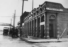
Historical Overview of the Harbor Freeway
Early Planning and Origins
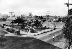
The Harbor Freeway’s roots go back to the 1924 Los Angeles Major Street and Traffic Plan, which called for improved access between downtown and the port in San Pedro by widening and extending Figueroa Street. However, legal restrictions initially prevented state agencies from maintaining roads within city boundaries, delaying progress (Gribblenation). By the 1930s and 1940s, as Los Angeles experienced rapid growth, the need for a dedicated freeway became clear. The Arroyo Seco Parkway—completed in 1941 and now part of SR-110—provided an early model for limited-access highways and was included in the 1943 master freeway plan (South LA Recap).
Construction Timeline and Milestones
Construction began in 1947, despite opposition from affected neighborhoods. The freeway opened in stages:
- 1952: Harbor Parkway segment (Four Level Interchange to Olympic Blvd)
- 1954–1957: Extensions to Washington Blvd, 42nd St, and 88th Pl
- 1958–1962: Continued south to Century Blvd, 124th St, Alondra Blvd, Torrance Blvd, and Pacific Coast Hwy
- 1970: Completion of the final segment to the Vincent Thomas Bridge and Terminal Island, finalizing the freeway’s modern route (Wikipedia).
Route Designations and Renumbering
Originally signed as US Route 6 and State Route 11, the Harbor Freeway’s designations changed in 1984, with the southern portion becoming I-110 and the northern portion (through downtown and into Pasadena) becoming SR-110 (Eisenberg Law Group).
Engineering Innovations and Historic Status
The freeway is renowned for its complex multi-level interchanges, such as the Judge Harry Pregerson Interchange with I-105, and the innovative Harbor Transitway, which provides dedicated bus and carpool lanes (Wikipedia). The Arroyo Seco Parkway segment is a National Historic Civil Engineering Landmark and a designated California Historic Parkway.
Visitor Information: How to Experience the Harbor Freeway
Accessibility and Viewing Points
- Vehicular Access: The Harbor Freeway is open 24/7; pedestrian and bicycle access is prohibited for safety.
- Best Viewing Spots:
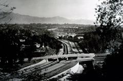
- Judge Harry Pregerson Interchange: Elevated views over the Los Angeles Basin and San Gabriel Mountains.
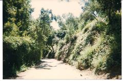
- Arroyo Seco Parkway: Drive the historic northern stretch for vintage freeway design and scenic value.
- Elysian Park: Offers safe, panoramic views of the downtown interchanges.
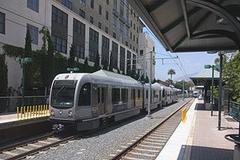
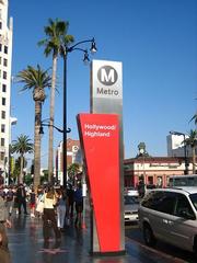
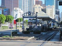
- Public Transit: The Metro J Line (formerly Silver Line) runs along the Harbor Transitway, offering a convenient, traffic-free perspective (LA Metro).
Travel Tips
- Avoid Rush Hour: Plan visits outside weekday rush hours (7–10 a.m. and 3–7 p.m.) for smoother travel.
- Safety: Use official overpasses and transit stations for any photos or sightseeing.
- Navigation: Real-time traffic and construction updates are available via Caltrans QuickMap.
Guided Tours and Educational Resources
While there are no official guided tours of the freeway itself, local historical and community organizations occasionally offer tours focusing on nearby neighborhoods or transportation history. The California Transportation Museum is an excellent stop for learning about regional transportation.
Tickets and Toll Information
- General Access: Free for all drivers.
- Express Lanes: HOT lanes require a FasTrak transponder; rates vary by time of day.
Nearby Attractions
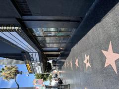
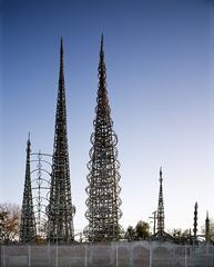
- Watts Towers: Folk art landmark, open Tuesday–Sunday, 12 PM–5 PM. Guided tours on weekends; free admission.
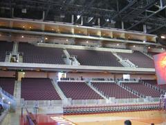
- Exposition Park: Includes the California Science Center, Natural History Museum, and LA Memorial Coliseum. Check individual sites for hours and ticketing.
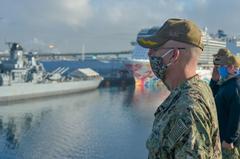
- Battleship IOWA Museum (San Pedro): Daily, 10 AM–5 PM; tickets required.
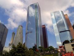
- Downtown Los Angeles: Home to historic districts, museums, and vibrant neighborhoods.
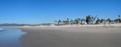
- LA Waterfront and Upcoming West Harbor Development: Shopping, dining, and entertainment near the port (LA Waterfront).
The Harbor Freeway in Los Angeles Culture and Economy
Cultural Impact
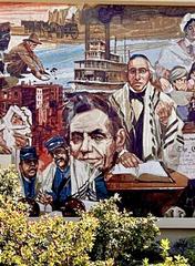
The Harbor Freeway is deeply woven into Los Angeles’ cultural landscape, representing both the city’s car-centric identity and its dynamic, diverse communities. Its elevated roadways and sprawling interchanges have been featured in films like La La Land and Speed, and the corridor is home to public art projects such as the Harbor Freeway Murals. Occasional events like CicLAvia convert sections of the freeway into public space for walking and cycling, highlighting its role in community life (CicLAvia).
Economic Significance
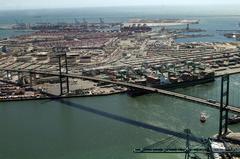
Connecting directly to the Port of Los Angeles—the busiest container port in the U.S.—the freeway supports billions in local and national commerce (Port of Los Angeles). It is also vital for regional workforce mobility, with over 300,000 vehicles traveling some segments daily (Caltrans Traffic Census).
Urban and Social Considerations
The freeway’s construction led to significant displacement, particularly in Black and Latino neighborhoods, and contributed to the city’s spatial segregation (Segregation by Design). Modernization efforts focus on sustainability, seismic retrofitting, and improved public transit integration.
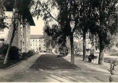
Visiting the Historic Arroyo Seco Parkway and Notable Monuments
Arroyo Seco Parkway (SR-110)
- Significance: Oldest freeway in the western U.S., a National Scenic Byway.
- Experience: Open 24/7; best enjoyed by driving during daylight.
- Tours: No formal tours, but local groups offer walking tours of adjacent landmarks.
Watts Towers
- Description: Iconic folk-art towers by Simon Rodia; National Historic Landmark.
- Hours: Tuesday–Sunday, 12 PM–5 PM.
- Tours: Free, with guided options on weekends.
Exposition Park
- Features: Museums (California Science Center, Natural History Museum), LA Memorial Coliseum.
- Hours and Tickets: Vary by institution; many offer free or discounted admission.
Battleship IOWA Museum
- Location: San Pedro Waterfront.
- Hours: Daily, 10 AM–5 PM.
- Tickets: Adults $20; discounts for seniors and children.
Frequently Asked Questions (FAQ)
Q: Can I walk or bike on the Harbor Freeway?
A: No. The freeway is for motor vehicles only; pedestrian and bicycle access is restricted to overpasses and transit stations.
Q: Are there visitor centers or museums dedicated to the Harbor Freeway?
A: No dedicated visitor center, but the California Transportation Museum and nearby attractions provide relevant exhibits.
Q: What’s the best time to avoid traffic?
A: Mid-mornings, late evenings, and weekends are best for lighter traffic.
Q: Are there official guided tours?
A: Not for the freeway itself, but local organizations offer tours of adjacent neighborhoods and landmarks.
Q: Is the freeway a historic landmark?
A: The Arroyo Seco Parkway segment is both a California Historic Parkway and a National Historic Civil Engineering Landmark.
Q: Are the Watts Towers accessible?
A: Yes, the Arts Center and grounds are wheelchair accessible.
Q: Are there events that let the public explore the freeway on foot?
A: Yes, events like CicLAvia occasionally close freeway sections for pedestrians and cyclists.
Conclusion
The Harbor Freeway is a vital connector and a living monument to Los Angeles’ engineering ambition, urban growth, and cultural diversity. Whether you’re capturing panoramic views, exploring adjacent cultural sites, or learning about the city’s infrastructure, the freeway offers a unique perspective into the heart of Los Angeles.
For interactive maps, guided tours, and real-time updates, download the Audiala app. Stay connected with our social media for the latest news and share your Harbor Freeway experiences using #HarborFreewayLA.
Visuals and Media Suggestions
- Panoramic view from Judge Harry Pregerson Interchange (alt: Los Angeles Basin from the Pregerson Interchange)
- Historic Arroyo Seco Parkway sign (alt: Vintage Arroyo Seco Parkway signage)
- Embed interactive maps and video clips from iconic films featuring the freeway.
References
- The Harbor Freeway: A Historical and Visitor’s Guide, 2022, Gribblenation (http://www.gribblenation.org/2022/05/the-harbor-freeway-interstate-110-and.html)
- Harbor Freeway History, 2022, South LA Recap (https://southlarecap.com/2022/03/26/110-harbor-freeway-history-south-los-angeles/)
- Interstate 110 and State Route 110 (California), Wikipedia (https://en.wikipedia.org/wiki/Interstate_110_and_State_Route_110_(California))
- Exploring the Rich History and Current Dynamics of Interstate 110, 2023, Eisenberg Law Group (https://eisenberglawgrouppc.com/exploring-the-rich-history-and-current-dynamics-of-interstate-110-and-state-route-110-in-california/)
- Harbor Freeway (I-110) Engineering Marvel, SoCalRegion (https://www.socalregion.com/highways/la_highways/i-110/)
- Segregation by Design: Harbor Freeway (I-110), 2024 (https://www.segregationbydesign.com/los-angeles/harbor-freeway-i110)
- Metro J Line Guide, LA Metro (https://www.metro.net/riding/guide/j-line/)
- CicLAvia Events and Information (https://www.ciclavia.org/)
- Port of Los Angeles Official Site (https://www.portoflosangeles.org/)
- California Transportation Museum (https://www.ctmonline.org/)
- LA Waterfront Attractions (https://www.lawaterfront.org/)
- UCLA Anderson Forecast: Economic Impact of Los Angeles Wildfires, 2025 (https://www.anderson.ucla.edu/about/centers/ucla-anderson-forecast/economic-impact-los-angeles-wildfires)
- Caltrans District 7 (https://dot.ca.gov/caltrans-near-me/district-7)
- Caltrans QuickMap Traffic Updates (https://quickmap.dot.ca.gov/)
- FasTrak Toll Payment System (https://www.bayareafastrak.org/)