Balboa Boulevard Los Angeles: Visiting Hours, Tickets, and Attractions Guide
Date: 04/07/2025
Introduction
Balboa Boulevard is a defining north-south thoroughfare in Los Angeles’ San Fernando Valley, weaving together history, community, and modern urban life. Once part of the Valley’s agricultural transformation in the early 20th century, the boulevard now links neighborhoods such as Encino, Lake Balboa, Van Nuys, and Northridge. Named after the Spanish explorer Vasco Núñez de Balboa, this corridor honors both historical exploration and the region’s continual growth (Wikiwand; Living New Deal).
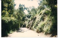
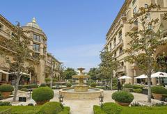
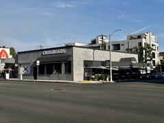
Balboa Boulevard today is an inviting destination, featuring attractions like the Sepulveda Basin Wildlife Reserve, Lake Balboa Park, the Valley Relics Museum, and the historic Knollwood Country Club. Enhanced infrastructure—such as expanded lanes, pedestrian-friendly sidewalks, and Metro G Line connectivity—makes visiting both convenient and enjoyable (cao.lacity.gov; Los Angeles Metro).
Whether you’re a San Fernando Valley resident or a visitor seeking culture and nature, this guide covers Balboa Boulevard’s history, top attractions, travel and accessibility tips, and natural highlights like the Sepulveda Basin Wildlife Reserve, a haven for over 200 bird species (LA Recreation & Parks).
Table of Contents
- Overview & Historical Background
- WPA Era and Boulevard Transformation
- Postwar Suburbanization and Urban Growth
- Infrastructure Expansion & Modernization
- Key Attractions and Landmarks
- Travel Tips and Accessibility
- Cultural and Community Significance
- Preservation of Historical Elements
- Ongoing and Future Development
- Frequently Asked Questions (FAQ)
- Sepulveda Basin Wildlife Reserve Guide
- Conclusion & Resources
Overview & Historical Background
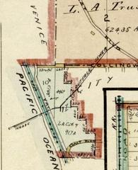
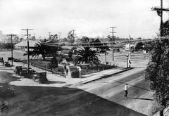
Balboa Boulevard’s transition from rural farmland to a bustling urban artery mirrors the transformation of the San Fernando Valley itself. Its naming after Vasco Núñez de Balboa reflects Los Angeles’ tradition of commemorating explorers, with the boulevard standing out alongside other historic streets like De Soto Avenue (Wikiwand).
WPA Era and Boulevard Transformation
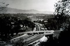
The Works Progress Administration (WPA) played a pivotal role in the 1930s by launching the “Balboa Avenue Improvement, Work Project No. 645.” This initiative aimed to create a direct traffic route connecting San Fernando Road with Ventura Boulevard, generating local jobs and laying the groundwork for future growth. Although the initial WPA project covered only 4.5 miles, it set the stage for Balboa Boulevard’s evolution into a vital urban corridor (Living New Deal).
Postwar Suburbanization and Urban Growth
After World War II, the Valley’s rapid suburbanization transformed Balboa Boulevard into a major urban thoroughfare. Today, it serves as a backbone for connecting residents to schools, parks, shops, and cultural centers in neighborhoods such as Encino, Lake Balboa, Van Nuys, North Hills, and Granada Hills (Wikiwand).
Infrastructure Expansion & Modernization
Modern Balboa Boulevard boasts multiple traffic lanes, advanced interchanges with freeways like the Ventura (US 101) and Ronald Reagan (SR 118), upgraded traffic signals, street lighting, and pedestrian-focused enhancements. Recent expansions, including the widening at Devonshire Street, prioritize safety and congestion reduction (cao.lacity.gov).
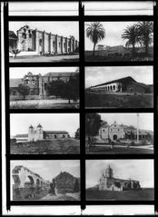
Key Attractions and Landmarks
- Sepulveda Dam Recreation Area: Ideal for hiking, picnicking, and outdoor sports.
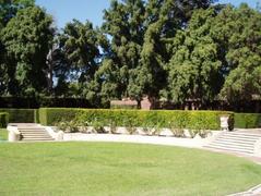
- Lake Balboa/Anthony C. Beilenson Park: Features a scenic lake, playgrounds, cherry blossom trees, and picnic areas.
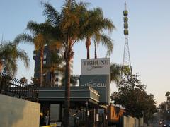
- Valley Relics Museum: Highlights San Fernando Valley’s pop culture, history, and vintage memorabilia (Valley Relics Museum).
- Knollwood Country Club: A historic golf and social club.
- The Cascades: A monumental water feature marking the Los Angeles Aqueduct terminus.
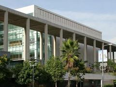
- Neighborhood Hubs: Including Encino Chamber of Commerce and Children’s Hospital Los Angeles outpatient center.
Most attractions are accessible by car, bike, or Metro public transit.
Travel Tips and Accessibility
- Roadway Access: Balboa Boulevard is open 24/7 as a public street.
- Attraction Hours: Parks typically open from dawn to dusk; museums like Valley Relics operate Thursday–Sunday, 10:00 AM–4:00 PM (Valley Relics Museum).
- Parking: Available at parks and along the boulevard; check for restrictions at each site.
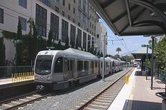
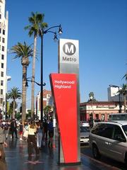
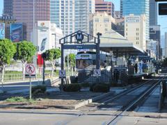
- Public Transit: Served by Metro Local lines 235 and 236; the Metro G Line station at Victory Boulevard enables convenient east–west travel (Metro).
- Biking & Walking: Enjoy bike lanes, improved sidewalks, and pedestrian lighting.
Cultural and Community Significance
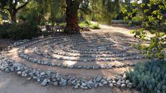
Balboa Boulevard connects a mosaic of communities and cultural destinations, from the Japanese Garden in Van Nuys to the historical displays at Valley Relics Museum. The boulevard is a living reflection of the Valley’s evolving identity and creative heritage (losangeles.net.au).
Preservation of Historical Elements
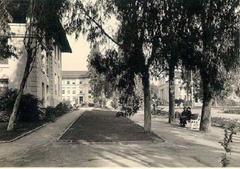
Sections of original WPA-era concrete roadway can still be found north of Burbank Boulevard, serving as a reminder of the boulevard’s lasting historical impact (Living New Deal).
Ongoing and Future Development
Balboa Boulevard continues to adapt to the city’s needs. Current projects focus on improving traffic flow, expanding transit connections, and supporting affordable housing—such as the proposed adaptive reuse of 5435 N. Balboa Boulevard into affordable units (Urbanize LA).
Frequently Asked Questions (FAQ)
Q: Is there a fee to drive or walk along Balboa Boulevard?
A: No, the boulevard itself is public and free to access. Some attractions may charge admission.
Q: What’s the best time to explore attractions?
A: Weekdays during daylight hours are ideal for sightseeing and avoiding traffic.
Q: How can I reach Balboa Boulevard by public transit?
A: Use Metro Local lines 235/236 or the Metro G Line at Victory Boulevard (Metro).
Q: Are there guided tours?
A: Not specific to the boulevard, but local organizations occasionally offer walks or bike rides in the Valley.
Sepulveda Basin Wildlife Reserve: Visitor’s Guide
Overview
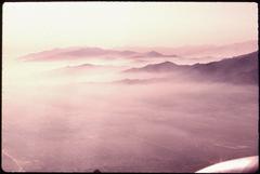
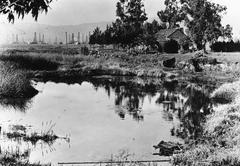
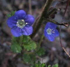
Adjacent to Balboa Boulevard, the Sepulveda Basin Wildlife Reserve is a 300-acre sanctuary for native plants and over 200 bird species. Established in 1980 as part of a flood control and conservation project, it provides Angelenos with a unique opportunity to experience nature within the city (LA Recreation & Parks).
Hours and Admission
- Open daily from sunrise to sunset.
- Admission is free.
Access and Transportation
- Car: Ample free parking at Sepulveda Basin Recreation Area lots.
- Public Transit: Metro bus lines 169 and 240 serve the area. Consult Moovit or Metro for schedules.
- Cycling: Bike paths connect the Reserve to Balboa Boulevard and the LA River trail.
Accessibility
- Paved and unpaved trails suitable for wheelchairs and strollers.
- Accessible parking, restrooms, and viewing platforms.
- Service animals are permitted; other pets are not, to protect wildlife (MobilityWorks).
Things to Do
- Birdwatching: Herons, egrets, hawks, and seasonal migratory birds abound.
- Walking/Hiking: Scenic trails through wetlands and grasslands.
- Photography: Capture wildlife, flowers, and tranquil landscapes.
- Picnicking: Designated areas for families and groups.
- Educational Programs: Seasonal guided walks and community events—check LA Recreation & Parks for details.
Visitor Tips
- Early morning or late afternoon visits are best for wildlife viewing and cooler temperatures.
- Bring binoculars, water, sunscreen, and comfortable shoes.
- Stay on marked trails and respect wildlife habitats.
Nearby Attractions and Dining
- Lake Balboa/Anthony C. Beilenson Park: Paddle boats, cherry blossoms, and picnic spots.
- Japanese Garden: Adjacent to the basin, renowned for its landscaping.
- Dining on Balboa Boulevard: A variety of global cuisines, from Mediterranean to classic diners.
FAQ: Sepulveda Basin Wildlife Reserve
Q: Is there an entrance fee?
A: No, admission is free.
Q: Are pets allowed?
A: Only service animals are permitted.
Q: Can I join a guided tour?
A: Check the LA Recreation & Parks website for current schedules.
Visuals and Media
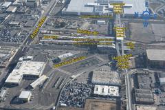
- Maps of Balboa Boulevard and surrounding attractions.
- Photos of Lake Balboa Park, Valley Relics Museum, Sepulveda Basin Wildlife Reserve, and the Japanese Garden.
- Alt text examples: “Balboa Boulevard near Lake Balboa Park,” “Birdwatching trail at Sepulveda Basin Wildlife Reserve.”
Additional Resources
- Balboa Boulevard on Wikiwand
- Living New Deal WPA Project
- Valley Relics Museum
- LA Recreation & Parks – Sepulveda Basin
- Metro Transit Planner
- MobilityWorks Accessible Rentals
- Moovit Transit App
- Urbanize LA – Balboa Boulevard Housing
Conclusion
Balboa Boulevard is more than a transportation route—it is a living corridor, rich with historical significance, community culture, and access to natural wonders. From the preserved WPA-era roadway to modern amenities, and from lively parks to tranquil wildlife reserves, the boulevard offers experiences for every visitor.
Plan your exploration with the Audiala app for real-time transit, interactive maps, and event updates. For more travel inspiration and community highlights, follow our social media channels and explore related guides on Los Angeles’ hidden gems.