Miklabraut Visiting Hours, Tickets, and Guide to Reykjavík Historical Sites
Date: 04/07/2025
Introduction: Miklabraut’s Role in Reykjavík’s Urban Landscape
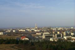
Miklabraut, widely recognized as Reykjavík’s main thoroughfare, serves as a vital east-west artery connecting some of the city’s most dynamic neighborhoods. Its evolution reflects Reykjavík’s transformation from a small fishing village into a modern, cosmopolitan capital. More than just a road, Miklabraut is a living testament to the city’s ongoing urban development, bridging residential, commercial, and cultural hubs, and supporting vital infrastructure such as public transport. As the city embraces innovative urban planning, Miklabraut stands at the forefront of projects designed to enhance sustainability, accessibility, and quality of life for both residents and visitors (Wikipedia: Route 49; Reykjavik City Journal; Reykjavík City Planning).
This guide provides a comprehensive overview of Miklabraut’s history, current significance, visitor information, and nearby attractions—offering you insightful travel tips and practical advice for exploring Reykjavík through this essential corridor.
Contents
- Introduction: Miklabraut’s Role in Reykjavík’s Urban Landscape
- Early Urbanization and the Emergence of Miklabraut
- Miklabraut’s Urban Context: Connecting Neighborhoods
- Infrastructure Evolution and Urban Cap Projects
- Urban Design and Architectural Features
- Significance in Reykjavík’s Urban Fabric
- Historical Milestones and Modernization
- Practical Visitor Information: Traffic, Accessibility, and Nearby Attractions
- Key Attractions and Transportation Near Miklabraut
- Safety, Accessibility, and Responsible Travel Tips
- Frequently Asked Questions (FAQ)
- Summary and Traveler’s Tips
- Sources
Early Urbanization and the Emergence of Miklabraut
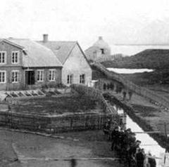
Miklabraut’s inception is tied to Reykjavík’s rapid urban expansion in the mid-20th century. As the city’s population surged post-World War II, so did the need for efficient roadways to link emerging districts. Miklabraut, meaning “Main Road,” was conceived as a response to increased car ownership and the growth of suburban neighborhoods such as Hlíðar, Norðurmýri, and Hlíðarendi (Reykjavik City Journal). Integrated into Route 49 (Nesbraut), Miklabraut became one of two principal east-west corridors, supporting both daily commutes and the movement of goods throughout the capital region (Wikipedia: Route 49).
Miklabraut’s Urban Context: Connecting Neighborhoods
Surrounding Miklabraut are diverse neighborhoods, each contributing to Reykjavík’s cultural and social landscape. Areas like Norðurmýri, Hlíðar, and Hlíðarendi developed alongside the road, with Miklabraut facilitating access while sometimes creating barriers for pedestrians. Urban planners now aim to address these divisions through projects like the Miklabraut Highway Cap, which will reconnect communities by capping sections of the road to create new public spaces and pedestrian-friendly areas (Reykjavík City Planning).
Infrastructure Evolution and Urban Cap Projects
Originally built to accommodate Reykjavík’s growing reliance on automobiles, Miklabraut’s function is being reimagined in line with contemporary priorities: sustainability, livability, and urban cohesion. The Miklabraut Highway Cap project—currently under planning—envisions capping sections of the road, reducing surface traffic by introducing tunnels, and developing green public spaces above. These plans, developed by interdisciplinary teams of architects and engineers, aim to transform Miklabraut from a divisive barrier into a unifying urban element (Yrki Architects).
Urban Design and Architectural Features
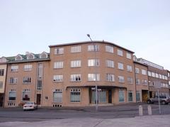
The future Miklatorg Square will serve as a mixed-use urban core, anchoring new developments along Miklabraut. Planned as a hub for trade, services, and diverse housing, the square will be surrounded by 3–5 story buildings designed to reflect the architectural character of neighboring districts. Emphasis is placed on environmentally friendly transport, safe pedestrian and cycling routes, and integration with the forthcoming CityLine Bus Rapid Transit (BRT) system (Reykjavík City Planning).
Significance in Reykjavík’s Urban Fabric
Miklabraut is not just a roadway but a critical thread in Reykjavík’s urban fabric, linking key institutions, residential areas, and commercial centers. Its transformation is viewed as a “missing puzzle piece” in the development of a cohesive city center, unlocking land for new amenities and fostering a stronger sense of community (Reykjavík City Planning).
Historical Milestones and Modernization
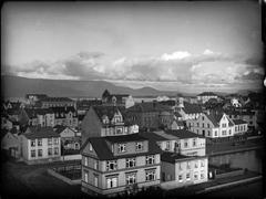
The construction of Miklabraut coincided with Reykjavík’s post-war modernization, marking a shift from traditional architecture to contemporary apartment blocks and commercial centers. Over the decades, the city has embraced innovation, with much of its infrastructure now powered by geothermal and hydroelectric energy. Miklabraut’s ongoing redevelopment embodies Reykjavík’s commitment to sustainable growth and urban well-being (Reykjavik City Journal).
Practical Visitor Information: Traffic, Accessibility, and Nearby Attractions
- Traffic and Accessibility: Miklabraut is open 24/7 as a public road. However, expect peak traffic during weekday mornings and afternoons. Pedestrian crossings and sidewalks are present, but ongoing construction may affect accessibility in some areas.
- Public Transport: The Strætó bus system serves Miklabraut with frequent routes. The CityLine BRT (under development) will further enhance east-west connectivity.
- Cycling and Walking: Dedicated paths are being expanded as part of redevelopment efforts.
- Nearby Attractions: Miklabraut offers easy access to major cultural and recreational sites, including Hallgrímskirkja, Perlan, Laugardalur Valley, and the Kringlan shopping mall (Guide to Iceland).
Key Attractions and Transportation Near Miklabraut
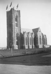
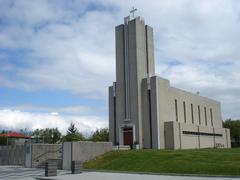
Hallgrímskirkja Church
- Hours: Daily 9:00 AM – 5:00 PM (extended in summer)
- Tickets: Free entry to church, tower access ISK 1000
- Accessibility: Wheelchair accessible
(Full Suitcase)
Perlan
- Hours: 10:00 AM – 6:00 PM
- Tickets: ISK 2900 (discounts for children/seniors)
- Accessibility: Fully accessible
(Guide to Iceland)
Nauthólsvík Geothermal Beach
- Hours: Facilities open 11:00 AM – 9:00 PM (summer)
- Tickets: ISK 1000–1500
- Accessibility: Partial
(World Travel Guide)
Kjarvalsstaðir Art Museum
- Hours: Tue–Sun 11:00 AM – 5:00 PM
- Tickets: ISK 1500 (free for children under 18)
- Accessibility: Fully accessible
(Full Suitcase)
Laugardalur Valley
- Hours: Pools 6:00 AM – 10:00 PM, other facilities vary
- Tickets: Swimming pool approx. ISK 1000
- Accessibility: Most facilities accessible
(Guide to Iceland)
Transportation Overview
- Strætó Bus System: Frequent service; use Reykjavík City Card for savings (Visit Reykjavík)
- Future CityLine BRT: Will provide fast, eco-friendly transit via Miklabraut (Reykjavík City Planning)
- Cycling/Walking: Paths connect key sites; dress for variable weather
- Taxis and Car Rentals: Options for flexible travel
(Hotel Reykjavik Saga)
Safety, Accessibility, and Responsible Travel Tips
- Safety: Reykjavík is globally recognized for its safety, but always use designated crossings and follow local traffic rules. In winter, be cautious of icy conditions.
- Accessibility: Sidewalks and public transport are generally wheelchair accessible. Check individual attractions for specific details.
- Sustainable Travel: Favor public transportation, cycling, or walking. Electric and hybrid car rentals are available.
- Waste and Recycling: Use color-coded bins; bring reusable items.
- Respect Local Culture: Stick to marked paths and support local businesses.
- Community Impact: Visit during off-peak times and explore lesser-known areas to reduce overtourism.
Frequently Asked Questions (FAQ)
Is Miklabraut open 24/7?
Yes, Miklabraut is a public road open at all times.
Are there tolls or tickets required?
No, Miklabraut is free to use.
How can I access live traffic updates?
Check the Reykjavík City website or use local traffic apps.
Is public transportation along Miklabraut accessible?
Yes, Strætó buses are accessible and frequent.
Are guided tours available?
Guided tours may include stops or routes near Miklabraut, especially for exploring Reykjavík’s urban landscape.
Can I cycle or walk along Miklabraut?
Yes, but use designated paths and crossings for safety.
Summary and Traveler’s Tips
Miklabraut epitomizes Reykjavík’s growth, linking neighborhoods, institutions, and attractions while serving as a model for sustainable urban development. Its ongoing transformation—highlighted by projects like the Miklabraut Highway Cap—reflects the city’s commitment to community, accessibility, and environmental responsibility (Reykjavik Planning Projects; Reykjavík City Planning). For travelers, Miklabraut offers seamless access to top sites like Hallgrímskirkja, Perlan, and Laugardalur Valley, as well as convenient transportation links.
To make the most of your visit:
- Use public transport or CityLine (when available) for efficient mobility.
- Explore on foot or by bike to enjoy the evolving urban landscape.
- Plan visits to attractions according to their specific opening hours.
- Download travel apps like Audiala for real-time updates and tips.
- Respect local customs and contribute to Reykjavík’s sustainable future.
Sources
- Miklabraut: Exploring Reykjavík’s Main Road and Urban Development, 2025, Reykjavík City Journal (https://reykjavikcityjournal.com/2025/04/17/a-brief-history-of-reykjavik/)
- Exploring Miklabraut: Reykjavík’s Key Transportation Artery and Urban Development Hub, 2025, Yrki Architects (https://yrki.is/en/reykjavik-city-at-a-turn-of-the-time-miklabraut-and-saebraut-road-tunnels/)
- Visiting Miklabraut: Key Attractions, Transportation, Visiting Hours, and Travel Tips in Reykjavík, 2025, Guide to Iceland (https://guidetoiceland.is/reykjavik-guide/things-to-do-near-reykjavik)
- Visiting Miklabraut: Safety, Accessibility, and Travel Tips in Reykjavík, 2025, Reykjavík City Planning (https://reykjavik.is/en/miklabraut-highway-cap/01-proposal)
- Wikipedia: Route 49 (Iceland), 2025 (https://en.wikipedia.org/wiki/Route_49_(Iceland))
- Reykjavík City Planning Projects, 2025 (https://reykjavik.is/en/planning-projects)
- Reykjavík Public Transport Guide, 2025 (https://reykjavik.is/en/public-transport)
- CityLine BRT Project Details, 2025 (https://reykjavik.is/en/cityline)
Discover Miklabraut and experience the heart of Reykjavík’s ongoing urban story.
