Arthur Laing Bridge: Visiting Hours, Tickets, and Guide to Vancouver Historical Sites
Date: 04/07/2025
Introduction
The Arthur Laing Bridge is a pivotal infrastructure landmark in Metro Vancouver, British Columbia, connecting the city of Vancouver to Richmond and granting direct access to Vancouver International Airport (YVR). Spanning the north arm of the Fraser River, this four-lane bridge is not only an essential transportation corridor but also a testament to Vancouver’s postwar expansion, urban development, and engineering innovation. Named after Arthur Laing, a prominent local politician and federal cabinet minister, the bridge represents visionary leadership and regional connectivity that have shaped Vancouver’s transportation landscape since the mid-1970s (Spacing Vancouver).
This comprehensive guide explores the Arthur Laing Bridge’s historical significance, structural features, practical visitor information—including hours and accessibility—travel tips, and nearby attractions. Whether you’re a commuter, history enthusiast, or visitor, discover how to experience this essential Vancouver landmark to its fullest.
Table of Contents
- Historical Background
- Structural Engineering and Bridge Design
- Visiting the Arthur Laing Bridge: Practical Information
- Public Transit, Cycling, and Sustainable Transportation
- Traffic Management, Safety, and Resilience
- Environmental and Community Considerations
- Economic and Regional Significance
- Emergency and Contingency Planning
- Multilingual and Inclusive Infrastructure
- Frequently Asked Questions (FAQ)
- Visitor Tips
- Visual and Interactive Resources
- Conclusion
- References and Further Reading
Historical Background
Origins and Planning
The Arthur Laing Bridge was conceived to meet Vancouver’s rapid postwar growth and the urgent need for improved access to Vancouver International Airport (YVR). Prior to its construction, the aging Marpole and Eburne bridges were the only crossings to Sea Island, but these had become bottlenecks due to their limited capacity (Reddit: Marpole Bridge). Planning began in the early 1970s, and the bridge was named after Arthur Laing, a local political leader known for championing major infrastructure projects (Spacing Vancouver).
Construction and Engineering
Construction commenced in the early 1970s, with the objective of building a robust, four-lane bridge capable of handling heavy commuter and airport traffic. The bridge officially opened to traffic in August 1975 and was inaugurated in May 1976. Costing $23 million, it quickly became one of the region’s most significant transport arteries (Spacing Vancouver).
Impact and Legacy
By reducing travel distance to the airport by over three kilometres, the bridge transformed regional logistics and spurred development in Richmond and southern Vancouver. Today, daily vehicle crossings have surpassed 90,000, illustrating the bridge’s ongoing economic and logistical importance (Wikiwand). Subsequent infrastructure upgrades and integration with public transit continue to ensure the bridge meets evolving transportation needs.
Structural Engineering and Bridge Design
Design and Construction
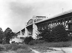
The Arthur Laing Bridge is a high-level, steel box girder bridge stretching approximately 1,676 metres (5,499 feet), with a main span of 270 metres (886 feet) rising 20 metres above the Fraser River (Wikiwand). Its two parallel, unpainted steel box girders provide excellent torsional rigidity and support for heavy traffic. Concrete piers on deep piles ensure stability in the delta’s soft soils (TransCanadaHighway.com).
Traffic Management
The bridge features four lanes and a reversible lane system, managed by overhead signals that adjust lane direction during rush hours—two lanes inbound in the mornings, two outbound in the evenings. This system efficiently handles over 60,000 vehicles daily (TransCanadaHighway.com).
Seismic Upgrades and Durability
Built before modern seismic standards, the bridge underwent extensive seismic upgrades in the 1990s and 2000s. Upgrades included bearing replacements, pier and foundation reinforcement, and soil liquefaction mitigation—ensuring resilience against earthquakes and regional flooding (Ausenco). The use of unpainted weathering steel and marine-grade concrete increases durability in the region’s moist climate.
Visiting the Arthur Laing Bridge: Practical Information
Visiting Hours and Accessibility
- Hours: Open 24/7 for vehicular and cyclist traffic.
- Tickets: No tolls or admission fees; the bridge is a public roadway.
- Pedestrian Access: There are no continuous sidewalks; pedestrian access is not recommended due to safety concerns (Reddit).
- Cycling: Dedicated bike lanes are present, with widened lanes since 2014, but cyclists must be cautious, especially where lanes merge with traffic.
- Parking: No parking directly on the bridge. Ample parking is available at YVR and nearby commercial areas.
How to Get There
The bridge connects Southwest Marine Drive in Vancouver to Sea Island and Richmond via Grant McConachie Way. Public transit options include several bus routes and proximity to the Canada Line SkyTrain, which provides efficient connections to downtown Vancouver and Richmond (Vancouver.ca).
Nearby Attractions
- Vancouver International Airport (YVR): Art displays, exhibitions, and dining.
- Terra Nova Rural Park: Offers scenic walking and viewing areas.
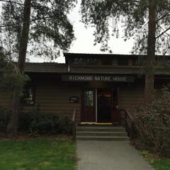
- Richmond Nature Park: Trails and wildlife observation.
- Steveston Village: A historic fishing community.
- McArthurGlen Designer Outlet: Shopping and dining near the airport.
Public Transit, Cycling, and Sustainable Transportation
The bridge is a major route for TransLink bus services connecting Vancouver, Richmond, and YVR. Its southern approach parallels the Middle Arm SkyTrain Bridge, which carries the Canada Line rapid transit to YVR and Richmond, enhancing multimodal connections (Wikiwand).
Cyclists can use the widened bike lanes on the bridge’s shoulders, though the crossing can be challenging due to traffic and weather exposure. The City of Richmond provides cycling maps for safe route planning (Richmond.ca).
Traffic Management, Safety, and Structural Resilience
To ensure safety and smooth traffic flow, the bridge employs camera monitoring and a dedicated tow truck during peak hours. Seismic strengthening, including the installation of 800 stone columns and elevation of adjacent roads, further enhances the bridge’s ability to withstand earthquakes and floods (Wikiwand). The Vancouver International Airport Authority oversees ongoing maintenance and regular inspections.
Environmental and Community Considerations
The bridge’s construction and maintenance address the Fraser River delta’s unique environmental challenges, such as flood risk and soil instability. Lightweight pumice in the road base and steel sheet pile walls protect both the structure and surrounding communities (Wikiwand).
Economic and Regional Significance
The Arthur Laing Bridge supports the Metro Vancouver economy by providing critical access to YVR—an international gateway and economic driver—and by facilitating commercial transport, tourism, and trade. Infrastructure enhancements, such as those linked to the McArthurGlen Designer Outlet, highlight the bridge’s ongoing role in supporting regional growth (Wikiwand).
Emergency and Contingency Planning
As a federally owned structure, the bridge is integral to emergency response plans for Metro Vancouver, ensuring connectivity during natural disasters and providing a critical evacuation and supply route (Vancouver.ca).
Multilingual and Inclusive Infrastructure
Reflecting its federal ownership and Vancouver’s multicultural identity, the bridge features bilingual (English and French) signage (Wikiwand), ensuring accessibility for diverse residents and international visitors.
Frequently Asked Questions (FAQ)
Q: Is the Arthur Laing Bridge open to pedestrians?
A: No. The bridge lacks continuous sidewalks and is not recommended for pedestrians.
Q: Are there fees or tickets required to cross the bridge?
A: No. The bridge is toll-free and open 24/7.
Q: Can I cycle across the bridge?
A: Yes, but cyclists should exercise caution, as bike lanes merge with traffic in some areas.
Q: What’s the best time to cross the bridge to avoid traffic?
A: Avoid morning and evening peak rush hours.
Q: Where are the best viewpoints for the bridge?
A: Terra Nova Rural Park and Richmond Nature Park offer excellent viewing opportunities.
Q: Are there public transit options?
A: Yes. Several TransLink bus routes cross the bridge, and the Canada Line SkyTrain runs nearby.
Visitor Tips
- Plan your journey outside of rush hours for a smoother crossing.
- Use public transit or cycling routes when possible to reduce congestion.
- For photography, visit sunrise or sunset for the best lighting.
- Explore nearby parks and historical sites for a richer experience.
- Consult official cycling maps (Richmond.ca) if planning to bike.
Visual and Interactive Resources
Alt text: Arthur Laing Bridge in Vancouver showing steel box girder structural design and traffic lanes.
Conclusion
The Arthur Laing Bridge is a cornerstone of Metro Vancouver’s transportation network—vital for commuters and travelers, and emblematic of the region’s growth, engineering innovation, and multicultural identity. While it primarily serves traffic and freight, its proximity to parks, historical sites, and YVR offers visitors unique perspectives on Vancouver’s past and present. Understanding its history, design, and visitor considerations will enrich your journey—whether you’re crossing for business, leisure, or exploration.
For real-time updates, route planning, and more detailed guides to Vancouver’s landmarks, download the Audiala app and follow our social media channels.

