Morrison Bridge Portland: Visiting Hours, Tickets, and Historical Sites Guide
Date: 15/06/2025
Introduction
The Morrison Bridge is a defining feature of Portland, Oregon’s urban landscape, renowned for its engineering innovation, historical significance, and vibrant role in the city’s cultural life. As Portland’s first bridge to cross the Willamette River, the Morrison Bridge has been pivotal to the city’s development—connecting neighborhoods, catalyzing economic growth, and serving as a canvas for public art and community engagement (Wikipedia; Oregon History Project).
Today, the Morrison Bridge is a vital transportation artery, accommodating tens of thousands of vehicles daily while also offering ADA-compliant pedestrian and bicycle access. Its minimalist mid-century design, dynamic LED lighting displays, and central location make it both a functional infrastructure element and a beloved civic landmark (Multnomah County; Travel Portland). Open 24/7 with no admission fees, the bridge invites visitors and locals alike to explore its history, architecture, and unique cultural experiences.
This guide presents essential information for planning your visit to the Morrison Bridge, including historical context, architectural and engineering highlights, accessibility, travel tips, nearby attractions, and its rich role in Portland’s civic identity.
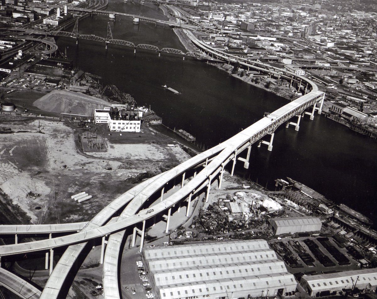
Table of Contents
- Early Origins and the First Morrison Bridge (1887–1905)
- The Second Morrison Bridge (1905–1958)
- The Present Morrison Bridge: Construction and Engineering (1958–Present)
- Visitor Information: Visiting Hours, Tickets & Accessibility
- Recent and Ongoing Upgrades
- Historical Significance and Preservation
- The Morrison Bridge in Portland’s Urban Landscape
- Structural Design and Engineering Features
- Architectural Significance and Urban Integration
- Notable Engineering Challenges and Solutions
- Visitor Experience: Highlights and Nearby Attractions
- Morrison Bridge as a Civic Landmark
- Approaching and Accessing Morrison Bridge
- Bridge Features and Visitor Highlights
- Unique Experiences and Local Culture
- Practical Visitor Tips
- Nearby Amenities and Attractions
- Local Insights and Recommendations
- FAQ
- Visuals and Media
- Explore More and Stay Connected
Early Origins and the First Morrison Bridge (1887–1905)
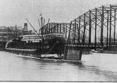
The original Morrison Bridge, dedicated in 1887, was a wooden truss swing-span bridge and Portland’s first crossing over the Willamette River (Wikipedia). At 1,200 feet, it was the longest bridge west of the Mississippi, replacing ferry crossings and enabling rapid development on the city’s east side (Oregon History Project). Named after Morrison Street, itself named for Scottish immigrant John L. Morrison, the bridge initially operated as a toll bridge before becoming toll-free in 1895.
The original structure quickly became essential to Portland’s economic and social life, facilitating the transition from horse-drawn vehicles to electric streetcars and supporting the city’s early growth (PDX Today).
The Second Morrison Bridge (1905–1958)
By 1905, the city needed a sturdier crossing to serve increasing traffic. The second Morrison Bridge, also a swing-span, was constructed with improved materials but was not designed for the automobile era, which arrived in force by the 1920s and 1930s (PDX Today). Despite accommodating streetcars, the bridge’s limitations became apparent with growing vehicle loads, prompting the need for a modern replacement (Wikipedia).
The Present Morrison Bridge: Construction and Engineering (1958–Present)
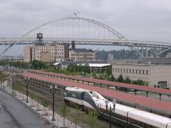
Completed in 1958 at a cost of $12.9 million, the current Morrison Bridge is a double-leaf bascule (drawbridge) structure designed to support six lanes of vehicle traffic and accommodate ongoing river navigation (Wikipedia). The main span, constructed with steel and reinforced concrete piers, was the product of engineering firms Sverdrup & Parcel and others, with construction led by American Bridge Division and U.S. Steel (Library of Congress; HistoricBridges.org). In 1961, ramps were added to connect the bridge to Interstates 5 and 84, solidifying its role in Portland’s evolving transportation network.
Visitor Information: Visiting Hours, Tickets & Accessibility
Visiting Hours: Open 24 hours a day, seven days a week, the Morrison Bridge is accessible to pedestrians, cyclists, and vehicles at all times. There are no admission fees or ticket requirements.
Accessibility: The bridge has ADA-compliant sidewalks, ramps, and crossings. Both pedestrians and cyclists benefit from dedicated paths, and the bridge integrates with nearby public transit routes (Travel Portland).
Tours and Events: While there are no regular guided tours of the bridge itself, it is often featured in city walking and cycling tours, as well as major events such as the annual Providence Bridge Pedal.
Photography: Best vantage points include the east and west riverbanks, Tom McCall Waterfront Park, and the Eastbank Esplanade. Evening visits offer spectacular views of the illuminated bridge.
Recent and Ongoing Upgrades
To ensure continued safety and functionality, Multnomah County is implementing major upgrades, including adding titanium rebar, removing weight restrictions, and repairing bascule span motors. These works are scheduled through 2026 (Multnomah County; Bridge Projects). Seismic retrofitting and modernization of electrical systems further enhance resilience and reliability.
Historical Significance and Preservation
The Morrison Bridge is listed on the National Register of Historic Places (since 2012), reflecting its importance in Portland’s urban development (Wikipedia; PDX Today). As the first bridge to cross the Willamette and a vital link throughout the city’s history, it embodies Portland’s identity as “Bridge City.”
The Morrison Bridge in Portland’s Urban Landscape
The bridge’s strategic placement enabled the expansion of eastside neighborhoods and facilitated economic growth. It remains one of Portland’s busiest crossings, supporting thousands of daily commuters and acting as a symbol of the city’s adaptability and resilience (Wikipedia).
Structural Design and Engineering Features
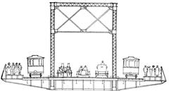
Bascule Bridge Mechanism
The Morrison Bridge’s double-leaf bascule design uses counterweights and electric motors to raise the central span, enabling river traffic to pass with minimal disruption (Multnomah County Morrison Bridge). The main span is 284 feet, and the bridge’s total length is approximately 760 meters.
Materials and Construction
Constructed with steel and reinforced concrete, the bridge’s robust superstructure is anchored deep into the riverbed for stability and resilience. Its design reflects mid-20th-century advances in high-strength steel and welding techniques.
Seismic Upgrades and Modernization
Significant seismic retrofitting and modernization have been undertaken to enhance earthquake resilience and operational safety (Multnomah County Seismic Upgrades).
Architectural Significance and Urban Integration
Aesthetic Considerations
The bridge’s minimalist, functional design exemplifies mid-century modernist values. The exposed steelwork and clean lines create a distinctive silhouette, especially when illuminated at night (Light the Bridges).
Multimodal Connectivity
Wide sidewalks and protected bike lanes ensure the bridge’s integration into Portland’s multimodal transportation network (Travel Portland: Getting Around).
Notable Engineering Challenges and Solutions
River Navigation and Traffic Management
The bascule design allows for efficient river navigation, balancing the needs of land and water transport. Coordinated operations minimize disruption for both road and river users.
Maintenance and Longevity
Routine maintenance—including inspections, lubrication, and painting—preserves the bridge’s function and longevity (Multnomah County Bridge Maintenance).
Visitor Experience: Highlights and Nearby Attractions
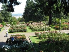
Walking or cycling across the bridge provides panoramic views of the skyline, river, and neighboring bridges. Interpretive signage offers historical and engineering context. Nearby attractions include Tom McCall Waterfront Park, the Eastbank Esplanade, OMSI, and downtown shopping and dining districts.
Morrison Bridge as a Civic Landmark
Urban Connectivity and Transportation Role
The bridge is a major connector between Southeast Portland and downtown, handling about 50,000 vehicles daily and providing critical access to Interstates 5 and 84 (Multnomah County). Its six-lane, 90-foot-wide deck and efficient bascule mechanism reflect its importance in Portland’s infrastructure.
Minimalist Architecture and Urban Aesthetics
Its utilitarian design, while understated, is emblematic of the era’s architectural trends and aligns with Portland’s embrace of modernity (Light the Bridges).
Lighting as Public Art and Civic Dialogue
The Willamette Light Brigade’s dynamic LED lighting system transforms the bridge into a platform for public art and community expression. Custom light displays celebrate local causes and events, making the bridge a beacon for civic dialogue (Light the Bridges; Willamette Week).
Seasonal and Festival Significance
During the annual Portland Winter Light Festival and other events, the bridge’s lighting becomes a focal point, attracting crowds and enlivening the riverfront (Light the Bridges; Willamette Week).
Community Engagement and Identity
Allowing public participation in lighting themes, the bridge reflects Portland’s diversity and values, reinforcing its status as a participatory landmark (Light the Bridges).
Urban Renewal and Economic Impact
The bridge’s connectivity supports the revitalization of neighboring districts and boosts economic and cultural activities along the waterfront (Multnomah County).
Symbolism and Legacy
Named for John L. Morrison, the bridge symbolizes Portland’s growth and its enduring relationship with the Willamette River (Light the Bridges).
Approaching and Accessing Morrison Bridge
Location and Connectivity
Centrally located, the bridge connects Morrison Street and I-5 on the east to Alder and Washington Streets on the west (Oregon Hikers Field Guide).
Modes of Crossing
- Car: One of Portland’s busiest bridges (Oregon Essential).
- Bike: Protected bike lanes.
- Foot: Dedicated pedestrian pathway added in 2009 (Travel Portland).
- Public Transit: Served by streetcar and bus lines (Travel Portland).
Visiting Hours and Tickets
- Hours: Open 24/7 to all modes.
- Tickets: Free to access.
- Special Events: Occasional closures for events like the Providence Bridge Pedal (Oregon Essential).
Bridge Features and Visitor Highlights
Engineering Marvel
The current bascule bridge features massive gears and counterweights, making it Oregon’s largest mechanical device (Oregon Essential).
LED Light Displays
Evening visitors are treated to colorful LED displays managed by the Willamette Light Brigade (Oregon Hikers Field Guide).
Views and Photo Opportunities
Enjoy panoramic city and river views, especially at sunset or during lighting events (Busy Tourist).
Unique Experiences and Local Culture
The Portland Troll Bridge
Beneath the bridge, the “Portland Troll Bridge” features a rotating collection of troll dolls—a quirky, unofficial art installation that reflects Portland’s creative spirit (Busy Tourist).
Annual Events
The bridge is a highlight of the Providence Bridge Pedal and other citywide events (Oregon Essential).
Practical Visitor Tips
- Best Times: Daytime for city views; evenings for light displays.
- Safety: Dedicated pathways; stay alert for cyclists and traffic.
- Navigation: Clear signage; convenient access from both ends.
- Weather: Prepare for rain in fall/winter.
Nearby Amenities and Attractions
- Tom McCall Waterfront Park: Adjacent on the west, great for walks and festivals (Busy Tourist).
- Eastbank Esplanade: Scenic multi-use path on the east (Oregon Essential).
- Downtown Portland: Shopping, dining, and cultural sites (Busy Tourist).
Local Insights and Recommendations
- For the best photos, visit after sunset from riverbanks or parks.
- Renting a bike is a great way to explore the city’s bridges and trails.
- Use public transit for easy access (Travel Portland).
- The bridge is suitable for families and is wheelchair accessible.
Frequently Asked Questions (FAQ)
Q: What are the visiting hours for Morrison Bridge?
A: Open 24/7 with no restrictions.
Q: Is there a fee to visit or cross the bridge?
A: No, access is free.
Q: Are guided tours available?
A: Not for the bridge itself, but local tours often feature it.
Q: Is the bridge wheelchair accessible?
A: Yes, the pedestrian path is ADA-compliant.
Q: When is the best time for photos?
A: Evenings, especially during lighting events.
Visuals and Media
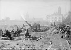
- Daytime and nighttime images of the bridge, including LED displays.
- Photo of the Portland Troll Bridge.
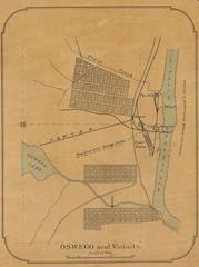
- Map showing the bridge and nearby attractions.
Alt text examples:
- “Morrison Bridge with Portland skyline during daytime”
- “LED-lit Morrison Bridge over the Willamette River at night”
Internal and External Links
Summary
The Morrison Bridge is a living emblem of Portland’s growth, resilience, and community spirit. Its innovative engineering, minimalist architecture, and role as a hub for public art and festivals make it a must-visit for locals and visitors alike. Open 24/7 and accessible to all, the bridge offers stunning views, vibrant light displays, and a gateway to exploring Portland’s rich history and culture (Wikipedia; Multnomah County; Light the Bridges; Willamette Week; Oregon Essential; Travel Portland).
References
- Wikipedia: Morrison Bridge
- Oregon History Project: The Growth of Portland
- Multnomah County: Morrison Bridge Strengthening
- HistoricBridges.org: Morrison Bridge
- PDX Today: Portland Bridge History
- Multnomah County: Morrison Bridge
- Travel Portland: Portland Bridges
- Light the Bridges: Morrison Bridge
- Willamette Week: Portland Winter Light Festival
- Oregon History Project: Morrison Street Bridge History
- Oregon Essential: Bridges Portland Oregon Facts
- Oregon Hikers Field Guide: Morrison Bridge
- Travel Portland: Getting Around
- Library of Congress: Morrison Bridge