Ross Island Bridge Visiting Hours, Tickets, and Portland Historical Sites Guide
Date: 04/07/2025
Introduction
The Ross Island Bridge is one of Portland, Oregon’s most distinguished river crossings, renowned for its unique engineering, historical significance, and role in shaping the city’s urban landscape. Completed in 1926, it not only connects Southwest and Southeast Portland via U.S. Route 26 but also stands as a testament to the city’s rapid growth and infrastructural modernization in the early 20th century. Designed by Gustav Lindenthal—famed for New York’s Queensboro and Hell Gate Bridges—the Ross Island Bridge embodies innovative cantilever truss engineering, minimal river traffic disruption during construction, and a striking “phthalo blue” steel structure that makes it a city landmark. This comprehensive guide details the bridge’s history, visitor information, accessibility, nearby attractions, and its place within Portland’s evolving urban fabric.
For further resources, see Travel Portland, Transportation History, and Structure Magazine.
Table of Contents
- Historical Background
- Visitor Information
- Structure, Aesthetics, and Preservation
- The Bridge in Contemporary Portland
- Cultural and Social Impact
- Frequently Asked Questions (FAQ)
- Visuals and Media
- Conclusion and Call to Action
- References
Historical Background
Origins and Planning
The Ross Island Bridge was conceived during Portland’s transformative 1920s, amid a surge in automobile ownership and a citywide bridge-building boom. City planners called for modern crossings to link expanding neighborhoods on either side of the Willamette River (Transportation History). By late 1922, engineers nationwide were invited to design major projects, including the Burnside, Sellwood, and Ross Island bridges (Structure Magazine). These efforts set the stage for Portland’s signature “Bridgetown” identity.
Design and Engineering
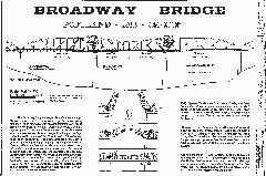
Gustav Lindenthal’s design for the Ross Island Bridge introduced advanced cantilever deck truss technology to Portland (Wikipedia; Architecture Adrenaline). The bridge’s form is often mistaken for a deck arch but is, in fact, a rare cantilever design in Oregon (Historic Bridges). With no central suspended span and steel truss anchor arms extending from piers, the bridge measures 1,819 feet in main and approach truss spans, with an overall length of about 4,122 feet (Structure Magazine). Additionally, it houses two 24-inch aqueduct mains, crucial to Portland’s water supply (Light the Bridges).
Construction and Dedication
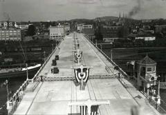
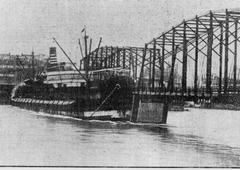
Construction began in the mid-1920s, with the Pacific Bridge Company using innovative methods such as assembling sections onshore and floating them into place (Structure Magazine; Architecture Adrenaline). The bridge opened on December 21, 1926, at a cost of $2 million (Wikipedia). Its dedication included a civic parade, ceremonial christening, and blessings by city leaders (Transportation History).
Naming and Location
Named after the nearby Ross Island—owned by Oregon pioneer Sherry Ross—the bridge does not connect directly to the island but stands about 800 feet north, commemorating the area’s early settlement (Wikipedia).
Visitor Information
Hours and Accessibility
- Open 24/7: The Ross Island Bridge is a public roadway with no entrance fees or ticket requirements.
- Vehicle Traffic: Carries U.S. Route 26 and is open to vehicles at all times.
- Pedestrian Access: A north-side sidewalk is available, but it is separated from traffic only by a curb and lacks a physical barrier. Use is recommended primarily during daylight and special events (e.g., Providence Bridge Pedal).
- Cyclists: Limited access; caution is advised due to traffic proximity and narrow passageways.
Travel Tips
- Best Time to Visit: Early morning or late afternoon for optimal light and reduced traffic.
- Parking: No dedicated parking on the bridge; street parking may be available nearby.
- Public Transit: TriMet bus lines serve both ends of the bridge. Routes 17, 19, and 70 cross the bridge (Moovit).
- Safety: Only use the sidewalk if comfortable with close vehicle traffic; consider using nearby parks for bridge viewing.
Nearby Attractions
- South Waterfront District: Dining, shopping, and parks.
- Ross Island: Natural area visible from the bridge, accessible to kayakers.
- OMSI (Oregon Museum of Science and Industry): Family-friendly and close to the east approach (The Broke Backpacker).
- Willamette River Greenway & Eastbank Esplanade: Riverfront trails and recreational areas.
- Other Historic Bridges: Hawthorne and Sellwood Bridges nearby, each with unique architectural styles.
Structure, Aesthetics, and Preservation
- Distinctive Color: Originally black, then green (1955–56), and since 1965, painted “phthalo blue” (Wikipedia).
- Historic Integrity: Maintained by the Oregon Department of Transportation since 1976, the bridge’s main truss spans remain largely unaltered (Transportation History; Historic Bridges).
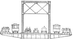
- Sidewalk Changes: Originally had sidewalks on both sides; the south sidewalk was removed in 1958 to increase traffic capacity.
The Bridge in Contemporary Portland
- Transport Role: Handles approximately 65,000 vehicles daily (Oregon Essential).
- Special Events: Occasionally open to pedestrians and cyclists during events such as the Providence Bridge Pedal.
- Urban Impact: The bridge contributed to the transformation and, at times, fragmentation of South Portland neighborhoods due to mid-century highway expansions (BikePortland).
Cultural and Social Impact
The Ross Island Bridge is emblematic not only of engineering achievement but also of the social changes resulting from urban infrastructure projects. Its construction and the subsequent addition of ramps displaced many immigrant and Black communities in South Portland, a legacy now addressed by city-led urban renewal and reconnection projects (BikePortland).
Current planning initiatives focus on restoring street grids, removing ramps, and transforming Naito Parkway into a welcoming main street, aiming to heal past divisions and promote equitable access (Portland Bureau of Transportation (PBOT); Portland Bureau of Planning and Sustainability (BPS)).
Frequently Asked Questions (FAQ)
Q: Are there entrance fees or tickets required to visit the Ross Island Bridge?
A: No, the bridge is a public roadway and sidewalk accessible 24/7 at no cost.
Q: Is the bridge safe for pedestrians and cyclists?
A: The north-side walkway is open but narrow and close to traffic; exercise caution. Cycling is permitted with care.
Q: What are the best nearby attractions to visit after crossing the bridge?
A: Explore the South Waterfront District, OMSI, Macadam Avenue shops, and Willamette River Greenway.
Q: Are guided tours available for the Ross Island Bridge?
A: No official tours, but many walking and cycling tours of Portland include the bridge and adjacent neighborhoods.
Q: How do I access the bridge via public transit?
A: TriMet bus routes 17, 19, and 70 cross the bridge, with additional service from nearby MAX and streetcar stations (Moovit; TriMet Transit).
Visuals and Media
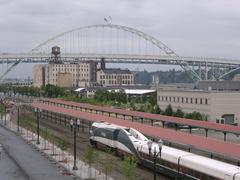
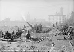
- Images: Panoramic shots of the Ross Island Bridge over the Willamette River, close-ups of the blue steel truss, historical construction photos, and maps with access points and nearby attractions.
- Alt Text Suggestions: “Ross Island Bridge spanning the Willamette River in Portland, Oregon,” “Cantilever truss bridge architecture,” “Map of Ross Island Bridge and surrounding areas in Portland.”
- Virtual Tours: Available on official tourism sites (Travel Portland).
Conclusion and Call to Action
The Ross Island Bridge is more than a river crossing—it’s a living symbol of Portland’s engineering prowess, urban evolution, and cultural complexity. Whether you are drawn by its distinctive design, panoramic views, or its role in shaping the city, a visit to the Ross Island Bridge enriches your understanding of Portland’s past and present.
For the best experience, plan your visit during golden hours, use public transit, and explore the vibrant neighborhoods on either side of the bridge. Download the Audiala app for real-time updates, interactive maps, and guided tours. Stay tuned to our social channels for news on Portland’s historic sites, upcoming events, and urban renewal projects.
References and Further Reading
- Travel Portland – Portland Bridges
- Transportation History – Ross Island Bridge Dedication
- Structure Magazine – Ross Island Bridge
- Wikipedia – Ross Island Bridge
- Architecture Adrenaline – Ross Island Bridge
- Historic Bridges – Ross Island Bridge Details
- Moovit – Visitor Guide
- BikePortland – Urban Renewal Coverage
- The Broke Backpacker – Portland Sites
- Portland Bureau of Transportation (PBOT)
- TriMet Transit
- Portland Bureau of Planning and Sustainability (BPS)


