Plan de Ayutla, Chiapas, Mexico: Visiting Hours, Tickets, and Historical Sites Guide
Date: 14/06/2025
Introduction
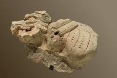
Plan de Ayutla, set amidst the verdant landscapes of Chiapas, Mexico, is a captivating archaeological site that opens a window into the grandeur and complexity of the ancient Maya civilization. Likely corresponding to the ancient city of Sak Tz’i’ (“White Dog”), the site is renowned for its monumental architecture, intricate inscriptions, and unique features such as the region’s largest Maya ballcourt and a rare ancient theater. Beyond its pre-Columbian significance, the name “Plan de Ayutla” also echoes through Mexican history, referencing the pivotal 1854 proclamation that catalyzed national reform and constitutional change.
This guide provides a detailed exploration of Plan de Ayutla’s history, architectural treasures, and cultural heritage, along with practical visitor information on hours, ticketing, accessibility, and travel tips. Whether you are drawn to Maya epigraphy, ceremonial spaces, or the living traditions of the Tzeltal and Lacandon communities, Plan de Ayutla offers an immersive, meaningful experience. Ongoing archaeological research and sustainable tourism initiatives—led by local guides—ensure that your visit supports both heritage preservation and community livelihoods.
For the latest details on permits, guided tours, and visitor protocols, consult official sources and local tourism offices. Enhance your journey by also visiting nearby Maya sites such as Bonampak and Yaxchilán, or exploring the cultural richness of the Lacandon Jungle (Plan de Ayutla: Visiting Hours, Tickets, and Exploring Chiapas’ Historic Maya Site, Plan de Ayutla Archaeological Site: Visiting Hours, Tickets & Historical Highlights in Chiapas, Plan de Ayutla, Chiapas: Visiting Hours, Tickets, and Historical Significance).
Table of Contents
- Discover Plan de Ayutla: A Premier Chiapas Historical Site
- Historical Overview and Identity
- Visiting Plan de Ayutla: Practical Information
- Architectural Highlights and Unique Features
- Rediscovery and Modern Archaeological Work
- Plan de Ayutla Within the Maya World
- Frequently Asked Questions (FAQ)
- Location and Accessibility
- Demographics and Local Life
- Historical and Archaeological Significance
- Things to Do and See
- Accommodation and Services
- Transportation and Getting Around
- Safety and Practical Tips
- Cultural Etiquette
- Photography and Media Recommendations
- Environmental Considerations
- Cultural and Political Significance in Regional and National Context
- Visitor Experience: Engaging with Cultural and Political Heritage
- Legacy and Ongoing Significance
Discover Plan de Ayutla: A Premier Chiapas Historical Site
Located in the Upper Usumacinta region, Plan de Ayutla stands as a testament to Maya ingenuity and sociopolitical organization. Visitors can explore monumental plazas, palatial complexes, and ceremonial structures, all set within the atmospheric jungle landscape of the Selva Lacandona.
Historical Overview and Identity
Plan de Ayutla is believed to be the ancient city of Sak Tzʼiʼ, dating back to at least 150 BCE. Its urban development, strategic location between rival Maya kingdoms, and epigraphic evidence point to a city deeply involved in regional politics and warfare. Architectural and inscriptional records document its alliances and conflicts with neighboring cities such as Yaxchilán, Bonampak, Toniná, and Piedras Negras.
Key features include the region’s largest ballcourt and a rare Terminal Classic theater, underscoring the city’s ceremonial and political prominence. While some debate remains over its identification as Sak Tz’i’ or Akʼe, current evidence strongly supports the Sak Tz’i’ hypothesis.
Visiting Plan de Ayutla: Practical Information
Visiting Hours and Tickets
- Hours: Generally open Tuesday–Sunday, 9:00 AM–5:00 PM. Closed on Mondays and major holidays. Some sources note daily access from 8:00 AM–5:00 PM; confirm with local authorities before your visit.
- Tickets: Entrance fees are typically around 70 MXN for adults, with discounts for students, seniors, and children. Tickets are available on-site or via authorized local operators, especially during peak periods.
Accessibility and Facilities
- The site features uneven terrain and jungle paths; sturdy footwear is essential.
- Accessibility is limited for visitors with mobility challenges.
- Facilities are basic, with restrooms and shaded areas at select points. Amenities in nearby towns are also limited.
How to Get There
- Plan de Ayutla is about 75 km northeast of Palenque or accessible from Jaltenango de la Paz and Tuxtla Gutiérrez by road.
- Public transportation is limited; private vehicles or guided tours are strongly recommended.
- Access may require a 3.5 km hike from the local Tzeltal community.
Best Times to Visit
- Season: The dry season (November–April) offers the most comfortable weather and best access.
- Time of Day: Early morning visits help you avoid midday heat and maximize wildlife sightings.
Nearby Attractions
- Bonampak and Yaxchilán: Explore other world-class Maya sites within driving or boat distance.
- Lacandon Jungle: Engage in ecotourism and cultural activities with indigenous communities.
Guided Tours and Special Events
- Local guides are often mandatory and strongly enhance the experience through cultural and archaeological context.
- Special events and workshops occur periodically; check with local tourism offices for updates.
Architectural Highlights and Unique Features
Site Layout
Plan de Ayutla covers roughly 25 hectares, encompassing 74 structures across three major acropolises (North, East, and West) and several plazas (Mesoweb PDF, p. 6).
- North Acropolis: Most excavated; features interconnected rooms on four levels, rare vaulted roofs, and palace complexes (Lonely Planet).
- East Acropolis: Home to the Temple of the Inscription, with stucco texts and a sanctuary similar to Palenque’s pib naah (Mesoweb).
- West Acropolis: Less excavated; contains residential and ceremonial structures (Mesoweb PDF, p. 6).
Ballcourt and Plazas
- Ballcourt: At 65 meters, the region’s largest and best-preserved, central to ritual and political life (Mesoweb).
- Plazas: The Great Plaza (Muku’l) and Plaza Tonna’ offer expansive ceremonial spaces.
Distinctive Features
- Terminal Classic Theater: Unique in the Maya world, seating about 120, used for elite performances and dynastic ceremonies.
- Elite Bathhouse: Advanced drainage systems reveal Maya engineering prowess.
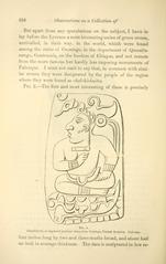
- Stucco Inscriptions: Fragments on the Temple of the Inscription contribute vital epigraphic data.
Rediscovery and Modern Archaeological Work
Plan de Ayutla was first reported by archaeologists in the 1970s. Systematic excavation and conservation began in the early 2000s under Luis Alberto Martos López, focusing on mapping, stabilization, and restoration (Mesoweb PDF, p. 2). Local Tzeltal communities collaborate in preservation, site management, and sustainable tourism.
Plan de Ayutla Within the Maya World
Once a prominent power in the Upper Usumacinta region, Plan de Ayutla’s history mirrors the broader Maya trajectory: dynamic political alliances, artistic achievement, and eventual decline around 1000–1100 CE. Today, local Tzeltal and Lacandon Maya sustain cultural continuity and stewardship of this ancient landscape.
Visitor Information: Key FAQs
Q: What are the visiting hours for Plan de Ayutla?
A: Typically Tuesday–Sunday, 9:00 AM–5:00 PM, but hours may vary; check locally.
Q: How do I get tickets or permits?
A: Purchase on-site or through local guides/community authorities; permits may be bundled with tours.
Q: Is the site accessible for people with disabilities?
A: Accessibility is limited due to rugged terrain.
Q: Are guided tours available?
A: Yes, and often required—arrange with local Tzeltal guides.
Q: What is the best time to visit?
A: The dry season (November–April) is ideal.
Location and Accessibility
Plan de Ayutla lies within the municipality of Ocosingo, Chiapas, near the Montes Azules Biosphere Reserve and about 24.5 km northeast of Jaltenango de la Paz (Pueblos América). Reachable by car or guided tour, the site is remote and public transport is limited.
Demographics and Local Life
With approximately 546 residents, Plan de Ayutla reflects the rural demographics of Chiapas. Agriculture and traditional crafts are central to daily life. Visitors can engage respectfully with locals, learning about their history and contemporary practices (Pueblos América).
Historical and Archaeological Significance
Plan de Ayutla’s ruins—including Maya graffiti, monumental palaces, and defensive walls—offer insights into Classic period urbanism and ritual. Unique graffiti, created by both specialists and non-specialists, provides a rare window into ancient Maya society (Cambridge University Press).
Things to Do and See
- Hiking and Nature: Explore jungle trails, enjoy birdwatching, and photograph the lush scenery.
- Community Interaction: Participate in local crafts and agricultural activities.
- Maya Graffiti Tours: Arrange visits via local guides or academic groups for in-depth exploration.
Accommodation and Services
No hotels are located directly at the site; visitors should stay in Jaltenango de la Paz or arrange rural homestays in advance. Basic amenities are limited; bring necessary supplies (Pueblos América).
Transportation and Getting Around
- Private Vehicle: Best option; roads can be rough—choose a vehicle with good clearance (Mexico Travel Secrets).
- Public Transport: Limited and irregular.
- Guided Tours: Recommended for access, context, and logistics (Rutopía).
Safety and Practical Tips
- Drive cautiously, especially in rainy season.
- Respect local customs and privacy.
- Bring insect repellent, sun protection, and first aid supplies.
- Use bottled water and carry cash.
- Prepare for limited mobile coverage.
- Stay updated on local events and road conditions (Off Path Travels).
Cultural Etiquette
Approach with respect and openness; learn basic Spanish, seek permissions before photographing people, and support local businesses.
Photography and Media Recommendations
Capture the site’s unique architecture, jungle ambiance, and Maya graffiti. Always respect restrictions and local preferences.
Environmental Considerations
- Carry out all trash and use biodegradable products.
- Stay on marked paths to protect flora and fauna.
Cultural and Political Significance
Plan de Ayutla is not only an archaeological treasure but also a symbol of Mexico’s struggle for reform. The 1854 Plan de Ayutla proclamation, sharing its name, marked the end of Santa Anna’s dictatorship and the dawn of liberal reforms (Encyclopedia.com). This dual heritage resonates today in the region’s ongoing pursuit of autonomy and justice.
Visitor Experience and Legacy
Interpretive signage, community-led tours, and participatory programs help visitors appreciate both the ancient and modern significance of Plan de Ayutla. Responsible tourism supports conservation and local well-being, ensuring that the site remains a vibrant link between past and present.
Summary and Final Travel Advice
Plan de Ayutla is a convergence point for Maya history, living indigenous culture, and national reform. Its monumental ruins, rare vaulted roofs, and evocative inscriptions offer unique insights into the Classic Maya world. Prepare for a remote, rustic experience by arranging guided tours, visiting in the dry season, and engaging respectfully with local communities.
For up-to-date visitor information, guided audio tours, and interactive maps, download the Audiala app. Supporting local initiatives and adhering to best practices will help safeguard this extraordinary site for generations to come (Plan de Ayutla Archaeological Site, Plan de Ayutla Visiting Hours, Tickets, and Travel Guide, Plan de Ayutla, Chiapas: Visiting Hours, Tickets, and Historical Significance).
References
- Plan de Ayutla: Visiting Hours, Tickets, and Exploring Chiapas’ Historic Maya Site (Mesoweb)
- Plan de Ayutla Archaeological Site: Visiting Hours, Tickets & Historical Highlights in Chiapas (Mesoweb PDF)
- Plan de Ayutla, Chiapas: Visiting Hours, Tickets, and Historical Significance (Encyclopedia.com)
- Plan de Ayutla Visiting Hours, Tickets, and Travel Guide to Chiapas Historical Site (Pueblos América)

