State Route 99 Tunnel Seattle Visiting Hours Tickets and Tourist Guide
Date: 04/07/2025
Introduction to the State Route 99 Tunnel in Seattle
Seattle’s State Route 99 Tunnel, often referred to as the SR 99 Tunnel or the Alaskan Way Viaduct Replacement Tunnel, stands as a monumental achievement in urban infrastructure and engineering innovation. Constructed to replace the aging and seismically vulnerable Alaskan Way Viaduct, which served as a critical north-south arterial highway since the mid-20th century, the tunnel now runs nearly two miles beneath downtown Seattle. This double-decker, single-bore tunnel not only enhances traffic flow and safety for tens of thousands of daily commuters but also catalyzed the rejuvenation of Seattle’s central waterfront, transforming it into a vibrant, pedestrian-friendly space that reconnects the city to Elliott Bay.
The tunnel’s construction involved unprecedented engineering feats, including the deployment of “Bertha,” one of the world’s largest tunnel boring machines, navigating deep beneath a dense urban environment while preserving over 150 buildings and critical infrastructure above. Its innovative stacked roadway design and advanced mechanical and safety systems set new standards for urban tunneling projects worldwide. Since opening in 2019, the tunnel has been a tolled facility with variable rates that help fund ongoing maintenance and debt repayment, underscoring its significance as a sustainable transportation asset.
While the SR 99 Tunnel itself is not accessible for pedestrian visits or tours, its portals and the adjacent revitalized waterfront area offer visitors a wealth of attractions, from the iconic Pike Place Market and Seattle Great Wheel to historical districts like Pioneer Square and cultural institutions such as the Museum of History & Industry (MOHAI). For tourists and infrastructure enthusiasts alike, understanding the tunnel’s history, tolling system, and surrounding amenities is key to appreciating its role in shaping modern Seattle.
This comprehensive guide provides an in-depth exploration of the SR 99 Tunnel’s history, engineering marvels, toll information, urban impact, and practical visitor tips—including advice on toll payment methods, nearby attractions, accessibility, and seasonal events. Whether you are a daily commuter, a curious traveler, or an infrastructure aficionado, this report equips you with everything needed to navigate and appreciate this transformative Seattle landmark. (WSDOT Record of Decision; Structure Magazine; Global Highways; HNTB Project Overview; Curbed Seattle)


Table of Contents
- Introduction
- Origins of the Alaskan Way Viaduct and Its Challenges
- The Decision-Making Process: Evaluating Alternatives for the Alaskan Way Viaduct Replacement
- Engineering Feats and Construction Challenges
- Tunnel Design and Engineering Specifications
- Tunnel Configuration and Dimensions
- Tunnel Boring Machine “Bertha”
- Stacked Roadway and Segmental Liner System
- Mechanical, Electrical, and Safety Systems
- Construction Sequence and Urban Tunneling Challenges
- Project Management and Cost
- Legacy and Influence on Tunnel Engineering
- Maintenance and Inspection
- SR 99 Tunnel Toll Information and Traffic Updates
- Urban Transformation and Waterfront Revitalization
- Traffic Patterns, Tolling, and Financial Implications
- Visiting the SR 99 Tunnel and Seattle Waterfront
- Nearby Seattle Attractions and Historical Sites
- Seasonal Events and Activities Near the SR 99 Tunnel
- Practical Visitor Information
- Social and Environmental Impact
- Economic and Cultural Revitalization
- Frequently Asked Questions (FAQ)
- Conclusion and Stay Connected
Introduction
The SR 99 Tunnel in Seattle, officially known as the State Route 99 Tunnel, is a modern engineering marvel that replaced the aging Alaskan Way Viaduct. This article explores the tunnel’s rich history, toll information, and its significant role in transforming Seattle’s waterfront into a vibrant, pedestrian-friendly area. Whether you’re a commuter, a visitor, or a local interested in Seattle’s urban development, this guide covers essential details including traffic updates, toll rates, visiting tips, and nearby attractions.
Origins of the Alaskan Way Viaduct and Its Challenges
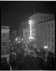
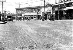
The original Alaskan Way Viaduct was constructed between 1949 and 1959 along Seattle’s waterfront. For over 60 years, it carried between 91,000 and 110,000 vehicles daily, serving as a crucial north-south route through downtown Seattle and supporting the movement of over $80 billion in goods annually (WSDOT Record of Decision). However, the 2001 Nisqually earthquake exposed the viaduct’s seismic vulnerabilities, and its aging structure no longer met modern safety standards, which led to increased collision rates and growing concerns over its future (Structure Magazine).
The Decision-Making Process: Evaluating Alternatives for the Alaskan Way Viaduct Replacement
In response to these challenges, city, state, and federal agencies evaluated several options to replace the viaduct while maintaining Seattle’s traffic flow and improving safety (WSDOT Record of Decision). The options included:
- Rebuilding the Viaduct: Dismissed due to seismic safety concerns and urban design priorities.
- Surface Street Improvements: Insufficient for expected traffic volumes.
- Cut-and-Cover Tunnel: Posed major disruptions to downtown businesses.
- Bored Tunnel: Selected as the preferred method for its minimal surface disruption and enhanced safety features (Global Highways).
After extensive public debate and environmental reviews, the bored tunnel option was officially chosen in 2009 (Structure Magazine).
Engineering Feats and Construction Challenges
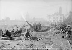
Construction began in 2013, led by Seattle Tunnel Partners using “Bertha,” then the world’s largest tunnel boring machine named after Seattle’s first female mayor (Global Highways). The 3.2-kilometer (2-mile), double-deck tunnel lies 120 to 140 feet below ground, designed to improve seismic resilience and traffic flow.
Bertha’s unexpected main bearing damage in late 2013 caused a two-year delay during repair efforts. Despite setbacks, boring was completed in 2016, and the tunnel opened to traffic in February 2019 (Fox 13 Seattle).
SR 99 Tunnel Toll Information and Traffic Updates
The SR 99 Tunnel is a tolled facility with variable toll rates determined by the Washington State Transportation Commission. Toll rates vary based on time of day, number of vehicle axles, and payment method:
- Good to Go passholders pay between $1.20 and $2.70 per trip.
- Drivers without a pass pay higher rates via license plate billing (Global Highways).
The initial target was to carry around 75,000 vehicles daily without tolls, but the COVID-19 pandemic reduced traffic volumes to about 47,000 vehicles per day as of 2023 (WSDOT). Toll revenues fund ongoing maintenance and help repay construction costs.
Visiting the SR 99 Tunnel and Seattle Waterfront
While the SR 99 Tunnel is a transportation corridor and not a tourist attraction with traditional visiting hours or ticketing, visitors can experience the transformed Seattle waterfront area made possible by the tunnel’s construction:
- Waterfront Park and Promenade: Newly opened pedestrian and cyclist-friendly spaces with scenic views of Elliott Bay.
- Nearby Attractions: Seattle Aquarium, Pike Place Market, and the Great Wheel are all within walking distance.
- Photography Spots: Waterfront piers and the restored promenade offer excellent views of downtown and the bay.
Travelers using the tunnel should be aware of toll rates and consider obtaining a Good to Go pass for discounted tolls. Real-time traffic updates and toll information are available on the Washington State Department of Transportation website.
Advanced Safety and Technology Features
The SR 99 Tunnel boasts state-of-the-art safety and operational systems, including 95 miles of electrical wiring, 21 miles of sprinkler pipes, and advanced fire suppression and ventilation systems. These features make it one of the world’s smartest tunnels, ensuring safe and efficient travel through downtown Seattle (Fox 13 Seattle).
Frequently Asked Questions (FAQ)
Q: What are the SR 99 Tunnel toll rates? A: Toll rates vary by time, vehicle type, and payment method. Good to Go passholders pay between $1.20 and $2.70 per trip. Non-pass users pay higher rates via license plate billing.
Q: Are there visiting hours or tours available for the SR 99 Tunnel? A: The tunnel is a transportation facility and not open for tours. Visitors can enjoy the Seattle waterfront redevelopment above ground.
Q: How can I pay the tolls? A: Toll payments can be made with a Good to Go pass or billed via license plate recognition.
Q: What nearby attractions can I visit after traveling through the tunnel? A: Pike Place Market, Seattle Aquarium, Seattle Great Wheel, and Waterfront Park are all nearby.
Q: Has the tunnel affected traffic in Seattle? A: The tunnel improved seismic safety and traffic flow on SR 99. However, tolling and pandemic impacts have reduced traffic volumes compared to initial forecasts.
Conclusion
The SR 99 Tunnel is a transformative project that replaced the seismically vulnerable Alaskan Way Viaduct, enhanced traffic safety, and enabled the revitalization of Seattle’s waterfront. Visitors and commuters alike benefit from improved urban connectivity and new public spaces along Elliott Bay. For those using the tunnel, understanding toll rates and payment options is essential. Explore the waterfront to experience the lasting impact of this landmark infrastructure project.
Image Suggestions:
- A high-resolution photo of the SR 99 Tunnel entrance with alt text: “SR 99 Tunnel entrance in Seattle with toll plaza visible”
- Scenic image of Seattle waterfront post-viaduct removal with alt text: “Seattle waterfront redevelopment featuring pedestrian pathways and Elliott Bay views”
- Historical photo of the Alaskan Way Viaduct with alt text: “Historic Alaskan Way Viaduct along Seattle’s waterfront”
These images should be optimized for SEO and mobile viewing.
Exploring the State Route 99 Tunnel in Seattle: Engineering Marvel and Visitor Information
Introduction
The State Route 99 (SR 99) Tunnel in Seattle, also known as the Alaskan Way Viaduct Replacement Tunnel, is not only a remarkable feat of modern engineering but also an important piece of Seattle’s urban landscape. Stretching nearly 2 miles beneath downtown Seattle, this double-decker highway tunnel has transformed the city’s transportation while offering visitors and infrastructure enthusiasts a unique glimpse into advanced tunnel construction. This article provides an overview of the tunnel’s design and engineering, as well as practical visitor information, nearby attractions, and travel tips to enhance your experience.
Tunnel Design and Engineering Specifications
Tunnel Configuration and Dimensions
The SR 99 tunnel is a double-decker, single-bore highway tunnel approximately 2 miles (9,270 feet or 2,830 meters) long beneath downtown Seattle. It features two lanes of northbound traffic on the lower deck and two lanes of southbound traffic on the upper deck. Each deck measures 32 feet (9.8 meters) wide, accommodating two 11-foot (3.4-meter) travel lanes, an 8-foot (2.4-meter) west shoulder, and a 2-foot (0.61-meter) east shoulder. The vertical clearance on both decks is 15.5 feet (4.7 meters), with a posted speed limit of 45 miles per hour (72 km/h) (Wikipedia; Structure Magazine).
The tunnel reaches its deepest point at Virginia Street, approximately 211–215 feet (64–66 meters) below street level, ranking it among North America’s deepest road tunnels (Wikipedia; Tunneling Online). It passes beneath over 150 buildings and critical infrastructure, requiring advanced engineering to prevent ground settlement and structural damage (Structure Magazine).
Tunnel Boring Machine “Bertha”
A key player in the tunnel’s construction was “Bertha,” a custom-built tunnel boring machine (TBM) manufactured by Hitachi Zosen Corporation. At 57.5 feet (17.5 meters) in diameter and weighing 7,982 tons, Bertha was the world’s largest earth pressure balance TBM at deployment. It was powered by 16,500 horsepower and equipped with 56 propulsion jacks capable of delivering 44,000 tons of thrust (Tunneling Online; The Supertunnel).
Bertha excavated the tunnel from July 2013 to April 2017, installing 1,426 precast concrete rings and removing roughly 900,000 cubic yards of soil (Tunneling Online).
Stacked Roadway and Segmental Liner System
The SR 99 tunnel’s innovative stacked roadway design allows both northbound and southbound traffic in a single bore, minimizing surface disruption. The permanent tunnel lining consists of precast concrete rings installed and grouted in place as the TBM advanced, ensuring structural integrity and controlling ground settlement. The liner is engineered to withstand seismic events, groundwater pressure, and vehicle loads (Structure Magazine).
Mechanical, Electrical, and Safety Systems
Below the roadway decks, the tunnel houses essential utility spaces for ventilation, lighting, and fire suppression. Key safety features include:
- Ventilation: High-capacity fans and air quality monitoring maintain safe conditions.
- Fire Suppression: Automated detection and suppression systems ensure rapid response.
- Lighting: Energy-efficient LED lighting enhances visibility.
- Emergency Egress: Strategically placed cross passages and exits facilitate quick evacuation (Wikipedia; WSDOT).
Construction Sequence and Urban Tunneling Challenges
The tunnel’s construction presented unique urban challenges, including coordination with city agencies, businesses, residents, and utility providers. The route traversed historic neighborhoods and critical infrastructure, necessitating careful monitoring to mitigate ground movement (Tunneling Online).
Simultaneous boring and interior construction of the double-deck roadway saved time, with significant portions of the decks’ foundations completed before tunnel boring finished. Seattle’s varied geology caused challenges, including a two-year delay caused by TBM damage from an obstruction. Rigorous settlement monitoring and continuous grouting protected overlying buildings (Wikipedia; Structure Magazine).
Project Management and Cost
Delivered under a design-build contract, Seattle Tunnel Partners served as the general contractor, with HNTB Corporation as lead designer and engineer. The tunnel construction contract cost $1.35 billion, with the broader replacement program totaling about $3.1 billion (Tunneling Online; Informed Infrastructure).
Legacy and Influence on Tunnel Engineering
The SR 99 tunnel set new standards for large-diameter, deep-bore urban tunnels, pioneering solutions like the stacked roadway and concurrent construction. Its success influences tunnel engineering globally (Informed Infrastructure; Structure Magazine).
Maintenance and Inspection
Since opening in February 2019, the tunnel undergoes regular maintenance and closures for inspection, fire suppression testing, lighting repairs, and cleaning, with advance notices provided by WSDOT (WSDOT; My Edmonds News).
Visiting the SR 99 Tunnel: What You Need to Know
Visitor Access and Tickets
The SR 99 tunnel is a public highway tunnel and does not offer public tours or ticketed visits. However, visitors can drive through the tunnel as part of Seattle’s road network, experiencing this engineering marvel firsthand. There are no entrance fees or visiting hours restrictions beyond normal traffic regulations.
Nearby Attractions and Seattle Historical Sites
While the tunnel itself is not a traditional tourist attraction, its portals are near several Seattle landmarks and historical sites worth exploring:
- Seattle Center and the Space Needle: The tunnel’s north portal is close to these iconic attractions.
- Pioneer Square: Historic district featuring museums, shops, and restaurants.
- Waterfront Park: Offers scenic views of Elliott Bay.
- Museum of History & Industry (MOHAI): Provides insights into Seattle’s history and innovation.
These sites offer rich cultural experiences complementing your visit to the area around the tunnel.
Accessibility and Travel Tips
- Accessibility: The tunnel and surrounding roads are fully accessible for all vehicles, including those with mobility devices.
- Traffic: Peak hours can be busy; check WSDOT traffic updates before planning your drive.
- Safety: Observe posted speed limits and tunnel safety signage.
Educational and Infrastructure Enthusiast Opportunities
While public tours are unavailable, educational groups and infrastructure enthusiasts can find extensive resources online about the tunnel’s design and construction. Several documentaries and articles provide detailed insights.
Frequently Asked Questions (FAQs)
Q1: Can I visit the SR 99 tunnel as a tourist?
A1: The tunnel is a functional highway tunnel without public tours. Visitors can drive through it but cannot access it on foot.
Q2: Are there any tickets or visiting hours for the tunnel?
A2: No tickets or special visiting hours are required; the tunnel operates as part of Seattle’s road system.
Q3: What are some nearby attractions to visit after the tunnel?
A3: Seattle Center, the Space Needle, Pioneer Square, Waterfront Park, and MOHAI are nearby attractions.
Q4: Is the tunnel safe to drive through?
A4: Yes, it is equipped with advanced safety systems and is regularly maintained.
Q5: How deep is the SR 99 tunnel?
A5: The tunnel reaches depths of approximately 211–215 feet (64–66 meters) below street level.
Conclusion and Call to Action
The State Route 99 tunnel stands as a landmark achievement in urban engineering and a vital part of Seattle’s infrastructure. While it primarily serves transportation needs, its innovative design and construction story captivate engineers and visitors alike. Next time you’re in Seattle, consider driving through the SR 99 tunnel to experience this engineering marvel firsthand.
For more information on Seattle’s infrastructure and attractions, explore our related articles and follow us on social media. Stay updated with WSDOT for traffic and maintenance notices to plan your visit smoothly.
Visuals:
- Include high-resolution images of the tunnel construction, “Bertha” TBM, tunnel interior, and nearby Seattle landmarks.
- Use descriptive alt tags such as “SR 99 Tunnel Double-Deck Interior,” “Bertha Tunnel Boring Machine in Seattle,” and “Seattle Center Near SR 99 Tunnel.”
Internal Links:
- Link to related articles on Seattle transportation, urban tunnels, and local attractions to enhance engagement.
By integrating detailed engineering insights with visitor-friendly information and SEO-focused keywords like “State Route 99 tunnel visiting hours,” “SR 99 tunnel tickets,” and “Seattle historical sites,” this article aims to serve both technical readers and tourists seeking to learn about or experience Seattle’s iconic tunnel.
Introduction
The State Route 99 Tunnel in Seattle, also known as the Alaskan Way Viaduct Replacement Tunnel, is a landmark urban infrastructure project reshaping the city’s transportation and waterfront experience. This article explores the tunnel’s history, engineering marvels, tolling system, and its profound impact on Seattle’s urban landscape. Whether you’re a commuter seeking SR 99 Tunnel toll rates and traffic info or a visitor interested in Seattle waterfront attractions, this comprehensive guide will provide valuable insights.
Historical Context and Rationale for the Tunnel
The original Alaskan Way Viaduct, an elevated highway built in the 1950s, served as a vital north-south artery but became increasingly problematic due to age, seismic vulnerability, and its divisive effect on the city’s waterfront (WSDOT). The 2001 Nisqually earthquake exposed structural weaknesses, prompting emergency repairs and accelerating calls for a safer, more sustainable solution. Replacing the viaduct with the deep-bore State Route 99 Tunnel was aimed at improving public safety, reducing congestion, and reconnecting downtown Seattle with its waterfront.
Engineering Significance and Urban Innovation
Spanning 1.7 miles (2.7 km) with a 57.5-foot diameter, the SR 99 Tunnel is a double-deck, bored tunnel and one of North America’s largest of its kind (FlatironDragados). Constructed using “Bertha,” one of the world’s largest tunnel boring machines, it carries two lanes of traffic in each direction beneath downtown Seattle, closely following the old viaduct’s alignment.
This project improved seismic resilience and set new standards for urban tunneling in dense city environments, balancing traffic flow, historic preservation, and soil stability management (ITS International).
Urban Transformation and Waterfront Revitalization
Removing the viaduct in 2019 opened Seattle’s central waterfront, enabling new public spaces, parks, and pedestrian and bicycle pathways (WSDOT). The new Alaskan Way surface street serves as a multimodal corridor, connecting SR 99 with downtown and supporting transit, cycling, and walking alongside vehicles.
This urban redesign has created a vibrant, accessible waterfront, encouraging tourism, recreation, and economic development, and reconnecting communities previously divided by the highway (Curbed Seattle).
Traffic Patterns, Tolling, and Financial Implications
The SR 99 Tunnel operates as a toll facility designed to repay $200 million in construction debt and cover ongoing costs (ITS International). Tolling began in late 2019 with variable rates from $1 to $4.25 depending on time and payment method, and scheduled 3% increases every three years (My Edmonds News). The latest toll increase took effect July 1, 2025.
Since tolling started, daily trips decreased from 75,000 to about 55,000 due to alternate route use, including the expanded Alaskan Way and Interstate 5 (The Urbanist). The COVID-19 pandemic further reduced traffic to around 25,655 daily trips in 2020. Though traffic is rebounding, revenues remain below forecasts—$49.7 million in 2021-23 (15% below projections) and $53.5 million expected in 2023-25 (12% below estimates) (ITS International).
Financial sustainability is challenged by toll-free alternatives and persistent remote work, which reduces downtown commuting. Legislative measures and settlements have helped temporarily, but long-term solutions may involve further toll adjustments or public funding (The Urbanist).
Visitor Information and Accessibility
The SR 99 Tunnel is designed exclusively for vehicle traffic and is not open to pedestrians or cyclists (Curbed Seattle). There are no visiting hours or ticket prices beyond the toll fees. For visitors interested in Seattle’s waterfront attractions, the revitalized Alaskan Way offers scenic walking and biking paths, public art, parks, and cultural events.
Entrances and exits are conveniently located near major landmarks such as the stadiums (south portal) and Seattle Center (north portal) (KING 5). For those exploring on foot or bike, the surface street and waterfront promenade provide accessible, safe routes with interpretive signage highlighting Seattle’s waterfront history (WSDOT).
Social and Environmental Impact
By moving traffic underground, the tunnel eliminated the visual and physical barrier of the viaduct, restoring views of Elliott Bay and improving air quality along the waterfront. The surface street prioritizes pedestrian safety and accessibility with wide sidewalks, landscaping, and dedicated bike lanes (WSDOT). Environmental reviews confirmed minimal adverse impacts, with mitigation efforts addressing construction effects. The new green spaces contribute to a more sustainable and livable city environment.
Economic and Cultural Revitalization
The tunnel’s completion has boosted economic activity by improving waterfront access and attractiveness. Festivals, markets, and public art now enrich Seattle’s cultural landscape. Enhanced connectivity supports local businesses and has increased property values in nearby neighborhoods (Curbed Seattle). The project symbolizes Seattle’s commitment to innovative urban planning and resilience, offering lessons for other cities facing aging infrastructure challenges.
FAQ Section
Q: Can pedestrians or cyclists use the SR 99 Tunnel? A: No, the tunnel is exclusively for vehicle traffic. Pedestrians and cyclists should use the new Alaskan Way surface street and waterfront paths.
Q: What are the current toll rates for the SR 99 Tunnel? A: Toll rates vary from $1 to $4.25 depending on time of day and payment method, with scheduled increases every three years. Discounts apply for Good To Go passholders.
Q: Are there toll-free alternative routes to the SR 99 Tunnel? A: Yes, drivers can use the expanded Alaskan Way surface street or Interstate 5 as toll-free alternatives.
Q: What are the visiting hours for the tunnel? A: The tunnel operates 24/7 for vehicle traffic but is not accessible to visitors on foot or by bike.
Q: What attractions are nearby for visitors? A: The revitalized Seattle waterfront offers parks, walking and biking paths, public art, festivals, and views of Elliott Bay.
Visuals and Media
High-quality images and maps illustrating the SR 99 Tunnel route, toll plazas, and waterfront transformations enhance visitor understanding and engagement. Interactive virtual tours of the Seattle waterfront area highlight key attractions and urban renewal projects.
Internal and External Links
For further reading, explore our related articles on Seattle’s urban development and transportation projects. External links to WSDOT, ITS International, and local news sources provide detailed project updates and traffic information.
Conclusion and Stay Connected
The State Route 99 Tunnel stands as a milestone in Seattle’s urban transformation, blending engineering innovation with thoughtful urban renewal. While tolling and traffic patterns continue to evolve, the tunnel has redefined waterfront access and connectivity.
Whether you’re a daily commuter seeking the latest SR 99 Tunnel toll rates or a visitor exploring Seattle waterfront attractions, stay informed and connected. Download the Audiala app for real-time traffic updates, explore our related articles for deeper insights, and follow us on social media for the latest news and events.
Exploring the SR 99 Tunnel: Visiting Tips, Tickets, and Nearby Seattle Attractions
Introduction
The SR 99 Tunnel is more than just a roadway beneath Seattle—it’s a fascinating engineering marvel and a gateway to some of the city’s top attractions. Whether you’re planning a drive through this impressive tunnel or exploring nearby Seattle historical sites, this guide offers essential visiting tips, ticketing information, and highlights of surrounding points of interest to enhance your experience.
Navigating the State Route 99 Tunnel: Visitor Experience
Driving Through the Tunnel
The State Route 99 Tunnel, or SR 99 Tunnel, offers visitors a unique driving experience beneath downtown Seattle. Stretching approximately 2 miles (3.2 km) with a diameter of 57.3 feet, it ranks among the world’s largest and most advanced road tunnels (HNTB Project Overview). Its double-decker design features two northbound lanes stacked below two southbound lanes, providing a swift bypass for motorists seeking to avoid surface congestion in Seattle’s central business district.
SR 99 Tunnel Visiting Hours and Ticketing
The SR 99 Tunnel is open 24/7 for vehicular traffic, with no specific visiting hours since it is primarily a transportation corridor. There are no tickets required for entry; however, it is a tolled facility. Tolling operates electronically in both directions upon exit, with rates varying by time of day—lower rates apply during nights and weekends.
Payment options include the Good To Go! pass system, which offers the lowest rates, or Pay By Plate, which registers your license plate and adds a $0.25 surcharge per trip (WSDOT Tolling Info). There is no option for cash payment. Clear signage with approximately 24 toll signs warns drivers of tolling ahead.
Safety and Comfort
The SR 99 Tunnel is engineered with world-class safety and seismic features, making it one of the safest tunnels globally. Key features include:
- Advanced Ventilation: Equipped with eight exhaust fans and 17 jet fans, vents every 100 feet ensure optimal air quality and rapid smoke removal in emergencies (WIRED Tunnel Tech).
- Environmental Monitoring: Continuous sensors detect carbon monoxide, nitrogen oxides, and particulates, activating ventilation automatically if needed.
- Emergency Walkways: Unique self-sufficient walkways with pressurized air and independent fans provide safe evacuation routes.
- Incident Detection: Cameras and sensors monitored by Washington State DOT ensure quick response to incidents.
The tunnel is well-lit with digital signage that provides real-time updates and instructions. Its smooth, climate-controlled roadway ensures a comfortable drive regardless of Seattle’s often unpredictable weather.
Accessibility
The SR 99 Tunnel is exclusively for vehicular traffic; pedestrians and cyclists are not permitted. However, the tunnel’s construction has improved surface-level pedestrian and cyclist access along the waterfront, enhancing connectivity to scenic city areas (HNTB Project Overview).
Visitor Tips for a Memorable Tunnel Experience
- Plan Your Route: The tunnel connects the SODO neighborhood to South Lake Union directly beneath downtown Seattle. Use navigation apps to check traffic and toll rates.
- Prepare for Tolling: Set up a Good To Go! account ahead of time for discounted toll rates. Register your license plate if using Pay By Plate to avoid extra fees (WSDOT Tolling Info).
- Observe Speed Limits: Speed limits are strictly enforced and may change dynamically based on traffic or incidents.
- No Stopping: Stopping inside the tunnel is prohibited except for emergencies. Use emergency walkways and follow instructions if needed.
- No Photography: For safety and security reasons, taking photos inside the tunnel is not allowed. However, excellent photo opportunities exist at the tunnel’s portals and nearby waterfront areas.
Guided Tours and Virtual Experiences
Although the SR 99 Tunnel does not offer public guided tours, virtual tours and educational videos are available online for those interested in its construction and technology. Check local tourism websites and transportation authority resources for virtual content updates.
Nearby Seattle Attractions and Historical Sites
The SR 99 Tunnel’s strategic location places visitors near many of Seattle’s iconic attractions and historical sites, accessible from the tunnel’s north and south portals.
Seattle Waterfront
The tunnel’s opening and the removal of the Alaskan Way Viaduct have revitalized Seattle’s waterfront, transforming it into a lively destination. Highlights include:
- Seattle Great Wheel: A 175-foot-tall Ferris wheel at Pier 57 offering panoramic views of Elliott Bay and the skyline (Visit Seattle City).
- Seattle Aquarium: Showcasing marine life native to the Pacific Northwest, great for families.
- Pier 62: Hosts concerts, festivals, and waterfront events throughout the year (Events12 Waterfront Concerts).
Pike Place Market
A short walk from the tunnel’s northern exit, Pike Place Market is a Seattle landmark. Explore fresh produce, artisanal foods, crafts, and the famous fish-throwing vendors (Seattle Southside Top Attractions).
Pioneer Square
Near the southern portal, Pioneer Square is Seattle’s historic district. Attractions include:
- Underground History Tour: Explore Seattle’s hidden underground passageways, remnants after the Great Fire of 1889 (Events12 Underground Tour).
- Occidental Square: A vibrant public park with markets, festivals, and art installations.
Museum of History & Industry (MOHAI)
Located in South Lake Union, MOHAI offers engaging exhibits on Seattle’s history and future (Seattle Southside Top Attractions).
Washington State Ferries
Colman Dock ferry terminal on the waterfront provides scenic rides across Puget Sound to destinations like Bainbridge Island and Bremerton (Seattle Southside Top Attractions).
Benaroya Hall
Home to the Seattle Symphony, Benaroya Hall is just a few blocks from the tunnel’s northern end (Events12 Benaroya Hall).
The Fremont Troll
For a quirky photo, visit the Fremont Troll sculpture beneath the Aurora Bridge, a short drive north of the tunnel (Visit Seattle City).
Seasonal Events and Activities Near the SR 99 Tunnel
Seattle’s downtown and waterfront areas host many seasonal events within walking distance:
- Taste of Seattle: Food festivals celebrating local cuisine (Events12 Taste of Seattle).
- Waterfront Concerts: Live music events at Pier 62 during summer.
- Pioneer Square Fest: Art, food, and music festival in the historic district (Events12 Pioneer Square Fest).
Practical Visitor Information
- Parking: Parking lots and garages are available near both tunnel portals, especially around the waterfront and Pioneer Square. Rates vary by season and event.
- Public Transit: Numerous bus routes, the Seattle Streetcar, and Link light rail stations at Westlake and Pioneer Square connect the tunnel area to the rest of the city.
- Walking and Biking: While pedestrians and cyclists cannot use the tunnel, nearby waterfront and city streets offer extensive walking and biking paths, including the scenic Burke-Gilman Trail (Visit Seattle City).
FAQ: Your Questions About the SR 99 Tunnel
Q: How do I pay the SR 99 Tunnel toll? A: Payment is electronic only via Good To Go! pass or Pay By Plate license registration. No cash accepted.
Q: Are pedestrians or cyclists allowed in the tunnel? A: No, the tunnel is for vehicles only. Pedestrians and cyclists can enjoy improved waterfront paths nearby.
Q: What are the SR 99 Tunnel visiting hours? A: The tunnel operates 24/7 for vehicle traffic; no specific visiting hours apply.
Q: Is photography allowed inside the tunnel? A: No, stopping for photos inside the tunnel is prohibited for safety reasons.
Q: Are there guided tours of the tunnel? A: The tunnel does not offer public guided tours, but virtual tours and educational content are available online.
Q: What nearby Seattle historical sites can I visit? A: Pioneer Square’s Underground History Tour, MOHAI museum, and the historic waterfront are all close to the tunnel.
Enhance Your Visit
Combine your tunnel drive with a stroll along the waterfront, a visit to Pike Place Market, or a scenic ferry ride for a full Seattle experience. Check local event calendars for concerts and festivals near the tunnel area (Events12 Seattle Events). Most nearby attractions are ADA-accessible, with ramps and elevators for easy navigation.
Call to Action
Ready to explore the SR 99 Tunnel and Seattle’s vibrant neighborhoods? Download the Audiala app for up-to-date visitor information, traffic alerts, and local event guides. Follow us on social media for the latest news and insider tips to make the most of your Seattle adventure!
Internal Links:
External Links:
- HNTB Project Overview
- WSDOT Tolling Info
- WIRED Tunnel Tech
- Visit Seattle City
- Events12 Seattle
- Seattle Southside Top Attractions
Summary and Final Tips for Visiting the State Route 99 Tunnel
The State Route 99 Tunnel in Seattle exemplifies a landmark convergence of civil engineering excellence, urban planning foresight, and community revitalization. By replacing the seismically compromised Alaskan Way Viaduct with a deep-bore, double-deck tunnel, Seattle not only enhanced the safety and efficiency of a key transportation corridor but also unlocked the potential for a dramatic waterfront transformation. This redevelopment has reconnected downtown Seattle with Elliott Bay, creating inviting public spaces, pedestrian promenades, and cultural amenities that enrich the city’s social and economic fabric.
Despite challenges such as construction delays and evolving traffic patterns influenced by tolling and broader societal shifts, the tunnel remains a critical infrastructure asset supported by cutting-edge safety features and ongoing maintenance efforts. Visitors driving through the tunnel experience a seamless journey beneath the city, while access to nearby attractions such as Pike Place Market, Seattle Aquarium, Pioneer Square, and the Seattle Great Wheel offer ample opportunities to explore Seattle’s rich history and vibrant culture.
For travelers and locals alike, understanding tolling procedures, traffic updates, and the surrounding urban landscape ensures a smooth and memorable visit. The SR 99 Tunnel project stands as a testament to Seattle’s commitment to resilient, innovative urban development, providing valuable lessons for cities worldwide facing the challenges of aging infrastructure and urban renewal.
Whether you are navigating the tunnel as part of your daily commute or exploring the revitalized waterfront and historic neighborhoods, this guide encourages you to engage deeply with Seattle’s evolving cityscape. Stay informed with real-time traffic updates through official resources and enhance your experience by visiting the remarkable sites that surround this engineering marvel. (WSDOT; The Urbanist; Global Highways; Curbed Seattle)
References and Further Reading
- SR 99 Tunnel in Seattle: History, Toll Information, and Waterfront Transformation, 2025, WSDOT Record of Decision https://wsdot.wa.gov/sites/default/files/2021-05/AWV-PDF-RecordOfDecision2011.pdf
- Exploring the State Route 99 Tunnel in Seattle: Engineering Marvel and Visitor Information, 2025, Structure Magazine https://www.structuremag.org/article/sr99-tunnel/
- Highway 99 Revisited, 2024, Global Highways https://www.globalhighways.com/wh10/feature/highway-99-revisited
- Alaskan Way Viaduct Replacement Program, 2025, WSDOT https://wsdot.wa.gov/construction-planning/major-projects/alaskan-way-viaduct-replacement-program
- State Route 99 Tunnel, 2025, Wikipedia https://en.wikipedia.org/wiki/State_Route_99_tunnel
- Digging Deep to Unlock the Waterfront: Massive New Tunnel Opens Below Downtown Seattle, 2024, Informed Infrastructure https://informedinfrastructure.com/47665/digging-deep-to-unlock-the-waterfront-massive-new-tunnel-opens-below-downtown-seattle/
- SR 99 Tunnel Slated for Fall Opening: What to Know About Tolling, Viaduct Closure, More, 2019, Fox 13 Seattle https://www.fox13seattle.com/news/sr-99-tunnel-slated-for-fall-opening-what-to-know-about-tolling-viaduct-closure-more
- SR 99 Tunnel Tolling Information, 2025, WSDOT https://wsdot.wa.gov/travel/roads-bridges/toll-roads-bridges-tunnels/sr-99-tunnel-tolling
- SR 99 Tunnel Financial Outlook and Traffic Uptick, 2023, The Urbanist https://www.theurbanist.org/2023/05/17/sr-99-tunnels-financial-outlook-remains-negative-despite-cash-infusion-traffic-uptick/
- Seattle Waterfront Transformation: Viaduct Removal and Public Spaces, 2019, Curbed Seattle https://seattle.curbed.com/2019/1/31/18205730/seattle-viaduct-tunnel-opening-tolls
- HNTB Project Overview: Alaskan Way Viaduct Replacement Program, 2025, HNTB https://www.hntb.com/projects/alaskan-way-viaduct-replacement-program/