Plan and listen to Kharkivske Highway with Audiala.
Audio guide in your pocket, itinerary in your browser. Built for the way you actually visit.
Introduction
Kharkivske Highway is a pivotal arterial road in Kyiv’s dynamic Darnytskyi district. More than just a transportation link connecting the city center with the southeastern outskirts and Boryspil International Airport, it is a living testament to Kyiv’s industrial history and post-war growth. The corridor offers a blend of residential neighborhoods, commercial centers, parks, and authentic local experiences—making it equally relevant for business travelers, commuters, and urban explorers. This comprehensive guide delivers detailed historical context, practical travel advice, and an overview of nearby attractions to help you make the most of your visit. For the latest updates and transit information, consult official Kyiv tourism resources (Exploring Kharkivske Highway), public transport maps, and trusted travel guides (Lost With Purpose).
Historical Background and Urban Development
The Darnytskyi district, once characterized by forests and small settlements, was transformed by industrialization in the late 19th and early 20th centuries. Kharkivske Highway emerged as a key route during this expansion, facilitating the integration of Kyiv’s left and right banks and supporting extensive residential and industrial development, especially during the Soviet era. Its name references its strategic role as the road to Kharkiv, Ukraine’s second-largest city. The highway’s alignment and surrounding architecture reflect the principles of Soviet urban planning, with wide avenues, high-rise apartment blocks, and integrated transit infrastructure.
Transportation Access and Visitor Information
Kharkivske Highway extends for approximately 4.25 kilometers and is well integrated into Kyiv’s public transport network. Nearby metro stations—Borispilska, Vyrlytsya, Darnytsia, and Kharkivska—provide fast connections to the city center and airport (adresa.locator.ua). Numerous bus, trolleybus, and marshrutka (minibus) routes serve the corridor, making it accessible for commuters and visitors. For those driving, the highway connects to Mykoly Bazhana Avenue and Boryspilske Highway, with parking available at shopping centers and business complexes.
Visiting Hours and Tickets:
Kharkivske Highway itself is a public road with unrestricted access at all hours. Parks such as Park Voiniv-Internacionalistiv and Park Partizanskoi Slavi are open from early morning until sunset, free of charge.
Notable Nearby Attractions
Parks and Green Spaces
-
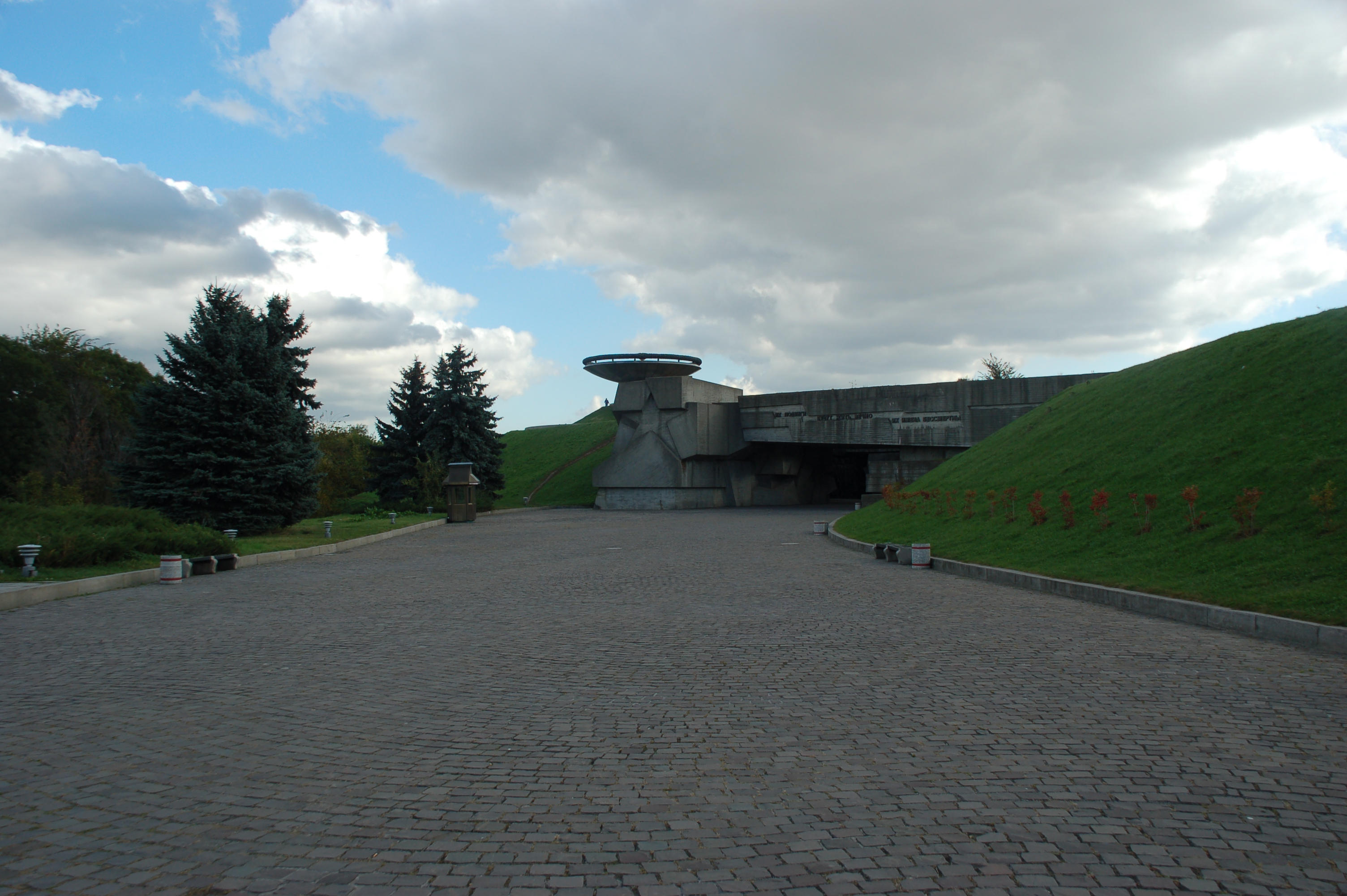
Park Voiniv-Internacionalistiv:
A local memorial park with walking paths, playgrounds, and monuments, offering a peaceful retreat amidst urban life. -
Park Partizanskoi Slavi and Verevocnyj Park “Seiklar”:
Popular for picnics, outdoor sports, and seasonal festivals, these parks provide ample green space and recreation opportunities. -
Park Peremohy (Victory Park):
A large, scenic park just north of the highway, open year-round with lakes, paved trails, and accessible amenities. -
Kyoto Park:
Known for its Japanese-style landscaping and cherry blossoms, particularly enchanting in spring.
Shopping and Entertainment
-
Prospekt Shopping Mall:
A modern retail and entertainment center featuring international and Ukrainian brands, cinemas, and dining options.
Hours: 10:00 AM – 9:00 PM daily. -
Metro Cash & Carry:
A wholesale hypermarket catering to families and small businesses; open Monday-Saturday 8:00 AM–8:00 PM, Sunday 9:00 AM–6:00 PM. -
Darnytskyi Market:
A bustling open-air market offering fresh produce, local delicacies, and souvenirs.
Hours: 7:00 AM – 6:00 PM.
Cultural and Historical Landmarks
-
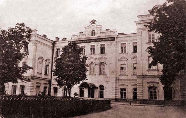
Darnytsia Railway Station:
A key transport hub with Soviet-era architecture, providing insight into Kyiv’s industrial past. -
Church of the Nativity of the Blessed Virgin:
A modern Orthodox church open daily, welcoming visitors for quiet reflection. -
Soviet-Era Residential Architecture:
Neighborhoods along the highway showcase Khrushchyovka and Brezhnevka-style apartment blocks, emblematic of mid-20th-century urbanization. Walking tours highlighting these features may be available through local operators.
Community Life and Urban Landscape
The Kharkivske Highway corridor is characterized by a vibrant mix of residential, commercial, and institutional buildings. Community life centers around neighborhood markets, cafés, and green spaces. The area’s diverse population and the presence of schools and public institutions contribute to a dynamic urban atmosphere. Street art, pop-up flea markets, and seasonal events further enrich the local experience (visitukraine.today).
Practical Visitor Tips
-
Best Time to Visit:
Spring through early autumn for pleasant weather and outdoor activities. -
Transport:
Use nearby metro stations (Darnytsia, Kharkivska, Vyrlytsia, Borispilska) for quick access. Buses and marshrutkas provide connections to local attractions. -
Accessibility:
Many parks, malls, and public spaces offer wheelchair access; verify with individual sites if needed. -
Amenities:
Cafés, restaurants, pharmacies, and supermarkets are widely available. Free Wi-Fi is common in larger establishments. -
Safety:
Kyiv is generally safe, but visitors should remain vigilant in crowded areas. As of 2025, observe nightly curfew regulations (typically 00:00–05:00) and follow official advisories due to ongoing regional conflict (visitukraine.today). -
Payments:
Most places accept cards; carry small cash for markets and transport.
Frequently Asked Questions
Q: Are there entrance fees for Kharkivske Highway or local parks?
A: The highway and most parks are free to access. Museums and certain historical sites may charge modest admission.
Q: What public transportation serves Kharkivske Highway?
A: Metro stations (Borispilska, Vyrlytsya, Darnytsia, Kharkivska), buses, and marshrutkas.
Q: How can I reach Boryspil Airport from Kharkivske Highway?
A: Via Boryspilske Highway by car or taxi; public transport options are also available.
Q: Is the area suitable for pedestrians and cyclists?
A: Yes, sidewalks and bike-friendly paths are common along the highway and in parks.
Q: Are English services available?
A: English is spoken in larger hotels and some restaurants; Ukrainian and Russian are the main languages.
Listen to the full story in the app
The whole Kharkivske Highway,
told well.
Audio guides for 1,100+ cities across 96 countries. History, stories, and local insight — offline ready.

Verified, and shown.
Researched and written by the Audiala editorial team from historical records, architectural archives, and local expertise.
Last reviewed