Penang Bridge Visiting Hours, Tickets, and Travel Guide for Tourists
Date: 14/06/2025
Introduction
The Penang Bridge is an engineering marvel and a cultural icon, representing Malaysia’s progress and Penang’s vibrant transformation. Since opening in 1985, this 13.5-kilometer dual carriageway bridge has connected Penang Island with the mainland, fostering economic growth, social integration, and tourism. Beyond its function as a transport link, the bridge has become a symbol of unity and modernization, celebrated in art, photography, and annual events like the Penang Bridge International Marathon (ICE; Wikipedia; heyexplorer.com).
This guide provides all the essential details for visiting the Penang Bridge: from its historical significance and cultural impact to visitor tips, accessibility, event highlights, and travel logistics.
Table of Contents
- Introduction
- Historical Background and Architectural Significance
- Architectural Highlights
- Visitor Information
- Cultural and Economic Impacts
- Travel Tips and Practical Advice
- Frequently Asked Questions (FAQ)
- Visuals and Media
- Internal and External Links
- Conclusion
- References
Historical Background and Architectural Significance
Vision and Planning
Plans for connecting Penang Island to the mainland originated in the 1960s, driven by economic growth and the limitations of ferry services. The project gained government approval in the late 1970s as a strategic investment to boost regional development (ICE).
Construction Timeline
Construction began in 1982 and concluded in 1985, with the bridge officially opening on September 14, 1985. Over 2,300 workers participated, and the project overcame significant technical and environmental challenges. Tragically, 20 workers lost their lives during construction (Wikipedia).
Socio-Economic Impact
The bridge transformed Penang’s connectivity, enabling rapid industrialization and urbanization. It became the first and only road connection between the island and mainland, significantly improving the movement of goods, services, and people. The bridge’s completion is commemorated in Malaysian culture, from postage stamps to popular media (penang-local.com; heyexplorer.com).
Expansion and Modernization
Initially built with six lanes in the central span and four on the approaches, the bridge was widened to six lanes throughout by 2009 to accommodate increasing traffic (Wikipedia).
Architectural Highlights
Design and Structure
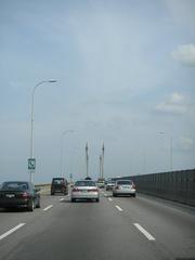
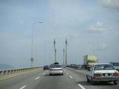
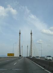
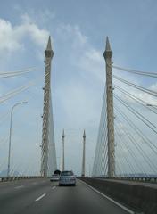
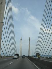
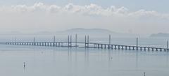
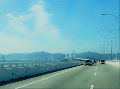
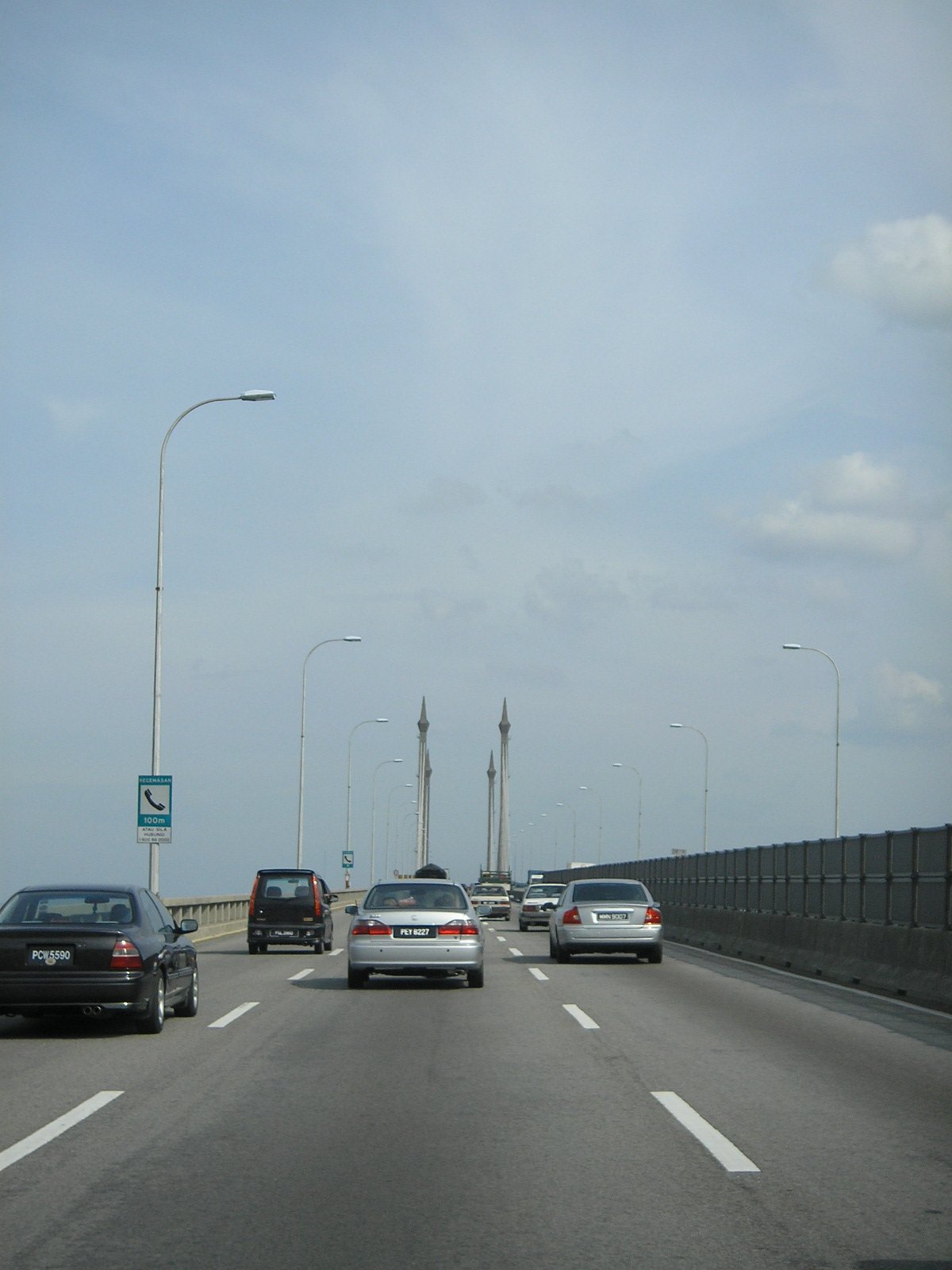
The Penang Bridge is a 13.5 km dual carriageway, cable-stayed bridge, with 8.4 km over water. The main span is 225 meters, supported by four towers rising 101.5 meters above the water. The deck is 33 meters above sea level, allowing ship passage beneath (traveladdict.com; Wikipedia). The cable-stayed midsection with its fan-like frame is instantly recognizable (thisissoutheastasia.com).
Engineering Innovations
Engineers tackled soft marine clay and seabed shells by removing topsoil and using compacted backfill. The cable-stayed design was chosen for its strength and ability to withstand seismic activity and the marine climate. Modern safety features include emergency lay-bys, SOS phones, CCTV, and variable message signs. The bridge also carries a 132kV power cable for national electricity supply (ICE; Wikipedia).
Symbolism and Cultural Value
The bridge is a powerful symbol of Penang’s progress, instantly recognizable in photos and artwork. It is the venue for the Penang Bridge International Marathon, offering a rare pedestrian experience and celebrating Penang’s multicultural spirit (malaysiavacationguide.com; heyexplorer.com).
Comparative and Urban Significance
When completed, it was the longest bridge in Southeast Asia, a title now held by the Second Penang Bridge (opened in 2014). The bridge remains vital for Penang’s daily traffic and has stimulated urban development on both sides, particularly in Bayan Lepas, Gelugor, and Butterworth (aecom.com; penang-local.com).
Visitor Information
Visiting Hours & Access
- Open: 24 hours daily for vehicles.
- Pedestrian Access: Restricted, except during special events like the Penang Bridge International Marathon.
- Cyclists: Not permitted for safety reasons.
Tickets & Toll Fees
- No tickets required for visiting or crossing.
- Toll Fees: As of 2025, RM7.00 for private cars (payable when entering the island), with rates varying by vehicle type (Malaysia Travel Guide – Penang; thrillophilia.com).
- Payment: Electronic only (Touch ‘n Go or SmartTAG).
Accessibility
- Vehicles: Cars, taxis, buses, and motorcycles permitted (with dedicated motorcycle lanes).
- People with Disabilities: Modern taxis and many buses are accessible. Viewpoints at the bridge’s approaches offer ramps and accessible toilets, but some facilities may require assistance (iWheelTravel – Penang Accessibility).
Getting There
- By Car: Via the North-South Expressway (E1) or local roads from Penang Island (Gelugor) and the mainland (Perai).
- By Bus: Rapid Penang buses (e.g., 401, 401E, 102) cross the bridge frequently (Malaysia Travel Guide – Penang).
- By Taxi/E-hailing: Widely available; travel time 15–30 minutes, longer during peak hours.
- By Train or Ferry: Arrive at Butterworth Railway Station or the ferry terminal; take a taxi or bus across the bridge.
Viewpoints & Nearby Attractions
- Penang Bridge Rest Area (Perai): Panoramic sunrise/sunset vistas.
- Queensbay Mall Seafront (Penang Island): Great for evening photos.
- Batu Uban/Gelugor Waterfronts: Accessible by car/taxi.
- Nearby: George Town UNESCO sites, Penang Hill, Kek Lok Si Temple, Batu Ferringhi Beach.
Special Events
- Penang Bridge International Marathon (PBIM): Annual event letting runners cross the bridge on foot (Penang Bridge International Marathon official site; malaysiavacationguide.com).
- ASEAN Cultural Night Run: Held on the Second Penang Bridge, combining cultural festivities with a night run (Howei).
Guided Tours
While there are no dedicated tours on the bridge for safety reasons, some sightseeing tours include the bridge as a photo stop and share its history (wtstravel.com.sg). Virtual tours and interactive maps are available online.
Cultural and Economic Impacts
Cultural Impact
The bridge is a unifying symbol for Penang’s diverse communities and features in local art and public celebrations. Major events like the marathon foster community spirit and highlight Penang’s multicultural identity (core.ac.uk).
Economic Impact
The bridge has catalyzed economic growth, supporting Penang’s high-tech industries, boosting tourism, and increasing property values. Toll revenues fund maintenance and upgrades, contributing to local development (penanginstitute.org; thrillophilia.com).
Travel Tips and Practical Advice
- Best Time to Visit: November to March for milder weather and clearer skies.
- Traffic: Avoid morning and evening peak hours; weekends are less congested.
- Weather: Sudden showers are common—carry rain gear, especially during monsoon months.
- Toll Payment: Ensure your Touch ‘n Go card has sufficient balance; cash is not accepted.
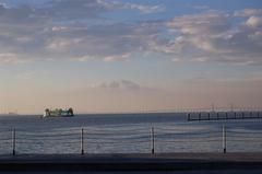
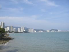
- Photography: Sunrise and sunset offer the best lighting. Top spots: Perai R&R and Queensbay Mall seafront.
- Alternative Route: The Second Penang Bridge is a less congested option during peak times.
Frequently Asked Questions (FAQ)
Q: What are the Penang Bridge visiting hours?
A: The bridge is open 24/7 for vehicles. Pedestrian access is allowed only during special events.
Q: Are tickets required to cross the Penang Bridge?
A: No tickets are required. Toll fees apply for vehicles.
Q: Can I walk or cycle across the Penang Bridge?
A: No, except during organized events like the marathon.
Q: Are guided tours available?
A: There are no tours on the bridge itself, but some sightseeing tours include it as a highlight.
Q: Best time to visit for photography?
A: Visit at sunrise or sunset from recommended viewpoints.
Visuals and Media
- Sunrise over Penang Bridge showcasing panoramic views
- Participants running across Penang Bridge during PBIM
- Second Penang Bridge lit up at night
Interactive maps and photo galleries are available at Penang Maps.
Internal and External Links
Conclusion
The Penang Bridge stands as a testament to Malaysia’s engineering prowess and Penang’s dynamic spirit. Whether you are crossing it en route to Penang’s heritage sites, participating in a marathon, or capturing its silhouette at sunset, the bridge is integral to the region’s identity. Plan your visit with awareness of tolls, traffic, and accessibility—and don’t miss the opportunity to experience Penang’s vibrant culture and scenic beauty from this iconic landmark.
For the latest updates, travel tips, and event information, download the Audiala app and follow us on social media.
Emergency Contacts
- Penang Bridge Authority: Emergency numbers are displayed along the bridge.
- Police/Ambulance: Dial 999 for urgent assistance.
References
- Penang Bridge (Wikipedia)
- Penang Bridges Infrastructure Project (ICE)
- What is Penang Known and Famous For? (HeyExplorer)
- Malaysia Events 2025 (Malaysia Vacation Guide)
- Penang’s Socio-Economic Transformation (Penang Institute)
- Places to Visit in Penang (Thrillophilia)
- Penang Tours (WTS Travel)
- Penang Travel Guide (Malaysia eBrochures)
- Penang Bridge International Marathon (Official Site)
- ASEAN Cultural Night Run 2025 (Howei)
- Time for More Penang Adventures in 2025 (The Star)
