Route d’Arlon Visiting Guide: Luxembourg City History, Tickets, Attractions, and Tips
Date: 15/06/2025
Introduction
Route d’Arlon is a historic and vibrant corridor in Luxembourg City, offering a unique blend of ancient heritage, modern urban development, and cultural diversity. Tracing its origins back to the Roman era, it has long served as a critical passageway for trade, administration, and cultural exchange, linking Luxembourg City with its western suburbs and the Belgian border. Today, Route d’Arlon stands as a dynamic urban artery, home to significant landmarks, green spaces, public services, and a multicultural community. This comprehensive guide covers the historical significance, practical visitor information, key attractions, travel tips, and nearby points of interest—making it essential reading for history enthusiasts, cultural explorers, and visitors alike. For an enriched experience, consider using local resources such as the Audiala app for guided tours and event updates (Visit Luxembourg).
Contents
- Introduction
- Historical Background of Route d’Arlon
- Early Origins and Roman Legacy
- Medieval to Modern Evolution
- Urbanization and Redevelopment
- Transportation and Connectivity
- Cultural and Social Significance
- Visiting Route d’Arlon: Practical Information
- Hours & Accessibility
- Tickets & Entry
- Travel Tips
- Nearby Attractions & Photographic Spots
- Events & Guided Tours
- Notable Landmarks Along Route d’Arlon
- Dining, Shopping, and Accommodation
- Frequently Asked Questions (FAQ)
- Summary & Visitor Recommendations
- Sources and Further Reading
Historical Background of Route d’Arlon
Early Origins and Roman Legacy
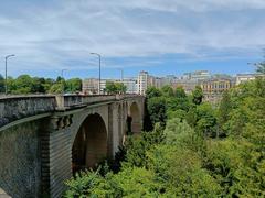
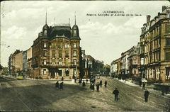
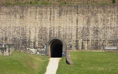
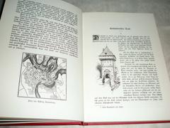
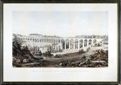
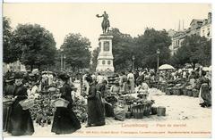
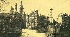
Route d’Arlon’s history stretches back to the Roman Empire, when it formed part of a critical Roman road network connecting Trier (Augusta Treverorum), Arlon (Orolaunum), and Reims. This ancient thoroughfare passed through today’s Strassen commune, with archaeological finds like the remnants of the Roman road unearthed during the 20th century (Luxtoday). The very name “Strassen” comes from the Latin “strata,” meaning paved road, underscoring the area’s historical function as a key route for commerce and administration.
Medieval to Modern Evolution
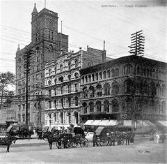
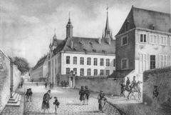
During the Middle Ages, the road continued to play a strategic role, facilitating trade and movement between Luxembourg and neighboring regions. As Luxembourg City grew into a fortified stronghold, Route d’Arlon became a main approach to the city’s western gates, with surrounding lands remaining largely rural until the 19th century.
With the expansion of Luxembourg City beyond its medieval walls, Route d’Arlon was formalized as a principal entryway from the west. The route’s alignment was adapted for increased traffic, and it became central to the city’s urban expansion (AddressHistory).
Urbanization and Redevelopment
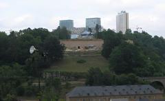
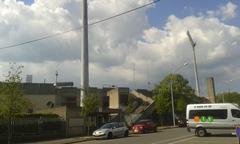
The 20th century brought rapid urbanization, especially after World War II. Route d’Arlon became a spine for residential and commercial development, with districts like Belair, Merl, and Strassen flourishing along its length. Landmark institutions such as the Josy Barthel Stadium—opened in 1931 and named after Luxembourg’s Olympic gold medalist—cemented its place in the city’s social and sports life.
Today, the area is undergoing major redevelopment, notably the transformation of the former Josy Barthel Stadium into the “Wunnquartier Stade,” a mixed-use residential and commercial district. The winning urban planning concept, “STADePARK,” features high-rise residences, parks, and community facilities, with a strong emphasis on preserving historical routes and integrating green spaces (VDL; Delano).
Transportation and Connectivity
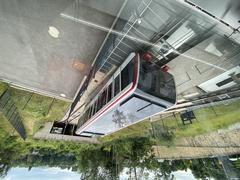
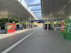
Route d’Arlon is a vital transportation axis, serving commuters, public transport, and commercial traffic. Traffic congestion and noise pollution are challenges, but the city is addressing these with sustainable mobility initiatives. By 2032, a new tram line will connect Place de l’Étoile to the Centre Hospitalier de Luxembourg (CHL), with several above-ground stops and an underground section, enhancing connectivity for residents and visitors alike (RTL Today; LuxTimes).
Cultural and Social Significance
Route d’Arlon is more than infrastructure: it is a microcosm of Luxembourg’s cosmopolitan society. The avenue runs through diverse neighborhoods, home to local families, expatriates, and newcomers drawn by the city’s economic opportunities. Public spaces, sports centers, and cultural venues along the route foster a strong sense of community (Delano).
Visiting Route d’Arlon: Practical Information
Hours & Accessibility
- Route d’Arlon is a public street, accessible 24/7. Daytime visits are recommended for safety and sightseeing.
- Sidewalks and crossings make the area pedestrian-friendly, though some slopes and older sections may require moderate mobility.
Tickets & Entry
- No tickets are required to walk or cycle along Route d’Arlon.
- Nearby attractions—such as Stade de Luxembourg or museums—may charge entry fees. Always check individual sites for current prices and opening hours.
Travel Tips
- Best time to visit: May through August for pleasant weather.
- Getting there: Multiple bus lines serve the area; the tram extension will further improve access by 2032.
- Parking: Limited on-street and public lot parking available. Using public transport is recommended.
Nearby Attractions & Photographic Spots
- Josy Barthel Stadium/Wunnquartier Stade: Observe the site’s transformation and urban skyline.
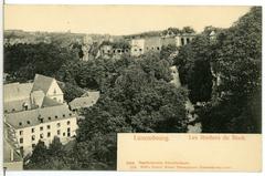
- Strassen Commune: See remnants of Roman roads and local heritage museums.
- Belair and Merl: Discover charming residential streets, local shops, and green spaces like Parc de Merl.
Events & Guided Tours
- Seasonal markets, sports events at Stade de Luxembourg, and occasional historical walks are organized along or near Route d’Arlon. Check with Visit Luxembourg or Luxembourg City Tourist Office for up-to-date listings.
Notable Landmarks Along Route d’Arlon
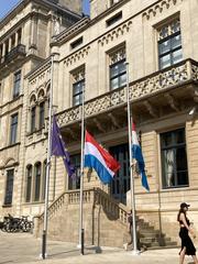
Place de l’Étoile
A major transport hub at the eastern gateway of Route d’Arlon, Place de l’Étoile is an ideal starting point for exploration. The square is undergoing redevelopment, including a future tram extension (Virgule).
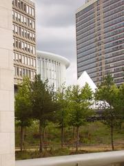
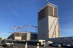
Stade de Luxembourg & Wunnquartier Stade
Luxembourg’s main sports venue, Stade de Luxembourg, hosts national and international events. Adjacent Wunnquartier Stade is a new residential and commercial district.
- Events: Check official website for schedules and ticketing.
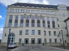
Centre Hospitalier de Luxembourg (CHL)
The city’s main hospital on Route d’Arlon, incorporating modern architecture and ongoing expansion.
- Visiting hours: Typically 14:00–20:00; confirm with CHL.
Parks and Green Spaces
- Parc de Merl: Accessible daily 6:00–22:00, offering lakes, playgrounds, and walking paths.
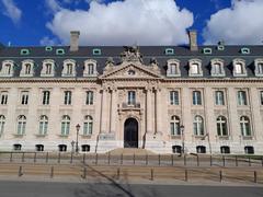
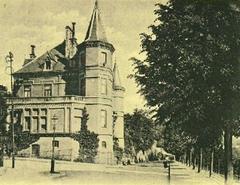
Architectural Highlights
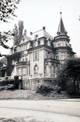
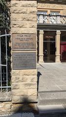
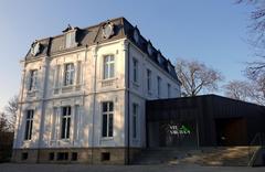
A blend of early 20th-century villas, embassies, post-war apartments, and contemporary office buildings gives Route d’Arlon its unique character.
Dining, Shopping, and Accommodation
Restaurants & Cafés
- TWO6TWO (262 Route d’Arlon): Modern European cuisine, stylish setting (Nox Agency).
- Numerous bakeries, casual cafés, and international restaurants line the avenue.
Shopping
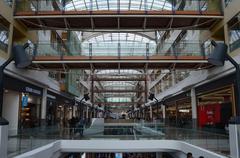
- Supermarkets: Cactus, Delhaize, and other grocery stores.
- Local products: Ligue HMC cooperative sells local produce and artisanal goods (Visit Luxembourg).
- Pharmacies and convenience stores are frequent and open late.
Accommodation
While Route d’Arlon is largely residential, several hotels and guesthouses are nearby. Advance booking is advised during events or holidays.
Frequently Asked Questions (FAQ)
Q: Is Route d’Arlon accessible year-round?
A: Yes, it is a public road open 24/7.
Q: Are there guided tours?
A: Local tour companies and tourism offices occasionally offer thematic walks covering parts of Route d’Arlon.
Q: How can I reach Route d’Arlon via public transport?
A: Multiple bus lines currently serve the route; a tram extension is planned by 2032.
Q: Is the area safe?
A: Luxembourg is very safe; standard precautions apply (Ireland.ie).
Q: Are facilities accessible for people with disabilities?
A: Most public areas and transport are accessible, though some older sections may have uneven surfaces.
Summary & Visitor Recommendations
Route d’Arlon is a living testament to Luxembourg City’s evolution—from Roman times to modern urban redevelopment. Major projects like the Wunnquartier Stade and the upcoming tram line reflect Luxembourg’s commitment to sustainable mobility and vibrant community life (VDL; LuxTimes). With excellent public transport, welcoming neighborhoods, and a wide range of dining and shopping options, Route d’Arlon is an ideal starting point for discovering Luxembourg’s heritage and contemporary culture. Enhance your visit with digital resources such as the Audiala app and official tourism platforms for guided tours, real-time event info, and personalized itineraries (Luxembourg City Tourist Office).
Sources and Further Reading
- Exploring Route d’Arlon: History, Urban Development, and Visitor Guide in Luxembourg (Luxtoday)
- Urban redevelopment and future projects of Route d’Arlon (VDL)
- Stadepark Urban Planning Competition Winners (VDL)
- Tram Extension Plans and Transport Developments (RTL Today)
- Tram and Train Works Planned for 2025 (LuxTimes)
- Discovering Route d’Arlon: A Cultural and Historical Gateway in Luxembourg City (Visit Luxembourg)
- Exploring Route d’Arlon: Visitor Information, Key Attractions, and Historical Sites (Luxembourg City Tourist Office)
- Your Complete Guide to Visiting Route d’Arlon (Visit Luxembourg)
- Virgule - Tram Extensions
- Nox Agency - Best Restaurants Luxembourg
- Ireland.ie - Travel Advice Luxembourg
- AddressHistory - 245 Route d’Arlon