Montopolis Bridge Visiting Hours, Tickets, and Travel Guide: Austin Historical Sites
Date: 15/06/2025
Introduction: The Montopolis Bridge – History and Cultural Significance
The Montopolis Bridge, spanning the Colorado River in Austin, Texas, stands as a monument to the city’s dynamic history, engineering prowess, and resilient community spirit. Built in 1938 following devastating floods that claimed earlier crossings, the bridge provided a vital link between the Montopolis neighborhood and central Austin. Its distinctive Parker through truss design, fabricated by the Pittsburgh-Des Moines Steel Company, not only represents early 20th-century engineering innovation but also serves as a symbol of integration and progress within East Austin.
Today, the Montopolis Bridge is celebrated for its architectural merit and as a cultural landmark that reflects the city’s commitment to historic preservation and sustainable urban development. Since its transformation in 2018 into a dedicated pedestrian and bicycle path, the bridge has become a beloved gathering place for residents and visitors alike—offering panoramic river and skyline views, access to green spaces, and a direct connection to local trails and neighborhoods.
For a deeper dive into its history and significance, visit the Texas Historical Commission (Texas Historical Commission), HistoricBridges.org (HistoricBridges.org), and the Austin History Center (Austin History Center).
Table of Contents
- Introduction
- Historical Overview
- Visiting the Montopolis Bridge
- Notable Events and Transformations
- Frequently Asked Questions (FAQ)
- Conclusion
- References
Historical Overview
Origins and Construction
The current Montopolis Bridge was completed in 1938, replacing earlier wooden and iron bridges repeatedly destroyed by floods, most notably the catastrophic 1935 flood (Texas Historical Commission). Strategically located, it connected the predominantly working-class and minority Montopolis neighborhood with the heart of Austin, transforming regional mobility by providing reliable access for commerce, education, and emergency services.
Architectural Significance
As a Parker through truss bridge, the Montopolis Bridge showcases a polygonal top chord—an efficient design that allowed for longer spans and reduced material use. Measuring approximately 1,221 feet and consisting of five main steel truss spans, the bridge was engineered with advanced riveted connections and reinforced concrete piers (HistoricBridges.org). Its historic engineering has earned it a place on the National Register of Historic Places (National Park Service).
Role in the Community
For decades, the bridge was a lifeline for East Austin, providing critical access to jobs, schools, and services, and helping to integrate the historically segregated Montopolis neighborhood with the wider city (Austin History Center). Beyond transportation, it became a venue for community events and a symbol of resilience, particularly during periods of flooding when other crossings were impassable.
Visiting the Montopolis Bridge
Visiting Hours and Access
- Hours: Open daily from dawn to dusk.
- Admission: Free; no tickets required.
- Access: Exclusively for pedestrians and cyclists since 2018.
Accessibility
- Pathways: Smooth, level surfaces suitable for wheelchairs and strollers.
- Parking: Available along Montopolis Drive.
- Transit: Served by several Capital Metro bus routes.
- Cycling: Direct connections to the Ann and Roy Butler Hike-and-Bike Trail and Southern Walnut Creek Trail.
Travel Tips
- Visit during daylight for the best views and safety.
- Bring a camera to capture the bridge’s steel structure and river scenery.
- Wear comfortable shoes for walking or cycling.
- Check the weather, as the site is outdoors with limited shelter.
Nearby Attractions
- Montopolis Park: Adjacent green space with picnic areas.
- East Austin Murals: Vibrant street art in surrounding neighborhoods.
- Lady Bird Lake: Trails and water activities just west of the bridge.
- Historic Cemeteries: Burditt Prairie and San Jose Cemeteries highlight the area’s deep roots.
Notable Events and Transformations
Floods and Natural Disasters
The bridge’s elevated design was a direct response to the destruction caused by the 1935 flood (Austin American-Statesman). It has since withstood numerous flood events, reinforcing its status as a resilient piece of infrastructure.
Transition to Pedestrian and Bicycle Use
With the construction of a new vehicular bridge in 2018, the original Montopolis Bridge was repurposed for non-motorized use (TxDOT Project Page). This adaptive reuse preserved its historic character while supporting Austin’s sustainable transportation goals.
Preservation and Community Advocacy
Local advocacy groups, historians, and residents collaborated with city and state agencies to save the bridge from demolition (Preservation Austin). Interpretive signage and periodic public art installations now enhance the visitor experience.
Recognition and Legacy
The bridge’s listing as a City of Austin Historic Landmark and on the National Register of Historic Places cements its legacy as an emblem of urban development, transportation equity, and historic preservation (City of Austin Historic Landmarks).
Frequently Asked Questions (FAQ)
Q: What are the Montopolis Bridge visiting hours?
A: The bridge is open daily from dawn to dusk.
Q: Do I need a ticket to visit?
A: No, it is free and open to the public.
Q: Is the bridge wheelchair accessible?
A: Yes, it features smooth, accessible pathways.
Q: Can I bike across the bridge?
A: Yes, the bridge is a popular route for cyclists and is part of the city’s trail network.
Q: Is there parking nearby?
A: Street parking is available along Montopolis Drive.
Q: Are pets allowed?
A: Yes, but please keep them leashed and clean up after them.
Q: Are restrooms or food vendors available?
A: No, but nearby neighborhoods offer dining and restroom facilities.
Q: Are guided tours available?
A: Occasional historic tours are offered by local groups; check listings for details.
Travel Guide: Getting There and Making the Most of Your Visit
By Car
The bridge is located at 616 1/2 Ed Bluestein Blvd, Austin, TX 78702. Free street parking is available nearby (Evendo).
By Public Transportation
Capital Metro bus routes serve the area; route 20 from downtown stops at Ed Bluestein Blvd/Carolina St, a short walk from the bridge (Capital Metro).
By Bicycle or On Foot
Austin’s bike-friendly streets and connected trails make cycling or walking to the bridge convenient and scenic (Evendo).
Amenities, Accessibility, and Visitor Tips
- Accessibility: Ramps and wide paths make the bridge accessible for all visitors (Evendo).
- Restrooms/Food: Not available on the bridge; visit nearby neighborhoods for amenities.
- Best Times: Spring and fall offer the best weather (Travellers Worldwide).
- Safety: The well-lit area is generally safe; exercise caution during late hours and be mindful of other users.
- Photography: Sunrise and sunset provide optimal lighting for photographs.
Cultural and Community Context
The bridge is a key part of the El Camino Real de los Tejas National Historic Trail and reflects the resilience of the Montopolis neighborhood, historically home to African American, Mexican American, and working-class Anglo communities (Wikipedia; Living New Deal; Travis County Historical Blog). Nearby cemeteries and cultural attractions further highlight the area’s deep historical roots.
Plans for up to $7 million in improvements—including seating, lighting, and educational signage—are underway to enhance the bridge while honoring community heritage (Austin Monitor; Fox 7 Austin). Community input is central to ensuring these enhancements respect the neighborhood’s needs and history.
Visuals and Interactive Media
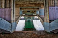
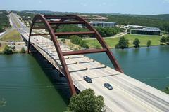
- Photos: Include images of the bridge’s truss design, river views, and community gatherings (Alt text: “Montopolis Bridge panoramic view at sunset, Austin, Texas”).
- Interactive Maps: Highlight routes, parking, and nearby attractions.
- Virtual Tours: Explore 360-degree views through local tourism websites.
Summary & Call to Action
The Montopolis Bridge exemplifies Austin’s commitment to historic preservation, community engagement, and accessible urban spaces. Its transformation into a scenic pedestrian and cycling corridor creates opportunities for recreation, reflection, and cultural discovery. With free daily access, direct links to trails, and a rich history, it is a must-visit for anyone exploring Austin’s heritage.
Enhance your visit by downloading the Audiala app for guided tours and real-time updates. Stay connected through our social media channels and explore more of Austin’s historic sites.
For further research, visit the National Park Service, Preservation Austin, and the City of Austin Historic Landmarks pages.
References
- Montopolis Bridge Austin: Visiting Hours, History, and Things to Know, 2024, Texas Historical Commission (Texas Historical Commission)
- Montopolis Bridge Austin: Visiting Hours, Historical Significance & Visitor Guide, 2024, HistoricBridges.org (HistoricBridges.org)
- Montopolis Bridge: Visiting Hours, History, and Cultural Significance in Austin, 2024, Austin History Center (Austin History Center)
- Austin 1935 Flood, 2015, Austin American-Statesman (Austin American-Statesman)
- Montopolis Bridge Project, 2018, TxDOT Project Page (TxDOT Project Page)
- Montopolis Bridge Preservation Efforts, 2018, Preservation Austin (Preservation Austin)
- National Register of Historic Places, Montopolis Bridge, 1996, National Park Service (National Park Service)
- City of Austin Historic Landmarks, 2024, City of Austin (City of Austin Historic Landmarks)
- Living New Deal (Living New Deal)
- Travis County Historical Blog (Travis County Historical Blog)
- Community Impact (Community Impact)
- Austin Monitor (Austin Monitor)
- Fox 7 Austin (Fox 7 Austin)
- Wikipedia (Wikipedia)
- Evendo (Evendo)
- Capital Metro (Capital Metro)
- Travellers Worldwide (Travellers Worldwide)
- Destguides (Destguides)
- Tourist Secrets (Tourist Secrets)
- Do512 (Do512)
