Staumauer Lago di Lei: Visiting Hours, Tickets, and Historical Sites in Canton of the Grisons, Switzerland
Date: 04/07/2025
Introduction
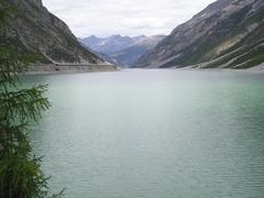
Nestled high in the Swiss Alps within the Canton of Graubünden, the Staumauer Lago di Lei and its reservoir present a unique blend of natural beauty, historical depth, and engineering mastery. The site is defined by its striking concrete arch dam—standing 138 meters tall and constructed between 1957 and 1961—and by its rare cross-border configuration: while the dam itself is on Swiss territory, the majority of the adjoining reservoir lies within Italy. This arrangement, forged through mid-20th-century land exchanges and diplomatic collaboration, stands as a testament to peaceful European cooperation during the Cold War (alpenpaesse-wasserscheiden.at; webuildvalue.com; trek.zone).
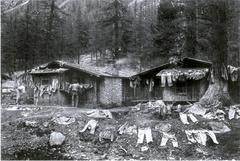
Beyond its technical significance, Lago di Lei offers insights into a rich alpine cultural history. The valley, long inhabited by herding communities, was profoundly transformed by the dam’s creation, which submerged ancestral homes and alpine pastures. Today, the site invites visitors to reflect on themes of environmental change, displacement, and the resilience of memory, especially when receding water levels reveal the remnants of submerged villages (SRF.ch).
This guide provides essential information on visiting hours, ticketing, accessibility, travel tips, and nearby attractions, along with detailed historical and cultural context. Whether your interests lie in hydroelectric engineering, Alpine heritage, or outdoor adventure, Lago di Lei promises a memorable and meaningful experience.
Table of Contents
- Lago di Lei: History, Access, and Visitor Information
- Planning Your Visit
- Technical and Environmental Insights
- Practical FAQs
- Summary and Next Steps
Lago di Lei: History, Access, and Visitor Information
Medieval and Early Modern Valley Use
The Valle di Lei, the site of the Staumauer Lago di Lei, has been utilized since the Middle Ages for seasonal alpine grazing. Historically, herders accessed the valley from Italy’s Bergell region, using high mountain passes for transhumance. In 1462, Valle di Lei became part of the Bergeller Gemeinde Piuro, integrating it administratively with Italy. For centuries, the region remained remote, shaped by traditional alpine economies (alpenpaesse-wasserscheiden.at).
Border Changes and Napoleonic Era
In 1797, the Cisalpine Republic realigned regional borders, assigning Valle di Lei and Piuro to Italy. The Alpine crest became a defining boundary, later critical to mid-20th-century international agreements (alpenpaesse-wasserscheiden.at).
Hydrology and Geopolitical Geography
Valle di Lei, situated above 1,900 meters in the Alpi del Platta, is unique hydrologically: its river, Reno di Lei, is the only Italian river draining northward to the Rhine and the North Sea (trek.zone). While most of the valley and reservoir lie in Italy, the dam and tunnel access are in Switzerland’s canton of Graubünden, stemming from a mid-20th-century land exchange (schweizersee.ch).
Construction and Cross-Border Agreements
Between 1957 and 1961, Swiss and Italian authorities collaborated to build the Staumauer Lago di Lei, a 141-meter-tall arch dam with a crest length of 690 meters. A 1955 land exchange ceded the dam site to Switzerland in exchange for an equal area elsewhere, allowing Swiss jurisdiction over the dam while the reservoir remained primarily Italian. Bilateral treaties in the 1960s formalized this arrangement (webuildvalue.com; trek.zone).
Planning Your Visit
Access Routes and Tunnel Hours
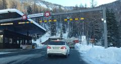
Access: Lago di Lei is accessible exclusively from Switzerland. The journey starts from Innerferrera, Graubünden, following a mountain road and a 950-meter tunnel (Scheiteltunnel) beneath Passo del Scengio (Alpenrouten.de).
Tunnel Hours: The tunnel operates seasonally from May 1 to November 30, daily from 05:00 to 22:00. Traffic is regulated by signals. The road is paved but steep; caution is advised, especially during adverse weather (Komoot).
Parking: A designated parking area awaits visitors beyond the tunnel, with public toilets nearby. Overnight parking is permitted for campervans, but the ground may be soft after rain (Wohnmobilland Schweiz; Viamala Tourism).
Public Transport: The nearest bus stop is in Innerferrera; from there, visitors can hike or arrange a taxi to the tunnel portal. The area is not wheelchair accessible due to the terrain.
Tickets, Tours, and Visitor Facilities
- KHR Inforama (Visitor Center): Open daily, May 15–October 31, 09:00–20:00. Exhibits cover hydroelectric power, engineering, and environmental impact (Unterwegs SOB).
- Guided Tours: Free tours by Kraftwerke Hinterrhein AG (KHR) take place in July and August, usually on Tuesday afternoons. Advance registration is required by 16:00 the previous day (Unterwegs SOB; Naturpark Beverin).
- Fees: There is no entrance fee for the dam area or visitor center. Guided tours are free but must be booked in advance.
Best Time to Visit and Travel Tips
- Season: The best period is late June to early October when the tunnel is open and hiking conditions are optimal.
- Clothing: Wear sturdy hiking boots and layered clothing; weather can change rapidly at high elevations.
- Food: Bring water and snacks; the only restaurant nearby is on the Italian side of the dam.
- Accommodation: Limited lodging is available in nearby villages; wild camping is not allowed.
Activities and Highlights
- Guided Dam Tours: Learn about dam construction, hydroelectric operations, and regional history.
- Hiking: Trails range from gentle walks across the dam to rigorous alpine circuits. Notable routes include the hike to Rifugio Bertacchi and the Valle di Lei circuit (Komoot; Viamala Maps).
- Cycling and Motorcycling: The access road is popular, but cycling/motorbiking is not permitted beyond the dam parking area (Alpenrouten.de).
- Photography: Panoramic dam and lake views, alpine flora and fauna, and—during periodic maintenance—exposed ruins of submerged huts.
Technical and Environmental Insights
Dam Specifications and Hydroelectric Role
- Type: Concrete arch dam
- Height: 138 meters
- Crest Length: 690 meters
- Base Width: 28.1 meters
- Crest Width: 15 meters (exceeding structural needs for Cold War military security)
- Concrete Volume: 840,000 m³
- Reservoir Capacity: 197 million m³
- Reservoir Length: 8 km
- Surface Elevation: 1,931 m a.s.l.
- Operator: Kraftwerke Hinterrhein AG (KHR)
The dam supports Swiss hydroelectric power generation, with water fed through tunnels and penstocks to turbines, and is monitored by real-time sensors for safety and efficiency (webuildvalue.com).
Environmental and Social Impact
The reservoir transformed a remote alpine valley into a fjord-like lake, submerging 15 traditional pastures and displacing local herding communities (SRF.ch). The change affected local ecosystems, disrupted wildlife habitats, and altered the microclimate. Beverin Nature Park promotes sustainable tourism and conservation (Naturpark Beverin).
Responsible Tourism and Safety
- Trails: Stay on marked paths; off-trail travel can damage sensitive alpine habitats.
- Waste: Carry out all litter; open fires are prohibited.
- Swimming/Boating: Not permitted, for safety and water quality reasons.
- Weather: Rapid changes are common—always check forecasts and be prepared.
- Emergency: Nearest services are in Innerferrera; mobile coverage is limited.
Practical FAQs
Q: What are Staumauer Lago di Lei’s visiting hours?
A: The access tunnel is open from May 1 to November 30, 05:00–22:00. The KHR Inforama is open May 15–October 31, 09:00–20:00.
Q: Are guided tours available?
A: Yes, free tours are offered in summer (July–August, usually Tuesdays), with advance booking required.
Q: Do I need tickets?
A: No tickets are required for entry or tours, but guided tours must be booked in advance.
Q: Is the dam wheelchair accessible?
A: No; steep terrain and infrastructure limit accessibility.
Q: Can I cycle or drive a motorbike beyond the dam?
A: No, cycling and motorbikes are allowed on the access road up to the parking area only.
Summary and Next Steps
The Staumauer Lago di Lei and its reservoir represent a remarkable convergence of Swiss-Italian cooperation, innovative engineering, and Alpine heritage. The dam’s construction not only addressed strategic and energy needs but also irrevocably altered the landscape and local ways of life. Today, the site invites thoughtful exploration—whether you’re hiking, joining a guided tour, or learning at the KHR Inforama.
Key points:
- Seasonal access from May to November via Innerferrera and the Scheiteltunnel.
- No entrance fees; free guided tours available with advance booking.
- Activities include hiking, educational visits, and panoramic photography.
- Respect environmental guidelines and prepare for alpine conditions.
For up-to-date information, tour bookings, and maps, consult the Kraftwerke Hinterrhein website, Unterwegs SOB, and myswitzerland.com.
Stay connected! Download the Audiala app for guided tours, interactive maps, and real-time updates. Follow us on social media for exclusive stories and travel inspiration.
References
- Discover Lago di Lei: History, Access, and Visitor Information, 2025, Alpenpaesse Wasserscheiden (alpenpaesse-wasserscheiden.at)
- A Blue Tongue in the Alps, 2025, Webuildvalue (webuildvalue.com)
- Lago di Lei, Italy, Trek.Zone (trek.zone)
- Lago di Lei Dam Scenic View, Schweizersee.ch (schweizersee.ch)
- Visiting Staumauer Lago di Lei, 2025, Kraftwerke Hinterrhein and Swiss Tourism Portals (khr.ch, myswitzerland.com)
- Lago di Lei: Historic Displacement and Environmental Impact, 2025, SRF.ch (SRF.ch)
- Alpenrouten.de: Lago di Lei Access and Hiking (Alpenrouten.de)
- Unterwegs SOB: KHR Inforama Visitor Center Information (Unterwegs SOB)
- Naturpark Beverin: Sustainable Tourism at Valle di Lei (Naturpark Beverin)
- Wohnmobilland Schweiz: Campervan Access Lago di Lei (Wohnmobilland Schweiz)
- Viamala Tourism: Parking and Facilities at Lago di Lei (Viamala Tourism)
Images and Maps:
- Use high-quality photos of Lago di Lei dam, reservoir, hiking trails, and the visitor center with descriptive alt tags.
- Provide an access map from Innerferrera and highlight hiking routes.
Internal Links:
- Articles on other Graubünden historical sites
- Guides to hiking in the Swiss Alps
- Information on sustainable mountain tourism
