Lago di Lei Visiting Hours, Tickets, and Travel Guide – Canton of the Grisons, Switzerland
Date: 14/06/2025
Introduction
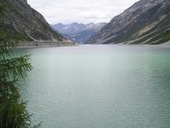
Nestled deep in the Lepontine Alps, Lago di Lei is a spectacular alpine reservoir that perfectly embodies the intersection of natural beauty, engineering prowess, and international cooperation. Straddling the border between Switzerland and Italy, with the dam itself operated from the Swiss canton of Grisons (Graubünden) and the lake stretching into Italy’s Lombardy region, Lago di Lei is a unique destination for hikers, nature lovers, and those fascinated by hydroengineering and cross-border history (Wikipedia: Val di Lei; Webuild Group).
This comprehensive guide details Lago di Lei’s historical context, visiting hours, ticketing and access policies, travel tips, nearby attractions, and practical advice to help you plan a memorable visit to this extraordinary alpine site.
Historical and Geopolitical Significance
A Unique Borderland
Lago di Lei is a rare geographical and political anomaly: though its waters lie almost entirely within Italian territory (Piuro, Lombardy), the dam that controls the reservoir is on Swiss soil (Ferrera, Grisons). This arrangement resulted from a 1955 land swap agreement, allowing Switzerland to harness the hydropower potential of the Valle di Lei in exchange for an equivalent land area ceded to Italy (Wikipedia: Val di Lei).
Engineering Marvel
Built between 1957 and 1962, the Val di Lei Dam was, at completion, the world’s longest double-curvature arch dam, spanning 690 meters and standing 141–173 meters high depending on the source (Webuild Group; CSGSRL). The reservoir holds up to 197 million cubic meters of water and is the only Italian valley whose waters drain north into the Rhine and ultimately the North Sea (Spoony’s Bike Blog).
Social and Environmental Impact
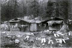
The creation of the lake submerged 15 alpine pastures and profoundly affected the local community, ending centuries-old agricultural traditions (SRF: 50 Jahre unter Wasser). Today, when water levels are low, remnants of these pastures resurface, offering a glimpse into the valley’s past.
Visiting Lago di Lei: Essential Information
How to Get There
Primary Access:
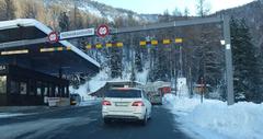
- From Switzerland: Reachable by car via the Val Ferrera road through Innerferrera. The road includes several tunnels and is restricted at night (closed 22:00–05:00). In winter, occasional closures may occur due to snow or hazardous conditions (Dangerous Roads).
- By Public Transport: Limited bus service runs to Innerferrera; from there, visitors must hike or cycle to the lake (Naturpark Beverin).
From Italy:
- On Foot or Bike: No direct road access; mountain passes connect the Italian side to the lake (Webuild Value).
Visiting Hours
- Lake and Dam Area: Open year-round, daylight hours preferred.
- Access Road: Open daily from 05:00 to 22:00 (subject to weather and maintenance).
Tickets and Entry
- No Entrance Fee: There are no tickets or fees to visit Lago di Lei or the dam area.
- Guided Tours: Rare, but may be available during special events or by arrangement with Kraftwerke Hinterrhein AG or local tourism offices.
Facilities
- Amenities: Minimal. Public toilets may be found near the dam or at mountain refuges; there are no shops or restaurants at the lake.
- Parking: Available at the dam crest, but limited, especially on weekends.
- Visitor Center: Offers interpretive panels and exhibits about the dam’s construction and environmental aspects (Webuild Value).
Accessibility
- Terrain: Remote, mountainous, and rugged. Not suitable for wheelchairs or visitors with limited mobility.
- Recommended Gear: Sturdy hiking boots, layered clothing for alpine weather, and supplies (food, water, maps).
What to Do at Lago di Lei
Hiking and Mountain Activities
- Hiking Trails: Multiple routes for various skill levels, such as the Lago di Lei – Refugio Baita Del Capriolo loop and the Juferrhein circuit (Komoot).
- Mountain Biking: Technical trails available for experienced riders.
- Wildlife Watching: Alpine marmots, ibex, and diverse birdlife.
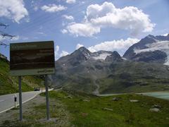
- Photography: The dam, turquoise lake, and surrounding peaks offer incredible vistas.
Swimming and Nature Observation
- Swimming: Possible, but water temperatures remain cold even in summer.
- Nature Photography: Best light in early morning or late afternoon.
Cultural Excursions
- Cross-Border Experience: Freely cross between Switzerland and Italy on foot or bike (both are in the Schengen Area; carry valid ID).
- Local Cuisine: Try regional dishes and cheeses at nearby villages or Italian mountain refuges (Claudia Travels).
Engineering Features and Sustainability
- Hydroelectric Power: Lago di Lei supplies the Kraftwerke Hinterrhein system, generating over 1.3 billion kWh annually (Webuild Group).
- Solar Integration: The dam wall now hosts a solar power plant with over 1,000 panels, producing enough energy for 160 households (Swissinfo).
- Environmental Monitoring: Advanced geotechnical systems ensure the dam’s safety and environmental integration (CSGSRL).
Weather and Best Time to Visit
- Best Season: Late June to early October when trails are snow-free and weather is stable.
- Climate: Alpine—cool summers (10–20°C), cold winters, rapid weather changes.
- Winter: Access may be restricted; only experienced mountaineers should attempt visits.
Safety and Responsible Tourism
- Preparation: Inform someone of your plans, bring maps/GPS, and be self-sufficient.
- Leave No Trace: Carry out all waste, stay on marked trails, and respect wildlife and livestock.
- Sustainability: Support local businesses, minimize waste, and respect local customs.
Nearby Attractions
- Pizzo Stella: Popular hiking destination.
- Roflaschlucht Gorge: Notable natural site for walking and photography.
- Parc Ela & Tectonic Arena Sardona: Explore geological and cultural heritage (Claudia Travels).
Frequently Asked Questions (FAQ)
Q: What are the visiting hours for Lago di Lei?
A: The site is accessible year-round, but the road is open 05:00–22:00 and may close in winter.
Q: Is there an entrance fee or ticket required?
A: No, entry to the lake and dam area is free.
Q: Are guided tours available?
A: Rare but possible by prior arrangement with local authorities.
Q: Is public transport available?
A: Limited bus service to Innerferrera; final access by hike or private vehicle.
Q: Are there facilities at the lake?
A: Facilities are minimal—bring supplies and be prepared for remote conditions.
Key Facts – Summary Table
| Feature | Description |
|---|---|
| Location | Val Ferrera, Grisons, Switzerland (near Italian border) |
| Elevation | ~1,931 m |
| Lake Surface Area | ~4.12 km² |
| Max Depth | ~133 m |
| Dam Height | 141–173 m |
| Dam Length | 690 m |
| Volume | 197 million m³ |
| Main Inflow | Reno di Lei |
| Outflow | Hinterrhein (Rhine basin) |
| Access | Year-round, but road may close in winter; hiking/biking from Innerferrera |
| Facilities | Limited (basic toilets, parking, visitor center) |
| Best Season | Late June–early October |
| Activities | Hiking, mountain biking, swimming, wildlife photography |
| Languages | German, Romansh, Italian |
| Currency | Swiss franc (CHF), euro (Italy) |
Visual Media Suggestions
- Map of Lago di Lei indicating the Swiss dam and Italian valley location (alt text: “Map of Lago di Lei showing cross-border location”).
- Photos of the dam with solar panels and turquoise reservoir (alt text: “Lago di Lei dam and reservoir from Swiss side”).
- Images of hiking trails and submerged alpine pastures at low water (alt text: “Alpine pastures revealed by low water at Lago di Lei”).
Visitor Recommendations
Lago di Lei is a compelling destination for those seeking alpine adventure, engineering history, and serene natural landscapes. Prepare for minimal amenities, unpredictable weather, and remote conditions. Respect the environmental and cultural heritage of this rare cross-border site and consider supporting sustainable tourism initiatives.
For the latest updates and audio guides, download the Audiala app, and follow local tourism channels for news on guided tours and seasonal events.
References and Further Reading
- Wikipedia: Val di Lei
- Webuild Group
- Webuild Value
- SRF: 50 Jahre unter Wasser
- Laghettialpini
- Naturpark Beverin
- Swissinfo
- Dangerous Roads
- Komoot
- Claudia Travels
- CSGSRL
- Travalour
- Spoony’s Bike Blog
