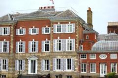
Principal Triangulation of Great Britain: Richmond, United Kingdom – Visiting Hours, Tickets & Travel Guide
Date: 03/07/2025
Introduction
The Principal Triangulation of Great Britain is a defining achievement in the history of cartography and geodesy. Launched in the late 18th century, this major survey provided the scientific foundation for Britain’s national mapping, supporting military, administrative, and scientific needs. Richmond, United Kingdom, played a pivotal role in this network, serving as both a strategic triangulation point and the administrative center for the Board of Ordnance. Today, Richmond’s triangulation sites are freely accessible, offering visitors a tangible connection to a landmark scientific enterprise that shaped modern mapping.
This comprehensive guide details the origins, achievements, and enduring legacy of the Principal Triangulation, with a practical focus on visiting Richmond’s historic triangulation sites. Whether you are an enthusiast of geography, history, or outdoor exploration, this resource provides essential information on visiting hours, tickets, accessibility, guided tours, nearby attractions, and tips for making the most of your visit (Ordnance Survey, Nature, 1914, Wikipedia).
Table of Contents
- Early Origins and Motivations
- The Principal Triangulation: Scope and Execution
- Scientific and Technical Achievements
- Richmond’s Role in the Triangulation
- Instruments and Methodologies
- Visiting Richmond Triangulation Stations
- Impact on Cartography and Science
- Re-examination and Legacy
- Preservation and Public Engagement
- Frequently Asked Questions (FAQs)
- Conclusion
- References and Further Reading
Early Origins and Motivations
The late 18th century saw Britain facing a pressing need for accurate national maps. The aftermath of the Jacobite uprisings and ongoing military tensions highlighted the necessity of reliable geographic data for defense and administration. In 1783, the British government commissioned the Principal Triangulation to address these needs, marking the start of systematic scientific mapping in the nation (archive.org). The newly established Ordnance Survey, under the Board of Ordnance, became the driving force behind this ambitious project.
The Principal Triangulation: Scope and Execution
Between 1783 and 1851, surveyors measured and mapped a network of 552 triangles across Great Britain and Ireland. Strategic stations were chosen for their elevation and visibility, often situated on hilltops or specially constructed towers. These triangles formed a geometric framework that enabled the accurate charting of the entire country (Nature, 1914).
Key figures such as General William Roy, Captain Alexander Ross Clarke, and Lt. Colonel Henry James led the project, employing advanced instruments and innovative techniques. The Anglo-French Survey (1784–1790) initiated by Roy was particularly significant, linking the Greenwich and Paris Observatories and laying the groundwork for international geodetic collaboration.
Scientific and Technical Achievements
The Principal Triangulation was not only a feat of cartography but also a pioneering scientific investigation into the Earth’s shape and size. Surveyors performed meticulous baseline measurements—such as those at Salisbury Plain and Hounslow Heath near Richmond—using rods and chains with exceptional precision. Astronomical observations were integrated to determine latitudes and longitudes, enhancing the accuracy of the network (archive.org).
The Ramsden theodolite, a groundbreaking instrument, allowed for measurements with accuracy previously unattainable. The entire network ultimately enabled the calculation of the spheroidal figure of Britain and Ireland, advancing both national mapping and global geodesy (Nature, 1914).
Richmond’s Role in the Triangulation
Richmond served as both a crucial triangulation station and the administrative hub for the Board of Ordnance. Its elevated terrain and clear sightlines made it ideal for precise angle measurements and baseline observations. The nearby Hounslow Heath baseline, stretching over 8,350 meters, served as the foundational measurement for much of the survey (Ordnance Survey). Richmond’s historic connection is further cemented by figures like Charles Lennox, 3rd Duke of Richmond, who championed the project’s scientific and strategic goals (Wikipedia).
Instruments and Methodologies
The survey’s success depended on the precision of its instruments and methodologies. The Ramsden theodolite, crafted in 1791 by Jesse Ramsden, enabled angle measurements down to a single second of arc (Science Museum Group). Surveyors carefully compensated for environmental effects on measuring rods and chains, and astronomical observations anchored the network’s positions. The work established rigorous standards that influenced surveying around the world (Ordnance Survey).
Visiting Richmond Triangulation Stations
Hours, Tickets, & Accessibility
- Visiting Hours: Richmond’s triangulation sites are outdoors and open year-round during daylight hours, typically from 8:00 AM to sunset.
- Tickets & Admission: There is no admission fee; all triangulation points and markers are freely accessible.
- Accessibility: Many sites are reachable via well-maintained paths, though some trig points may require walking over uneven terrain. Richmond Park and other local attractions offer facilities for visitors with disabilities (Visit Richmond).
Travel Tips & Guided Tours
- Getting There: Richmond is accessible by train (20 minutes from London Waterloo), Underground (District Line), and bus.
- Guided Tours: Local heritage groups and the Ordnance Survey occasionally offer guided walks focused on the triangulation and Richmond’s history. Check event listings or the Ordnance Survey website for schedules.
Photographic Opportunities & Special Events
- Photo Spots: Trig pillars on Richmond Hill and in Richmond Park offer panoramic views of the Thames Valley and London skyline.
- Events: Heritage organizations sometimes organize talks, exhibitions, and family activities highlighting the triangulation’s history.
Impact on Cartography and Science
The Principal Triangulation provided the geometric framework for all subsequent mapping in Britain and Ireland. Its legacy includes the Ordnance Survey’s millions of maps and the influence on mapping projects worldwide. The results informed global geodetic models and set the standard for scientific surveying (Retrospect Journal).
Re-examination and Legacy
Throughout the 20th century, the network was re-examined and enhanced, most notably during the Retriangulation of Great Britain (1936–1962), which introduced over 6,500 concrete trig pillars (History.Scot). Richmond’s sites remained integral, serving as both historical artifacts and active reference points for modern mapping. The Ordnance Survey’s commitment to accuracy and innovation continues, with digital mapping now supporting billions in UK economic activity (ASPRS Report).
Preservation and Public Engagement
Richmond’s triangulation sites and the Ramsden theodolite (now in the Science Museum, London) are preserved as part of Britain’s scientific heritage (Science Museum Group). Educational programs, exhibitions, and walking tours foster public engagement, while interactive maps and apps like Audiala offer digital resources for self-guided exploration.
Frequently Asked Questions (FAQs)
Q: What are the visiting hours for Richmond’s triangulation sites?
A: Sites are open year-round during daylight hours, usually 8:00 AM to sunset.
Q: Is there an admission fee or ticket requirement?
A: No, these outdoor sites are free to visit.
Q: Are guided tours available?
A: Yes, local historical societies and the Ordnance Survey offer guided tours seasonally.
Q: Are the sites accessible for those with mobility issues?
A: Many are accessible via maintained paths, but some trig points may require walking over uneven ground.
Q: Where can I see the original Ramsden theodolite?
A: At the Science Museum, London.
Conclusion
Richmond’s triangulation stations are more than historic markers—they are gateways to Britain’s scientific and cultural heritage. Visiting these sites connects you to the ingenuity of pioneers like William Roy and Jesse Ramsden, the evolution of national mapping, and the scenic beauty of Richmond upon Thames. Combine your visit with Richmond’s local attractions, museums, and parks for a comprehensive experience. For the latest updates, events, and digital resources, consult the Ordnance Survey and local heritage organizations.
Plan your visit, immerse yourself in the story of British mapping, and become part of a living tradition that continues to shape the landscape and identity of the United Kingdom.
References and Further Reading
- Ordnance Survey History
- Principal Triangulation of Great Britain - Wikipedia
- ASPRS Report on UK Mapping
- Museum of Richmond
- Principal Triangulation of Great Britain and Ireland, 1858, Ordnance Survey
- The Principal Triangulation of Great Britain, 1914, Nature
- An OS History of the Theodolite, Ordnance Survey Blog
- Why We Must Thank a Scot for the Accuracy of British Maps, History.Scot
- Principal Triangulation Stations: The History of a British Landmark, Retrospect Journal
- Theodolite Used for the Principal Triangulation of Great Britain, Science Museum Group
