Gżira

Malta Updated Apr 2026

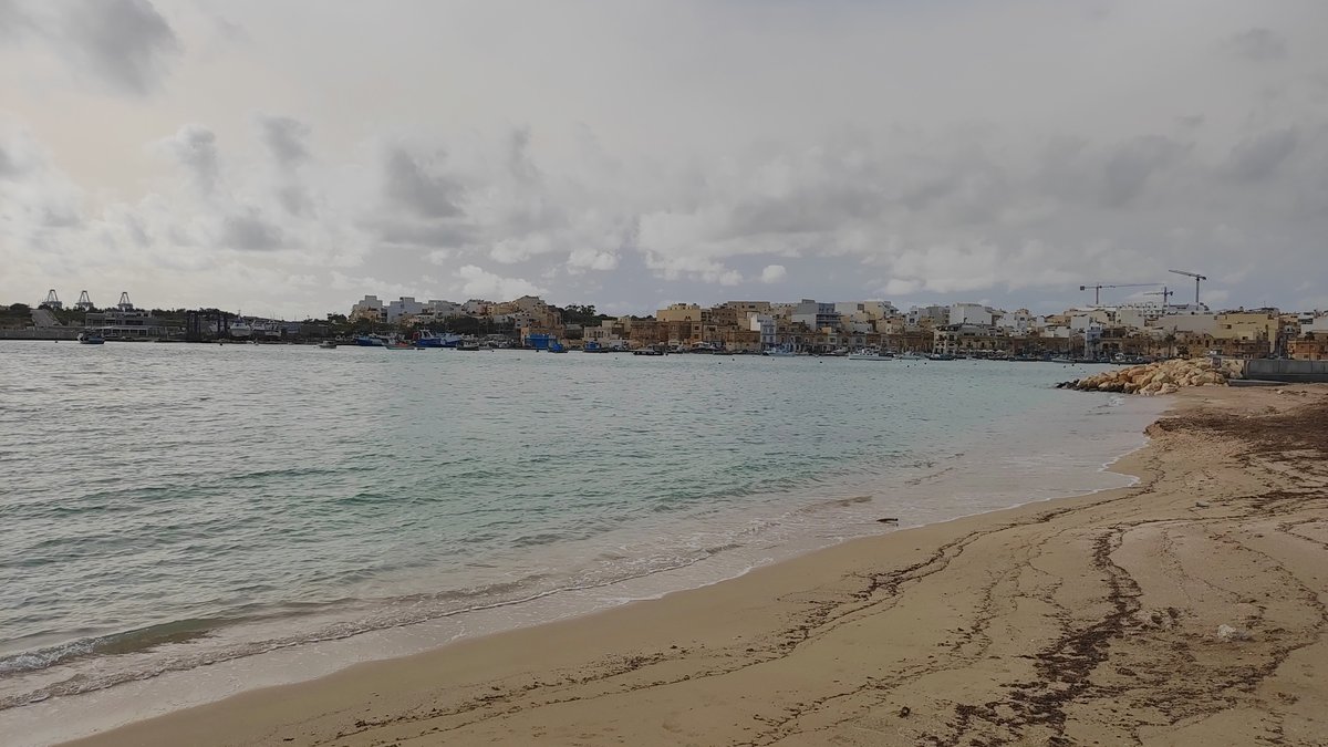
Across Marsamxett Harbour from Valletta's golden fortifications, the water in Gżira is the colour of faded denim and engine oil. The first sound you notice isn't church bells, but the groan of yacht rigging against masts and the sharp clatter of a bridge being lowered for a passing boat. This is a town built for harbour life, not for tourists, and its raw utility is what makes it magnetic.

Gżira, Malta Photo: Tom Fisk / Pexels
Attractions
4
Audio
52 min
Trip length
2-3 days
Best season
Spring or Autumn (April-May, Sept-Oct)

Why Gżira

Built from cited sources · see the method · How we make our guides →

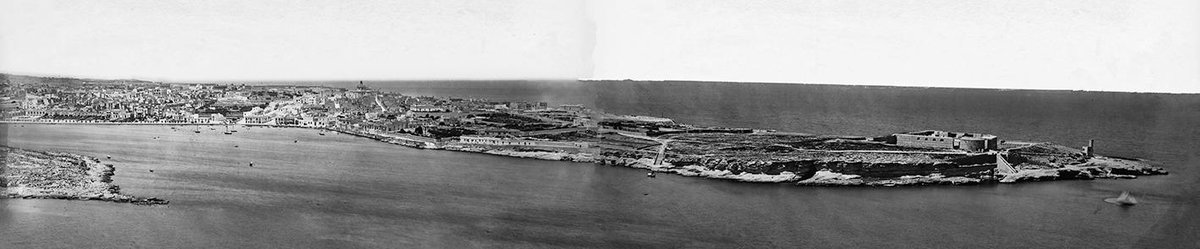
Gżira’s identity is tethered to Manoel Island, a low, green hump of land connected by a single bridge. Fort Manoel, a star-shaped 18th-century fortress built by the Knights of St. John, sits on it like a stone crown, though its gates are often locked behind redevelopment fencing. You view it from the promenade, a silent sentinel against the skyline, its story paused mid-chapter.

The town itself feels lived-in. The seafront promenade is where life happens: old men play chess on stone tables while joggers weave past, and the air smells of salt and fried fish from waterfront kiosks. At night, the light shifts. The modern glass cube of Aqualuna glows, its poolside terrace becoming a social anchor where the soundtrack changes from seabirds to deep house.

This duality defines the place. One street back from the water, you'll find the 111 Art Gallery in a quiet townhouse, its white walls holding contemporary Maltese paintings. The Gżira Project stages community theatre in local halls. The culture here isn't packaged for display; you have to lean in to catch it, between the boat schedules and the construction noise.

  • Fort Manoel & the Unfinished Island

    The 18th-century star fort on Manoel Island is a silent sentinel across the water. Its redevelopment has been a local saga for decades—check access before you go, but the view of its limestone bastions from the Gżira promenade is always free.
  • The Harbour Vista

    Gżira’s identity is its waterfront. The promenade gives you a working view of Marsamxett Harbour, where fishing boats and superyachts share the water. It’s the best spot to watch the sun set behind Valletta’s skyline, turning the limestone walls to gold.
  • A Community Stage

    Look beyond the postcard views for the local arts pulse. The Gżira Project runs community theatre and workshops, while the 111 Art Gallery shows contemporary Maltese work. It’s a quieter, more personal counterpoint to the island’s grand historic narrative.

Neighborhoods

Where to wander, by quarter — each with its own rhythm.

  • The Gżira Waterfront & Promenade

    This is the town's spine and its social heart. The paved walkway runs for over a kilometre along Marsamxett Harbour, offering an uninterrupted, postcard-perfect view of Valletta's bastions. It's a functional space: you'll see fishermen mending nets, commuters waiting for the ferry to the capital, and locals walking dogs at sunset. The best cafes here are the simple ones with plastic chairs, where you can sit for hours with a Kinnie and watch the harbour traffic.
  • Manoel Island

    Less a neighborhood, more a mood. Connected by a single, often-raised bridge, the island is a world apart. Fort Manoel dominates, its massive limestone walls sheer and silent. Access to the fort itself is frequently restricted, but you can walk the perimeter, feeling the crunch of gravel underfoot. The atmosphere is one of arrested decay and whispered redevelopment plans. Go for the profound quiet and the unique perspective back towards Gżira's own skyline.
  • The Aqualuna Quarter

    Centered on the modern Aqualuna complex, this slice of the waterfront represents Gżira's newer, curated face. It's a daytime-to-nighttime transition zone. By afternoon, the sound is splashing water and cocktail shakers from the pool deck. After dark, it becomes a sleek social hub with a dressier crowd. The energy is deliberately manufactured, a stark and fascinating contrast to the organic, salt-weathered life just a few meters down the promenade.
  • The Backstreets (Triq ix-Xatt & Environs)

    Move one block inland from the water and Gżira reveals its residential soul. The streets are narrower, lined with traditional Maltese townhouses and the occasional modernist apartment block from the 70s. This is where you find the 111 Art Gallery, a pocket of contemporary calm, and hear the rehearsals from The Gżira Project's community theatre. The air is cooler, shaded from the harbour sun, and smells of jasmine from hidden courtyards.

Plan your trip

Before you go

Getting There
Everyone arrives via Malta International Airport (MLA), 8 kilometers south. From the airport, a pre-booked taxi or ride-share to Gżira takes about 20 minutes and costs roughly €20. The X2 express bus also runs from the airport to Sliema, a 10-minute walk from Gżira’s centre.
Getting Around
Malta’s public transport hub is the bus. In 2026, the primary network is still the extensive, government-run bus system. A 12-journey Tallinja card costs €15, valid for a year. For Gżira, buses to Valletta (routes 13, 14) leave every 10 minutes from the seafront. The ferry to Valletta departs from Sliema, a 15-minute walk away.
Climate & Best Time
Summers (June-August) are hot and dry, with temperatures consistently above 30°C. Spring (April-May) and autumn (September-October) are ideal, with highs around 22-26°C and fewer crowds. Winter is mild (15°C average) but can be wet and windy. July and August see peak tourist numbers and prices.
Language & Currency
Maltese and English are both official languages. You’ll hear Maltese spoken everywhere, but English is used for all signage, menus, and services. The currency is the Euro (€). Contactless payments are widely accepted, but keep some cash for small vendors and bus tickets.
Safety
Malta is generally very safe. Petty theft like bag-snatching can occur in crowded tourist areas, so keep valuables secure. The local police force is the Malta Police Force (112 for emergencies). The biggest practical hazard is traffic; be very cautious when crossing streets.

Where to Eat

Where locals actually book dinner — not the tourist menus.

Insider tips

Small things that change how the city treats you.

  • Check Manoel Island access

    Fort Manoel and the connected island often face redevelopment closures. Confirm access before you plan a visit by checking recent local social media or tourism forums.
  • Use the waterfront ferries

    Skip the traffic. Regular ferries from the Gżira/Sliema waterfront zip across Marsamxett Harbour to Valletta in minutes, offering the best city views.
  • Skip the promenade dinner

    The main waterfront strip caters heavily to tourists. For better value and more authentic Maltese food, walk two blocks inland where local spots serve ftira and pastizzi.
  • Visit in shoulder season

    Come in April-May or September-October. You'll avoid the intense summer heat, the peak tourist crowds, and find better accommodation rates.
  • Photograph the evening light

    The late afternoon sun hits Valletta's bastions directly across the harbour. The Gżira promenade is the perfect spot for that golden-hour shot of the fortress walls glowing.

Frequently asked

Is Gżira worth visiting?

Yes, if you want a quieter, local-feeling base with a direct view of Valletta. It's not packed with major sights itself, but its waterfront promenade, connection to Manoel Island, and ferry links make it a practical and pleasant spot to stay.

How many days should I spend in Gżira?

It works best as a base, not a destination. Stay 3-4 nights. Use your days to explore Valletta, take boat trips from the harbour, and enjoy the local seafront atmosphere in the evenings.

How do I get from Gżira to Valletta?

Take the ferry. It's faster, cheaper, and more scenic than driving or the bus. Ferries depart regularly from the Sliema/Gżira ferry terminal, just a short walk along the promenade.

Is Gżira safe for tourists?

Yes. Malta has a very low crime rate. Standard city precautions apply: watch your belongings in crowded areas and be mindful of traffic when crossing streets, but violent crime is rare.

What is there to do in Gżira at night?

The seafront promenade comes alive. Stroll, find a bar for a drink with a harbour view, or head to spots like Aqualuna for a poolside social scene. It's generally relaxed, not a party town.

All Places to Visit.

8 places to discover

St. Paul'S Bay
Place

St. Paul'S Bay

Tarxien
Place

Tarxien

Ħaġar Qim
Place

Ħaġar Qim

Port of Marsaxlokk
Place

Port of Marsaxlokk

Borġ In-Nadur
Place

Borġ In-Nadur

Tigné Point
Place

Tigné Point

Fort Manoel
Place

Fort Manoel

Empire Stadium, Gżira
Place

Empire Stadium, Gżira

Photo credits (9)
  1. Tom Fisk — Pexels License (https://www.pexels.com/license/) — Source: https://www.pexels.com/photo/30692573/
  2. Manoel Island - Panorama — PayniePaynie — CC BY-SA 4.0 (https://creativecommons.org/licenses/by-sa/4.0/) — Source: https://commons.wikimedia.org/wiki/File:Manoel_Island_-_Panorama.jpg
  3. Malta - Gzira - Triq Ix-Xatt 37 ies — Frank Vincentz — CC BY-SA 3.0 (https://creativecommons.org/licenses/by-sa/3.0/) — Source: https://commons.wikimedia.org/wiki/File:Malta_-_Gzira_-_Triq_Ix-Xatt_37_ies.jpg
  4. Places in Gzira 04 — Continentaleurope — CC BY-SA 4.0 (https://creativecommons.org/licenses/by-sa/4.0/) — Source: https://commons.wikimedia.org/wiki/File:Places_in_Gzira_04.jpg
  5. Il Gzira view — Larsvr6 — CC BY-SA 4.0 (https://creativecommons.org/licenses/by-sa/4.0/) — Source: https://commons.wikimedia.org/wiki/File:Il_Gzira_view.jpg
  6. Triq Il - Forti Manoel, Il-Gżira, Malta - panoramio — Alan C. Bonnici — CC BY-SA 3.0 (https://creativecommons.org/licenses/by-sa/3.0/) — Source: https://commons.wikimedia.org/wiki/File:Triq_Il_-_Forti_Manoel,_Il-Gżira,_Malta_-_panoramio.jpg
  7. Gzira OSM — OpenStreetMap contributors — CC BY-SA 2.0 (https://creativecommons.org/licenses/by-sa/2.0/) — Source: https://commons.wikimedia.org/wiki/File:Gzira_OSM.jpg
  8. Triq l-Imsida, Il-Gżira, Malta - panoramio — Alan C. Bonnici — CC BY-SA 3.0 (https://creativecommons.org/licenses/by-sa/3.0/) — Source: https://commons.wikimedia.org/wiki/File:Triq_l-Imsida,_Il-Gżira,_Malta_-_panoramio.jpg
  9. Tas-Sliema u l-Gżira. Mill-Belt — Enrique Íñiguez Rodríguez (Qoan) Credit information This work was created by Enrique Íñiguez (Qoan). You are free to use it for any purpose as long as you credit me properly (e.g. © Enrique Íñiguez (CC-BY-SA); other variants are acceptable, let me know if in doubt). .mw-parser-output .div-col{margin-top:.3em;column-width:30em}.mw-parser-output .div-col-small{font-size:90%}.mw-parser-output .div-col-rules{column-rule:thin solid var(--border-color-base)}.mw-parser-output .div-col dl,.mw-parser-output .div-col ol,.mw-parser-output .div-col ul{margin-top:0}.mw-parser-output .div-col li,.mw-parser-output .div-col dd{page-break-inside:avoid;break-inside:avoid-column} Reuse: If you use this image outside of Wikimedia projects, I would be happy to hear from you. If you use this image in a printed publication, I would love to get a copy for my archives. Contact me: If you're unsure about how you can use this picture. If you have any questions about attribution or other topics related to my files. — CC BY-SA 4.0 (https://creativecommons.org/licenses/by-sa/4.0/) — Source: https://commons.wikimedia.org/wiki/File:Tas-Sliema_u_l-Gżira._Mill-Belt.jpg

Photos may have been resized or cropped.