Thanneermukkom Bund: Visiting Hours, Tickets, and Travel Guide
Date: 14/06/2025
Introduction
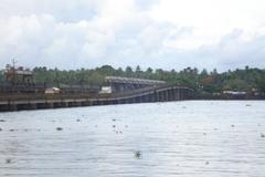
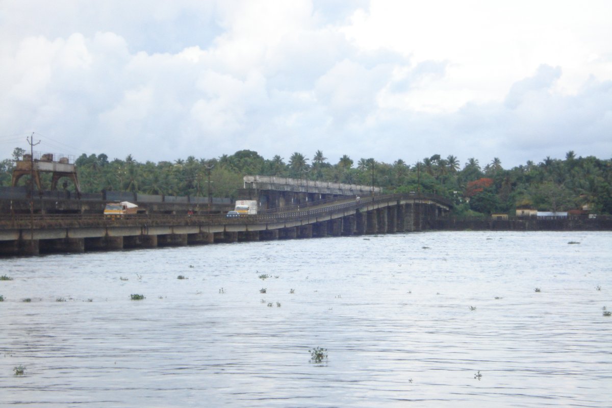
The Thanneermukkom Bund stands as one of Kerala’s foremost engineering achievements and a pivotal landmark in the Kuttanad region. Built to prevent the intrusion of saltwater from Vembanad Lake into the low-lying paddy fields, it transformed the agricultural landscape, making all-season cultivation possible in Kerala’s “rice bowl.” Besides its agricultural importance, the Bund reflects the socio-economic aspirations and challenges of the local communities—striking a balance between the needs of farmers and fishing communities.
The Bund is now an integral part of the Vembanad-Kol wetland system, a Ramsar site of international significance. It draws visitors for its scenic beauty, ecological diversity, and historical value. This guide offers detailed insight into the Bund’s origins, engineering, environmental impacts, visiting hours, tickets, accessibility, and visitor tips. Whether you’re an eco-enthusiast, history buff, or traveler exploring Kerala’s backwaters, the Thanneermukkom Bund promises a unique blend of natural wonder, cultural heritage, and technological ingenuity.
For planning your visit, consult resources like the official Kerala Tourism portal and local tourism platforms (keralatourism.org; dtpcalappuzha.com).
Table of Contents
- Introduction
- Historical Background
- Engineering and Environmental Significance
- Visiting Information
- Activities and Visitor Experiences
- Frequently Asked Questions (FAQ)
- Key Facts and Figures
- Conclusion
- References
Historical Background
Origins and Socio-Economic Context
The idea of the Thanneermukkom Bund was rooted in the agricultural needs of Kuttanad, where paddy fields are situated below sea level. For decades, saltwater intrusion from Vembanad Lake rendered large tracts unsuitable for cultivation, threatening farmers’ livelihoods (keralatourism.org). The Bund was championed by farmers but faced opposition from local fishing communities, whose livelihoods depended on the natural saline-freshwater flow for fish breeding (Taylor & Francis).
Construction Timeline
First conceptualized as part of the Kuttanad Development Scheme, construction of the Thanneermukkom Bund began in 1958. The western and eastern portions, each 470 meters long with 31 manually operated shutters, were completed by 1967. The central section, also 470 meters, was finished after 1977, connecting the villages of Thanneermukkam and Vechoor and linking Kottayam and Alappuzha districts (keralatourism.org). The Bund is now the largest mud regulator in India.
Engineering and Environmental Significance
Design and Structure
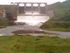
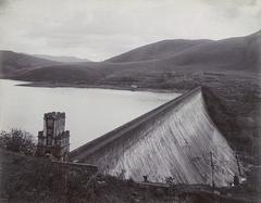
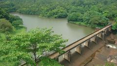
The Bund spans 1,400 meters across Vembanad Lake, with 62 sluice gates controlling the flow between the freshwater and brackish water zones. The gates are closed from December to May to retain freshwater and opened during the June–November monsoon for flood control (keralatourism.org).
Hydrological and Ecological Impact
By dividing the lake, the Bund created a freshwater zone (supporting agriculture) and a brackish water zone (supporting fisheries). While it enabled year-round paddy cultivation, it also altered the natural ecosystem:
- Increased siltation and reduced lake depth, affecting navigation and biodiversity.
- Disrupted tidal flushing, causing stagnation, invasive aquatic plants, and water quality decline.
- Adverse impacts on fish breeding and local fishing livelihoods (thehindu.com; Springer Nature).
Despite these challenges, the Bund remains a model of large-scale water management and is part of a Ramsar-listed wetland (Taylor & Francis).
Visiting Information
Visiting Hours and Entry
- Hours: Open daily from 6:00 AM to 6:00 PM
- Entry Fee: Free of charge (dtpcalappuzha.com)
Accessibility
The Bund is accessible by road with parking facilities nearby and is suitable for families and senior citizens. Wheelchair access may be limited in some areas, so advance arrangements are recommended.
How to Reach
- By Road: Approximately 15 km from Kottayam, 25 km from Alappuzha; frequent buses and taxis available.
- By Rail: Nearest stations are Cherthala (10 km) and Kottayam (15 km).
- By Air: Cochin International Airport is about 69–100 km away (Tripinic).
Travel Tips
- Visit early mornings or late afternoons for cooler weather and better photography.
- Carry water, sun protection, and cash for small purchases.
- Respect local customs and avoid littering.
- Wear comfortable shoes for uneven paths and bring rain gear during monsoon.
- Safety: Use caution near water edges; no lifeguards are present.
Activities and Visitor Experiences
Scenic Drives and Photography
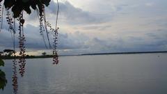
Enjoy panoramic drives along the bund, especially at sunset. The views over Vembanad Lake and the surrounding paddy fields are spectacular for photography (Tripinic).
Boating and Nature Walks
Local operators offer boat rides for exploring the backwaters and birdwatching. The region is a haven for migratory birds, especially in winter (MakeMyTrip).
Fishing
Fishing is permitted in designated areas; enthusiasts may bring their own equipment.
Local Cuisine
Nearby eateries serve authentic Kerala snacks and fresh seafood, perfect for an evening by the water.
Nearby Attractions
- Kumarakom Bird Sanctuary: A prime location for birdwatching (keralatourism.org)
- Alappuzha Beach: Known for its lighthouse and promenade.
- Alappuzha Backwaters: Renowned for houseboat cruises.
- Alappuzha Lighthouse: Historical maritime site.
Frequently Asked Questions (FAQ)
Q: What are the visiting hours for Thanneermukkom Bund?
A: Daily from 6:00 AM to 6:00 PM.
Q: Is there an entry fee?
A: No, visiting the Bund is free.
Q: How do I reach the Bund?
A: By road, rail (Cherthala/Kottayam), or air (Cochin Airport).
Q: Are there guided tours?
A: Occasionally offered by local agencies; inquire locally or via Kerala Tourism.
Q: Is it suitable for children and elderly visitors?
A: Yes, but assistance may be needed due to uneven terrain.
Key Facts and Figures
- Length: 1,400 meters
- Sections: Two 470-meter shuttered portions, one 470-meter central section
- Shutters: 62 manually operated gates
- Location: Between 76°23′–76°25′E and 9°40′N
- Purpose: Prevent saltwater intrusion, enable year-round farming
- Ecological Role: Part of Ramsar-listed Vembanad-Kol wetlands
Conclusion
The Thanneermukkom Bund is more than an engineering achievement; it is a testament to Kerala’s balance between human development and ecological stewardship. Despite ecological challenges, its role in transforming agriculture and shaping local communities is undeniable. Visitors can immerse themselves in its history, enjoy the serene landscapes, and appreciate the region’s rich biodiversity.
For the latest travel updates and detailed guides, visit keralatourism.org, dtpcalappuzha.com, or Tripinic.
Download the Audiala app for more travel inspiration and follow us on social media to stay updated on Kerala’s best destinations!
References
- keralatourism.org
- dtpcalappuzha.com
- Tripinic
- Taylor & Francis
- thehindu.com
- Springer Nature
- MakeMyTrip
- New Indian Express
