Lechmere Viaduct Visiting Hours, Tickets, and Boston Historical Sites Guide
Date: 04/07/2025
Introduction
The Lechmere Viaduct is a monumental testament to Boston’s transit evolution, architectural innovation, and urban development. Stretching gracefully across the Charles River, it connects Boston’s West End to Cambridge’s Lechmere neighborhood. Since its completion in 1912 by the Boston Elevated Railway Company, this reinforced concrete arch bridge has played a pivotal role in facilitating efficient streetcar—and now light rail—transit, helping to alleviate surface congestion and shape Boston’s transit landscape (Rails, Roads, and Riverside; RT&S; Historic Bridges).
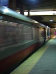
Today, the viaduct is not just a functional piece of infrastructure but a cultural landmark, woven into the fabric of Boston’s identity. Recent rehabilitation projects have preserved its historic character while equipping it to support modern light rail vehicles, including the new Type 10 “supercars.” Visitors experience the viaduct via the MBTA Green Line, which offers panoramic views of the Charles River and the Boston–Cambridge skyline. Nearby stations, such as Lechmere and Science Park, provide convenient access to the viaduct and connect visitors to attractions like the Museum of Science and Kendall Square (MBTA Press Release; Light Boston).
This guide offers a detailed exploration of the Lechmere Viaduct’s history, architectural and engineering significance, its role in Boston’s transit system, visitor information, and nearby attractions—making it an essential resource for transit enthusiasts, history buffs, and visitors alike.
Table of Contents
- Introduction
- Origins and Construction
- Architectural and Engineering Significance
- Role in Boston’s Transit System
- Rehabilitation and Modernization
- Visitor Information: Hours, Tickets, and Accessibility
- Nearby Attractions and Travel Tips
- Visuals and Media
- FAQ
- Conclusion
- Sources
Origins and Construction of the Lechmere Viaduct
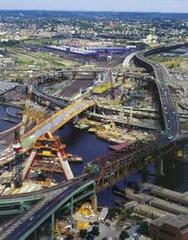
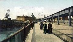
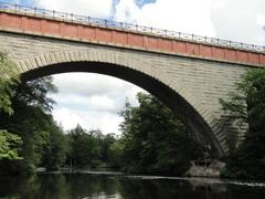
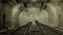
Conceived in the early 1900s, the Lechmere Viaduct was part of the Boston Elevated Railway Company’s push to modernize the city’s streetcar network. Construction began in 1907, and the viaduct opened in 1912, providing a dedicated right-of-way for streetcars to bypass congested downtown streets and directly connect Boston and Cambridge (Rails, Roads, and Riverside). The viaduct spans Nashua Street, the Charles River, Museum Way, and Charlestown Avenue, marking a significant extension of the Tremont Street Subway and enhancing rapid transit between the two cities (RT&S).
Architectural and Engineering Significance
The Lechmere Viaduct is a prime example of early 20th-century reinforced concrete engineering. Composed of 12 concrete arches, the structure stretches approximately 1,700 feet, and features a rare 129-foot Strauss bascule drawbridge. Its robust design supports the weight of streetcars and modern light rail vehicles while its graceful arches have become an iconic part of the Charles River skyline. The use of reinforced concrete was innovative for its era and set a precedent for future transit infrastructure (RT&S).
Role in Boston’s Transit System
Early Operations and the “Lechmere Model”
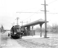
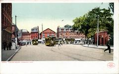
Upon opening, the viaduct allowed streetcars from Harvard Square, Union Square, and other suburbs to seamlessly travel from street level onto the subway, connecting outlying neighborhoods directly to downtown Boston (Rails, Roads, and Riverside). In 1922, a transfer terminal was added at Lechmere Square, shifting to a model where surface cars terminated at the terminal and subway cars operated within the station’s dedicated right-of-way. This concept, known as the “Lechmere Model,” influenced future rapid transit operations in Boston and beyond.
Integration into the MBTA Green Line
With the formation of the MBTA in the 1960s, the viaduct became a vital link on the Green Line, serving thousands of commuters daily. It connects central Boston to East Cambridge and beyond, supporting access to key destinations such as Science Park, the Museum of Science, Kendall Square, and the rapidly developing East Cambridge area (RT&S).
Rehabilitation and Modernization
Recognizing its age and importance, the MBTA completed a comprehensive $87.4 million rehabilitation of the Lechmere Viaduct between 2019 and 2021 (RT&S). Key upgrades included:
- Reinforcing spans with carbon fiber wrap for structural strength
- Replacing 3,500 feet of track and installing 70,000 feet of new signal wiring
- Modernizing the overhead catenary system
- Improving accessibility at Science Park station
- Preparing the viaduct for heavier, modern light rail vehicles, including the future Type 10 “supercars”
These improvements enhance reliability, support increased service, and ensure the viaduct’s continued role as an iconic and functional part of Boston’s transit network.
Visitor Information: Visiting Hours, Tickets, and Accessibility
Visiting Hours:
The Lechmere Viaduct is accessible by riding MBTA Green Line trains, which operate daily from approximately 5:00 AM to 1:00 AM. There is no direct pedestrian access on the viaduct itself.
Tickets:
A standard MBTA fare is required to ride over the viaduct. Options include single-ride tickets, CharlieCards, CharlieTickets, and daily or weekly passes. Tickets are available at station vending machines, MBTA retail locations, and via the official MBTA app (MBTA Fares).
Accessibility:
Nearby stations such as Lechmere and Science Park are fully ADA accessible, with elevators, ramps, and tactile warning strips. The adjacent Community Path offers an accessible route for pedestrians and cyclists.
Nearby Attractions and Travel Tips
- Museum of Science: Adjacent to Science Park Station, offering interactive exhibits and river views.
- Kendall Square: Accessible via Lechmere Station, featuring dining, innovation hubs, and public art.
- Charles River Esplanade: Scenic walking and biking paths with great views of the viaduct.
- NorthPoint Park & Community Path: Offers pedestrian and cycling access with vantage points for photography.
Travel Tips:
- Ride the Green Line during daylight for the best views.
- Use the MBTA mobile app for tickets and real-time updates.
- Public transit is recommended due to limited parking.
Visuals and Media
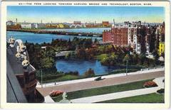
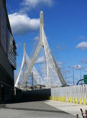
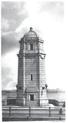
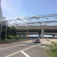
- High-resolution images of the viaduct and surrounding skyline (alt text: “Lechmere Viaduct Boston historical site”)
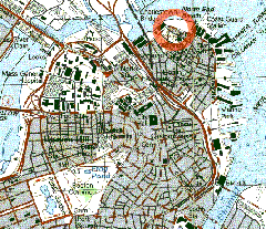
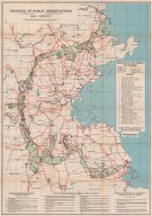
- Maps showing viaduct location relative to MBTA stations and attractions
- Virtual tour links and drone footage available on MBTA and partner websites
Frequently Asked Questions (FAQ)
Q: Can I walk or bike on the Lechmere Viaduct?
A: No, the viaduct is for train traffic only. However, nearby paths are available for pedestrians and cyclists.
Q: Are there guided tours available?
A: No official tours exist for the viaduct, but some local historical walking tours cover the surrounding areas.
Q: Is the viaduct accessible for people with disabilities?
A: Yes, all connected stations are fully accessible.
Q: Where are the best photo spots?
A: From the train, Charles River Esplanade, NorthPoint Park, and the Community Path extension.
Preservation and Future Prospects
The Lechmere Viaduct’s recent rehabilitation ensures it remains a vibrant link in Boston’s transit network. As the city continues to invest in public transportation and sustainable mobility, the viaduct stands as both a historical icon and a symbol of Boston’s ongoing commitment to innovative urban infrastructure.
Plan Your Visit
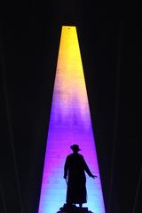
Explore Boston’s transit history by riding the Green Line over the Lechmere Viaduct and visiting nearby attractions. Download the Audiala app for real-time transit updates, and consult MBTA’s resources for schedules and fare information. For the latest on lighting events and community projects, visit Light Boston.
Sources
- Lechmere Viaduct Boston: History, Visiting Hours, Tickets & Travel Tips, 2023, Rails, Roads, and Riverside
- Lechmere Viaduct Rehabilitation Project, 2021, RT&S
- MBTA Lechmere Viaduct Rehabilitation Project
- Historic Bridges: Lechmere Viaduct
- MBTA Press Release
- Light Boston Community Initiatives
- Herzog GLX Milestones, 2023


