
Place
Mexico Updated Oct 2026
In Orizaba, Mexico, the former city hall came from Belgium in 3,369 packages, then took shape as a lacework of iron in the middle of a mist-prone mountain valley. Locals call the city Pluviosilla, the “little rainy place”; on damp evenings, that name makes sense in the hush of the river walk and the smell of hot chileatole.
 Photo: Isaacvp · CC BY-SA 4.0
Built from cited sources · see the method · How we make our guides →
Orizaba grew as a waystation on the Royal Road between Veracruz port and Mexico City, and its streets still hold traces of that passage: a monumental Franciscan convent, a 19th-century theater, and the Palacio de Hierro, inaugurated in 1894. Look closely at the palace’s metalwork, then step inside for coffee beneath its iron roof.
The city is made for wandering between different kinds of green. A five-kilometer path follows the Orizaba River past footbridges and public art, while a cable car climbs Cerro del Borrego to a hillside marked by the 1862 battle fought there; on clear days, the view reaches toward Pico de Orizaba.
Rain has its own menu here: chileatole, a thick corn-and-chile broth, and Orizaba-style pambazos, soft rolls stuffed with beans and meat. Try them around the historic center, where the city’s story feels less like a collection of monuments than a daily habit.
Not every monument, just the ones we'd walk you past ourselves.

Where to wander, by quarter — each with its own rhythm.
Before you go
From an Indigenous valley of streams to a railway and textile city
Long before Spanish records, Totonac communities lived in the Orizaba valley, where springs and rivers ran down from the mountains. The Nahuatl name Ahuializapan is often translated as “place of pleasing waters”—a fitting name for a settlement shaped by water and mountain routes.
Accounts place the marriage of Malintzin, also known as La Malinche, to the conquistador Juan Jaramillo in Huiloapan, near Orizaba. The episode belongs to the upheaval of the conquest, when Indigenous communities and Spanish newcomers were forging political ties under extreme pressure.
Spanish authorities made Orizaba a cabecera de jurisdicción, an administrative center for the surrounding district. The new status encouraged more permanent building: timber gave way to stone and lime as the town grew along the road between Veracruz and Mexico City.
Construction began on the monastery and hospital of San Juan de Dios beside the Orizaba River. Its location joined religious care to the practical needs of travelers crossing a busy and often difficult mountain corridor.
A severe earthquake damaged churches, monasteries, and civic buildings in Orizaba. Local accounts connect the destruction to a rule limiting buildings to one story—a reminder that even in this water-rich valley, the ground could dictate the shape of a town.
The Spanish Crown established its tobacco monopoly and designated Orizaba an authorized center for production. Tobacco cultivation and cigar-making brought money, workers, and new construction to a town already well placed on the royal road.
Work began on the Casas Consistoriales and prison beside the Plaza Mayor. Their construction gave the growing town a more formal civic center, amid the trade and tobacco wealth that was changing its streets.
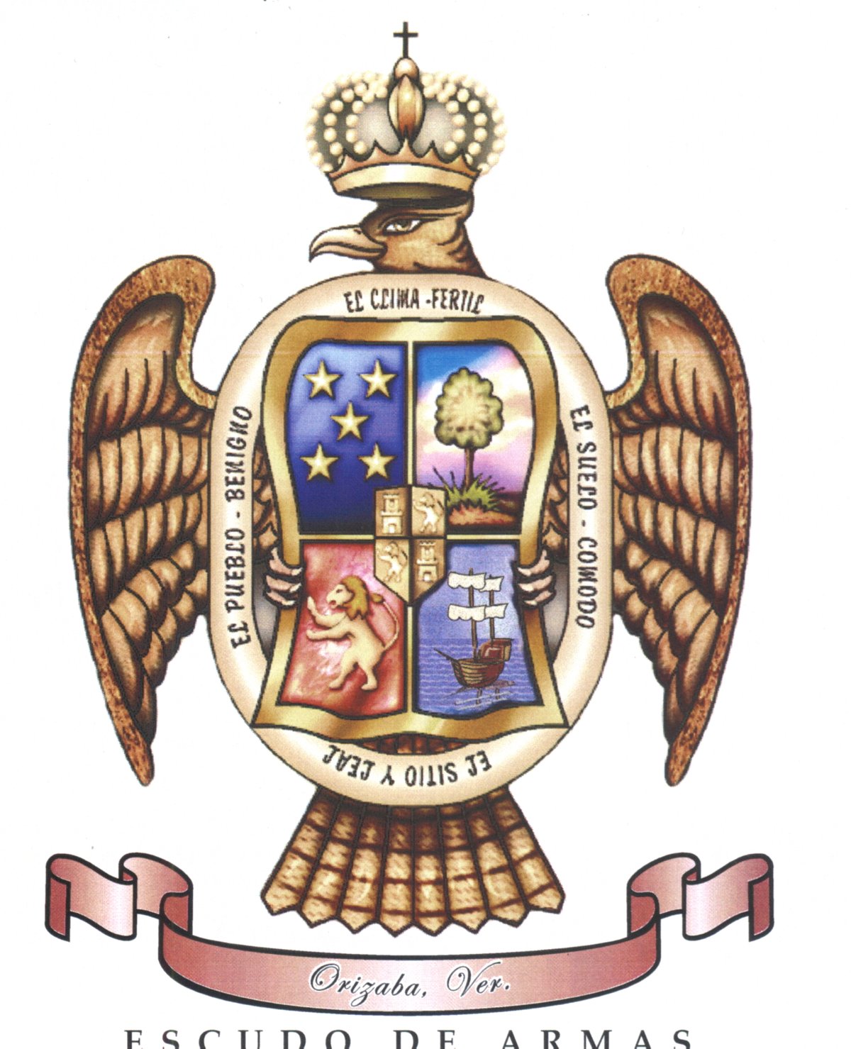
A royal charter issued by Charles III granted Orizaba a coat of arms and the rank of villa. The distinction gave local elites a mark of status, but the town’s prosperity still rested on the steady movement of goods and people through the valley.
Viceroy Miguel de la Grúa Talamanca, the Marqués de Branciforte, temporarily moved his court and military encampment to Orizaba. Coastal threats from Britain had made the port feel exposed; for a brief spell, the valley town served as a working seat of viceregal power.
Insurgent leader José María Morelos took Orizaba and captured royal tobacco stores to fund the independence campaign. The tobacco wealth that had enriched the Crown now helped supply the rebellion against it.
Born in Orizaba, Ignacio de la Llave became a liberal general and governor of Veracruz, fighting in the Mexican-American War, the Reform War, and the struggle against French intervention. He also initiated the city’s theater project; the state later took his name.
Orizaba was elevated from villa to ciudad by the government of independent Mexico. The title recognized a place whose importance had grown through trade, tobacco, and its position on the route between the Gulf and the capital.
Though born in nearby Córdoba, writer Rafael Delgado spent much of his life in Orizaba, taught at its preparatory school, and set fiction there. His work gave the city its enduring literary nickname, Pluviosilla, or “Rainy City,” a name that catches the valley’s mist better than a map can.
French forces ambushed Mexican troops on Cerro del Borrego, the steep hill overlooking Orizaba, after the Mexican victory at Puebla. The French attack broke the position held by General Jesús González Ortega’s men and gave the expeditionary army room to regroup.
The Mexican Railway opened its station in Orizaba, linking Mexico City with the port of Veracruz. Steam locomotives changed the valley’s old rhythms: goods and passengers could cross the mountains on a schedule, rather than at the pace of mule trains.
Governor Francisco Landero y Cos declared Orizaba the capital of Veracruz. The city held the state offices until 1878, when the seat of government moved permanently to Xalapa.
The Teatro Ignacio de la Llave opened with an Italianate neoclassical design by Joaquín Huerta. Its stage gave Orizaba a public home for performance and ceremony, a different kind of civic building from the mills rising nearby.
French-Mexican investors formed the Compañía Industrial de Orizaba, bringing major textile operations under one company. Mills at Río Blanco, Cocolapan, San Lorenzo, and Cerritos drew power from local rivers and turned the valley into one of Mexico’s early industrial centers.
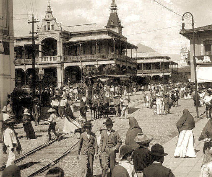
Orizaba inaugurated its Palacio de Hierro, a prefabricated iron building designed by the Belgian firm Société anonyme de construction de Chaudronnerie et Forges d’Aiseau. Shipped in three cargo vessels and assembled with more than 823,000 rivets, it made imported engineering part of the city’s everyday civic life.
Sara García was born in Orizaba before becoming one of Mexico’s best-known film actresses, remembered across generations as “La Abuelita de México.” Her screen persona travelled far beyond Veracruz, but her story began in this industrial mountain city.
German entrepreneur Wilhelm Hasse founded Cervecería Guillermo Hasse y Cía., later known as Cervecería Moctezuma. The brewery drew on the region’s water and added another major industry to a city already marked by textile mills, railway traffic, and tobacco.
Textile workers in the Orizaba valley struck against harsh conditions and company stores; the confrontation at Río Blanco ended in a massacre by government forces. The killings became a defining episode in Mexican labor history and a warning of the upheaval that would break out in 1910.
Francisco Gabilondo Soler was born in Orizaba and grew up among the valley’s rivers, gardens, and mountain weather. As Cri-Cri, the “Singing Cricket,” he later wrote songs and stories that carried echoes of childhood far beyond the city.
Orizaba became the national headquarters of the Casa del Obrero Mundial, an anarcho-syndicalist labor organization. Its Red Battalions allied with Venustiano Carranza’s Constitutionalist forces, drawing workers directly into the military and political contests of the Revolution.
Orizaba was the site of an early national industrial strike conducted under the labor protections of Article 123 of the 1917 Constitution. The constitutional promise met the factory floor, where workers tested what newly written rights could mean in practice.
The Mier y Pesado Foundation established the complex now known as Poliforum Mier y Pesado. Its castle-like forms brought an unexpected architectural note to an industrial city, and the site would later house a museum devoted to Orizaba-born Cri-Cri.
A magnitude 7.1 earthquake struck the Puebla–Veracruz region, killing hundreds and damaging historic buildings in Orizaba. The Teatro Ignacio de la Llave lost its roof and interior, a hard blow to a city whose public memory was held in its old walls as much as in its archives.
A federal decree declared Orizaba’s central core a Historic Monuments Zone, covering 53 blocks and hundreds of buildings. The designation put legal weight behind the work of keeping colonial and Porfirian façades standing amid the pressures of a modern city.
The creation of the Diocese of Orizaba raised the Church of San Miguel Arcángel to cathedral status. Its long history of building and rebuilding now had a new role at the center of the city’s religious life.
The Orizaba cable car opened a direct route from the historic center to Cerro del Borrego. The hill once known chiefly for its battlefield became part of the city’s modern public life, with the same steep ascent now made by cable instead of on foot.
Mexico’s Secretariat of Tourism named Orizaba a Pueblo Mágico. The designation brought fresh attention to a city whose identity had already been shaped by Indigenous settlement, royal-road traffic, factories, and the recurring sound of water.
Composer and singer · 1907–1990
Born here
Born in Orizaba in 1907, Francisco Gabilondo Soler became Cri-Crí, the singing cricket whose songs made small animals into unforgettable characters for generations of children. The museum at Poliforum Mier y Pesado keeps his music close to home; he might recognize his playful imagination in the statues scattered through the Alameda.
Muralist · 1883–1949
Painted a mural here in 1926
In 1926, Orozco painted La Revolución Social, also known as Reconstrucción, in the building now serving as Orizaba’s municipal palace. Its revolutionary subject suits a city shaped by industry and labor unrest; today, the mural holds its ground amid the quieter business of civic offices.
Where locals actually book dinner — not the tourist menus.
Small things that change how the city treats you.
The city, as it actually looks.


Yes, especially if you like walkable historic centers, unusual architecture and mountain views. The iron Palacio de Hierro, the Paseo del Río and the cable car to Cerro del Borrego give the city a character distinct from Veracruz’s coastal towns.
Plan two days for the center, river walk and Cerro del Borrego. Add a third day for an outing to the 500 Escalones or a regional destination such as Laguna de Nogales.
Walk between central sights, use the free Gallo and Búho municipal shuttles for their fixed stops, or take a city bus. Circuito Valle costs about 8 MXN in cash; local taxis generally have no meters, so agree on the fare before riding.
The historic center, Alameda, Poliforum and Paseo del Río are described as well-patrolled areas, but use normal precautions. After dark, stay alert outside the main avenues and avoid driving rural mountain roads alone late at night.
You can keep costs down: the river walk, Alameda and municipal shuttles are free, and a city bus ride is about 8 MXN. The Pase Diversión bundle has been listed around 350 MXN, but check its current price and attractions before purchasing.
ADO buses run from Veracruz Airport to Orizaba in about 2 hours and 5–10 minutes. Research listings put fares around 400–450 MXN; check current schedules and prices before travel.
November through May is generally the drier period, with better odds of clear mountain views. Rain and mist are more common from June through October, particularly in July and August.
5 places to discover
Saved and recently read places — kept on this device only.
Photos may have been resized or cropped.
