What Chembra Peak is
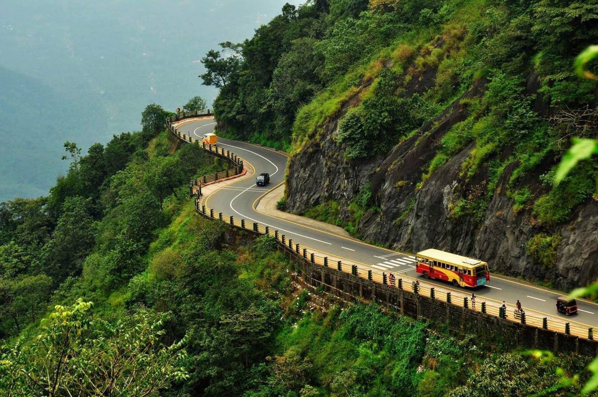
Chembra Peak, in Wayanad district, Kerala, India, is the highest point in Wayanad and stands at 2,100 meters above sea level. Part of the Wayanad hill ranges in the Western Ghats, it is known for its biodiversity, trekking routes, panoramic views, tea plantations, and heart-shaped Hridhayathadakam Lake. The area is also described as being within the ecologically sensitive Wayanad Wildlife Sanctuary.
History and cultural significance
The peak and surrounding areas have long been part of the cultural and spiritual heritage of local Indigenous communities, including the Paniyas, Kurichiyas, and Adiyas. The name “Chembra” is said to derive from the words “Chembra” and “Kund,” which translate to “Red Soil” in Malayalam. The area was initially known mainly to local tribes and a few adventurous explorers; its wider recognition as a tourist destination came in recent decades, as Kerala gained prominence on the world tourism map (CampScholar, TravelSetu).
Local legends say the peak is named after a mythological figure believed to have lived in the hills. Some beliefs hold that Goddess Sita bathed in the heart-shaped lake, adding to the folklore surrounding the trek (Decathlon).
As interest in eco-tourism grew, Chembra Peak became part of Kerala Government initiatives to promote sustainable tourism while preserving the region’s natural habitat. The Kerala Forest Department developed and maintains trekking routes, with the aim of limiting disturbance to the environment. The routes are managed by the “Chempra Peak VSS” under the South Wayanad Forest Development Agency, which provides guides and trekking equipment for a fee (TravelSetu, Wikipedia).
Entry fees and trekking charges contribute to conservation initiatives. The continuing challenge for tourism at the peak is to balance visitor numbers with environmental preservation. Online permits, GPS tracking, and virtual tours have also been introduced to support trip planning, navigation, and compliance with park regulations. (CampScholar, TravelSetu)
What to see
Hridhayathadakam, the heart-shaped lake
The heart-shaped lake, known locally as Hridhayathadakam, lies halfway up the peak, around 2 km uphill from the watchtower. It is said never to have dried up, even during the worst droughts. Trekkers often stop here to rest and enjoy the lake’s surroundings, and its distinctive shape makes it a popular spot for couples and photographers (Vythiri Hills).
Views, flora, and wildlife
The climb offers views of valleys, hills, tea plantations, forests, rolling meadows, and overgrown grasslands. From the summit, the views are described as panoramic, with a 360-degree outlook over the region; on a clear day, distant towns are visible. Mist-covered hills and the greenery below are among the views along the way.
The trail is rich in flora and fauna. Trekkers may see birds, butterflies, and small mammals, as well as trees and plants, some endemic to the region.
Photographic spots
- Heart-shaped lake The lake’s shape and peaceful surroundings.
- Summit Panoramic views of the surrounding landscape.
- Forests and meadows The greenery and varied flora along the trail.
Practical visiting information
Permissions, tickets, and hours
The South Wayanad forest department controls the core trek route. Trekkers need permission from the forest department and must obtain a permit from the forest office in Meppadi. The office opens at 7 AM; arriving early allows time to submit identity documents and complete formalities. Tickets are available at the forest office in Meppadi or online through the official Wayanad tourism website.
The reported fees differ:
- One account gives an entry fee of around INR 750 for a group of up to 10 people, with additional charges potentially applying for guides and equipment (Wayanad Tourism).
- Another reports a fee of 850 INR for a group of up to 10 people, and 1500 INR for a group of up to 5 foreign visitors; the charges include permits and service fees (Travalour).
- Another gives an approximate entry fee of INR 750 for Indian nationals and INR 1500 for foreign tourists, with additional costs possible for guides or trekking equipment.
Trekking hours are 7 AM to 2 PM. Late reporting after 2 PM is prohibited. The daily visitor limit is reported as about 200; another account says only 200 people are given permission each day on a first-come-first-served basis. Trekkers are advised to start early and return to the forest office by 3 PM.
Trek route and difficulty
The trek is around 4.5 km in total. It starts from a watchtower at the foot of Chembra Hill; the base camp is described as being near Meppadi. The route passes through tea plantations, thick forests, rolling meadows, and overgrown grasslands. The trek to the heart-shaped lake takes around two and a half hours (Indiahikes).
The first part of the hike is an easy walk, followed by a moderately difficult section with steeper rocky patches. The peak assault is very steep and requires stamina. The trek is also described as moderately challenging and suitable for novice and experienced trekkers.
Getting there
Chembra Peak is accessible by road from Kalpetta and Vythiri. To reach the peak, travel to Meppadi and hire a taxi; Meppadi is 10 km from Kalpetta, which has frequent buses. Regular buses and taxis also connect Meppadi with major towns in Kerala, and self-driving is an option. Ample parking is reported near the base camp.
The nearest airport is Calicut International Airport, reported as approximately 92 km away and also as approximately 100 km from Meppadi. Kannur International Airport is 120 km away. The nearest railway station is Kozhikode, reported as 90 km away; another account gives its distance from Meppadi as about 79 km. Buses and taxis connect Kozhikode with Kalpetta, and taxis or buses can be taken from the station to the base camp (Kerala Tourism).
Accommodation
Hotels and lodges are available near Chembra Peak. Recommended options include:
- Vythiri Mist Resort
- Silent Creek Resort
- Vythiri Holiday Resort
- Annapara Homestay
Advance booking is advised, especially during peak tourist seasons (Travalour).
Trekking tips and environmental guidelines
The recommended visiting periods are given as September through February and September to March. The weather is described as pleasant during these months, with clear skies and lush, vibrant tea plantations. The rainy season, June to August, can make the trail slippery and challenging; summer months can be hot. The lake’s blue waters and floating clouds are also noted during the recommended visiting period (The Hosteller).
Wear sturdy trekking shoes and comfortable clothing, and carry suitable trekking gear, snacks, a first-aid kit, and enough water. Two liters of water per person is recommended. Shops at the base sell water, but supplies cannot be purchased during the trek. Weather can change rapidly, so a raincoat and warm clothing are advised. Leeches and other insects may be present, especially during the rainy season; long sleeves and pants can help protect against bites.
Stick to marked trails to protect endangered plants. Avoid littering and noise pollution, and do not feed or disturb wildlife. Visitors are encouraged to follow Leave No Trace principles and the forest authorities’ guidelines.
Camping at the peak is prohibited because of the sensitive ecology and to prevent trouble from wildlife (Travalour).
Guidance information varies: the trekking routes are managed by the Chempra Peak VSS, which provides guides and equipment for a fee, and hiring a local guide is recommended for a safe and informative trek. Another account says guided tours are not mentioned in official information sources and suggests checking with local tour operators in Vythiri Taluk for updates.
Nearby places
- 900 Kandi Glass Bridge Safari Located 2.88 km from Chembra Peak. Its glass bridge extends out from the mountain and offers views of the Western Ghat mountains. It is described as the first attraction of its kind in South India. More information is available here.
- Thusharagiri Waterfall Located 5.74 km from Chembra Peak, this set of five waterfalls cascades down from the mountains of the Western Ghats.
- Kanthanpara Waterfalls A 30-meter-high, two-tiered waterfall between tea plantations, located 7.1 km from Chembra Peak (Travalour).
- Kuruva Island (Kuruvadweep) A group of uninhabited islands in the Kabini River, reachable by bamboo rafts, with greenery and diverse wildlife. It is noted as a destination for bird watchers and nature enthusiasts. More information is available here.
- Thirunelli Temple An ancient temple dedicated to Lord Vishnu, believed to be over a thousand years old. It is situated among the Brahmagiri hills.
- Meenmutty Waterfalls A waterfall in lush forest that descends about 300 meters in three tiers. The trek to the falls offers views of the surrounding landscape. More details are available here.
- Jain Temple, Sultan Bathery A 13th-century temple with intricate carvings and architecture.
- Soochipara Falls Also known as Sentinel Rock Waterfalls, this three-tiered waterfall is in the Vellarimala region. It is surrounded by dense forest, and the pool at its base is described as suitable for swimming and relaxation.
- Pookode Lake A freshwater lake amid forests and hills, with boating and picnicking.
- Wayanad Wildlife Sanctuary A wildlife sanctuary home to elephants, tigers, leopards, and deer, where visitors can take wildlife safaris. More information is available here.
- Edakkal Caves An archaeological site with rock engravings dating back thousands of years, including narrow crevices and ancient carvings.
FAQ
Is the trek suitable for beginners?
It is described as moderately challenging and suitable for both novice and experienced trekkers, though the steep peak assault requires stamina.
Are guided tours available?
The route management provides guides and trekking equipment for a fee, and hiring a local guide is recommended. Another account says guided tours are not mentioned in official information sources; it suggests checking with local tour operators in Vythiri Taluk for updates.
Can I camp at Chembra Peak?
No. Camping is prohibited because of the sensitive ecology and wildlife.