Chittagong Hill Tracts Visiting Hours, Tickets, and Travel Guide
Date: 14/06/2025
Introduction
The Chittagong Hill Tracts (CHT) — encompassing Bandarban, Rangamati, Khagrachhari, and nearby Ukhia Upazila in Cox’s Bazar — offer one of Bangladesh’s most captivating travel experiences. With its dramatic hilly landscapes, lush forests, and vibrant indigenous cultures, this region stands in stark contrast to Bangladesh’s predominately flat terrain. Ukhia Upazila acts as a southwestern gateway, blending coastal and hill landscapes, and is a crucial starting point for travelers eager to explore the area’s natural and cultural diversity (Royal Bengal Tours; Audiala).
Steeped in complex history and home to more than a dozen indigenous communities, the CHT is a mosaic of traditions, languages, and spiritual practices. Its ecological significance is equally profound, sheltering rare species like Asian elephants and the endangered white-winged wood duck, and featuring natural attractions such as Himchari National Park, Inani Beach, and the vast Kaptai Lake (UNPO; tripjive.com).
This comprehensive guide details the region’s history, cultural heritage, ecological highlights, essential visitor information — including visiting hours, ticketing, permits — and practical travel tips. Whether you seek adventure, cultural immersion, or breathtaking scenery, the Chittagong Hill Tracts promise an unforgettable journey.
Table of Contents
- Introduction
- Historical Evolution of the Chittagong Hill Tracts
- Cultural Heritage and Indigenous Communities
- Physical Geography and Location
- Geological Formation and Topography
- Climate and Hydrology
- Forests, Vegetation, and Biodiversity
- Ecological Challenges and Conservation Efforts
- Human-Environment Interactions
- Major Natural and Cultural Attractions
- Adventure and Outdoor Activities
- Local Markets and Culinary Experiences
- Visiting Hours and Ticketing
- Essential Travel Logistics
- Safety and Security
- Responsible Tourism and Community-Based Initiatives
- Practical Tips for Visitors
- Legal and Administrative Considerations
- Frequently Asked Questions (FAQ)
- Conclusion
- References
Historical Evolution of the Chittagong Hill Tracts
Pre-Colonial and Colonial Era
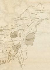
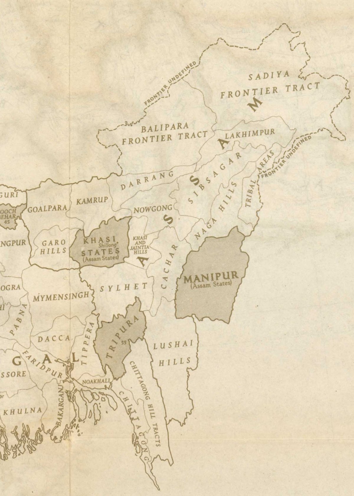
The CHT has long been inhabited by indigenous communities governed through traditional chieftaincies such as the Chakma, Bohmong, and Mong Circles. During British rule, these systems were formalized, and the CHT was administered as a region distinct from the Bengali-majority plains. The Chittagong Hill Tracts Regulation of 1900 restricted land ownership and non-indigenous migration, helping preserve the area’s unique cultural and demographic character (Wikipedia).
Partition and East Pakistan Era
At Partition in 1947, despite a predominantly non-Muslim population, the CHT was assigned to East Pakistan, a decision that led to protests and unrest among indigenous leaders (countylocalnews.com). Bengali settlement and new administrative structures further heightened tensions.
Post-Independence Bangladesh and Autonomy Struggles
After Bangladesh’s independence in 1971, indigenous demands for autonomy persisted. State-sponsored migration and land disputes led to conflict and displacement (Travel and Tour World). The 1997 Peace Accord promised autonomy and land restitution, but implementation remains incomplete (countylocalnews.com).
Cultural Heritage and Indigenous Communities
Diversity and Traditions
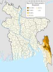
The CHT is home to over a dozen indigenous groups, including the Chakma, Marma, Tripura, Mru, and Bawm, each with their own languages, religions, and customs (India Outbound). Many communities follow Buddhism, while others practice animism or Christianity. Traditional bamboo and wooden stilt houses are adapted to the hilly landscape and monsoon climate (Bangladesh Eco Adventure).
Festivals and Religious Sites
Major festivals like Biju (Chakma), Sangrai (Marma), and Boisabi (Tripura) mark the New Year with vibrant dances, music, and rituals (The Daily Star). The region is dotted with Buddhist monasteries, pagodas, and temples, notable for their golden stupas and woodcarvings (Prothom Blog).
Cuisine and Handicrafts
Local cuisine features dishes like bamboo chicken and Chicken Luxho, prepared with wild herbs and fermented fish (Prothom Blog). Indigenous women produce vibrant textiles using backstrap looms, and bamboo and cane crafts are widely sold (India Outbound).
Physical Geography and Location
The CHT covers approximately 13,295–14,000 km², about 10% of Bangladesh’s area (Springer; UNPO). It borders India’s Tripura and Mizoram states, Myanmar’s Rakhine State, and the Chittagong and Cox’s Bazar districts (Royal Bengal Tours). Ukhia Upazila forms part of the southwestern entrance to this mountainous terrain.
Geological Formation and Topography
The CHT is part of a mountain chain stretching from the eastern Himalayas to Bangladesh. The hills, formed of sandstone and shale, rise from 300 to over 1,000 meters, with Bangladesh’s highest peaks—Keokradong and Tajingdong—located nearby (Royal Bengal Tours). The landscape features steep slopes, narrow valleys, and rivers carving deep gorges.
Climate and Hydrology
The region’s tropical monsoon climate features hot pre-monsoon months (April–May), a rainy season (June–October), and a cooler dry season (November–March). Annual rainfall averages 2,500–3,000 mm, feeding the Karnaphuli, Feni, Sangu, and Matamuhuri rivers. Kaptai Lake — Bangladesh’s largest — is a major feature, formed by damming the Karnaphuli River (UNPO).
Forests, Vegetation, and Biodiversity
The CHT supports tropical evergreen, semi-evergreen, and deciduous forests, along with bamboo groves and savannah patches (UNPO). These habitats shelter Asian elephants, gaur, leopards, langurs, and the endangered white-winged wood duck. Ukhia’s forests, though fragmented, remain vital for biodiversity and watershed protection.
Ecological Challenges and Conservation Efforts
Deforestation for plantations, illegal logging, shifting cultivation, and the creation of Kaptai Lake have threatened local ecosystems (UNPO). Current conservation focuses include community-based forest management, reforestation, and supporting indigenous land rights (ScienceDirect).
Human-Environment Interactions
The indigenous Jumma peoples’ traditional shifting agriculture and sustainable resource use have shaped the region’s landscape. Ukhia’s socio-ecological fabric is further influenced by Bengali settlers and refugee populations, underscoring the need for sustainable management (UNPO).
Major Natural and Cultural Attractions
Himchari National Park and Waterfall
Located in Ukhia, this park is renowned for its lush forests, rolling hills, and the Himchari Waterfall. It covers about 1,729 hectares and supports diverse flora and fauna (audiala.com).
- Visiting Hours: 8:00 AM – 5:00 PM.
- Tickets: 20 BDT (locals), 100 BDT (foreigners).
Marked trails offer panoramic views of the Bay of Bengal. The Himchari Hill viewpoint is ideal for sunrise and sunset photography.
Inani Beach and Marine Drive
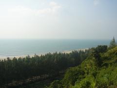
Inani Beach boasts golden sands and coral stones, offering a quieter alternative to Cox’s Bazar Beach. The Marine Drive Road provides spectacular coastal views (audiala.com).
- Tickets: Free entry; some parking areas may charge a small fee.
Tribal Villages and Cultural Experiences
Guided visits to indigenous villages enable immersion in local weaving, cuisine, rituals, and festivals (chakmalibrary.net). Tribal bazaars showcase crafts and textiles (pathfriend-bd.com).
Kaptai Lake and Boat Tours
Accessible via Rangamati, Kaptai Lake offers boat tours to floating markets, tribal villages, and Buddhist monasteries (tripjive.com).
- Visiting Hours: Boat tours 9:00 AM – 4:00 PM.
Trekking and Hiking Trails
The CHT features the country’s top trekking routes:
- Keokradong Trek: Challenging three-day trek to the highest peak.
- Sangu River Valley Trek: Two-day trek along the scenic Sangu River.
- Boga Lake Trek: Hike to a crater lake, ideal for camping.
- Thanchi Trek: Four-day adventure through remote terrain.
Permits: Special permits required; arrange through local guides (unusualtraveler.com).
Wildlife and Birdwatching
Himchari and adjacent forests are ideal for birdwatching and wildlife spotting, especially at dawn and dusk (audiala.com).
Buddhist Monasteries and Religious Sites
The Buddhist heritage is visible in monasteries and temples in Bandarban and Rangamati, open to visitors (tripjive.com).
Adventure and Outdoor Activities
- River Rafting and Boating: Sangu and Matamuhuri rivers are ideal for boating, especially during monsoon (chiamhuiy.com).
- Camping and Eco-Tourism: Eco-resorts and campsites near Ukhia provide rustic options and guided walks (tripjive.com).
- Photography: Panoramic viewpoints at Himchari Hill, Nilachaal, and hill stations offer sweeping landscapes (chiamhuiy.com).
Local Markets and Culinary Experiences
- Tribal Bazaars: Weekly markets are vibrant venues to shop for produce, textiles, and crafts (pathfriend-bd.com).
- Traditional Cuisine: Try bamboo shoot curry, smoked fish, and prawn bhuna at guesthouses or during village visits (tripjive.com).
Visiting Hours and Ticketing
- General Hours: Most sites open 8:00/9:00 AM to 5:00/6:00 PM.
- Tickets: Ranges from free to BDT 200, depending on the attraction.
- Permits: Foreigners require special permits for the CHT, processed at the Deputy Commissioner’s office in Chittagong; allow 10–12 days (India Outbound).
Essential Travel Logistics
- Getting There: Ukhia is accessible from Cox’s Bazar by bus or car; the CHT can be reached from Dhaka or Chittagong by long-distance bus (Bangladesh Travel and Tours).
- Local Transport: Auto-rickshaws, tuk-tuks, and boats are common; roads can be challenging during monsoon (Audiala).
- Accommodation: Ukhia has limited options; Cox’s Bazar and major CHT towns offer guesthouses, eco-lodges, and tribal homestays (Bangladesh Travel and Tours). Book in advance in peak season.
Safety and Security
- Regional Concerns: There are sporadic ethnic tensions and land disputes; check travel advisories (UK Government Travel Advice).
- Permits: Mandatory for foreigners, enforced at checkpoints.
- Health: Use bottled water, avoid street food, and carry a medical kit. Medical facilities are limited in remote areas (ACAPS).
- Wildlife: Be cautious of snakes, monkeys, and wild animals (Bandarban Tours).
- Personal Safety: Travel in groups, secure valuables, and always carry ID and permits.
Responsible Tourism and Community-Based Initiatives
- Cultural Sensitivity: Dress modestly, remove shoes in homes and temples, and ask before taking photographs. Learn basic Bengali phrases and respect local customs (Global History Dialogues).
- Support Local Communities: Choose indigenous-owned accommodations, buy crafts directly, and avoid exploitative tours (Flinders University Thesis).
- Environmental Stewardship: Follow Leave No Trace principles, minimize plastic, and protect wildlife (Bandarban Tours).
- Community-Based Tourism: Engage with homestays and local workshops (Academia.edu).
Practical Tips for Visitors
- Best Time to Visit: November–March, for cooler weather and accessible trails.
- Packing: Lightweight, modest clothing, trekking shoes, rain gear, insect repellent, and a basic medical kit.
- Connectivity: Mobile coverage is good in towns, patchy in remote areas.
- Money: Carry cash; ATMs are only in larger towns.
- Travel Insurance: Strongly recommended (UK Government Travel Advice).
Legal and Administrative Considerations
- Permits: Apply at least 10 days in advance via the Ministry of Home Affairs or your embassy (UK Government Travel Advice).
- Registration: Register upon arrival; carry your passport and permit at all times.
- Local Laws: Respect local customs, especially regarding dress and behavior.
Frequently Asked Questions (FAQ)
Q: What are the visiting hours for most sites in the Chittagong Hill Tracts?
A: Generally, 8:00/9:00 AM to 5:00/6:00 PM.
Q: Are entry fees required for parks and treks?
A: Many natural sites are free, but some cultural attractions and guided treks may have fees up to BDT 200.
Q: Are permits necessary for visiting the CHT?
A: Yes, foreigners must obtain permits in advance.
Q: When is the best time to visit?
A: November to March offers the most comfortable weather and best trekking conditions.
Q: Is it safe to travel in the CHT?
A: With proper permits, guides, and adherence to travel advisories, most visits are safe and rewarding.
Conclusion
The Chittagong Hill Tracts and Ukhia Upazila invite visitors to experience breathtaking natural beauty and the vibrant heritage of Bangladesh’s indigenous peoples. By understanding the region’s historical context, respecting local customs, and following responsible tourism practices, you’ll contribute to preserving the area’s ecological and cultural richness while enjoying an unforgettable adventure.
Plan ahead, secure required permits, and travel with cultural sensitivity for a rewarding and meaningful journey. For more tips, interactive maps, and the latest travel information, download the Audiala app and explore our related articles.
Related Articles:
Visuals
Alt text: Trekking group ascending Keokradong Mountain in Chittagong Hill Tracts
Alt text: Scenic view of Boga Lake surrounded by hills in Ukhia Upazila
References
- Chittagong Hill Tracts Visiting Hours, Tickets, and Cultural Guide to Bangladesh’s Historical Sites, 2025, Audiala
- Geographical and Ecological Significance of the Chittagong Hill Tracts: Your Ultimate Travel Guide to Ukhia and Beyond, 2025, Royal Bengal Tours
- Historical and Cultural Context of the Chittagong Hill Tracts, 2025, countylocalnews.com
- Indigenous Cultures and Traditions in the Chittagong Hill Tracts, 2025, India Outbound
- Ecological and Conservation Challenges in the Chittagong Hill Tracts, 2025, UNPO
- Trekking and Adventure Tourism in the Chittagong Hill Tracts, 2025, tripjive.com
- UK Government Travel Advice for Bangladesh: Regional Risks, 2025
- Responsible Tourism and Cultural Relations in Bangladesh, 2025, Global History Dialogues
